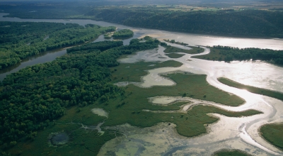
Mississippi River, the longest river of North America, draining with its major tributaries an area of approximately 1.2 million square miles (3.1 million square km), or about one-eighth of the entire continent. The Mississippi River lies entirely within the United States. Rising in Lake Itasca in Minnesota, it flows almost due south across the continental interior, collecting the waters of its major tributaries, the Missouri River (to the west) and the Ohio River (to the east), approximately halfway along its journey to the Gulf of Mexico through a vast delta southeast of New Orleans, a total distance of 2,340 miles (3,766 km) from its source. With its tributaries, the Mississippi drains all or part of 31 U.S. states and two provinces in Canada.
As the central river artery of a highly industrialized nation, the Mississippi River has become one of the busiest commercial waterways in the world, and, as the unruly neighbour of some of the continent’s richest farmland, it has been subjected to a remarkable degree of human control and modification.
Picture Credit : Google