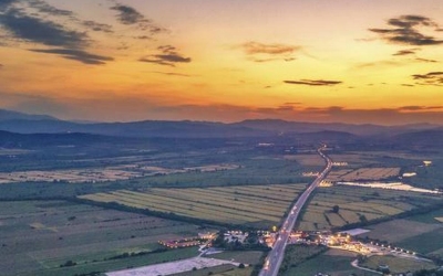
Stunning pictures such as this one that show a birds-eye view of a region on the Earth’s surface are so common these days that we hardly stop to think about how they are achieved. The advent of drones have led to a proliferation of such images as aerial photography has become more accessible than ever before.
The technique of photographing the Earth’s surface, or even features of its atmosphere and hydrosphere, using cameras that are mounted on rockets, aircraft. Earth-orbiting satellites or any spacecraft in general is known as aerial photography. While the growth of aerial photography was fast-tracked after its application in military reconnaissance and intelligence gathering was identified, it has spilled over to many other fields as well.
Terrestrial mapping
Mapping remains an important use of aerial photography as terrestrial features can be well captured using this method. With satellite technology and interpretation using experts, aerial photography has made available crucial data on topography, geology, hydrology, soil, vegetation, ocean currents, fish resources, and many other areas.
A little-known German engineer named Alfred Maul played his part in the growth of aerial photography. Through his experiments in rocket photography at the start of the 20th Century, Maul pioneered aerial reconnaissance.
Born to a trader and his wife in 1870, Maul attended community schools in Poessneck and Dresden before graduating from the Conservatory of Dresden. Apart from being musically gifted and an excellent piano player, Maul turned out to be a professional engineer after studying at the engineering school in Reichenberg (now Liberec).
Multi-disciplinary Maul Even though he was listed as a civil engineer in the address register of Dresden, Maul dabbled in various fields with considerable success. The fact that he ended up with over 20 patents in mechanical engineering and contributed significantly to aerial photography is testament to it.
Maul was drawn towards the theoretical aspects of building a rocket apparatus to aid aerial photography in about 1900. He started his first tests by 1901 and was soon confronted by several obstacles – the parachute didn’t work once, the rocket exploded in another instance, the camera shutter didn’t release at times, and there were other times when it released at the wrong moment.
Photos taken laterally
Maul ticked each of these complications one by one off his list as he kept experimenting to enhance his device further. While the idea of taking such photos wasn’t new, Maul was able to come up with an invention in which the photograph could be taken laterally or from the side of the instrument and not vertically or beneath the apparatus. This had particular advantages as the photo could be clicked during stable flight and hence were less blurred, and the camera could also be aimed at specific terrains.
Maul applied for his patent in the U.S. with the title Rocket apparatus for taking photographs in 1903 and obtained it on April 19, 1904. The primary use of the device had been for military reconnaissance, and by offering demonstrations, Maul was able to find takers for his invention.
Aircraft take precedence
Maul is believed to have experimented with these ideas from 1901 to 1912 with no evidence of having worked on it after this period. The timing couldn’t have been worse as by the time the First World War made its way in 1914, aircraft became the vehicle of choice for aerial reconnaissance.
Even though Maul gained little for these efforts of his, his invention is among the first instrumented rockets, and with hindsight can be seen as a milestone in aerial photography. Thanks to Maul and the many others who followed, the technology in this field has progressed so fast in the 100-odd years since then, offering us stunning visuals of the Earth’s surface.
Picture Credit : Google


