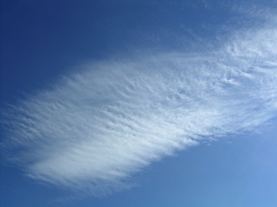
Cirrostratus clouds are high, thin sheet-like thin clouds that usually cover the entire sky. The clouds are so thin that the Sun or moon can sometimes shine through and appear to have a halo as light hits the ice crystals and bends. The halo is the width of your hand held at arm’s length. Cirrostratus clouds usually come 12 to 24 hours before a rain or snowstorm.
As a result of slowly rising air, cirrostratus cloud can form. Usually generated at the forefront of frontal weather systems, the movements of cirrostratus can be used to predict what the weather will do in the next 24 hours.
Cirrostratus clouds can also form through contrails, the vapour trails left by planes as they fly through a dry upper troposphere. These streaks can spread out and become cirrus, cirrostratus and cirrocumulus.
Though cirrostratus itself does not produce precipitation, it can indicate whether or not precipitation is likely. If cirrostratus nebulosus exists in the sky it is likely that an incoming warm front will bring persistent rain within a day. If cirrostratus fibratus is spotted, stratus may proceed it, bringing only light drizzle.
Picture Credit : Google


