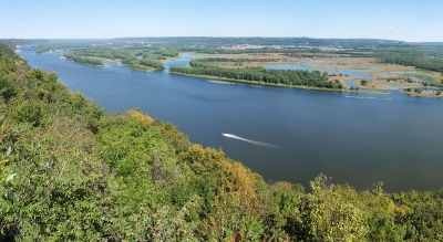
The Mississippi River runs through or along 10 states, from Minnesota to Louisiana, and is used to define portions of these states borders, with Wisconsin, Illinois, Kentucky, Tennessee, and Mississippi along the east side of the river, and Iowa, Missouri, and Arkansas along its west side.
Although the Mississippi can be ranked as the fourth longest river in the world by adding the length of the Missouri-Jefferson (Red Rock) system to the Mississippi downstream of the Missouri-Mississippi confluence—for a combined length of 3,710 miles (5,971 km)—the 2,340-mile length of the Mississippi proper is comfortably exceeded by 19 other rivers. In volume of discharge, however, the Mississippi’s rate of roughly 600,000 cubic feet (17,000 cubic metres) per second is the largest in North America and the eighth greatest in the world.
As the central river artery of a highly industrialized nation, the Mississippi River has become one of the busiest commercial waterways in the world, and, as the unruly neighbour of some of the continent’s richest farmland, it has been subjected to a remarkable degree of human control and modification. Furthermore, the river’s unique contribution to the history and literature of the United States has woven it like a bright thread through the folklore and national consciousness of North America, linking the names of two U.S. presidents—Abraham Lincoln and Ulysses S. Grant—with that of the celebrated author Mark Twain.
Credit : Britannica
Picture Credit : Google


