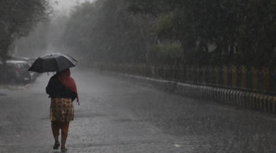
Let’s brace for a chillier winter this year, as La Nina has emerged in the tropical Pacific Ocean, the National Oceanic and Atmospheric Administration’s (NOAA) Climate Prediction Center announced recently. La Nina is a natural ocean-atmospheric phenomenon marked by cooler-than-average sea surface temperatures across the central and eastern Pacific Ocean near the Equator. The climate pattern typically spells below-normal temperatures in the northern hemisphere. Countries in the northern hemisphere have started issuing warnings about a frigid winter. The Indian Meteorological Department also predicted that the temperature is set to drop steeply over north India in November. Reports say temperatures are expected to drop below 3 degrees Celsius in the months of January and February 2022, due to the La Nina weather pattern. Forecasters point out that this is the second La Nina winter in a row, a phenomenon that they call a “double-dip”. What is La Nina? How does it affect countries around the world?
Recurring climate pattern
To understand La Nina, we need to know ENSO – the El Nino Southern Oscillation. ENSO is a recurring climate pattern involving changes in the temperature of waters in the central and eastern tropical Pacific Ocean. For year ranging from two to seven, the surface waters across a large swath of the tropical Pacific Ocean warm or cool by 1 to 3 degrees Celcius above or below normal. The warming phase of ENSO is called El Nino, while the cooling phase is known as La Nina. ENSO affects the tropics (the regions surrounding the equator) and the subtropics (the regions adjacent to or bordering the tropics).
Weather depends a lot on ocean temperatures. Where the ocean is warm, more clouds form, and more rain falls in that part of the world. In the Pacific Ocean, near the equator, the sun makes the water especially warm on the surface. In normal conditions, trade winds travel from east to west across the tropical Pacific, pushing the warm surface waters near South America westward towards Indonesia. At the same time, cooler waters rise up towards the surface in the eastern Pacific near the coasts of Ecuador, Peru, and Chile. (This process, called upwelling, in fact, aids in the development of a rich ecosystem.)
El Nino
An El Nino phenomenon sets in when there is anomaly in this pattern. The westward-blowing trade winds weaken along the Equator and start blowing in the other direction – from west to east. Due to changes in air pressure, the surface water moves eastwards to the coast of South America. Warmer surface waters in eastern Pacific increase precipitation and bring above-normal rainfall in South America. As winds that usually fetch rain to Asia and Australia become weaker, they bring less rainfall to these regions and thereby drought.
La Nina
La Nina is considered to have the opposite effect of El Nino. During a period of La Nina, the sea surface temperature across the eastern Pacific Ocean will be lower than normal. It will bring greater-than-normal rainfall to Southeast Asia and Australia, and cause drier-than-normal conditions in South America and the Gulf Coast of the U.S. Scientists say this years La Nina could worsen California’s ongoing drought and make its wildfire season even more of a threat. La Nina usually brings in colder-than-normal winters in Asian countries, including India. La Nina influences the Indian subcontinent by piping in cold air from Siberia and South China.
Duration and frequency
La Nina (or El Nino) episode lasts nine to 12 months. Some may last for years. Its average frequency is two to seven years. El Nino is often (but not always) followed by La Nina the following year, particularly if the El Nino is strong.
Impact of climate change?
Scientists do not yet fully understand what triggers a La Nina or an El Ninocycle. They say it is difficult to know how climate change affects ENSO patterns. However, a 2018 study on atmospheric conditions showed how a warming climate may amplify the effects of El Nino and La Nina.
Forecasting helps
To forecast La Nina, scientists monitor temperatures of the ocean and watch out for the tell-tale temperature shift from the western Pacific to the eastern Pacific. Predicting the life cycle and strength of El Nino and La Nina is critical for helping people avoid or mitigate potential damage from weather events stemming from El Nino or La Nina.
Why the name
According to the NOAA centuries ago, South American fishermen noticed warmer-than-normal coastal Pacific Ocean waters and dramatic decreases in fish catch occurring periodically around Christmas time. They nicknamed the phenomenon “El Nino” (Spanish for little boy), in connection with the celebration of the Christian holiday marking the birth of Jesus. In the 1980s, when the opposite phase of El Nino was discovered (i.e., cooler-than-normal ocean temperatures), scientists called it “La Nina” (Spanish for little girl).
Picture Credit : Google


