WHICH IS THE LONGEST NATURAL SAND BEACH?

Cox’s Bazar in Bangladesh is the world's longest natural sea beach. This beach distinguishes being the world’s longest ‘natural sea’ beach, stretching across 93 miles. It’s an exciting place that is one of the most popular tourist attractions in Bangladesh but remains relatively little known amongst tourists since Bangladesh is not considered a top destination for the average family.

The people who go here will find three different spots to enjoy: Laboni Beach, the main beach close to town, Humchari, which is loved for its waterfalls, and Inani Beach, which is favoured for suntanning. You may hear people here calling the beach Panowa; the term means ‘little flower’ and is the nickname that locals know the place by.

Credit: BEST TOPPERS

Picture Credit : Google

HOW ARE COASTS FORMED?

When waves, tidal waves in particular, hit land, the force of water has the power to break and crush rocks and to erode the soil. But they also bring in seashells, seaweed, other organic matter and debris from the sea, which all gets mixed and deposited among the crushed rocks to shape the coastline. Coasts are formed over hundreds of years and can be quite changeable, changing with time as tidal waves constantly crush, erode, wash away, bring in and deposit materials.

The coast, also known as the coastline or seashore, is defined as the area where land meets the ocean, or as a line that forms the boundary between the land and the ocean or a lake.

Geologists classify coasts on the basis of tidal range into macrotidal coasts with a tidal range greater than 4 meters (13 feet); mesotidal coasts with a tidal range of 2 to 4 meters (7 to 13 feet); and microtidal coasts with a tidal range of less than 2 meters (7 feet). The distinction between macrotidal and mesotidal coasts is more important. Macrotidal coasts lack barrier islands and lagoons, and are characterized by funnel-shaped estuaries containing sand ridges aligned with tidal currents. Wave action is much more important for determining bedforms of sediments deposited along mesotidal and microtidal coasts than in macrotidal coasts

Waves erode coastline as they break on shore releasing their energy; the larger the wave the more energy it releases and the more sediment it moves. Coastlines with longer shores have more room for the waves to disperse their energy, while coasts with cliffs and short shore faces give little room for the wave energy to be dispersed. In these areas, the wave energy breaking against the cliffs is higher, and air and water are compressed into cracks in the rock, forcing the rock apart, breaking it down. Sediment deposited by waves comes from eroded cliff faces and is moved along the coastline by the waves. This forms an abrasion or cliffed coast.

Credit: Wikipedia

Picture Credit : Google

HOW ARE WAVES FORMED?

When sunlight enters Earth's atmosphere, the energy from the Sun heats up the air. This hot air expands and rises, creating space under it for cooler air to rush in. This movement causes winds. Winds that blow over the surface of ocean water transfer energy to the water, setting off ripples. As these ripples get bigger, they become waves.

The ocean is in constant motion. Waves form as a result of the water’s motion, gravitational forces, and winds. The most common waves we see are created by wind. However other waves include those created by gravitational forces (e.g. tidal waves) and those created by underwater disturbances, such as earthquakes (e.g. tsunamis).

There are three main factors that affect wave formation: wind velocity, fetch, and duration. Wind velocity is the speed of the wind, fetch is the distance over the water that the wind can blow uninterrupted (which can be huge distances out at sea), and duration is the amount of time the wind blows over that patch of water. The greater the wind velocity, the longer the fetch, and the greater duration the wind blows, then the more energy is converted to waves and the bigger the waves. However, if wind speed is slow, the resulting waves will be small, regardless of the fetch or duration. It takes all three factors acting together to create big waves.

Waves often result from storms, which tend to move across the ocean with the prevailing winds. So although a storm might only have 500 nautical miles (nm) of fetch, the storm can travel greater distances, say 1,000 nm, creating a travelling fetch of more than 1,000 nm.

Credit: UBC EOAS

Picture Credit : Google

HOW IS A ROCK ARCH CREATED?

When a high, rocky outcrop juts out into the water, the crashing of waves over the years erodes the base. If the layer of rock higher up stays intact as the base is worn through, a natural rock arch is carved out.

Most people understand that erosion plays an important role in creating arches and bridges. A natural rock arch is formed by erosion. There are two types of erosive forces that account for most arches and bridges – weather erosion and water erosion.

If a crack forms in the soft layers of a sandstone fin, it allows wind to penetrate into the rock. In the desert, winds are common, and they carry lots of sand – kind of like a natural sandblaster – this can cause the cracks to widen. Acidic rain can accumulate in these cracks, chemically weakening the rock. Then, freezing and thawing frosts can cause fractured sections of rock to break off. With enough time, the constant cycle of wind, ice and rain will form an arch. This is weather erosion, and most arches and bridges throughout the world were formed this way.

Water erosion relies, as the name suggests, almost entirely on running water to create arches and bridges. Streams and rivers may eventually cut through a fin of sandstone (this is how Rainbow Bridge was formed) or acidic rain-water might pool in depressions and create an arch from above (Double Arch in Arches National Park is the perfect example of this).

Credit: NATURAL UNIVERSAL SECRETS

Picture Credit : Google

WHAT IS A SHINGLE BEACH?

When stone, pebbles and small rocks are deposited along the coast, they create a porous layer that is not as tightly packed together as sand is. These are shingle beaches. Common to New Zealand, Japan and the United Kingdom, shingle beaches support little vegetation and mostly have lichen-covered rocks.

The term shingle beach refers to a beach along any body of water that is made up of stones, pebbles, and other small rocks. These materials, also known as shingles, may vary in size from 2 to 200 millimeters and can also be mixed with other sediments, like sand or silt. Shingle beaches are primarily characterized by a steep profile, which means the area further inland sits at a higher elevation than the section of the beach found along the water. These beaches are located along a number of geological formations, including spits, barrier islands, and pocket beaches. Since the stones and pebbles that make up these beaches do not fit tightly together, they create a rather porous environment. These large pores prevent the beach from retaining any significant amount of water, although they also prevent evaporation in the soil below. Many shingle beaches can be found in New Zealand, Japan, and the United Kingdom.

Geologists have linked the formation of many shingle beaches to areas around the world that were subjected to glaciation during the Pleistocene era. These areas tend to be located at higher latitudes, and glaciers brought with them rocks and pebbles that were deposited on the shorelines. Sometimes the rocks and pebbles on shingle beaches are deposited by rivers that empty into the ocean. Additionally, shingle beaches may be formed from intense wave activity that erodes larger pieces of rock located further inland. Over time, continued wave activity carries these large pieces of sediment onto the shores, depositing the biggest pieces further from the water and at higher elevations. The composition of these beaches works to decrease the strength of the tide as it moves back out to the ocean.

Credit: World Atlas

Picture Credit : Google

WHAT IS A COAST?

Land that runs along a sea or ocean is called a coast. The edge of the land where it meets the water is called the coastline. Coasts can be wide swathes of soft, sandy beaches, narrow, rocky stretches or sheer cliff faces. Coastlines are given shape by waves, currents and tides. They are ever changing and form an important and unique environment.

If you've ever been to the beach, you've been on a coast. The coast is the land along a sea. The boundary of a coast, where land meets water, is called the coastline.

Waves, tides, and currents help create coastlines. When waves crash onto shore, they wear away at, or erode, the land. But they also leave behind little parts of the sea, such as shells, sand dollars, seaweeds, and hermit crabs. Sometimes these objects end up as more permanent parts of the coastline.

Coastal changes can take hundreds of years. The way coasts are formed depends a lot on what kind of material is in the land and water. The harder the material in the land, the harder it is to erode. Coastlines of granite, a hard rock, stay pretty stable for centuries. Sugarloaf Mountain, on the coast of Rio de Janeiro, Brazil, is made mostly of granite and quartz. It has been a landmark for centuries.

Tides, the rise and fall of the ocean, affect where sediment and other objects are deposited on the coast. The water slowly rises up over the shore and then slowly falls back again, leaving material behind. In places with a large tidal range (the area between high tide and low tide,) waves deposit material such as shells and hermit crabs farther inland. Areas with a low tidal range have smaller waves that leave material closer to shore.

Credit:  National Geographic Society

Picture Credit : Google

HOW MUCH OF THE WORLD IS COVERED BY DESERTS?

Seen from space, the majority of the Earth’s surface is covered by oceans – that makes up 71% of the surface of the Earth, with the remaining 29% for land. But what percentage of the Earth’s land surface is desert? Deserts actually make up 33%, or 1/3rd of the land’s surface area.

That might sound like a surprisingly large amount, but that’s based on the official definition of a desert. Deserts are any region on Earth that can have a moisture deficit over the course of a year. In other words, they can have less rainfall in a year than they give up through evaporation.

You would think that deserts are hot, but there are cold deserts too. In fact, the largest cold desert in the world is the continent of Antarctica. There are barren rock fields in Antarctica that never receive snow, even though they’re incredibly cold. The largest hot desert is the Sahara desert, in northern Africa, covering 9 million square kilometers.

Credit: UNIVERSE TODAY

Picture Credit : Google

WHAT IS A WADI?

A wadi is a freshwater ecosystem and a type of fluvial landform, which is considered any type of geological feature that is related to rivers or streams. The term wadi comes from both the Arabic and Hebrew languages. Specifically, it refers to a dry riverbed that contains water during rainy seasons and is located in a valley-like area of the desert.

Characteristics Of a Wadi

Wadis are generally located in the flat or slightly rolling areas of deserts and often leads to dry lakes as well. A wadi can be recognized by its braided appearance, which is caused by a lack of constant water flow and an excess of sediment build-up. Sometimes, this sediment may collect in significant amounts, blocking water flow and effectively changing the direction of seasonal rivers. In addition to the low water levels, wind also affects sediment buildup by bringing in dry sands that collect on top of moist sand.

The bottoms of wadis are often covered in sand and loose gravel. The lower levels of this sediment are often packed very densely. This means that during rainy season, water is not quickly absorbed by the ground and has nowhere to drain, resulting in rapid flooding. Flash flooding in wadis is made even more dangerous because of the previously mentioned directional changes, which can send waters into communities unexpectedly.

Credit: World Atlas

Picture Credit : Google

WHAT IS AN OASIS?

An oasis is where water from a source deep underground comes to the surface in a desert, supporting life and vegetation.

An oasis is a lush green area in the middle of a desert, centered around a natural spring or a well. It is almost a reverse island, in a sense, because it is a tiny area of water surrounded by a sea of sand or rock.

Oases can be fairly easy to spot—at least in deserts that do not have towering sand dunes. In many cases, the oasis will be the only place where trees such as date palms grow for miles around. For centuries, the sight of an oasis on the horizon has been a very welcome one for desert travelers.

Scientific Explanation

It seems amazing that trees could sprout in an oasis. Where do the seeds come from? As it happens, scientists believe that migrating birds spot the glint of water from the air and swoop down for a drink. Any seeds that they happen to have swallowed earlier will be deposited in the damp sand around the waterhole, and those seeds that are hard enough will sprout, providing the oasis with its tell-tale splash of color in the sand.

Caravans in desert areas such as Africa's Sahara or the dry regions of Central Asia have long depended on such oases for food and water, both for their camels and their drivers, during difficult desert crossings. Today, some pastoral peoples in western Africa still depend on oases to keep themselves and their livestock alive as they travel through deserts between different grazing areas. In addition, many kinds of desert-adapted wildlife will seek water and also take shelter from the blazing sun in local oases.

Credit: ThoughtCo

Picture Credit : Google

CAN IT SNOW IN THE SAHARA?

While snow is present in Africa at very high elevations, snow in the Sahara Desert is a very rare event. 

The Sahara Desert is an extremely hot and arid region.  An area about 3,600,000 square miles (9,200,000 square kilometers), the desert is about the size of the United States and stretches across much of North Africa. 

Winter is the season when any rainfall might fall in this area.  The air above the desert is so dry, that often rain doesn’t reach the ground or arrives in very small quantities. 

There have been three recorded episodes of significant snowfall.  The first was recorded in 1979, the second in December of 2016, and the third in January 7, 2018. 

On January 7, 2018, about 10 to 30 centimeters (4 to 12 inches) of snow covered the desert higher elevations above 1000 meters. The snow lasted for less than a day thanks to warming temperatures.

Credit: GEOGRAPHYREALM

Picture Credit : Google

WHICH IS THE WORLD'S YOUNGEST DESERT?

The Aralkum Desert, in Uzbekistan and Kazakhstan. It was once a water body called the Aral Sea, but water from the two rivers that fed it was diverted for agriculture and, gradually, by 2000, most of the sea had become a desert.

The white salt terrain left behind by the desiccation of the southern Aral Sea is now known as the Aralkum Desert. 

At around 17,000 square miles (45,000 square kilometers), the Aralkum Desert is the world’s youngest desert, created entirely due to man-made disturbances. The desolate area has replaced a once vibrant fishing and tourist industry. With the climate mitigating effects of the Aral Sea diminished, winters are now colder and summers hotter.

The Aralkum Desert lies in the path of a powerful east-west airstream and these pollutants have been carried as far away as Antarctica.  Known as Black Blizzards, these powerful wind sorts carry dust pollutants from the Aral Sea over thousands of miles away; Aral dust has been found in the bloodstream of penguins in Antarctica, in the glaciers of Greenland, and in Norway’s forests.

Credit: GEOGRAPHYREALM

Picture Credit : Google

WHAT IS A SAND DUNE?

When grains of sand pile up to form a mound or ridge, it is called a sand dune. Dunes are usually formed by wind blowing the sand in one direction. They can be of various shapes and sizes, including crescents, stars, and long ridges called seifs.

Sand dunes are some of nature’s most scintillating creations. These eye-catching land masses are found around the globe in different climatic conditions. They are not only limited to deserts, but can form in any landscape on the earth’s surface provided the conditions are right. Every sand dune is formed as a result of the interaction between the wind and soil in the form of sand grains. There are many ways thrill seekers can explore sand dunes, for example, sliding down the dunes, Bird viewing in wetlands, skiing, sand boarding or just sledging on the sand slopes. Sky divers or those on airplanes experience the true beauty of sand dunes.

A Sand Dune is a small ridge of hill of sand found in a desert or on top of a beach. When they form on a beach, they are typically above the normal maximum reach of the waves. They form from millions of finely divided sand particles that are blown by the wind and get deposited against some obstacle such as a piece of drift wood, bush or rock.

Credit: EARTH ECLIPSE

Picture Credit : Google

WHERE DID THE SAND IN THE DESERT COME FROM?

Today's deserts were not always arid lands, and their soil was held in place by plants and trees. But when vegetation dies out, the soil is exposed to erosion. Gradually, the lighter clay and dried organic particles are blown away by the wind, leaving behind grains of sand made up of small particles from eroded rocks.

Sand consists of small particles of larger rock that’s been eroded. But erosion doesn’t happen fast enough in arid environments to be the only cause of desert sand.

Nearly all sand in deserts came from somewhere else – sometimes hundreds of kilometers away. This sand was washed in by rivers or streams in distant, less arid times – often before the area became a desert.

Once a region becomes arid, there’s no vegetation or water to hold the soil down. Then the wind takes over and blows away the finer particles of clay and dried organic matter. What’s left is desert sand.

Finding the exact origin – the source rock – of a desert’s sand can be difficult. Scientists might look for the origin by following dried riverbeds upstream or by tracking the “footprints” that sand left as it traveled – for example, streaks on the faces of boulders left behind by blowing sand in centuries past.

Sometimes an entire desert has migrated due to movement of Earth’s huge overlying land plates. When that’s happened, pieces of the same source rock are sometimes discovered on both sides of a fault line. When scientists identify a potential source rock, they match it to sand grains by its age and composition.

Credit: Earth Sky

Picture Credit : Google 

WHY ARE DESERTS ARID?

Deserts are dry for different reasons depending on where they are. Winds in sub-tropical deserts, such as the Sahara in northern Africa, prevent rain clouds from forming. Coastal deserts, like the Atacama in Chile, get no rain, just a little moisture from fog. Death Valley, in California, USA, is a rain shadow desert on mountainsides that face away from rain-filled winds. The Gobi, in Mongolia, is an interior desert; rain-bearing winds cannot reach so far inland. Polar deserts, such as the Arctic and Antarctic, are dry because the water is locked as ice.

Areas that receive less than 25 centimeters (10 inches) of rain annually are called deserts. Deserts are dry with sparse vegetation. Landforms tend to have angular features because the lack of rain results in minimal chemical weathering, and flash floods create steep?walled scarps and gullies. There are few plants to protect the soil from the wind, so the soil is blown away to expose the rocky surface. Even in such a dry climate, most of the landforms are carved by the rare periods of heavy rainfall that result in flash floods, erosion, and sediment deposition.

Hot air rises at the equator, where the land receives the greatest amount of the sun's radiation. Most of the world's deserts are located near 30 degrees north latitude and 30 degrees south latitude, where the heated equatorial air begins to descend. The descending air is dense and begins to warm again, evaporating large amounts of water from the land surface. The resulting climate is very dry.

Other deserts are located in the rain shadows of mountain ranges. As moist air passes over a mountain range, it expands and cools, precipitating most of its moisture as it rises. As it sweeps down the other side of the mountain range, it warms and compresses, causing high evaporation rates and shedding little rain. Many of the deserts in the southwestern United States are the result of rain shadows.

Credit: Cliffs Notes

Picture Credit : Google 

HOW HOT OR COLD CAN A DESERT GET?

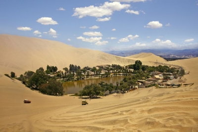
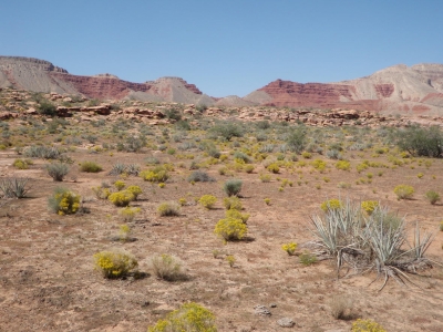
Deserts can have extremes in temperature. Daytime may get as hot as 54°C in hot deserts, while at night, dryness and lack of cloud cover cause a sharp drop in temperature, and it can get as cold as 4°C.

As extremes of nature go, the marked contrast in temperature of a desert during the day and at night is one of the most impressive. Searing heat can torture human occupants. After dark, the problem is reversed, and a winter jacket might prove useful. On average, temperatures in Africa's Sahara Desert can swing an astounding 75 degrees in 24 hours, rising to an average 100°F with the sun out and plummeting to 25°F after it sets.

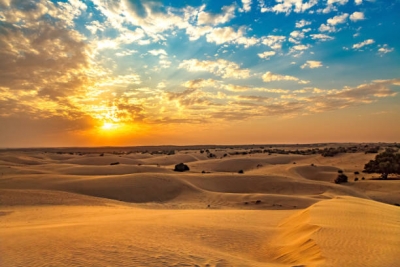
When the sun is out, sand proves to be an effective distributor of heat, reflecting it back into the air. But it’s not very good at retaining heat. Once the sun goes down, heat from the sand is released quickly.

The thing that could help retain warm air overnight is humidity, but deserts don’t have much of that. Water vapor in the air traps heat: Think of it like an insulating blanket, preventing either heat or cold from dispersing into the air. When the heat source is taken away, that vapor will retain it for long periods. Without sun or humidity, daytime heat isn’t being held anywhere, and the desert will cool rapidly.

Humidity is also why deserts can feel hotter than other places even though the temperature is the same. The water vapor needs lots of solar energy to heat up, while a dry climate takes that energy head-on.

All of this happens quickly because of that lack of humidity. Just as warm air escapes when night falls, there’s no humidity to trap the chilly evening weather. When the sun rises, it’s back to scorching.

Other factors can come into play. Clouds that help moderate temperature and wind can both help keep temperatures from dropping. But generally, you’ll roast in a desert and then freeze because the combination of sand and low humidity isn’t really suited for comfortable and consistent climates.

Credit: MENTAL FLOSS

Picture Credit : Google