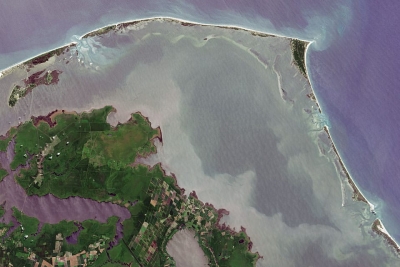
Barrier islands form as waves repeatedly deposit sediment parallel to the shoreline. As wind and waves shift according to weather patterns and local geographic features, these islands constantly move, erode, and grow. They can even disappear entirely.
They are generally separated from the mainland by tidal creeks, bays, and lagoons. Beaches and sand dune systems form on the side of the island facing the ocean; the side facing the shore often contains marshes, tidal flats, and maritime forests. These areas are important habitat for seabirds, fish and shellfish, and nesting sea turtles.
Many barrier islands are found off the U.S. Gulf and East coasts, such as the Outer Banks off North Carolina. Barrier island chains tend to form near river deltas and in areas with low tectonic activity and relatively flat coastal terrain. The rocky cliffs and shifting tectonic plates off the West Coast, along with other features of the terrain and tides, prevent barrier islands from forming there.
These islands are critical to protecting coastal communities and ecosystems from extreme weather. Beach dunes and grasses on barrier islands absorb wave energy before the wave hits the mainland. This generally means smaller storm surge and less flooding on the coast.
Unfortunately, barrier islands are disappearing at an alarming rate. Erosion can be caused by human activities such as ship traffic, hard levees, and infrastructure projects, even those far upriver. Damming and dredging projects can significantly affect the amount of sand and sediment available to fortify barrier islands. The effects of climate change, including rapid sea level rise and extreme weather events, can cause or worsen barrier island erosion.
Credit : NOAA
Picture Credit : Google


