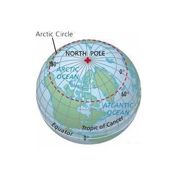
The Arctic Circle is a line of latitude that circles the Earth at approximately 66° 33′ 47.2″ north of the Equator. How was that strange number determined? The position of the Arctic Circle is at the latitude above which the sun does not set on the summer solstice and does not rise on the winter solstice.
This is what causes the Arctic to have a very long continuous night each year and a very long continuous day. The length of these long continuous days and nights are six months each at the North Pole. Their length decreases with distance from the North Pole.
The latitude of the Arctic Circle is slowly drifting northward at a speed of about 15 meters per year. On July 2, 2018 it was at approximately 66° 33′ 47.2″ north of the Equator. This drift has nothing to do with climate change. Instead, the drift occurs because the Earth wobbles on its axis of rotation in a 40,000 year cycle in response to the gravitational attraction of the moon.
To most of the general public, using the Arctic Circle as the defining southern boundary for “the Arctic” is easy and makes total sense. However, some researchers believe that there are better ways to draw a map of the Arctic.
Credit: geology.com
Picture credit: Google


