This affects ocean temperatures, speed and strength of ocean currents, the health of coastal fisheries, and also the local weather in several countries
The World Meteorological Organisation (WMO) has predicted a high probability of El Nino developing later this year. This will fuel higher global temperatures. Let us know more about this phenomenon.
El Nino
El Nino, Spanish word for 'little boy', is a natural climate pattern associated with the warming of the central Pacific Ocean waters near South America. It is the warm phase of El Nino-Southern Oscillation (ENSO), a recurring phenomenon involving changes in the Pacific Ocean temperature.
El Nino affects the ocean temperatures, speed and strength of ocean currents, the health of coastal fisheries, and also the local weather in several countries. For instance, El Nino can cause rain in South America while threatening drought in Indonesia and Australia.
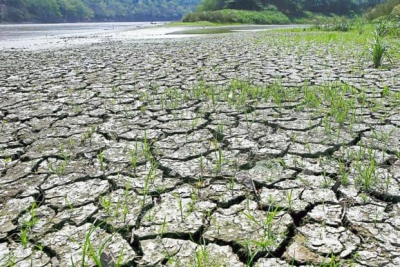
It occurs irregularly at two- to seven-year intervals and episodes usually last nine to 12 months. An El Nino year creates a mini global-warming crisis because the warm water spreading across the tropical Pacific releases a large amount of heat into the atmosphere. It results in hot and dry weather in Southeast Asia.
El Nino events are indicated when the temperature of the sea surface increases by more than 0.5° C for at least five successive overlapping three-month seasons.
El Nino events of 1982-83 and 1997-98 were the most adverse of the 20th Century. During 1982-1983, the sea surface temperatures in the eastern tropical Pacific were 7.8-12.8° C above normal. These strong temperature increases caused harsh drought in Australia, typhoons in Tahiti, and record rainfall and flood in central Chile.
The 1997-1998 El Nino event was the first time that was scientifically monitored from beginning to end. It caused drought conditions in Indonesia, Malaysia, and the Philippines. Peru faced very heavy rains and severe flooding. While California faced winter rainfall, the Midwest received record-breaking warm temperatures. Strong El Nino events can cause weaker monsoons in India and Southeast Asia and increased rainfall during the rainy season in sub-Saharan Africa.
ENSO and La Nina
ENSO involves changes in the temperature of the central and eastern tropical Pacific Ocean. This affects the rainfall distribution in the tropics and weather across the world. El Nino and La Nina are the extreme phases of the ENSO cycle. Besides, there is another phase neither El Nino or La Nina. It is known as the ENSO-neutral.
La Nina, Spanish word for 'little girl', is the cool phase of ENSO. During La Nina events, trade winds (blowing east to west just north and south of the Equator) are stronger than usual and push more warm water toward Asia. Meanwhile, near the west coast of the Americas, upwelling increases, bringing cold and nutrient-rich water to the surface. During such a year, the winter temperatures are warmer than normal in the South and cooler than normal in the North. La Nina ended this year after a three-year run and the tropical Pacific is at present in an ENSO-neutral state.
Prediction
The WMO has predicted a 60% chance for a transition from ENSO-neutral to El Nino during May-July 2023, an increase to about 70% in June-August and 80% in July-September.
This April, the India Meteorological Department (IMD) predicted that an El Nino will likely develop during this southwest monsoon. However, the IMD has stated that India will likely receive a normal amount of monsoon rain this year despite the probability of the weather phenomenon.
Picture Credit : Google


