What’s special about spratly Islands ?

For several years, there has been an ongoing territorial dispute among China, Taiwan, Vietnam, the Philippines, and Malaysia over the ownership of the Spratly Islands. Let us know more about these islands.
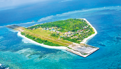
 

Spratly Islands

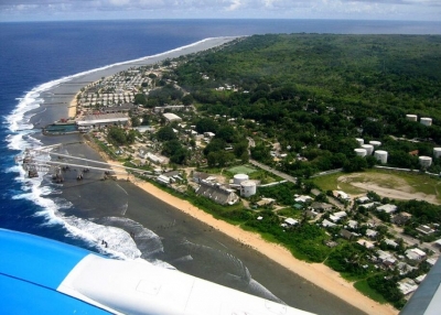
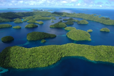
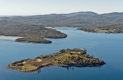
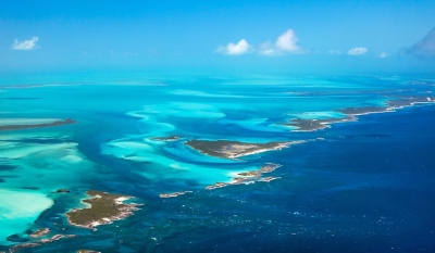
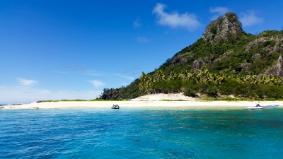
 The Spratly Islands consists of over 100 small islands or reefs, shoals, atolls,       and small islets in the South China Sea of the Pacific Ocean. The islands are surrounded by rich fishing grounds, and gas and oil deposits.

While a great number of islands of Spratlys are now submerged, of the 12 main naturally occurring islets, the largest is the 90-acre Itu Aba. Another, called Spratly Island or Storm Island, measures 900 by 1,500 feet. Turtles and seabirds are the only wildlife on these islands. There is no permanent human habitation.

The Spratlys is significant due to their strategic location. During World War II, Japan occupied the archipelago and developed it as its submarine base. After the war, the Chinese Nationalist government established a garrison on Itu Aba and the government maintained it even after their exile to Taiwan in 1949.

When Japan renounced its claim to the islands in 1951, Taiwan, mainland China, and Vietnam declared themselves the rightful owners. The Philippines made a claim based on proximity in 1955.

The United Nations Convention on the Law of the Sea, which came into effect in the early 1980s, established the concept of exclusive economic zones (EEZ) extending 200 nautical miles from a country's coast. This resulted in the Spratlys becoming more desirable for their potential resources.

Dispute

By the late 20th Century, Vietnam, China, Taiwan, Malaysia, and the Philippines had laid claims to the Spratlys. However, the United States, which has kept a dominant presence in the Pacific region since the early 20th Century, has not recognised the claims of any country on the Spratlys. It insisted that the Spratlys are in international waters.

Meanwhile, China has asserted that its claim to the Spratlys dates back centuries. According to the Chinese government, almost the entire South China Sea, including the Spratlys and other island groups, is within its sphere of influence. However, these claims have been disputed by others, especially the Philippines and Vietnam.

Picture Credit : Google

Which is the smallest island nation?

The world's smallest republic as well as the smallest island nation is Nauru. Located in the southwestern Pacific Ocean, this island is about 1,300 km to the northeast of the Solomon Islands. Its closest neighbour is the island of Banaba in Kiribati, which is about 300 km to the east. Nauru does not have an official capital, but its government offices are located in the district of Yaren.

People from Micronesia settled here around 1000 BCE, and Nauru was made a colony by the German Empire in the late 19th century. After World War I, the League of Nations authorised Australia, New Zealand, and the Kingdom to jointly administer Nauru. Later, during the Second World War, it was occupied by Japanese troops. After the war came to an end, the country became a part of the United Nations trusteeship and gained its independence in 1968. It became a member of the Pacific Community (PC) in 1969.

Nauru's constitution offers fundamental rights and freedoms for individuals. The country has a government that combines parliamentary and presidential systems. Its parliament has members elected by Nauruan citizens aged 20 and older, and it serves a tenure of three years unless dissolved by a vote of no confidence. This parliament elects the president, who acts as the head of both the state and the government. Nauru accepts aid from Australia and is sometimes called a client state of Australia.

Picture Credit : Google 

WHAT WAS ELLIS ISLAND FAMOUS FOR?

For over 60 years, Ellis Island was the entry point for immigrants to the U.S.

From 1892 to 1954, Ellis Island, located in Upper New York Bay at the mouth of the Hudson River, was the entry point for immigrants to the United States. It is estimated that by the time it was closed, over 12 million people had been processed and sent on to the mainland by the U.S. Immigration Bureau.

Ellis Island was once part of tidal flats known for their oyster beds. It was taken over by the federal government in 1808 and used as an arsenal and military post for nearly 80 years till the new immigration centre was opened to replace the Castle Garden facility in Manhattan. The island's area was increased by landfills. However, in 1897, five years after it opened, the centre was burned down in a fire.

New buildings were constructed, including a dining hall to seat 1,000 people and a large hospital, and Ellis Island reopened to immigrants in 1900. The arrivals peaked between 1907 and 1914, when officials handled 5,000 immigrants a day, mostly from Europe.

In 1917, passing a literacy test became mandatory. In 1924, quotas were instituted and overseas embassies were allowed to process immigrants. This reduced the flood to a trickle.

The Ellis Island Immigration Museum opened in 1990.

Island of hope, island of tears

Would you like to know about some of the stories of the 12 million people who came to Ellis Island to gain entry to America? A video series has been developed for students by the US goverment on the island's past. You can view it at bit.ly/libertymonument Not all who came were able to settle in the US. Many were deported. The Statue of Liberty Museum and the Ellis Island National Museum of Immigration explores the difficult history of this landmark.

Picture Credit : Google 

WHAT IS AN ARCHIPELAGO?

The word archipelago refers to an island chain. An archipelago is a type of landform that consists of a group of islands, often including similar formations like atolls or islets. The islands that make up an archipelago are clustered or form a chain within a body of water, such as an ocean, gulf, sea, or lake.

The Hawaiian Islands, the Aleutian Islands, the Florida Keys, Bermuda, The Bahamas, the Philippines, the Canary Islands, Indonesia, and islands in the Aegean Sea are all examples of archipelagos.

Archipelagos have been formed by seafloor volcanism, sea level rise or fall, coral reefs, and occasionally by the actions of people.

  • Most archipelagos include a combination of inhabited and uninhabited islands, including ones that can only be accessed by sea.
  • They can be made up of volcanic islands or continental fragments, or be formed via processes like erosion, sedimentary deposits or rising sea levels.
  • Some are large, spreading out over thousands of miles, while others extend over much smaller areas of less than 100 miles

.Credit: yourdictionary.com

Picture Credit : Google 

King George Island is located in which ocean?

King George Island (Argentina: Isla 25 de Mayo, Chile: Isla Rey Jorge, Russian: ????????? Vaterloo) is the largest of the South Shetland Islands, lying 120 km (75 miles) off the coast of Antarctica in the Southern Ocean.

The island was first claimed by the British in 1819 and named after King George III, however the following years were turbulent with many disputes about who owned the island.  In some form or another, Argentina, Brazil, Chile, China, South Korea, Poland, Russia, Uruguay, the Netherlands, Ecuador, Germany, Peru and the US all have a presence on the island. In so doing, these countries earn the status of a consultative party, or full member, of the Antarctic Treaty.

King George Island now serves as an aerodrome for flights to Antarctica, and is known as the unofficial capital of the continent because of the numerous research stations there. Aside from the scientific significance, the island is a haven for wildlife, and is home to many marine mammals such as Elephant, Weddell and Leopard seals, and colonies of Chinstrap and Gentoo penguins.

Picture Credit : Google

Greenland Island is located in which ocean?

Greenland is the world's largest island, located between the Arctic and Atlantic oceans, east of the Canadian Arctic Archipelago. Greenland is an autonomous territory within the Kingdom of Denmark. 

The coastline is rugged, mountainous and barren, with the land rising to a sloping ice cap that covers most of the island. Northeast Greenland National Park is the world’s largest national park. The Greenland ice sheet covers approximately 83% of the surface. The extreme north, Peary Land, is not covered by ice because the air is too dry to produce snow. If the Greenland ice sheet were to melt away completely, there would be a measurable rise in the world’s sea level.

Much of the economy is based on fishing, with shrimp fishing the largest income producer. Greenland appears to have large reserves of fossil fuels. The state oil company Nunaoil was created to help develop the future hydrocarbon industry. Mining of ruby deposits began in 2007.

Picture Credit : Google

The Bahamas Island is located in which ocean?

The Bahamas known officially as the Commonwealth of The Bahamas, is a country within the Lucayan Archipelago of the West Indies in the Atlantic. It takes up 97% of the Lucayan Archipelago's land area and is home to 88% of the archipelago's population. The archipelagic state consists of more than 700 islands, cays, and islets in the Atlantic Ocean, and is located north of Cuba and northwest of the island of Hispaniola (split between Haiti and the Dominican Republic) and the Turks and Caicos Islands, southeast of the US state of Florida, and east of the Florida Keys. The capital is Nassau on the island of New Providence. The Royal Bahamas Defence Force describes The Bahamas' territory as encompassing 470,000 km2 (180,000 sq mi) of ocean space.

Extensive and beautiful forests of Caribbean pine are found on Grand Bahama, Abaco, Andros, and New Providence islands. Hardwood forests also occur on some of the islands. Elsewhere the woody vegetation consists mostly of shrubs and low trees. Animal life is dominated by frogs, lizards, and snakes, all of them nonpoisonous, and several species of bats are found in caves along the more rocky coasts. Larger animals include the agouti, a rodent; the raccoon; the iguana; and the elegant flamingo, the national bird. All of these have been much reduced in numbers and in distribution. In addition, several animals—notably sheep, horses, and other livestock—have been introduced from Europe. The surrounding waters abound with fish and other edible marine animals, such as conch and spiny lobster (crayfish).

Picture Credit : Google

Fiji Island is located in which ocean?

Fiji is generally considered to be located in the South Pacific Ocean, the area between Viti Levu Island and the Lau Islands is actually called the Koro Sea.

Almost half of Fiji’s total area remains forested, while dry grasslands are found in western areas of the large islands. Coconut palms are common in coastal areas, and almost all tropical fruits and vegetables can be grown. Much of the shoreline is composed of reefs and rocks, while mangrove swamps are found on eastern coasts. There are few white-sand swimming beaches and, because of the encircling reef, little surf. Most animals, including pigs, dogs, cattle, and a few horses, are domesticated. Mongooses, introduced to prey on snakes and rats, are often seen.

The economy also has a strong service and light-industrial component serving small neighbouring countries as well as Fiji; activities range from boatbuilding (especially fishing boats and pleasure craft) to brewing and paint manufacture. The government offers incentives (including residence) for investors but insists on potential for job creation and training programs for local employees.

Picture Credit : Google

Madagascar Island is located in which ocean?

Madagascar is located in the southwestern Indian Ocean and is separated from the African coast by the 250-mile- (400-km-) wide Mozambique Channel.

Madagascar belongs to the group of least developed countries, according to the United Nations. Malagasy and French are both official languages of the state. The majority of the population adheres to Christianity, traditional beliefs, or an amalgamation of both. Ecotourism and agriculture, paired with greater investments in education, health, and private enterprise, are key elements of Madagascar's development strategy. Under Ravalomanana, these investments produced substantial economic growth, but the benefits were not evenly spread throughout the population, producing tensions over the increasing cost of living and declining living standards among the poor and some segments of the middle class. As of 2017, the economy has been weakened by the 2009–2013 political crisis, and quality of life remains low for the majority of the Malagasy population.

Along the length of the eastern coast runs a narrow and steep escarpment containing much of the island's remaining tropical lowland forest. To the west of this ridge lies a plateau in the center of the island ranging in altitude from 750 to 1,500 m (2,460 to 4,920 ft) above sea level. These central highlands, traditionally the homeland of the Merina people and the location of their historic capital at Antananarivo, are the most densely populated part of the island and are characterized by terraced, rice-growing valleys lying between grassy hills and patches of the subhumid forests that formerly covered the highland region. To the west of the highlands, the increasingly arid terrain gradually slopes down to the Mozambique Channel and mangrove swamps along the coast.

Picture Credit : Google

Why is the Sumatran rainforest in danger?

Declared a UNESCO World Heritage Site in 2004, the tropical rainforest regions in Indonesia's Sumatra Island comprise three national parks, namely Gunung Leuser National Park, Kerinci Seblat National Park, and Bukit Barisan Selatan National Park. Spread across more than 25,000 sq.km. a portion of the area falls within Sumatra's Leuser ecosystem that's often described as "the last place on Earth where tigers, rhinos, orangutans and elephants still live together".

The Parks, which are located on the spine of Bukit Barisan Mountains of Sumatra, show amazing uniqueness in biodiveristy, and are home to 10,000 species of plants. The regions also show a stunning variety in ecosystem from lowland rainforest to montane forest and subalpine low forest to scrub and shrub vegetation. The Gunung Leuser National Park is the place to see both the world's largest flower (Rafflesia arnoldi) and the tallest flower (Amorphophallus titanum).

Wildlife

The area is said to nurture more than 500 species of birds. Ducks, geese, partridges, scrubfowls, pheasants, grebes, pigeons, doves, quails, cuckoos, coucals, malkohas, koels, frogmouths, nightjars, swifts, swiftlets, needletails, rails, waterhens, crakes, thickknees, stilts, plovers, lapwings, snipes, jacanas, sandpipers, pratincoles, gulls, terns, petrels, shearwaters, storks, frigatebirds, tropicbirds, boobies, darters, cormorants, pelicans, herons, bitterns, egrets, ibises, kites, buzzards, eagles, owls, harriers, trogons, hornbills, kingfishers, bee-eaters, rollers, woodpeckers, barbets, kestrels, falcons, parakeets, broadbills, pittas, ioras, minivets, shrikes, orioles, drongos, fantails, flycatchers, magpies, swallows, bulbuls, warblers, tailorbirds, white eyes, babblers, thrushes, mynas, starlings, leafbirds, flowerpeckers, sunbirds, spiderhunters, wagtails, weavers, munias, and finches are among the birds that can be spotted in the region. The place also supports more than 200 mammal species, including several that are endemic and endangered. The mammals include the endemic Sumatran orangutan, the Sumatran tiger, dlouded leopard, rhinoceros, elephant, and the Malayan sun bear.

Threats

  • Given the expansive wealth of natural resources in the region, Sumatra has attracted heavy international financing zeroing in on extractive industries, "from precious hardwoods and minerals to palm oil, rubber, and coal". As a result, the precious wildlife in the area is losing their habitats and faces a very bleak future.
  • Road development in the rainforests is of great concern because they not just destroy the natural landscape and displace wildlife, but also provide access to people for illegal logging, encroachment, and poaching.
  • Agriculture is another cause of worry. As rainforests are wiped off to give way for agriculture, it becomes difficult to reclaim the lost forest area. In fact, a study less than a decade ago had said that the rainforests of Sumatra are likely to disappear in 20 years. So, right now, we have perhaps about 10 years to save the rainforests. This would also mean the eventual, permanent disappearance of some of the rarest wildlife species on the planet.
  • In 2011, the UNSECO placed the region under its List of World Heritage in Danger. Mining, encroachment, development activities, and, to a certain extent, invasive species are among the several threats to the rainforests in Sumatra listed by it.

Picture Credit : Google

What island in the Bahamas has pigs?

Big Major Cay, an island in Exuma, the Bahamas, has a rather than unusual attraction – the swimming pigs. Also known as Pig Beach, the island is about 82 miles south-east of Nassau. It is inhabited by feral but friendly swimming pigs that paddle around in the beautiful blue green water of the Bahamas.

The swimming pigs have populated the island for decades, but their actual origin is somewhat of a mystery. Local legend claims that they swam ashore after a shipwreck or were left on the island by sailors who planned to come back and eat them, but never returned. Today, the colony of these feral pigs has become a tourist attraction. Tourist can drive up to the pigs, and it’s legal for tourists to swim with them. Other islands of the Bahamas too have swimming pigs but not exclusively of them.

Picture Credit : Google

Where is surtsey?


            Surtsey is a volcanic island a few miles south-west of the West man Islands which are situated off the south coast of Iceland. The island appeared as a result of a volcanic activity on November 15, 1963. The Icelanders took the infant island into their care because it appeared in their territorial  waters.


            They called the volcanic vent Surtur, and the island Surtsey (island of Surtur): In Old Icelandic mythology Surtur was a giant who brought destructive fire from the south as a weapon in his fight with Frey, the god of fertility.


            During its early life there was doubt about the island's chance of survival, and many thought it might disappear. A similar one did vanish in 1783 after erupting from sea 65 miles south-west of Reykjavik, the Icelandic capital. Survival and long life were assured when re­peated outpourings of thin flowing lava followed the first violent eruptions. The lava capped the volcano with a gently sloping regular dome which acted as a protective shield.


            The arrival of Surtsey was no real surprise. For the 10,000-mile Mid-Atlantic Ridge, of which Ice­land forms the largest above-sea land mass, had been active along its length for some years up to 1963, although since then things seem to have settled down, al­though further activity is always possible. The neighbouring West man Islands were produced by volcanic activity 8,000 years ago.


Picture credit: google


What is the Heligoland bight?


        The Heligoland Bight is an arm of the North Sea extending south and east of the red sandstone island of Heligoland. Heligoland is a small remote island of the German north Frisian group lying in the North Sea between the coast of Schleswig-Holstein and the estuaries of the Jade, Weser and Elbe. It is 5,249 feet long and 1,640 feet wide at its broadest point.


          In 1807 Heligoland was a Danish possession but it was seized by the English in 1814 and given to Germany in 1890. Before 1914 Germany developed it as a great naval base with an extensive harbor in the south-east. There was a network of underground fortifications and coastal batteries and it was known as the “Gibraltar of the north Sea”. The Heligoland Bight became famous as the scene of a naval battle between the British and the Germans on August 28th, 1914.


Heligoland became a strong hold again under the Nazis and the capital town of Heligoland was destroyed by Allied bombers. In 1947 the whole character of the island was changed by the destruction of the fortifications.


Picture credit: google


Where is the Gulf Stream?


          The Gulf Stream is in the Atlantic. It is a warm ocean current which flows steadily from the Gulf of Mexico north-eastwards. One branch reaches the Canary Islands, turns southwards and moves back across the south Atlantic. The other branch flows past the western coasts of northern Europe.


           This current, which is like a river in the sea, is 50 miles wide at its narrowest and nearly 2,000 feet deep. It sweeps along with it many forms of warm water life from the tropics, but these die before they reach the European coasts where the warm water mixes with cold water moving down from the Arctic.


      The Gulf Stream has a great effect on the weather of Britain and Norway. The prevailing south-westerly winds are warmed by it and collect moisture which turns into rain. In winter the warm water keeps open the cold northern ports, such as Hammerfest, in Norway, and Murmansk, in the Soviet Union, while harbours in the Baltic, many miles farther south, are blocked with ice. In summer it causes bright flowers to bloom on the West coast of Spitzbergen 500 miles north of Norway. In contrast, the east coast, cooled by arctic water, is bleak and colorless.


       In 1912 the United States congress was asked for money to build a jetty which, it was thought, would divert the Gulf Stream and make it flow up the east coast of the United States. Although this scheme was unlikely to be successful, it was just as well for Britain and Norway that it was never tried. Without the Gulf Stream, Britain’s winters would be very much longer and colder, and Norway’s harbours, which are vital to the country, would be frozen over for many months.


What makes the Mamanuca Islands a place to see?

           The Mamanuca Islands are a group of volcanic islands in Fiji that lie to the west of Nadi and south of the Yasawa Islands. Altogether the archipelago consists of 20 beautiful islands out of which only a few are inhabited.


          What makes the Mamanuca Island cluster a popular tourist destination is its coastal beauty. The sandy beaches, live coral reefs, and the crystal clear water together offer an amazing experience to the visitors of this serene archipelago.


          In addition, one can also engage in activities like swimming, diving, surfing and snorkelling in the waters here.


          The Namotu Island noted for luxury resorts, the Plantation Island or Malolo Lailai that offer water sports and the Castaway Island, or Qalito are some of the major tourist sites in Mamanuca.