The Sunni Dam and the promise of green energy

The hydro electric project in Himachal Pradesh is expected to generate 1,382 million units of green energy annually and help reduce CO2 emissions significantly.

The government has approved Rs 2,614.51 crore for the Sunni Dam Hydro Electric Project in Himachal Pradesh. Where is the dam coming up and what is its significance? Let's find out...
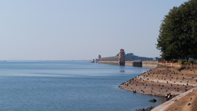
Over River Sutlej

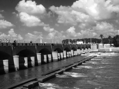
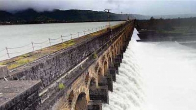
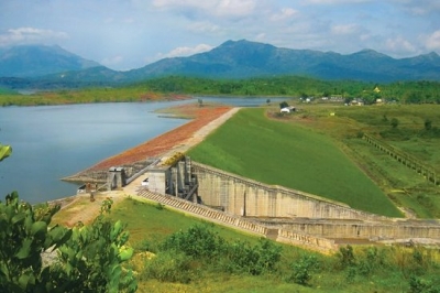
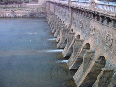
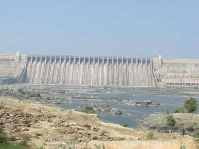
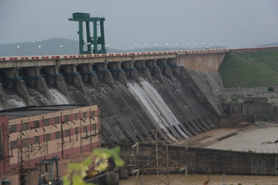
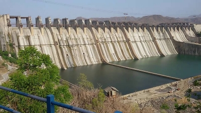
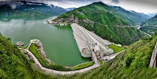
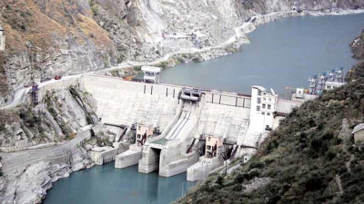
The 382 MW Sunni Dam Hydro Electric Project will come up over the river Sutlej, covering both Shimla and Mandi districts. It is constructed by state-owned SJVN Limited at an estimated cost of Rs. 2614.51 crore. The project is expected to be completed in five years.

The proposal to build the dam is expected to provide various benefits to local suppliers/enterprises/ MSMEs and encourage entrepreneurship opportunities within the country besides contributing to socio-economic development of the region. The implementation of the project is also expected to generate employment for about 4,000 persons during its peak construction.

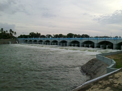
Run-of-the-river project

According to the Satluj Jal Vidyut Nigam (SJVN), a public sector undertaking involved in hydroelectric power generation and transmission, the run-of-the-river project will have a 71-metre-high gravity dam (one constructed from concrete), and six generating units in its surface powerhouse. Typically, a run-of-the-river hydroelectric generation plant will have no water storage or a limited storage. In other words, it's a facility that channels flowing water from a river through a canal to spin a turbine to enable power generation.

Green energy

The Sunni dam project will generate 1,382 million units of green energy annually and help reduce CO2 emissions equal to 1.1 million tonnes per year. Why is hydropower considered eco-friendly? Amidst intensification of human-induced climate warming, the fact that no fuels are burnt to generate hydropower and no emissions are released into the atmosphere in the process makes it a clean form of energy. The Sunni dam project is scheduled to be commissioned within 63 months of the commencement of construction.

Free power to HP government

On commissioning, 13% of the power generated will be provided free of cost to the Himachal Pradesh government, including 1% for the local area development fund. Usually, large dam constructions involve displacement of people in the respective regions. According to SJVN MD Nand Lal Sharma, each family affected by the project will get 100 units of free electricity per month for 10 years.

The aim of the hydroelectric power project is to fulfil a steady rise in electricity demand in the Northern Region by producing as much energy as possible, with minimum cost and fewer negative impacts on the environment. It is said that this hydro project will play a crucial role in balancing the grid over the intermittent nature of solar and wind power, and will significantly contribute towards the Government's vision of providing uninterrupted electricity supply to people.

Picture Credit : Google 

How old is the Kallanai dam?

Kallanai Dam or the Grand Anicut is one of the oldest dams in the world still in use. It is the fourth oldest water diversion or water regulator structure in the world. Built in the 2nd century AD across the Cauvery River in Tiruchirapalli district, Tamil Nadu, by King Karikala of the Chola Dynasty, the dam is made of unhewn stone and is 1,080 feet long and 66 feet wide. The dam was remodelled by the British during the 19th century. The area irrigated by the ancient irrigation network is about 28,000 hectares. By the early 20th century, the irrigated area had been increased to about 400,000 hectares.

The unique design and its effective functioning amazed the British in 1800s many years later and their military engineers were asked to study the river and the ancient dam. With an aim to increase irrigated area the British built another dam downstream by replicating the one made by Karikalan Chola. The Lower Anicut was built by Sir Aurthur Cotton in 19th century on a major tributary of River Kaveri.

While the tourists flock to gardens and bridge near Lower Anicut, the original Kallanai dam still stands strong and functions with as much effectiveness as 20 centuries ago. A larger than life statue of Karikalan atop a majestic elephant sits in a grandiose memorial structure, the Karikalan Chola Manimandapam. A statue of Sir Aurthur Cotton who built the second dam modelled after Kallanai dam has also been erected on the bridge.

Successful engineering, as they say, is all about understanding how things break or fail. It was this understanding of devastation that the fierce river waters could wreak that inspired ancient engineers to look at means to harness and prevent destruction. Indeed the story of civilization is in a sense the story of engineering….the long and arduous struggle to make the forces of nature work for man’s good.

Picture Credit : Google

Across which river does Mullaperiyar Dam lie?


Mullaperiyaru Dam is a masonry gravity dam on the Periyar River in the Indian state of Kerala. It is located 881 m (2,890 ft) above mean sea level, on the Cardamom Hills of the Western Ghats in Thekkady, Idukki District of Kerala, South India. It was constructed between 1887 and 1895 by John Pennycuick and also reached in an agreement to divert water eastwards to the Madras Presidency area (present-day Tamil Nadu). It has a height of 53.6 m (176 ft) from the foundation, and a length of 365.7 m (1,200 ft).


The Periyar river which flows westward of Kerala in to the Arabian sea was diverted eastwards to flow towards the Bay of Bengal to provide water to the arid rain shadow region of Madurai in Madras Presidency which was in dire need of a greater supply of water than the small Vaigai River could provide. The dam created the Periyar Thekkady reservoir, from which water was diverted eastwards via a tunnel to augment the small flow of the Vaigai River. The Vaigai was dammed by the Vaigai Dam to provide a source for irrigating large tracts around Madurai. Initially the dam waters were used only for the irrigation of 68,558 ha (169,411 acres).


The Periyar National Park in Thekkady, a protected area of Kerala, is located around the dam's reservoir, the 26 km2 (10 sq mi) Periyar lake. 62 different kinds of mammals have been recorded in Periyar, including many threatened ones. Periyar is a highly protected tiger reserve and hosts 35 tigers above two-years of age as of January 2017 in the reserve. Declared an elephant reserve on 2 April 2002, the population of Indian elephants in 2005 was estimated at 1100, however Periyar suffers greatly from poaching of elephant being the worst affected of South Indian sanctuaries.


Picture Credit : Google


Which mountain range forms the background for the Malampuzha Dam?


Malampuzha Dam is the largest dam and reservoir in Kerala[2], located near Palakkad, in the state of Kerala in South India, built post independence by the then Madras state. Situated in the scenic hills of the Western Ghats in the background it is a combination of a masonry dam with a length of 1,849 metres and an earthen dam with a length of 220 metres making it the longest dam in the state.


The dam project was begun in 1949 and completed in 1955. foundation stone for the project was laid on 27 March 1949, by the then Public Works Minister of Madras State, Sri M. Bhaktavatsalam as Palakkad was a part of the Madras Presidency during those times. The dam was constructed in record time, and on 9 October 1955, the then Chief Minister of Madras State, Sri. K Kamaraj, inaugurated the dam. The total catchment area is 145 square kilometres, while the reservoir has a capacity of 8000 cubic meters of water. The canal systems serve to irrigate farmland while the reservoir provides drinking water to Palakkad and surrounding villages.[4] The dam was constructed by the Madras government but upon the Creation of linguistically reorganized states ,The Malabar District encompossing the Dam became a part of the Kerala State.


This is a beautifully laid garden with a variety of brilliant and colourful flowers. It has the meticulously manicured grass lawn, the marvellous meadows and fabulous fountains displaying an orchestrated water show. The site of the Malampuzha Dam lies in the cauldron formed by the Western Ghats. The great stretch of the serene lake formed by the dam provides boating facilities. During the cool dark night, numerous lights sparkle like bright pearls arranged on a black sheet of cloth. This is a rare beauty. These lights are usually illuminated only in the weekends.


Picture Credit : Google


Across which river does the Banasura Sagar Dam lie?


The Banasura Sagar Dam traps the waters of the Karamanathodu, a tributary of the Kabini River. The goal of the project is to support the Kakkayam Hydro electric power project and satisfy the demand for irrigation and drinking water in a region known to have water shortages in seasonal dry periods.


In the dam's reservoir there is a set of islands that were formed when the reservoir submerged the surrounding areas. The islands with the Banasura hills are in the background view. It is the largest earth dam in India and the second largest of its kind in Asia. The dam is made up of massive stacks of stones and boulders.


The Banasura Sagar Dam is located 21 km from Kalpetta, in Wayanad District of Kerala in the Western Ghats. It is the largest earthen dam in India and the second largest in Asia and a starting point for hikes into the surrounding mountains. It is an important tourist attraction. Banasura Sagar Dam is at the foot of the Banasura Hill.


Picture Credit : Google


The ornamental Brindavan Gardens is attached to which dam constructed across the Cauvery?


The KRS dam is located across Kaveri River in Mandya district of Karnataka. The dam is surrounded by a beautiful ornamental garden known as Brindavan Gardens. The KRS dam was built across the river Kaveri in the year 1924.


The water released from this dam is further used as an important source of water in the state of Tamil Nadu, which has its own Mettur dam in the Salem district.


The dam is named for the then ruler of the Mysore Kingdom, Krishnaraja Wodeyar IV. The Chief Engineer, Sir M. Vishveswaraya engineered the construction of the dam during the Wadeyar kings regime in 1932.


The region of Mysore and especially Mandya had historically been dry and had witnessed mass migration to adjoining areas in the hot summers. A severe drought in 1875–76 had wiped out one-fifth of the population of the Kingdom of Mysore. Crop failures were common due to lack of water for irrigation. The Kaveri River was seen as a potential source of irrigation water for the farmers in and around Mysore in the erstwhile Kingdom of Mysore.


Foundation Stone to dam was laid on 11 November 1911. The dam was built across river Kaveri in 1924. It is the main source of water for the districts of Mysore. The water is used for irrigation in Mysore and Mandya, and it is the main source of drinking water for all of Mysore, Mandya and almost the whole of Bengaluru city, the capital of Karnataka. The water released from this dam flows into the state of Tamil Nadu and is stored in Mettur dam in the Salem district.


Picture Credit : Google


The Nagarjuna Sagar Dam on the Krishna straddles which two southern States?


Nagarjuna Sagar Dam is a masonry dam across the Krishna River at Nagarjuna Sagar which straddles the border between Guntur district, Andhra Pradesh and Nalgonda district, Telangana.


Nagarjuna Sagar Dam was the earliest in a series of large infrastructure projects termed as "modern temples" initiated for achieving the Green Revolution in India. It is also one of the earliest multi-purpose irrigation and hydroelectric projects in India. The dam provides irrigation water to the Nalgonda, Suryapet, Krishna, Khammam, West Godavari, Guntur, and Prakasam districts along with electricity generation. Nagarjuna Sagar Dam is designed and constructed to use all the water impounded in its reservoir of 312 TMC gross storage capacity which is the second biggest water reservoir in India.


The construction of the dam submerged an ancient Buddhist settlement, Nagarjunakonda, which was the capital of the Ikshvaku dynasty in the 1st and 2nd centuries and the successors of the Satavahanas in the Eastern Deccan. Excavations there yielded 30 Buddhist monasteries as well as artwork and inscriptions of historical importance. Prior to the reservoir's flooding, monuments were dug up and relocated. Some were moved to Nagarjunakonda, now an island in the middle of the reservoir. Others were moved to the nearby mainland village of Anupu.


The reservoir water was released into the left and right bank canals by Prime Minister Indira Gandhi on August 4, 1967. Construction of the hydroelectric power plant followed, with power generation increasing between 1978 and 1985 as additional units came into service. In 2015, diamond jubilee celebrations of project's inauguration were held, alluding to the prosperity the dam has ushered into the region.


Picture Credit : Google


Which dam – one of the longest in the country – in Odisha has been constructed across the Mahanadhi?


Hirakud is the longest earthen Dam in the world and stands across the mighty river, Mahanadi, in the Sambalpur region of Odisha. It was the first major multipurpose river valley project after India’s Independence in 1947. This human-made structure is located 15 km north of Sambalpur – its majesty only rivaled by the sparkling waters of the river it stands on. With an area of 1,33,090 sq km, the Dam is more than twice the area of Sri Lanka. The main Hirakud Dam has an overall length of 4.8 km (3.0 mi), stretching across the Laxmidungri hills on the left and the Chandili Dunguri hills on the right.


The construction of the Dam was proposed by M. Visveswararya to tackle the challenges of devastating floods in the Mahanadi delta. A detailed investigation report was submitted in 1945. Under the leadership of the then President of India, Dr. B. R. Ambedkar, efforts to procure investments began keeping in mind the prospective benefits of constructing the multipurpose Mahanadi Dam. The project was taken up by the Central Waterways, Irrigation and Navigation Commission.


On 15 March 1946, Sir Hawthorne Lewis, the Governor of Odisha, laid the foundation stone of the Hirakud Dam. Pandit Jawaharlal Nehru laid the first batch of concrete on 12 April 1948.


More than 200 temples were lost in the construction of the Dam. The waters of the Hirakud Dam provide excellent opportunities for archaeology buffs and scuba diving enthusiasts to explore the remnants of forgotten history. The hidden temples are visible to boating visitors during the summer months of May and June.


Picture Credit : Google


Located in Gujarat, which dam on the Narmada helps provide water and electricity to three other States too?


The Sardar Sarovar Dam is a concrete gravity dam on the Narmada River in Kevadiya near Navagam, Gujarat in India. Four Indian states, Gujarat, Madhya Pradesh, Maharashtra and Rajasthan, receive water and electricity supplied from the dam.


A special allocation of 0.86 MAF of water has been made to provide drinking water to 173 urban centres and 9490 villages  within and out-side command in Gujarat for present population of 28 million and prospective population of over 40 million by the year 2021. All the villages and urban centres of arid region of Saurashtra and Kachchh and all "no source" villages and the villages affected by salinity and fluoride in North Gujarat will be benefited. Water supply requirement of several industries will also be met from the project giving a boost to all-round production


There are two power houses viz. River Bed Power House and Canal Head Power House with an installed capacity of 1200 MW and 250 MW respectively. The power would be shared by three states - Madhya Pradesh - 57%, Maharashtra - 27% and Gujarat 16%. This will provide a useful peaking power to western grid of the country which has very limited hydel power production at present. A series of micro hydel power stations are also planned on the branch canals where convenient falls are available.


It will also provide flood protection to riverine reaches measuring 30,000 ha. covering 210 villages and Bharuch city and a population of 4.0 lac in Gujarat.


Picture Credit : Google


In which State does the Tungabhadra Dam lie?


One of the oldest Dams built in India post-independence, Tungabhadra Dam is also known as Pampa Sagar. Tungabhadra Dam is built across the Tungabhadra River, a tributary of River Krishna. The Dam lies in Hospet in the Ballari district of Karnataka and has a whopping capacity of 135,000 million cubic feet.


The river Tungabhadra is a wonder in itself. If you are a religious person, you will especially love to know that Tungabhadra River is considered sacred in Karnataka and Andhra Pradesh. This river was mentioned in the epic Ramayana by the name Pampa River.  Humans are always attracted to witness the unseen or rarely seen. These birds are rare as you cannot find them around normal villages and water bodies. You can spot flamingos, storks, greater spot-billed pelicans. Over the years after the construction of the Dam, these birds have made the Dam their habitat. The river is rich with various species of fish and other aquatic animals. Tourists visit this reservoir in order to spot these rare birds and enjoy fishing with family and friends. Tungabhadra Dam has become a popular picnic spot in the area over these decades. 


In the beginning of winter, a huge congregation of birds is seen along the vast mud-banks that span hundreds of kilometres. Small islands and mudflats provide shelter to migratory birds.   About 200 species of birds have been recorded in and around TB Dam reservoir, and more than 20,000 migratory birds are found in winter in the reservoir.


As far as conservation statuses are concerned, the TB Dam area is host to birds classified as ‘Vulnerable’ as well as many listed as ‘Near Threatened’ by the IUCN.  Over the period of sixty years of its existence, the backwaters of Tungabhadra Dam have remained a permanent paradise for local and migratory birds. In spite of disturbances such as the movement of cattle, people, vehicles, fishermen etc., the breeding of birds has sustained, and their populations continue to remain stable, which is heartening, and something beyond our imagination!


Picture Credit : Google


On which river has Kallanai dam been built?


Kallanai is an ancient dam built across the river Kaveri in South India. This is situated in Tamil Nadu in the district of Trichy. This dam was constructed in AD 2nd century by the Chola king Karikalan which is located 15 km away from Tiruchirapalli. The dam is originally located in Thanjavur district, by approximately 20 km from Trichy across Kaveri river. Kallanai Dam is the fourth older water rerouting system in the world which is still in existence.


Kallanai (is also known as Grand Anicut) is an incisive water flow system built by Karikala Cholan by his great engineering expertise. The main aim behind building a dam was to encourage irrigation. This was also constructed as a barrier across the river Kaveri, by means of protecting his kingdom from flooding. The dam was originally constructed by about 2000 years ago. Later on the 19th century, the British Captain Caldwell re-modeled the dam to cater irrigation needs.


The dam locality is related with the history of Tamil Nadu because of the Kallanai’s Engineering Marvel and it makes the visitors to read more about the Tamil literature, language and about the Sangam period. The tourists can experience a fresh bath on the river (if the water levels are not high) and can taste the fishes on the small shops on the pocket roads. The 2000-year-old dam leaves spectacular treat and the area is preserved with a park and the drive-in facilities so that the people use it as a picnic spot. Fresh fish sold by local fishermen at lowest prices in an overriding attraction to the tourists. The Kallanai dam is truly what something to be experienced before one leaves the earth!


Picture Credit : Google


In which State is the Tehri Dam – considered one of the highest in the country and built on Bhagirathi River – located?


The Tehri Dam is the highest dam in India and one of the highest in the world. It is a multi-purpose rock and earth-fill embankment dam on the Bhagirathi River near Tehri in Uttarakhand, India. Located in the foothills of the Central Himalayan Seismic gap, Tehri Dam is considered one of the world's largest hydroelectric projects. Though its construction has undergone different hurdles, the dam now stands proudly in the Tehri Garhwal region. The place offering a sight of the massive dam with stagnant water and high mountains on all side is easily reachable via well-maintained roads. An example of mindful engineering and architecture, the dam becomes a must visit for anyone seeking adventure in the laps of beauty.


A preliminary investigation for the Tehri Dam Project was completed in 1961 and its design was completed in 1972 with a 600 MW capacity power plant based on the study. Construction began in 1978 after feasibility studies but was delayed due to financial, environmental and social impacts.


In 1986, technical and financial assistance was provided by the USSR, but this was interrupted years later with political instability. India was forced to take control of the project and at the first, it was placed under the direction of the Irrigation Department of Uttar Pradesh. However, in 1988 the Tehri Hydro Development Corporation was formed to manage the dam and 75% of the funding would be provided by the federal government, 25% by the state. Uttar Pradesh would finance the entire irrigation portion of the project.


Picture Credit : Google