Which river flows in the Mudumalai Tiger Reserve?


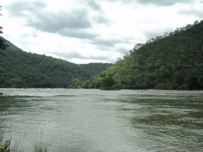
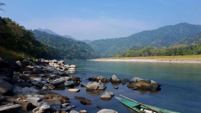
The Moyar river flows downstream into the Mudumalai Tiger Reserve and is the natural line of division between Mudumalai and Bandipur Sanctuary.


The Western Ghats Nilgiri Sub-Cluster of 6,000 Km2, including all of Mudumalai National Park, is under consideration by the UNESCO World Heritage Committee for selection as a World Heritage Site.


A variety of habitats ranging from Tropical Evergreen forest, Moist mixed deciduous, Moist Teak forest, Dry teak forest, Secondary grass lands, Shrubs and Swamps exists here.


There is a high diversity of animal life in the park with about 50 species of fishes, 21 species of amphibians, 34 species of reptiles, 200 species of birds and 50 species of mammals.


The park is ideal home to several endangered and vulnerable species including Elephant, Tiger, Gaur, Leopard, Deer, Wild dog etc.  There are about 200 species of birds in the park, including White rumped vulture, Long billed vulture, Red crest, Mynas, Parakeets, Owls etc.


Mudumalai National Park is located in the Nilgiris district of the state of Tamil Nadu. Mudumalai National Park is a part of Mudumalai Wildlife Sanctuary.


Mudumalai National Park is situated at the tri-junction of the three southern states of Tamilnadu, Kerala, and Karnataka.


The Sanctuary shares its boundaries with the states of Karnataka and Kerala.


Picture Credit : Google


Which river flows into neighbouring Tamil Nadu before draining into the sea at Poompuhar?


Cauvery water enters Tamil Nadu from Karnataka at Dabhakuzhi near Biligundulu in Dharmapuri district and the river endures rampant pollution from Mettur till the time it enters the sea in Poompuhar.


Cauvery is pumped from a place 100 km away from Bengaluru, making it Asia’s costliest water. The city receives about 1,390 million litres per day (MLD) water, and sewage of an equal amount or more is generated. The Bangalore Water Supply and Sewerage Board has 24 sewage treatment plants capable of treating only about 760 MLD. Remaining sewage flows directly into the lakes.


auvery’s tributaries, Noyyal and Bhavani, carry a considerable amount of pollution. The Noyyal is as good as dead due to effluents released by more than 700 dyeing units in Tiruppur. From Karur to Tiruchirapalli, the river flows at its broadest and is called Akanda Cauvery. Here, the river is put to severe stress due to rampant sand mining, which goes unabated till date despite numerous strictures by the Madras High Court.


Though the polluted water undergoes some natural cleaning process by the time it reaches the Delta region, letting of sewage and dumping of garbage and hospital waste into the river pollute it further, making the water unfit for drinking and sometimes even for irrigation.


Activists allege that the industries in the Cauvery belt release untreated effluents into the river during the night to escape the wrath of local people. The paper mill owned by the Tamil Nadu government near Karur is also a major cause for 

water pollution in the area and activists allege the factories on the banks of the river consume more water than they are allowed to pump.


Picture Credit : Google


Through which inlet does the Narmada drain into the Arabian Sea?


The Narmada River, also called the Reva and previously also known as Narbada (Nerbudda). It is also known as "Life Line of Madhya Pradesh and Gujarat" for its huge contribution to the state of Madhya pradesh and Gujarat in many ways. Narmada rises from Amarkantak Plateau in Anuppur district Madhya Pradesh. It forms the traditional boundary between North India and South India and flows westwards over a length of 1,312 km (815.2 mi) before draining through the Gulf of Khambhat into the Arabian Sea, 30 km (18.6 mi) west of Bharuch city of Gujarat.


The Narmada River in central India is the fifth largest river in the Indian subcontinent. It forms the traditional boundary between North India and South India and flows westwards over a length of 1,312 km (815.2 mi) before draining into the Arabian Sea. It is one of only three major rivers in pensinsular India that runs from east to west. It is also the only river in India that flows in a rift valley flowing west between the Satpura and Vindhya ranges.


In this orthorectified image, the Narmada can be seen connected to a large reservoir that is part of the Indira Sagar Project, a multipurpose key Project of Madhya Pradesh on the Narmada River at Narmadanagar in the Khandwa District of Madhya Pradesh. The construction of main dam started in 1992. Total catchment area at the dam site is 61642 km2.


Picture Credit : Google


In which state does the Rushikulya River flow?


The Rushikulya River is one of the major rivers in the state of Odisha and covers entire catchment area in the districts of Kandhamal and Ganjam of Odisha. The river flows from the Daringbadi hill station in Kandhamal district. In the Ganjam district it flows through Surada, Dharakote, Asika, Pitala, Purusottampur, Taratarini, Pratappur, Alladigam, Brahmapur, Ganjam and the Chhatrapur block. The river is 165 km long with a total catchment area of 7700 km2.


A number of large scale industries have been set up in the basin. Among them are Grasim Industries Ltd-Ganjam Chemical Division (formerly Jayashree Chemical Ltd). Aska Co-operative Sugar Industries Ltd. Nuagam, Aska Spinning Mills, Monorama Chemical Works Ltd., Orissa Tubes Pvt. Ltd., etc. There are about 3360 numbers of small scale industries of different categories mainly food and allied, forest & wood based, rubber and plastic products and glass and ceramics. There is enough scope for setting up forest based industries. The basin is rich in mineral wealth. The major economic minerals are clay, limestone, manganese, sand talc, black sand and grinding materials.


Picture Credit : Google


From which country does the Himalayan River Manas flow into India?


The river flows through Bhutan in a south-west direction between two ranges of the Lower Himalayas in V-shaped gorges and enters into Assam in India into the south-central foot hills of the Himalayas.


The river valley has two major reserve forest areas, namely the Royal Manas National Park (43,854 hectares (108,370 acres), established in 1966) in Bhutan and the contiguous Manas Wildlife Sanctuary (391,000 hectares (970,000 acres) in 1955 increased to 95,000 hectares (230,000 acres) in December 1985) encompassing Project Tiger reserve, an elephant reserve and a biosphere reserve, which constitutes a UNESCO World Heritage Site declared in December 1985.


The Manas River drains 41,350 square kilometres (15,970 sq mi) of eastern Bhutan and northeast India. It has three major branches: the Drangme Chhu, Mangde Chhu, and Bumthang Chhu that cover most of eastern Bhutan, with the Tongsa and Bumthang valleys also forming part of its catchment. The area drained in Bhutan territory is 18,300 km2 and is bound by the geographical coordinates 26.217°N 90.633°E. A part of the main stem of the river rises in the southern Tibet before entering into India at Bumla pass at the northwestern corner of Arunachal Pradesh.


Out of the large catchment of the river valley, protected or reserved areas have been specifically demarcated, both in Bhutan and India, which are declared national parks or sanctuaries. The two reserved forest and wild life areas cover an area of 9,938.54 square kilometres (3,837.29 sq mi), which account for about 24% of the total catchment area of 41,350 square kilometres (15,970 sq mi) of the Manas river valley; brief details are provided.


Picture Credit : Google


Which river is largely referred to as Tsangpo throughout its upper case?


The Brahmaputra called Yarlung Tsangpo in Tibet, Siang/Dihang River, in Arunachal Pradesh and Luit, Dilao in Assam, is a trans-boundary river which flows through Tibet, India and Bangladesh. It is the ninth largest river in the world by discharge, and the 15th longest.


The BrahmaputraRiver originates in the Chemayungdung mountain ranges which nearly sixty miles south-east of Mansarovar lake in the MountKailash range in Southern Tibet at an elevation of 5300 m.A spring called Tamchok Khambab spills from the glaciers which later gather breath and volume to become the Tsangpo, the highest river in world.


Apart from the name Tsangpo, the Brahmaputra is also known by its Chinese name, Yarlung Zangbo in Tibet.  There are several tributaries of Tsangpo in Tibet. Before entering India, the river passes Pi (Pe) in Tibet and suddenly turns to the north and northeast and cuts a course through a succession of great narrow gorges between the mountain Gyala Peri and Namjabarwa (Namcha Barwa) in a series of rapids and cascades.


In India the total basin area of BrahmaputraRiver is 197 316 sq. km. which 5.9% of the total geographic area of the country. In India the river is spread over states of Arunachal Pradesh, Assam, West Bengal, Meghalaya, Nagaland and Sikkim.


Picture Credit : Google


The Harappan civilization flourished around which river valley?


The Harappan civilization was located in the Indus River valley. Its two large cities, Harappa and Mohenjo-daro, were located in present-day Pakistan’s Punjab and Sindh provinces, respectively. Its extent reached as far south as the Gulf of Khambhat and as far east as the Yamuna (Jumna) River.


Before the excavation of these Harappan cities, scholars thought that Indian civilization had begun in the Ganges valley as Aryan immigrants from Persia and central Asia populated the region around 1250 BCE. The discovery of ancient Harappan cities unsettled that conception and moved the timeline back another 1500 years,situating the Indus Valley Civilization in an entirely different environmental context.


The Indus River Valley Civilization is considered a Bronze Age society; inhabitants of the ancient Indus River Valley developed new techniques in metallurgy—the science of working with copper, bronze, lead, and tin. Harappans also performed intricate handicraft using products made of the semi-precious gemstone Carnelian.


Picture Credit : Google


On which river bank is the Taj Mahal situated?


 The Taj Mahal was built on the banks of the river Yamuna, between 1631 and 1643, by the Mughal emperor Shah Jahan as a mausoleum for his beloved wife Arjumand Banu Begum, who was also known by the title Mumtaz Mahal. 


The Taj Mahal was designated as a UNESCO World Heritage Site in 1983 for being "the jewel of Muslim art in India and one of the universally admired masterpieces of the world's heritage". It is regarded by many as the best example of Mughal architecture and a symbol of India's rich history. The Taj Mahal attracts 7–8 million visitors a year and in 2007, it was declared a winner of the New 7 Wonders of the World (2000–2007) initiative.


The Taj Mahal incorporates and expands on design traditions of Persian and earlier Mughal architecture. Specific inspiration came from successful Timurid and Mughal buildings including the Gur-e Amir (the tomb of Timur, progenitor of the Mughal dynasty, in Samarkand), Humayun's Tomb which inspired the Charbagh gardens and hasht-behesht (architecture) plan of the site, Itmad-Ud-Daulah's Tomb (sometimes called the Baby Taj), and Shah Jahan's own Jama Masjid in Delhi. While earlier Mughal buildings were primarily constructed of red sandstone, Shah Jahan promoted the use of white marble inlaid with semi-precious stones. Buildings under his patronage reached new levels of refinement.


Picture Credit : Google


Which is the last Indian State the Himalayan River Ganges enters before flowing into Bangladesh and eventually into the Bay of Bengal?


 West Bengal is the last Indian state that the Ganges enters, and, after it flows into Bangladesh, the Mahananda River joins it from the north. In West Bengal in India, as well as in Bangladesh, the Ganges is locally called the Padma. The westernmost distributaries of the delta are the Bhagirathi and the Hugli (Hooghly) rivers, on the east bank of which stands the huge metropolis of Kolkata (Calcutta). The Hugli itself is joined by two tributaries flowing in from the west, the Damodar and the Rupnarayan. As the Ganges passes from West Bengal into Bangladesh, a number of distributaries branch off to the south into the river’s vast delta. In Bangladesh the Ganges is joined by the mighty Brahmaputra (which is called the Jamuna in Bangladesh) near Goalundo Ghat. The combined stream, there called the Padma, joins with the Meghna River above Chandpur. The waters then flow through the delta region to the Bay of Bengal via innumerable channels, the largest of which is known as the Meghna estuary.


The rivers in the West Bengal area are sluggish; little water passes down them to the sea. In the Bangladeshi delta region, the rivers are broad and active, carrying plentiful water and connected by innumerable creeks. During the rains (June to October) the greater part of the region is flooded to a depth of 3 or more feet (at least 1 metre), leaving the villages and homesteads, which are built on artificially raised land, isolated above the floodwaters. Communication between settlements during that season can be accomplished only by boat.


Picture Credit : Google


An asteroid impact is believed to have contributed to the extinction of the dinosaurs. When did this happen?


The dinosaur-killing crash threw huge amounts of debris into the air and caused massive tidal waves to wash over parts of the American continents. There is also evidence of substantial fires from that point in history.


For a long time it was thought that the non-bird dinosaurs died out 65 million years ago.


But Paul explains, 'The dating of those layers of clay around the world is very accurate - it's estimated to within a couple of thousands of years.


As originally proposed in 1980 by a team of scientists led by Luis Alvarez and his son Walter, it is now generally thought that the K–Pg extinction was caused by the impact of a massive comet or asteroid 10 to 15 km (6 to 9 mi) wide, 66 million years ago, which devastated the global environment, mainly through a lingering impact winter which halted photosynthesis in plants and plankton.


The blame can't solely rest on the asteroid. Prior to its crash landing, Earth was experiencing a period of climate change. This was making things harder for life on our planet.


In what is now central India, there was substantial volcanic activity that, although unrelated to the asteroid impact, was causing problems of its own. The resulting lava outcrop is now known as the Deccan Traps.


Paul says, 'For two million years there was a huge amount of volcanic activity going on, spewing gases into the atmosphere and having a major impact on global climate.


Picture Credit : Google


The FAST is the world’s largest and most sensitive radio telescope. Where is it located?


China's Five-hundred-meter Aperture Spherical Radio Telescope, known as FAST, is the world's most sensitive listening device.  For the review to be successful, FAST must meet the specifications initially laid out in the proposed design in 2008, such as the telescope's sensitivity and performance. NAOC ran an internal review earlier this year, demonstrating that the telescope is as - if not more - sensitive as planned.


The construction of FAST, while solely funded by the Chinese government, involved collaboration with international organizations, including Australia's Commonwealth Scientific and Industrial Research Organization, but exactly who in the international community will be able to use FAST - and to what extent - is still to be decided. While both LI and JIANG stressed the importance of international collaboration (they have both conducted research using data from radio telescopes in Australia and in Puerto Rico), the decision lies with the Chinese government.


That work could include the detection of pulsars, for example. When a giant star collapses in on itself, it forms a dense neutron star that rotates, flashing a beam of intense radiation every so often. The beam is called a pulsar, and it can't be visually observed. However, because that flash is a radio signal, scientists can listen it for using a radio telescope like FAST. Once they detect a pulsar, they can use it to identify and measure the behavior of other physical phenomena, such as gravitational waves.


Picture Credit : Google


What is the name of NASA’s next moon mission?


With the Artemis program, NASA will land the first woman and next man on the Moon by 2024, using innovative technologies to explore more of the lunar surface than ever before. We will collaborate with our commercial and international partners and establish sustainable exploration by the end of the decade. Then, we will use what we learn on and around the Moon to take the next giant leap – sending astronauts to Mars.


NASA’s powerful new rocket, the Space Launch System (SLS), will send astronauts aboard the Orion spacecraft nearly a quarter million miles from Earth to lunar orbit. Astronauts will dock Orion at the Gateway and transfer to a human landing system for expeditions to the surface of the Moon. They will return to the orbital outpost to board Orion again before returning safely to Earth.


While Mars remains our horizon goal, we have set our sights first on exploring the entire surface of the Moon with human and robotic explorers. We will send astronauts to new locations, starting with the lunar South Pole.


The femininity of the name is a deliberate choice as well: The Apollo missions were crewed exclusively by men, though they relied on many women for their success. This time around things are different: Both women and men have now explored and set records in space, and no doubt those of other identifications will do so soon as well.


Picture Credit : Google


Which Indian observatory discovered galaxy AUDFs01, one of the farthest in the Universe?


Indian astronomers have discovered one of the farthest star galaxies in the universe! In a key achievement for the Indian space programme, a team of astronomers headed by Dr Kanak Saha, from Pune-based Inter-University Centre for Astronomy and Astrophysics (IUCAA), discovered a galaxy called AUDFs01. The information was shared by Union Minister Dr Jitendra Singh on Tuesday. He said that the first Multi-Wavelength Space Observatory by India, “AstroSat”, found the galaxy, which is located at a distance of 9.3 billion light years from the Earth, by detecting extreme UV light from it.


The statement said that the uniqueness of this feat was the AstroSat/UVIT detector’s background noise was much less than the detector placed on the US-based NASA’s Hubble Space Telescope.


The Indian Space Research Organisation (ISRO) had launched the AstroSat on September 29, 2015. The development of the country’s maiden space observatory had been undertaken by a team led by Shyam Tandon, a Professor at IUCAA, and the project had been supported by the Indian space agency.


Picture Credit : Google


Which is the Russian Venus programme which sent probes to the planet between 1961 and 1984?


The Venera program was the name given to a series of space probes developed by the Soviet Union between 1961 and 1984 to gather information about the planet Venus. 


The probe was equipped with scientific instruments including a flux-gate magnetometer attached to the antenna boom, two ion traps to measure solar wind, micrometeorite detectors, and Geiger counter tubes and a sodium iodide scintillator for measurement of cosmic radiation. An experiment attached to one solar panel measured temperatures of experimental coatings. Infrared and/or ultraviolet radiometers may have been included. The dome contained a KDU-414 engine used for mid-course corrections. Temperature control was achieved by motorized thermal shutters.


During most of its flight, Venera 1 was spin stabilized. It was the first spacecraft designed to perform mid-course corrections, by entering a mode of 3-axis stabilization, fixing on the Sun and the star Canopus. Had it reached Venus, it would have entered another mode of 3-axis stabilization, fixing on the Sun and Earth, and using for the first time a parabolic antenna to relay data.


Picture Credit : Google


Which lunar spacecraft sent the first map of the Moon?


The Lunar Reconnaissance Orbiter (LRO) was launched with the Lunar Crater Observation and Sensing Satellite (LCROSS) on the first U.S. mission to the Moon in over 10 years. Both were part of NASA’s now-canceled Lunar Precursor Robotic Program.


LRO’s primary goal was to make a 3D map of the Moon’s surface from lunar polar orbit as part of a high-resolution mapping program to identify landing sites and potential resources, to investigate the radiation environment, and to prove new technologies in anticipation of future automated and human missions to the surface of the Moon.


LRO gathered information on day-night temperature maps, contributed data for a global geodetic grid, and conducted high-resolution imaging. The spacecraft paid particular emphasis to the Moon’s Polar Regions where scientists suspected there might be water in the permanently shadowed areas. (In 2018 a team of scientists directly observed definitive evidence of water ice on the Moon’s surface. At the southern pole, most of the ice is concentrated at lunar craters, while the northern pole’s ice is more widely, but sparsely spread.)


Picture Credit : Google