When did weather forecasting begin?


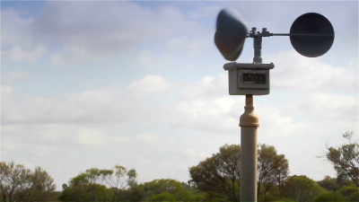
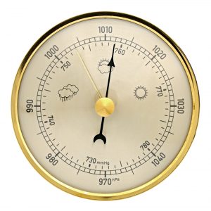
People have been able to forecast the weather for hundreds of years. Meteorologists have used simple instruments like thermometers, rain gauges, barometers and wind gauges for many years, but with the arrival of satellite photography, weather forecasting has been transformed. With the use of computers, increasingly accurate forecasting is now possible.


Traditional forecasters have been known to use pine cones, which open and close according to the humidity of the air. An open cone is supposed to mean dry weather. Seaweed also responds to changes in humidity. Dry seaweed indicates dry weather.


Fact File:


There is an old saying regarding the weather: if the oak tree has its leaves before the ash then it will be a fine summer.


Picture Credit : Google


When is a barometer used?


A barometer is used to measure the changes in air pressure. Air pressure varies across different parts of the Earth’s surface, and these differences cause winds. Air moves from an area of high pressure, or an anticyclone, to an area of low pressure, or a depression. Depressions are usually associated with worsening weather conditions and rain. In a mercury barometer the air pressure pushes down on the mercury, which is forced up the barometer to give an accurate reading.


Air pressure is greatest at sea level, where it amounts to 14.7 pounds a square inch. It is greatest there because that is the bottom of the atmosphere. At highest altitudes the pressure is less.


Fact File:


The higher we go the less air pressure there is. This is the reason that space suits and the cabins of high-flying planes are pressurized. They are designed to maintain the air pressure our bodies must have.


Picture Credit : Google


When do fog and mist arise?


It is tiny water droplets condensing from moist air that cause fog and mist to rise. The water droplets can occur at ground level. The air can only hold a limited amount of water. If the air suddenly cools, its capacity to hold water is reduced, which results in a mist or fog.


When fog develops, visibility can be affected quite badly. Mist is less dense. It often occurs on calm, clear nights when heat rises, forming a thin layer of mist close to the ground. Mist often forms over water because a mass of warm air passes over a cold stretch of water.


Sometimes visibility is affected in built up areas due to mist and fog, but this is sometimes mistaken for smog. Smog is a buildup of exhaust fumes and factory smoke which hangs over the area until a huge amount of air movement can blow the smog away.


Fact File:


Fog particles are small, less than 1/25,000 of an inch in diameter. When you have a dense fog and can’t see in front of you, it is because there may be as many as 20,000 of these particles in one cubic inch.


Picture Credit : Google