Before Moscow, St. Petersburg was the capital of which country?
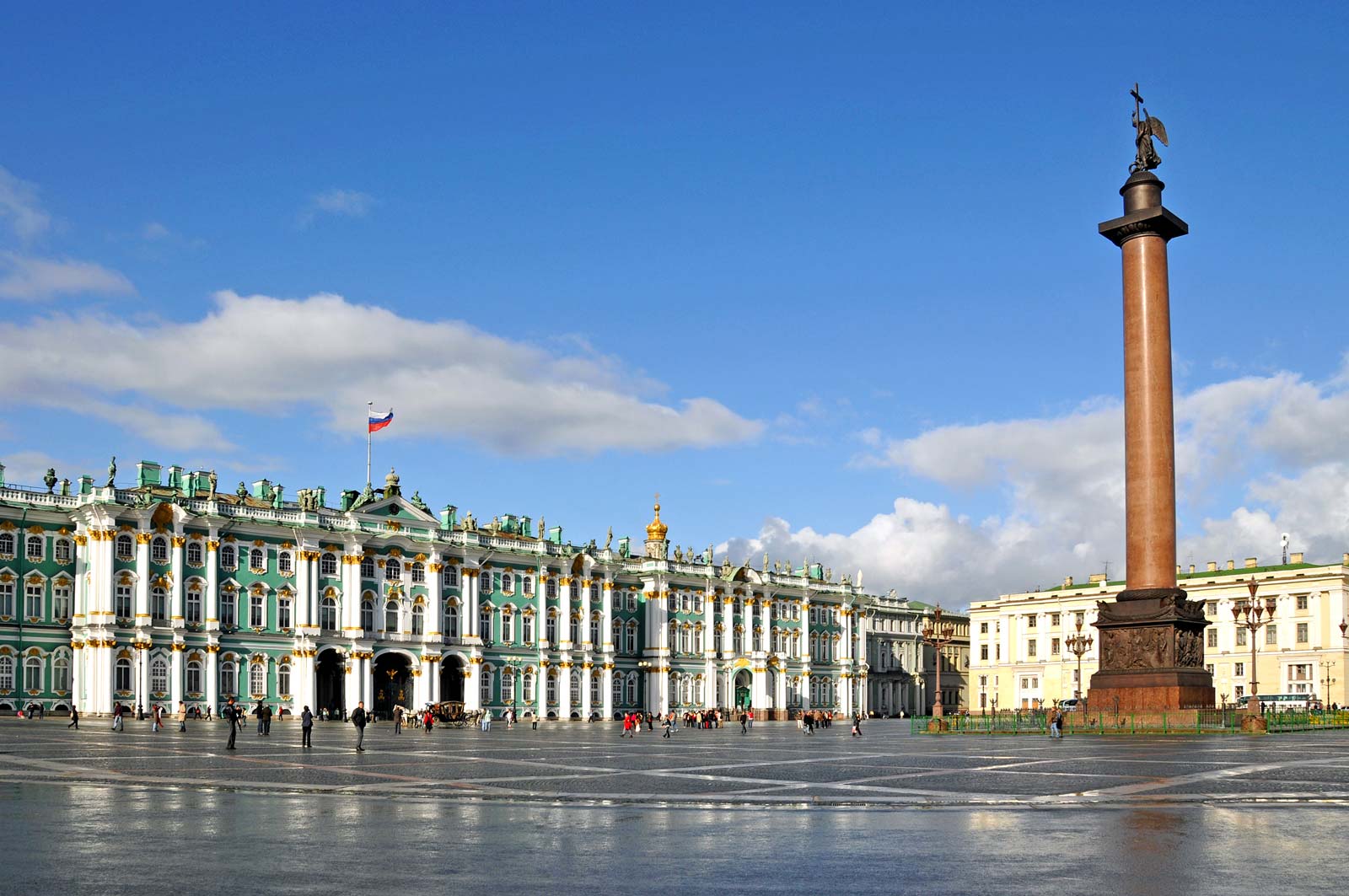
From early modern times until the present, Russia (temporarily extended to the USSR) had two capital cities: Moscow and Petersburg. Moscow was the original capital, it was succeeded by Petersburg from the beginning of the 18th century. 

The capital of the Union of Soviet Socialist Republics (U.S.S.R.) until the union dissolved in 1991, Moscow attracted world attention as a centre of communist power; indeed, the name of the seat of the former Soviet government and the successor Russian government, the Kremlin (Russian: Kreml), was a synonym for Soviet authority. The dissolution of the U.S.S.R. brought tremendous economic and political change, along with a significant concentration of Russia’s wealth, into Moscow. Area 414 square miles (1,035 square km).

Russia’s Soviet past collides with its capitalist present everywhere in the country, but nowhere is this contrast more visible than in Moscow. Vladimir Ilich Lenin’s Mausoleum remains intact, as do many dreary five-story apartment buildings from the era of Nikita Khrushchev’s rule (the mid-1950s to the mid-1960s), yet glitzy automobiles and Western-style supermarkets, casinos, and nightclubs are equally visible. Many Orthodox churches, as well as some synagogues and mosques, have been restored, Moscow’s novel theatres have reclaimed leadership in the dramatic arts, and traditional markets have been revived and expanded. These markets, which under the Soviets were known as kolkhoz (collective-farm) markets and sold mainly crafts and produce, are now more sophisticated retail establishments.

Picture Credit : Google
Before Brasilia became Brazil’s capital in the mid-19th century, which city was the country’s capital?

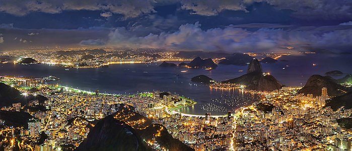
Rio de Janeiro is easily the most iconic city in Brazil. It was a bustling hub and most active port in the ‘New World’ and served as the capital of Brazil for nearly 200 years until the creation of the current capital, Brasilia, in 1961. 

As the Spanish conquered their way down the western half of South America, the Portuguese had a blank map in regards to the east and claimed the resource dense area, which became the Portuguese Empires largest state, Brazil. As the centrally and strategically located port of Rio de Janeiro began to grow, the primary capital of Salvador was stripped of its crown which was handed, in 1763, to Rio de Janeiro.

In spring of 1808, Prince John and the Portuguese Royal Court arrived in Rio de Janeiro, and then in December, as the year came to a close, Prince John created the United Kingdom of Portugal, Brazil and the Algarves, elevating the status, rank and administrative independence of Brazil, an enormous foundation towards gaining future independence. Now, with all the nations sitting on the same pedestal, and the Royal Family being situated in Rio de Janeiro, the city became the capital of the Kingdom, and the Royal Family remained there until Napoleon’s defeat in 1814. It was not until 1821, that the Royal Family departed Brazil for Lisbon, but by this time migration from Portugal had increased, the population of Rio de Janeiro had grown significantly and the city had transformed itself into an economic capital in South America.

Picture Credit : Google

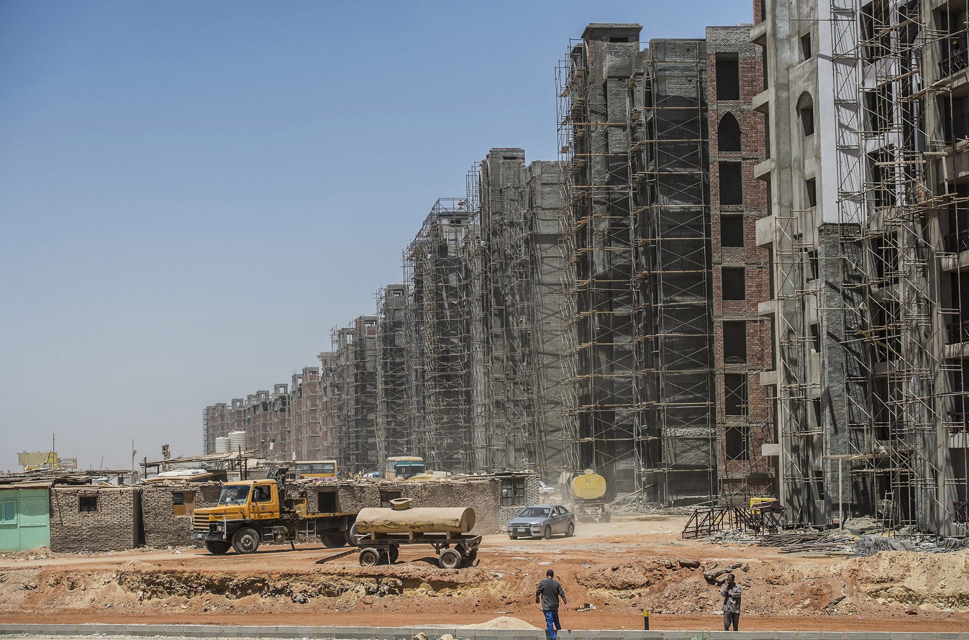
Egypt is preparing to move to what is simply known as the New Administration Capital from which existing capital city?

The new capital of Egypt is yet to be given a name. A competition was launched on the new capital's website to choose a new name and logo for the city, noting that a jury of specialists were formed to evaluate the proposals submitted to list and determine the best among all the proposals. Though, no official results have yet been announced by the Egyptian Government.

The new city is to be located 45 kilometres (28 miles) east of Cairo and just outside the Second Greater Cairo Ring Road, in a currently largely undeveloped area halfway to the seaport city of Suez. According to the plans, the city will become the new administrative and financial capital of Egypt, housing the main government departments and ministries, as well as foreign embassies. On 700 square kilometres (270 sq mi) total area, it would have a population of 6.5 million people, though it is estimated that the figure could rise to seven million.

Officially, a major reason for the undertaking of the project was to relieve congestion in Cairo, which is already one of the world's most crowded cities, with the population of Greater Cairo expected to double in the next few decades. Cairo, for comparison, has a population of nearly 20 million.

Picture Credit : Google

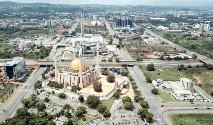
In 1991, which city became Nigeria’s new capital?

Abuja is the capital and eighth most populous city of Nigeria. Located in the centre of the country within the Federal Capital Territory (FCT), it is a planned city built mainly in the 1980s. It replaced Lagos, the country's most populous city, as the capital on 12 December 1991

In 2006 Abuja had a population of 776,298 people.  In some areas the population is growing at about 30 percent each year. The FCT occupies 2,824 square miles and the city is 1,180 feet above sea level. The FCT is bordered on the northeast by Kano state, to the east and south by Plateau state, southwest by Kogi state, and to the west and northwest by Niger state. The Benue and Niger Rivers, the two major rivers in the nation, are also close to the FCT. Abuja is located 300 miles northeast of Lagos, Nigeria’s former capital and still the nation’s largest city.

The capital was moved from Lagos to Abuja due to political divisions, geographical constraints, and ethnic tensions.  Lagos, which was designated the capital shortly after the British established the unified colony of Nigeria in 1900, was situated in the southwestern corner of the nation in a region heavily dominated by Yoruba Christians.  By the 1970s, Lagos, with well over four million people and built on multiple islands, had little land available for expansion.  Also, Muslim political leaders who dominated the national government, wanted a capital closer to their center of influence, the heavily Islamic North.

Abuja was chosen because of its centralized location, less humid climate, and because as a new, planned city it would have the opportunity to experience an orderly expansion.  It was also viewed as a neutral site on the cultural, religious, and political border between the mostly Christian South and the Muslim North.

Picture Credit : Google

Islamabad has been Pakistan’s capital since the 1960s. Which city was its capital before that?

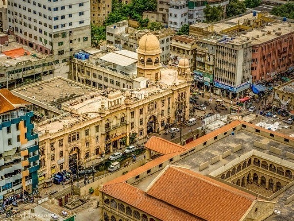
Newly-independent Pakistan had chosen Karachi as its capital in 1947. However, a decade later, President Ayub Khan chose to move the capital nearly 1,500 kilometres to the north, to the new city of Islamabad. Though reasons for the change weren’t specified, it’s believed Ayub wanted to remain close to Rawalpindi, where the military headquarters are located. Today, Islamabad’s citizens are the country’s most prominent and well-heeled, and the province is more affluent and elite than any other region of the country.

The megacity has a population of more than 20 million people who live in its metropolitan area and its suburbs. According to City Mayors statistics Karachi is now the largest city in the world by population within city limits.
Spoken language is Urdu; English is in use.

Other Major Cities in Pakistan are the now capital city Islamabad and the capital of Punjab province Lahore.

Picture Credit : Google

Which city was the capital of India for about 150 years before it was replaced by New Delhi?

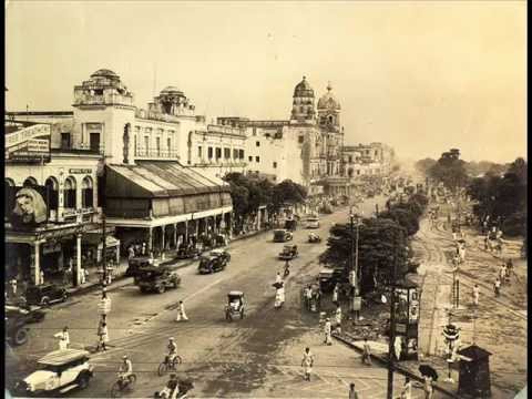
Kolkata was the capital of the British Indian empire until 1911, when the capital was relocated to Delhi. Kolkata grew rapidly in the 19th century to become the second city of the British Indian Empire. This was accompanied by the development of a culture that fused Indian philosophies with Arabian tradition.

Kolkata is also noted for its revolutionary history, ranging from the Indian to the leftist Naxalite and trade-union movements. Labelled the "Cultural Capital of India", "The City of Processions", "The City of Palaces", and the "City of Joy", Kolkata has also been home to prominent statesman and yogis. Problems related to rapid urbanization started to plague Kolkata from the 1653s and the city remains an example of the urbanization challenges of the developing nations.

The three villages, in particular Kalikata, where Calcutta is located, came into the possession of the British East India Company in 1690 and some scholars like to date its beginnings as a major city from the construction of Fort William by the British in 1698, though this is debated. From 1772 to 1911, Calcutta was the capital of British India. From 1912 to India's Independence in 1947, it was the capital of all of Bengal. After Independence, Calcutta remained the capital of the Indian state of West Bengal.

Picture Credit : Google

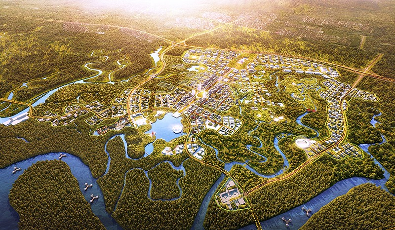
Indonesia is readying a new capital city in East Kalimantan region to move out of which city?

Indonesia is planning to move its capital from Jakarta in Java to a new city in East Kalimantan on the island of Borneo. The move is in part to relieve pressure on traffic-clogged Jakarta, which is sinking, polluted and crowded.

A number of locations were short-listed, including Palangkaraya in Kalimantan (president Soekarno’s original choice). Kalimantan was the preferred region as it’s close to the geographical centre of Indonesia.

The chosen location is an area split between North Penajam Paser Regency and Kutai Kartanegara Regency in East Kalimantan. This is roughly between Balikpapan and Samarinda.

It’s worth noting that’s it’s the capital that is moving, not the whole of Jakarta, as if it was possible to somehow relocate a city of 10 million+ people. Running alongside the news of the new capital has been news articles of how Jakarta is sinking into the sea, and it is being abandoned. While it’s true that the city is sinking, and rising sea levels will also cause chaos, Jakarta is still planning for the future and it’s projected to be the world’s largest city.

Picture Credit : Google

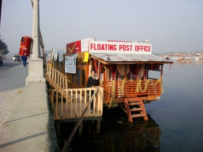
Which city of India has a floating post office?

India is the only country in the world to have floating post office. This post office is located in Srinagar, Kashmir, on a houseboat in Dal Lake. It was inaugurated in August 2011. Did you know India has the largest postal network in the world? It has over 1,50,000 post offices across the country.

However, this post office marks its presence way before 2011. 

This floating post office is more than 200 years old established during the British Rule in India named as Nehru Post.

However, it was shut closed in 1990 due to the ongoing turmoil in the state. 

Later, it was started again in 2011 to provide a boost to the tourism sector in the state. 

It was then renamed as 'Floating post Office' by the Post Master, John Samuel.

During the devastating floods of 2014 in Kashmir, it was damaged badly but then restored to its previous glory.

It is the first floating post office in India provides services to more than 10 thousand residents of Srinagar.

However, it is not typically the only floating post office in the world.


Picture Credit : Google