Climate change impact

According to the new analysis published in the journal Nature, rising global temperature has shifted at least twice the amount of freshwater from warm regions towards the Earth's poles than previously thought. The researchers estimate the volume of extra freshwater that shifted from warmer regions between 1970 and 2014 to be between 46,000 and 77,000 cubic km. This is consistent with an intensification of the water cycle of up to 7%. That means up to 7% more rain in wetter areas and 7% less rain (or more evaporation) in dryer areas. This is at the upper end of estimates established by several previous studies, which suggested an intensification closer to 2-4%.

With the water cycle intensifying in a "wet-gets-wetter-dry-gets-drier pattern, water problems such as drought and flooding are likely to become much worse around the world. California will experience more severe drought and Mumbai will experience more severe rainfall and flooding, say researchers. Some people and ecosystems I will be hit harder than others.

What can we do?

Decades of scientific research have shown the clear relationship between greenhouse gas emissions and rising global temperatures, which in turn drives water cycle intensification. Without doubt, decreasing the CO2 emission, better bringing it to zero emission, is our best bet to save the world.

Picture Credit : Google 

What is the water cycle?

The water cycle shows the continuous movement of water within the Earth and atmosphere. It is a complex system that includes many different processes. Liquid water evaporates into water vapor, condenses to form clouds, and precipitates back to earth in the form of rain and snow. Water cycle follows a cycle of evaporation, condensation, precipitation, and collection. Earth's water is in the oceans, rivers, lakes, and seas. When the sun heats up water from these sources, it evaporates as vapour and rises into the air. Rising vapour cools and condenses into clouds. The clouds get heavy and water falls back to the ground in the form of rain or snow. The rain replenishes the oceans, rivers, and ground water aquifers. This cycle continues again and again. In essence, we are using and re-using the same water that has been on Earth since the beginning of time.

The water cycle describes how water evaporates from the surface of the earth, rises into the atmosphere, cools and condenses into rain or snow in clouds, and falls again to the surface as precipitation. The water falling on land collects in rivers and lakes, soil, and porous layers of rock, and much of it flows back into the oceans, where it will once more evaporate. The cycling of water in and out of the atmosphere is a significant aspect of the weather patterns on Earth.

Why is water cycle important?

Water is the basis for life. Water cycle ensures the availability of water for all life on Earth and maintenance of most ecosystem on the planet.

The water cycle influences global temperature. When water evaporates, it takes up energy from its surroundings and cools the environment. When it condenses, it releases energy and warms the environment. These heat exchanges influence climate.

It also influences rainfall and related weather changes in an area.

Picture Credit : Google 

What species has a mutualistic relationship?

The planet is home to billions of organisms and none of them (including humans) exists on its own. We are all dependent on each other for our survival. Symbiosis is the umbrella term used to refer to such interactions among animals, birds and plants of different species living together. There are five main symbiotic relationships: mutualism, commensalism, predation, parasitism, and competition Mutualism is the relationship where both the species benefit from each other, in commensalism one species benefits from another, while the other remains unaffected in predation and parasitism, one benefits by harming the other while a predator kills its prey immediately, a parasite lives at the expense of the host species and may kill it over time Competition is the struggle between different species to utilise the same limited resources Today, let’s take a look at some of the species that share mutualistic relationship with each other.

Zebra and Ostrich

Zebras and ostriches are perfect examples of friends having each others' back. Herds of zebras and of ostriches often travel across the open African plains together and they warn each other of danger. Ostriches have a poor sense of hearing and smell, while zebras have a poor eyesight. Zebras look out for potential threats to the ostriches by using their exceptional hearing skills, while the far-sighted ostriches stay vigilant towards the zebras predators by scanning the grassland and spotting threat from afar.

Clownfish and Anemone

There are 30 species of clownfish and all of them form a mutual relationship with anemones. They are even called anemonefish. A sea anemone is a predatory marine animal that lives attached to rocks and catches prey by injecting venom from its tentacles. Clownfish are immune to the anemones venom and actually live within their tentacles. While sea anemones provide protection to the clownfish, the fish clean the anemones tentacles, keeping them free from parasites. Clownfish also lure anemones prey towards the tentacles by acting like baits.

 Humans and Honeyguide bird

An African bird called the greater honeyguide is famous for sharing a friendship with hunters. It helps humans locate bees’ nests to harvest honey. Honeyguides give a special call to attract people's attention, then fly from tree to tree to indicate the direction of a bees' nest. While humans get honey, the birds get to feast on bee larvae and wax. Honeyguide perhaps consider humans useful collaborators because of our ability to control stinging bees with smoke and use tools to open the honeycomb, which the bird cannot do on its own.

Ants and Aphid

Several species of ants and aphids share a well-documented mutualistic relationship. Aphids are small insects that feed on the sap from plants and secret a sugary-liquid called honeydew. This secretion is quite enjoyed by some species of ants. The ants milk the aphids by stroking them with their antennae and in return, the ants protect the aphids, pretty rigorously, from predators and parasites.

The ants ensure the aphids are well-fed. They move the insects to a new plant when the nutrients from the host plant are exhausted. Some species of ants go to the extent of destroying aphid predators' eggs. Some species of ants care for the eggs of aphids by transfering them to their own nest during winter. When the eggs hatch, the ants carry the newborns to host plants to feed. They secret the sugary meal for the ants and the cycle continues.

Bat and Pitcher plant

Pitcher plants are carnivorous plants that trap their insect preys by luring them with nectar. The unassuming insects fall down the slippery slope and eventually drown in the digestive liquid of the plant. While we might think it would be prudent for animals to avoid these plants, woolly bats voluntarily clamber inside the plants - to roost. They share a mutually beneficial relationship with the plants. So what does the plant get in return for subletting its comfy room to the mammal? Poop. The bat guano (waste) is rich in nitrogen, a crucial plant nutrient, you see!

Picture Credit : Google

Why coastal regions are important to lives on the planet and how humans are degrading them?

Places where the land meets the sea are crucial for our planet to function. They support biodiversity and the livelihoods of billions of people. But due to pressure caused by human activity, only 16% of coastal areas around the world remain intact, according to a study. The research, involving an international team of experts, revealed an alarming story.

An international team led by researchers at the University of Queensland in Australia has mapped the impact of human-caused pressures on coastal regions to identify those that have been already highly degraded, and those that remain intact. The findings, published in the journal Conservation Biology, provide insights into the widespread impacts of human activity on Earth's precious coastal ecosystems.

What did the study find?

The research looked at two datasets - one focussed on human impacts on land, and the other observed human impacts from a marine perspective. Both maps use data up to the year 2013 - the most recent year for which cohesive data is available.

  • Coastal regions containing seagrasses, savannah, and coral reefs had the highest levels of human pressure compared to other coastal ecosystems.
  • More than half the coastal regions have degraded in 84% of countries.
  • Earth's 47.9% of coastal regions have been exposed to very high levels of human pressure.
  • Human pressures were high in about 43% of protected coastal regions.
  • Scientists believe that some coastal regions have been so degraded that they cannot be restored.

Where are the highly damaged coastal regions located?

High levels of degradation are found in island nations, much of Europe, and in countries including Vietnam, India and Singapore.

Which are the intact regions?

Many of the intact coastal regions are in Canada, followed by Russia and Greenland. Large expanses of intact coast are also found elsewhere including Australia, Indonesia, Papua New Guinea, Chile, Brazil and the United States.

Why are coasts vital?

  • Coastal regions encompass some of the most diverse and unique ecosystems on Earth. They include coral reefs, kelp forests, seagrass, tidal flats, mangroves, estuaries, salt marshes, wetlands and coastal wooded habitats.
  • Many animal species, including those that migrate, rely on coastlines for breeding, foraging and protection.
  • Coastal sites are also where rivers discharge, mangrove forests exchange nutrients with the ocean, and tidal flows are maintained.
  • Humans also need coastlines. Among other functions, they support our fisheries, protect us from storms and, importantly, store carbon to help mitigate climate change.

How is human activity impacting the coasts?

As much as 74% of the human population live within 50km of the coast, and humans put pressure on coastal environments in myriad ways. In marine environments, these pressures include:

  • Fishing at various intensities
  • Water and light pollution
  • Recreation and tourism
  • Shipping
  • Climate change and associated issues such as ocean acidification, sea-level rise and increased sea surface temperatures.

On land, human pressures include:

  • Coastal development
  • Infrastructure development
  • Agriculture and pasture lands
  • Clearing of land for settlement
  • Plastic and other forms of land pollution

What should governments do?

Governments should take steps to conserve the coastal regions that remain in good condition, while restoring those that have been degraded but can still be fixed.

Other actions should include improving environmental governance and laws related to encroachments, increasing well-resourced protected areas, mitigating land-use change to prevent increased pollution run-off, better community and local engagement, strengthening indigenous involvement in managing coastal regions, effective management of fishing resources, addressing climate change and tackling geopolitical and socioeconomic drivers of damage to coastal environments.

Picture Credit : Google

What is greenwashing?

Greta Thunberg, the young climate activist, in her famous speech "Blah, Blah, Blah..." made at COP26 conference at Glasgow in November last year spoke about how climate summits are becoming 'greenwashing' festivals. She attacked CO2 offset commitments by corporates as just a greenwash. We have all heard of brainwash" and whitewash". Now what is greenwash?

When companies and organisations mislead their consumers by claiming that a product or service they provide, or that their organisation itself is environmentally friendly or sustainable, when it actually is not, it is called greenwashing. Greenwashing is not a new concept. The term was originally coined by environmental activist Jay Westerveld in the mid-1980s.

How does this happen?

From high-end cars to toilet papers, everything these days carries a label claiming that it is green or eco-friendly. But more often than not, they are half truths. Sometimes labels are vague, poorly defined, or so broad that their real meaning is likely to be misunderstood by the consumer. Some products are simply labelled 'green' without any proof or certification by authorities concerned.

As for CO2 offset" commitments, environmentalists are of the view that offsets are a way for companies to continue polluting while funding projects to adopt climate-friendly behaviours elsewhere.

It's a matter of concern

Why are corporations falling all over themselves to demonstrate that they are environmentally conscious? While some of the claims may be genuine, most are just marketing tools to drive profit, rather than to take environmental responsibility. In the face of climate crisis, consumers are more cautious of buying environment-friendly products. They're also likely to spend the extra amount it takes to acquire the so-called eco-friendly goods. It is essentially exploitation as companies prioritise financial gain over being eco-conscious.

  • Brainwash is to make someone believe something by repeatedly telling them that it is true.
  • Whitewash is to make something bad seem acceptable by hiding the truth.
  • Carbon offset refers to the measures taken by a company or organisation to reduce or remove emissions of carbon dioxide or other greenhouse gases elsewhere to compensate for the emissions made by it for its business.

Picture Credit : Google

How is climate change altering bird behaviours?

Starlings are medium-sized passerine birds that are famous for gathering in huge flocks and moving across the sky in sync to form startling ‘murmurations’. Between October and February every year, millions of starlings migrate from northern Europe to Central and Southern Europe to escape the cold. But scientists have lately observed that warmer temperatures in northern European caused by climate change have shortened the starlings' stay in Southern parts. Studies have predicted that warmer temperatures could also make starlings advance their breeding period.

Though one would be fascinated by the sheer number of the birds in the flock (pre-roost murmurations have been known to number as many as 1,00,000 birds), many roosts are significantly smaller than they used to be due to population decline. Lack of food and habitat loss, partly driven by climate change, have put some of the starling species on the IUCN red list in various Europe countries. (IUCN- International Union for Conservation of Nature). Starlings are not alone in this struggle. Many birds around the world are impacted by climate change. The timing of bird’s migration, nesting, hatching, and feeding are adapted to specific conditions, such as the availability of suitable habitat and adequate food sources. These factors make birds particularly vulnerable.

Here is a closer look at the threats faced by birds due to a warming planet.

Migration pattern

The impact of climate change on birds migration patterns has been noticed in the last few decades. Scientists have documented that fewer birds show up in breeding and wintering grounds and they attribute it to the increasing temperatures, changing vegetation, and extreme weather conditions.

Birds synchronise their migratory movements with seasonal changes. The start of their journey and their speed must match the life cycle (before caterpillars pupate) of food sources at the stopover and destination sites. But these environmental cues go for a toss with changing climate.

Habitat loss

One of the major effects of climate change is the loss of habitats. While some species face shrinking ranges, others face habitat destruction. For migrating birds, flooding or desertification could spell doom. Flocks might fly thousands of kilometres only to find their destination submerged or barren. Many goose species use the Siberian tundra's rocky bedrock to raise their offspring. But increasing temperatures make the permafrost soil to thaw and change the habitat completely, making it impossible for the geese to breed.

Lack of food

A number of birds has adjusted breeding times to match early Spring. They arrive at the breeding site earlier than before.

Meanwhile, increasing temperatures also make the vegetation bloom and insects hatch earlier at the site. But sometimes these shifts are not in line with each other. As a result, the chicks hatch way after the caterpillars are gone. And so, they starve. (On average, the window of time when birds lay their eggs has gotten earlier by almost two weeks over half-a-century. Since many small songbirds can raise their young in roughly one month, two weeks is a big shift in their timing.)

Sea-level rise

Sea-level rise and erosion alter coastal wetlands. Many birds, such as piping plovers, that inhabit coastal areas lay their eggs directly on the sand of the beach in a shallow depression. The erosion of beaches and storm surges can cause nests to be lost to the ocean.

Smaller body, larger wings

A study published in December 2019 found that global warming was causing birds to shrink and their wingspans to grow in size. Scientists explained that it could be an adaptation of birds as smaller birds are better at cooling off, losing, body heat more quickly due to their larger surface-area-to-volume ratios. But smaller body size means less energy available for the birds to complete long journeys. Scientists say that birds would have evolved to grow long wings to compensate for their smaller bodies as it helps them survive migration.

Picture Credit : Google

NASA Says Tonga Eruption Was More Powerful Than an Atomic Bomb

The recent volcanic eruption in the region was hundreds of times more powerful than the Hiroshima atomic bomb, says NASA

  • Tonga's eruption unleashed explosive forces equivalent to up to 30 million tonnes of TNT - hundreds of times more than Hiroshima's atomic bomb, NASA says.
  • As a comparison, the U.S. atomic bomb dropped on Hiroshima in August 1945 was estimated to be about 15 kilotons (15,000 tonnes) of TNT.
  • Mount St. Helens exploded in 1980 with 24 megatons and Krakatoa burst in 1883 with 200 megatons of energy.
  • Before the eruption, the Hunga Tonga-Hunga Ha'apai volcanic island was two separate islands joined by new land formed in 2015.
  • Nasa says the eruption was so powerful all the new land is gone, along with "large chunks" of the two older islands.
  • Tonga says more than four fifths of the population has been affected by the tsunami and falling ash. Three people were confirmed killed in the tsunami last month.

Picture Credit : Google

What is ozone all about? And why is it considered a pollutant?

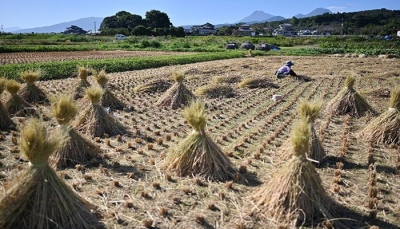
A new study published in journal Nature Food has found that persistently high levels of ozone pollution in Asia are costing China, Japan and South Korea an estimated $63 billion annually in lost rice, wheat and maize crops. The research used pollution monitoring data from the region and field experiments to show ozone affects Asia's crop yields more than previously thought.

The researchers found that on an average 33% of China's wheat crop is lost annually because of ozone pollution. While South Korea lost 28% of wheat. Japan lost 16%. For rice, the mean figure in China was 23%. In South Korea the figure was nearly 11%, while in Japan it was 5%. And maize crops in both China and South Korea were also affected. The crop is not grown in Japan in significant quantities. The study's authors said the findings should push policymakers to reduce emissions that produce ozone.

You may have learnt from your teachers that the ozone layer protects us from the harsh sunlight.

What is ozone?

Ozone is a highly reactive gas composed of three oxygen atoms-03. It occurs naturally in the stratosphere layer of the Earth's atmosphere. But ozone also comes from man-made sources and is found in the lowest layer of the atmosphere (troposphere). While the former affects life on Earth in positive ways, the latter does so in negative ways. Our concern in this article is the second form of ozone.

What is the ozone layer?

The atmosphere consists of a mixture of 78% nitrogen, 21% oxygen and 1% of other gases. Each of the five layers of our atmosphere has its own role in protecting Earth and supporting life on the planet. The second layer - the stratosphere - is the most stable region, where jets fly. It is also the region where ozone is abundant. Stratospheric ozone is formed naturally through the interaction of solar ultraviolet (UV) radiation with molecular oxygen (02). The layer, found about 10 to 40 km above the ground, is the ozone layer. It is part of the stratosphere and it protects life on Earth from the harmful effects of UV rays by absorbing them. Ultraviolet rays can damage DNA, and cause sunburn, skin cancer and cataract in humans.

What is ozone pollution?

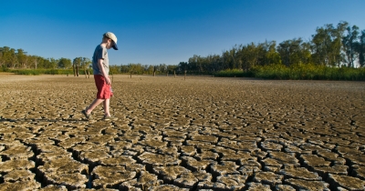
At the ground level, ozone is a highly unstable and poisonous gas which is created by chemical reactions between oxides of nitrogen (NOx) and volatile organic compounds (VOC). This happens when pollutants emitted by cars, power plants, industrial boilers, refineries, chemical plants, and other sources chemically react in the presence of sunlight. When the percentage of ozone at ground level reaches alarmingly high levels, ozone pollution occurs. Ozone pollution is common in urban areas because of vehicular pollutions and industries, ozone can be transported long distances by wind so even rural areas, where farming lands are found, can also experience high ozone levels. A higher percentage of ozone gives rise to health issues such as chest pain, congestion and coughing. It also affects crops and other vegetation.

How does ozone affect crop yield?

Ozone damages crops by entering leaves during normal gas exchange. As a strong oxidant, ozone causes symptoms in crops such as yellowing, cell injury, spots, and reddening. Many factors such as soil moisture, presence of other air pollutants, insects or diseases, and other environmental stresses, can increase the impact.

Ozone is the key pollutant causing the yield loss of crops such as rice and maize. Wheat is the most sensitive when it comes to ozone-caused damage. Ozone exposure could have an even bigger impact on yields of soybean, peanut and cotton.

Why is this concern in Asia?

East Asia is one of the biggest bread baskets and ricebowls in the world. It supplies 90% of the world's rice and 44% of its wheat. The researchers said surface ozone is "posing a threat to food security."

Asia is also a hotspot for ozone. While ozone levels have declined in America and Europe over the last two decades, with the introduction of stricter air quality measures, the pollutant is increasing in Asia.

Further, industry, energy and urban expansion are competing for limited land resources.

What is the solution?

The best way to bring down ozone levels is to curb the use of fossil fuels - the same action needed to bring down greenhouse gas emissions causing climate change.

Picture Credit : Google

What natural disasters happened in 2021?

Earthquake in Sulawesi: On Jan. 15, an M 6.2 earthquake struck the city of Majene on the west coast of Indonesia's Sulawesi island, killing more than 90 people and displacing 94,000.

Flood in Australia: Days of heavy rain pounded the Australian province of New South Wales at the end of March 2021, leading to a "once-in-a-hundred-year-flood".

Earthquake in Haiti: On Aug. 14, an M 7.2 earthquake, the biggest since 2010, struck Haiti. It killed more than 2000 people. At least 1,37.500 buildings were damaged or destroyed.

Volcanic eruption in Indonesia: Indonesia's Java Island experienced several days of heavy rain that left a heavy pool of water on the lava dome at the top of Mount Semeru. On Dec 4, the lava dome collapsed, unleashing the molten lava beneath in an explosive eruption that sent thousands of people fleeing the area.

Typhoon in the Philippines: Super Typhoon Rai made landfall on Siargao Island in southeastern Philippines on Dec. 16. It killed more than 400 people and caused half a billion dollars in damages.

U.S. Typhoon: About 68 out-of-season tornadoes ripped across several states in the United States on Dec. 10, and Dec. 11, leaving death and destruction in their wake. They killed more than 90 people across ten States. Officials estimated billions of dollars of damages.

Picture Credit : Google

Wildfires ravaging forestlands in many parts of world

Over the last few years, extreme heatwaves and drought have been leading to longer and severe wildfire seasons across the globe. In 2021, wildfires were reported in North America, many parts of Europe and Australia.

Australia's fire season continued from 2020 into early 2021. The 2021 Wooroloo bushfire at Werribee Road, Wooroloo, in February, was the biggest of them in 2021. It burnt out an area of over 10,500 hectares.

The wildfire season in California, in the U.S., experienced an unusually early start amid an ongoing drought. It began in January and went on till October. The 2021 season outpaced the 2020 season, which itself was the largest season in the state's recorded history, as multiple fires including the Dixie Fire. McFarland Fire. Caldor Fire, and others raged on, forcing evacuation of thousands of people and destruction of thousands of acres of forest. In July, Canada too battled dozens of blazes in British Columbia and Ontario provinces.

Thousands of miles away in Siberia, the fire season started in late April and accelerated dramatically in mid-June. The Siberia wildfire broke a record for annual fire-related emissions of carbon dioxide. The usually hot Mediterranean region experienced higher than usual temperatures last summer, triggering wildfires in Turkey, Cyprus and Greece. The heat combined with dry conditions turned the Mediterranean vegetation into a tinderbox. The wildfires in Turkey and Greece were described as the worst in at least a decade. Italy and Lebanon also witnessed widespread wildfires in August.

Picture Credit : Google

Ken-Betwa river linking project gets green panel nod

Nearly four decades after it was conceptualised. India's first river interlinking project, connecting Ken River in Madhya Pradesh with Betwa in Uttar Pradesh, finally got the green signal from the Union cabinet on December 8. The project is expected to address the woes of five water-starved districts in Uttar Pradesh and six in Madhya Pradesh. It will involve constructing a dam and a channel to transfer water from the Ken to the Betwa rivers in the Bundelkhand region of Uttar Pradesh and Madhya Pradesh. However, the project has stoked concerns about its likely environmental impacts - including submergence of a tiger reserve.

The environmental appraisal committee (EAC) had “duly considered” and “agreed” for the phase I of the project in its meeting held on December 30, 2016.

The project envisages construction of a dam across river Ken in Chhatarpur district in Madhya Pradesh to irrigate 6.35 lakh hectares of land, serve drinking water purposes in Bundelkhand region and generation of 78 MW hydropower.

Of this, 3.69 lakh hectares will be covered in Madhya Pradesh’s Chattarpur, Tikamgarh and Panna districts. The remaining 2.65 lakh hectares of area falls in poll-bound Uttar Pradesh’s Mahoba, Banda and Jhansi districts.

According to the Water Resources Ministry, a total of 10 villages consisting of 1,585 families are likely to be affected by this project.

The project comprises two powerhouses of 2x30 MW and 3x6 MW each, two tunnels of 1.9 km-long upper level, 1.1 km-long lower level tunnel, and a 221 km-long Ken-Betwa link canal, proposed on the left bank of the river.

The project was first mooted in the early 1980s but was actively taken up by the NDA government under Prime Minister Atal Bihari Vajpayee. It was then challenged in the Supreme Court, which finally gave the nod in 2013.

Credit : The Hindu

Picture Credit : Google

India establishes the largest network of Ramsar Sites in South Asia

The Ministry of Environment, Forest and Climate Change designated four wetlands to the list of Ramsar Sites - two each from Haryana and Gujarat. They are the Thol Lake Wildlife Sanctuary and the Wadhwana Wetlands from Gujarat and Bhindawas Wildlife Sanctuary and the Sultanpur National Park from Haryana. With these additions, India is now home to the largest network of Ramsar sites (46 in all) in South Asia. A Ramsar Site is a wetland designated to be of international importance under the Ramsar Convention, established by UNESCO.

India ratified the Ramsar Convention in 1982 at the behest of the then Prime Minister, Indira Gandhi, who is also credited to have heralded several key environment legislations in the country. Keoladeo National Park and Chilika were the first two sites to be placed on the Ramsar List by the Government of India initially. Till 1990, only four more sites were added to the list and another 19 over the following two decades. Since 2010, Ramsar Site designation has received a significant policy push from the MoEFCC, and 21 wetlands added to the list in the last decade alone. The network of Indian Ramsar Sites covering over 8% of the known wetlands’ extent of the country and is the largest in South Asia.

The Ramsar sites in India are highly diverse. The sites range from Himalayan high-altitude wetlands (Tso-Moriri, Tso kar complex and Chandertal), lakes and marshes (Wular, Hokera, Renuka,  Keoladeo, Kabartal, Nawabganj, Loktak, Deepor, Rudrasagar, Sandi, Saman, Keshopur-Miani, Sultanpur, Nalsarovar, and Sasthamkotta), river stretches (Upper Ganga River stretch, Beas Conservation Reserve and Kanjili), crater lake (Lonar), salinas (Sambhar), mangrove swamps (Sunderbans, Bhitarkanika, and Point Calimere) and lagoons and estuaries (Chilika, Ashtamudi and Vembanad-Kol). Water storage areas (Pong, Harike, Bhoj, Surinsar-Mansar, Bhindawas, Sur Sarovar, Asan, Wadhvana, and Thol) and assemblages of sewage-fed fish farms (East Kolkata Wetlands) have also been included in the list by the Government of India.  While the smallest Ramsar Site is just 49 ha in area (Chandertal), the largest, the Sunderbans spans 0.42 million ha.

Credit : Mongabay 

Picture Credit : Google

What is plastic waste management Amendment 2021?

On August 13, the Environment Ministry of India notified the Plastic Waste Management Amendment Rules, 2021, which prohibits specific single-use plastic items that have "low utility and high littering potential by 2022. Under this rule, the manufacture, sale, and use of a range of plastic products will be prohibited from July 1, 2022.

The new rule has also increased the permitted thickness of polythene bags. India further strengthened its fight against plastic pollution by launching a Plastic Pact in September. The Plastic Pact, the first of its kind in Asia, is a platform to promote a circular economy for plastic. It is a collaborative initiative that aims to bring together businesses, governments and NGOs to reduce, reuse, and recycle plastics in their value chain. With the pact, India aims to make 100% of the plastic packaging to be reusable or recyclable before 2030.

A National Level Taskforce has also been constituted by the Ministry for taking coordinated efforts to eliminate identified single-use plastic items and effective implementation of Plastic Waste Management Rules, 2016.

The State /UT Governments and concerned Central Ministries/Departments have also been requested to develop a comprehensive action plan for the elimination of single-use plastics and effective implementation of Plastic Waste Management Rules, 2016 and its implementation in a time-bound manner.

Directions under Section 5 of Environment (Protection) Act, 1986, have been issued to all States/Union Territories inter alia for setting up for institutional mechanism for strengthening enforcement of Plastic Waste Management (PWM) Rules, 2016.

The Government has also been taking measures for awareness generation towards the elimination of single-use plastics and effective implementation of Plastic Waste Management Rules, 2016. A two-month-long Awareness Campaign of Single-Use Plastic 2021 has been organized. The Ministry has also organized a pan India essay writing competition on the theme for spreading awareness among schoolchildren.

To encourage innovation in the development of alternatives to identified single-use plastic items and digital solutions to plastic waste management, the India Plastic Challenge – Hackathon 2021, has been organized for students of Higher Educational Institutions and startups recognized under Startup India Initiative.

Credit : Net Indian 

Picture Credit : Google

Why did UNESCO want to put the Great Barrier Reef on the in danger list?

The United Nations heritage body UNESCO and the Australian government got into a tiff over placing the Great Barrier Reef on the list of world heritage sites that are "in danger." Pointing to the threats the world's biggest coral reef system faces from climate change, the UNESCO committee recommended that the listing is necessary to address the issue. But the Australian governments diplomatic effort won enough support to override the UN body's recommendations. The final motion, passed by the UNESCO in July agreed not to place the Great Barrier Reef on the in danger list. The committee, however, asked Australia to deliver an updated report on the state of the reef in February 2022.

The Great Barrier Reef is the largest living marine organism in the world. It was inscribed as a World Heritage site 40 years ago and remains one of the world’s most iconic natural treasures. ‘The Reef’, as it is called in Australia, meets all four natural heritage criteria. These include its extraordinary natural beauty and globally significant biodiversity. The Reef contains vast mangrove forests, seagrass meadows, coral reefs, whales, dolphins, turtles, sharks and dugongs to name just a few species groups.

Australians love the Reef and many people around the world dream of visiting Australia to see it for themselves. Prior to COVID, the Reef generated over AU$6 billion a year to the Australian economy and supported 64,000 jobs. Seventy Indigenous Traditional Owner groups have looked after the Reef for thousands of years. One quarter of the world’s marine species depend on coral reefs for at least part of their life cycle. The Great Barrier Reef has enormous social, economic, cultural, and ecological value.

In 2019, an Australian government report concluded that the outlook for the Great Barrier Reef had deteriorated from poor to very poor. The report, which is based on the best scientific data, found that climate change is the Reef’s biggest threat. 

The Reef has already experienced five coral bleaching events, the most severe and widespread being in the last five years. In 2016 and 2017, about 50 percent of the corals died. While there has been some coral regeneration, the mix of species is shifting in favor of fast growing “weedy” species that are the most vulnerable to future coral bleaching. 

The Reef is also threatened by local pressures, in particular agricultural runoff from intensive sugarcane farming and extensive grazing of livestock in the adjacent catchment. Unsustainable commercial fishing and coastal development add to the pressures. 

The 2021 recommendations regarding the Great Barrier Reef were the first time UNESCO has recommended a World Heritage site be inscribed on the List of World Heritage in Danger predominantly due to climate change. UNESCO referred to 1.5 °C as a critical threshold, the first time UNESCO has highlighted the long-term goal of the Paris Agreement in its recommendations for a specific World Heritage coral reef. It is also the first time UNESCO has called directly on a country to undertake corrective climate change actions.

Credit : Earth Justice 

Picture Credit : Google

National Geographic Officially Recognizes the Southern Ocean as World’s Fifth Ocean

The icy waters surrounding Antarctica have long been recognised as a distinct ocean by scientists, the media and people across many countries. While many called this region the Southern Ocean, some scientists called it the Antarctic Ocean, or the Austral Ocean. But it had not been given a name by the National Geographic Society, a non-profit scientific and educational organisation whose mapping standards are referenced by atlases and cartographers.

Since the National Geographic began making maps in 1915, it had recognised only four oceans. It was only on June 8, 2021, the Society recognised the Southern Ocean as the world's fifth ocean! By officially naming the ocean, the National Geographic Society hopes to draw attention to the threats from pollution and climate change to the Southern Ocean ecosystem, therefore prompting conservation efforts here.

The US Board of Geographic Names, a federal body created in 1890 to establish and maintain “uniform geographic name usage” through the federal government, already recognizes the Southern ocean as occupying the same territory, but this is the first time the National Geographic has done so.

Attempts to ratify the boundaries and name of the Southern Ocean internationally have been thwarted.

The concept was proposed to the International Hydrographic Organization, which works to ensure the world’s seas, oceans and navigable waters are surveyed and charted, in 2000, but some of the IHO’s 94 members dissented. Despite that, Tait said it was important that the National Geographic christen the water area.

Credit : The Guardian 

Picture Credit : Google