What are the unique hiking trails in the world?
Today, let us learn about six unique trails in the world, some of which might involve treading grand old staircases or trundling down the steps in the wilderness.

BRAMANTE STAIRCASE, VATICAN CITY

Think about the structure of the DNA. Now imagine a staircase like that. That's how the Bramante Staircase in Vatican Museums in Vatican City, looks like. It was an architectural wonder during that time and continues to remain so even now with its unique double helix shape. The spiralling staircase was designed by the famous architect of Tuscany Donato Bramante. The staircase was designed to link the Belvedere Palace to the streets of Rome. In fact, there are two staircases with the same name in the Vatican Museums. The one under our purview is the original Bramante Staircase which was built in 1505. The modem one based on the original was built in 1932.

MACHU PICCHU, PERU

Thousands of steps will take you through a trail of an ancient civilisation. The Machu Picchu mountain trail leads you to the ruins of the Incan civilisation. The 43km Inca trail replete with archeological sites is unique. It leads to a stone citadel comprising living quarters of Inca royalty, ritualistic and sacrificial areas, and an elaborate irrigation system. It is believed that the citadel was built for Inca ruler Pachacuti who ruled from 1438 until his death.

THE VESSEL NEW YORK CITY, U.S.

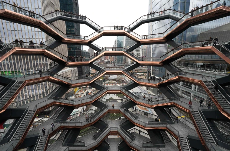
Located in Manhattan's Midtown West, the Vessel is often called "New York's Staircase". A 46-metre high, steel and glass building that offers a bird's eye view of the city, this spiral staircase sits as a centrepiece of the Hudson Yards (an urban development project) and is a 16-floor circular stairway structure with around 2500 steps. There is a labyrinth of 154 intricately interconnecting flights of stairs and the structure looks more like an art installation.

NONGRIAT DOUBLE-DECKER ROOT BRIDGE, MEGHALAYA, INDIA

In the forests of Meghalaya, there is an ancient, living bridge. It is the double-decker root bridge of Nongriat village in Meghalaya. The root bridges are made by weaving together the secondary roots of the rubber fig tree by Khasi villagers. And to visit this bridge, one will have to embark on a climb down from the village of Tyrna. It will take you some 3000 steps to reach here.

TIGER & TURTLE MAGIC MOUNTAIN, GERMANY

Some of you must have been on a roller coaster ride. What if we told you there was a structure that looked like a roller coaster and you could walk on it? The Tiger & Turtle Magic Mountain is a tangled structure designed by German artists Heike Mutter and Ulrich Genth. One can walk through these many loops and get rewarded with magnificent views of the countryside of Duisburg, Germany.

Picture Credit : Google 
Which place is known as the ‘Cradle of Humankind’?

It is a complex of dolomite caves in South Africa where fossils of early plants, animals and hominids have been found. Read on to know more about the caves where human life originated

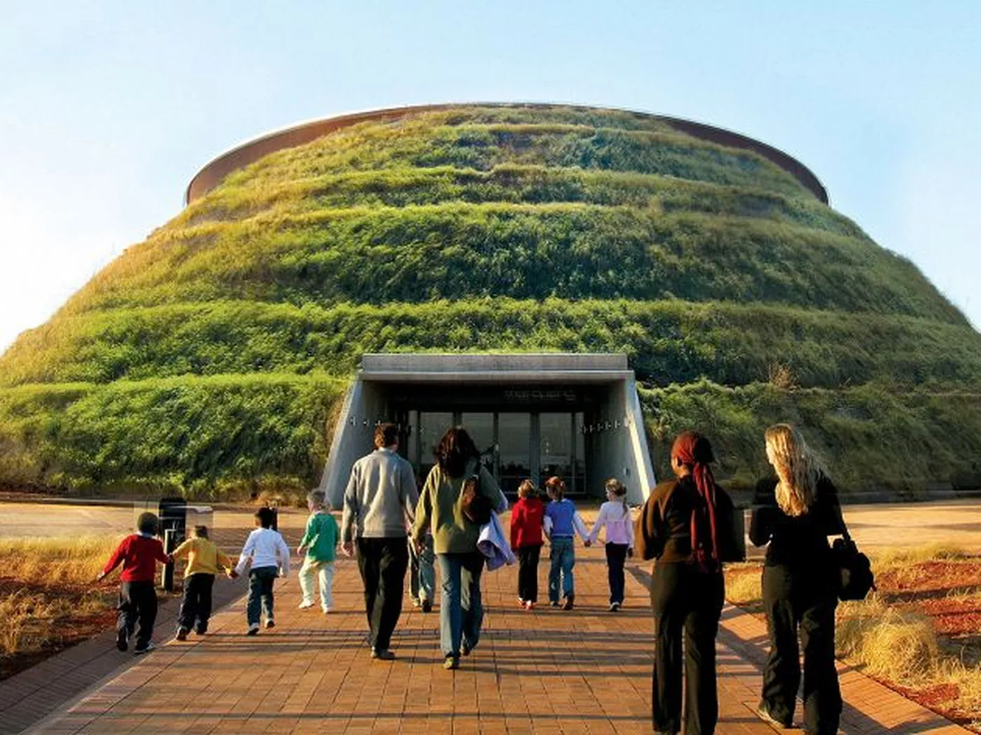
About 50 km from Johannesburg in South Africa lies a complex of dolomite caves from where the fossilised remains of a number of early plants, animals and hominids have been found. The cluster of about three dozen caves, of which the Sterkfontein caves are the most famous, are together named the 'Cradle of Humankind'. They boast over 850 hominid fossils, one of the world's richest and oldest concentrations of such remains. The site was declared a World Heritage Site in 1999.

The caves offer a window to the past, throwing light on how our ancestors evolved. In 1947, paleontologist Robert Broom found an almost complete skull of a female Australopithecus Africanus, nicknamed 'Mrs Ples', dating back 2.8 million years, at Sterkfontein.

More recently in 1997, Ronald Clarke discovered 'Little Foot, an almost complete hominin skeleton, estimated to be about 3.5 million years old.

Sustained excavation activities since 1966 have so far yielded an impressive 500 hominid specimens from the caves. The hominid remains corroborated the scientific view that the first humans lived in Africa. The fossil evidence has led scientists to believe that early human lineage separated from the apes in Africa about 5-6 million years ago.

The fossil remains from Broom's excavations are housed in the Transvaal Museum in Pretoria while the finds from 1966 onwards are housed at the University of Witwatersrand, Johannesburg.

Picture Credit : Google 

Why Hungary rich in culture?

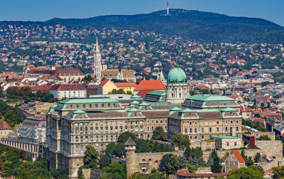
Budapest, Hungary's capital, is a UNESCO World Heritage Site because of its rich architectural legacy.

Ranu Joardar

Hungary, one of the several landlocked countries in Europe, is unique in itself. Having a language that is not related to any European language, the country has felt isolated through much of its history. It has produced a number of scientists, mathematicians, economists, anthropologists, musicians, and artists.

History

Hungary is referred to as Magyarorszag or the land of Magyars' by its citizens. Some believe that the country came into existence after the Magyars, a Finno-Ugric people, occupied the middle basin of the Danube River in the late 9th Century. However, archaeologist Gyula Laslo has opined that the country's history dates back to 670 with the arrival of the Late Avars, who were the early Magyars. The Magyars had a thriving society till 1241 when the Mongols invaded the region. The Mongols were defeated by the Magyars twice. It later became a part of the Ottoman Empire and remained so for several years. From 1699 till the First World War, Hungary was part of Austria. During the Second World War, Hungary fought alongside the Axis powers - Germany, Italy and Japan.

Geography

Hungary is bordered by Slovakia and Austria to the north, Ukraine and Romania to the east, Slovenia to the west, and Croatia and Serbia to the south.

The country is mostly flat and has a large lowland area known as the Great Hungarian Plain. The Danube River, the largest river in the country, cuts through the middle of the country. It crosses 10 countries on its way to the Black Sea. There are three key freshwater lakes including Lake Balaton, the largest in central Europe. Lake Balaton was designated as a World Heritage Site by UNESCO in 1989. Lake Heviz, which flows alongside the northern slope of Mount Keszthely, is one of the world's largest thermal lakes. Near the Slovakia border is the Aggtelek National Park, which was designated as a UNESCO World Heritage Site in the late 20th Century. Of eight World Heritage sites, the caves of Aggtelek Karst and Slovak Karst, is a natural site.

Flora and fauna

While half of the land is used for farming, about one-sixth is used for non-agricultural purposes and the remainder comprises meadows, rough pasture, forests and woodland. The Great Hungarian Plain is the grasslands covering the central and eastern part of the country. In the north of the plains is a mountain range known as the Northern Hills. The hilly areas in the west of the Danube River are known as the Transdanube.

The Great Hungarian Plain is home to several species of animals such as roe deer, wild boars, red foxes, mouflon sheep, and birds such as the imperial eagle and great bustard. In 1999, the United Nations designated Hortobagy National Park, the largest of Hungary's 10 national parks, as a UNESCO World Heritage Site. Many threatened and endangered species of fish such as sturgeon and the Danube salmon are found in the Danube River.

People

Since the 10th Century, Hungary has been a multi-ethnic country with the Magyars as the dominant population. The Hungarian language, Magyar, is part of the Finno-Ugric group of the Uralic language. It is written in Latin alphabet, but has 44 letters in total.

Music is integral to the Hungarian culture. Their folk music is based on the daily experiences of peasants in the countryside with themes ranging from joy and sadness to weather and farming. The two greatest composers - Bela Bartok and Franz  Liszt - were from Hungary. It is the birthplace of many famous people such as Erno Rubik, inventor of the Rubik's Cube.

Red meat forms an important part of their cuisine such as Gulyas (a thick beef soup cooked with onions and potatoes) and Hungarian sausage. Paprika is common in most Hungarian dishes. The Hungarian national anthem is based on the poem 'Hymnusz' written by Hungarian Romantic poet Ferenc Kolcsey in 1823. It was officially adopted in 1844.

The Hungarian capital Budapest has a rich architectural legacy from various periods that led to it being designated as a UNESCO World Heritage Site. The Danube Banks and the Buda Castle District (having medieval and characteristically Baroque style) were the first sites in Budapest to have been included on the UNESCO World Heritage List in 1987. Budapest has the remains of monuments such as the Roman city of Aquincum and the Gothic castle of Buda, which influenced the architecture of various periods.

Government

Hungary is one of the new democracies. Throughout the 19th and 20th Centuries, the country's political system had elements of autocracy. While between 1867 and 1948, the country had a parliament with a multiparty system, in 1948 the communists took over and a Soviet-style political system was followed. In 1990, the country held its first democratic elections. It became a part of the European Union in 2004. The country is now a parliamentary republic, led by a President is elected by the public. The Prime Minister is the head of the government. The current President Katalin Novak is the first female President of Hungary.

Picture Credit : Google 
What is special about Neelakurinji?

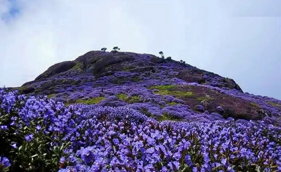
Strobilanthes kunthiana cover grassland slopes and shola forests of specific regions on the Western Ghats. These purplish blue flowers bloom once in 12 years, attracting wide-eyed visitors. But did you know that different varieties of Strobilanthes have different bloom cycles? Here are interesting and concerning facts about this genus.

  1. DIFFERENT VARIETIES: The word neelakurinji refers to the shrub Strobilanthes kunthiana, which grows in the shola forests of south Indian Western Ghats. It is part of the genus Strobilanthes, belonging to the family Acanthaceae. In addition to the neelakurinji, the Strobilanthes genus includes at least 300 flowering species such as Strobilanthes sessilis and Strobilanthes callosa. As mentioned earlier, the neelakurinji usually refers to Strobilanthes kunthiana, but in several instances (including news reports), different species of Strobilanthes are referred to as neelakurinji.
  2. BLOOMING PATTERNS AND TYPES: Many of the Strobilanthes species are 2 marked by unusual flowering patterns-blooming only once every one year to 16 years. While Strobilanthes kunthiana blooms once every 12 years. some other species may bloom once in four years, or 11 years, or 16 years, etc. Such species that take a long interval to bloom are scientifically referred to as plietesials. Apart from the time it takes for the shrub to bloom, what is fascinating is also the type of flowering that happens. The shrub witnesses two types of flowering-gregarious, where the flowering covers a very large area. and sporadic or isolated, where the flowering happens over a small area.
  3. A VITAL SHRUB: After they bloom,  strobilanthes species produce fruits, seeds, and then perish-only to be born again after the set interval. When the flowers bloom, especially on a large scale, they feed different types of larvae, and insects such as honeybees, butterflies, and moths. Since many of these are also pollinators, the blooming has a crucial role to play in the ecosystem. In addition, the flowers are said to have medicinal properties, though not much information is available on this aspect.
  4. SEVERAL THREATS:  The habitats of Strobilanthes bear the brunt of being used for plantation such as tea and coffee. Apart from this, issues such as encroachment, heavy tourist footfalls, water depletion, plastic waste, pollution, invasive species, and climate change threaten the species.
  5. WHEN NEXT? Notable blooming of 5 strobilanthes kunthiana happens in Tamil Nadu and Kerala. In 2006 and 2018, its blooming was witnessed in places such as Ervaikulam National Park in Kerala and Kodaikanal in Tamil Nadu. Given that this species has a 12-year flowering cycle, the next one can be expected in 2030. This September, Strobilanthes bloomed over a large area in Chikkamagaluru of Karnataka. However, reports suggest that it was not Strobilanthes kunthiana but Strobilanthes sessilis, believed to have last bloomed in 2006, a good 16 years ago!

Picture Credit : Google 

What makes the Burj Khalifa, of the UAE special?

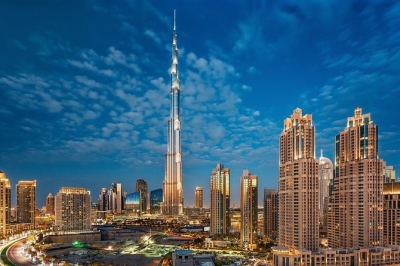
The world's tallest building, Burj Khalifa, is located in Dubai, in the United Arab Emirates. It is a mixed-use skyscraper with 162 floors and a height 828 metres. During its construction, it was known as Burj Dubai, but later it was officially named to honour Sheikh Khalifa ibn Zayed Al Nahyan, the leader of the neighbouring emirate Abu Dhabi. The tower was formally opened on 4 January 2010, but the entirety of its interior was not complete by then. Designed by the Chicago-based architectural firm of Skidmore, Owings & Merrill, it has a number of commercial, residential, and hospitality ventures. Adrian Smith was its architect, while William F. Baker served as structural engineer.

Another interesting aspect of Burj Khalifa is the water fountain outside it. Designed by WET Enterprises, this fountain system cost a total of US$217 million. This massive structure is lit by 6,600 lights and 50 coloured projectors. It is 270 metres long and shoots water to a height of 150 m into the air, which is accompanied by a range of classical and contemporary Arabic and other music. It is the world's largest choreographed fountain.

Picture Credit :Google

What makes La Paz special?

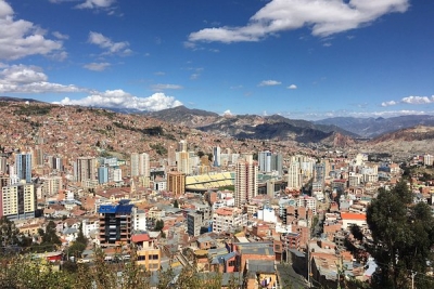
La Paz is the world’s highest national capital. It is the administrative capital of Bolivia, which lies between 3,250 and 4,100 metres above sea level. The city centre is located in a deep, broad canyon that was formed by the Choqueyapu River.

Founded in 1548, it was first named Nuestra Senora de La Paz (Our Lady of Peace) by the conquistador Captain Alonso de Mendoza on the site of an Inca village. It was later renamed as La Paz de Ayacucho in 1825. In 1898, it was set as the seat of the national government but Sucre is still Bolivia's constitutional capital, where the country's Supreme Court is located while La Paz is home to the executive and legislative centres.

The city is popular for its cultural assets with places like The National Museum of Art, a children's museum, the Museum of Ethnography and Folklore, the National Museum of Archaeology, and the Mercado de Brujas (Witches Market), where herbs and other remedies that are used by the local Aymara people are sold. In 1998, the city faced an earthquake which killed hundreds of residents and destroyed many buildings. Santa Cruz overtook La Paz in the wake of the 21st century as Bolivia's most populous city but before that La Paz held that status for many years.

Picture Credit : Google

Which is the largest art museum in the world?

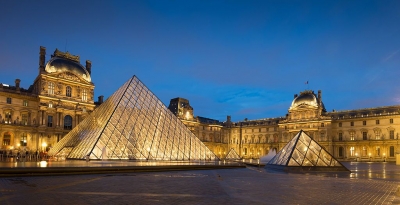
The Louvre, Paris is not only the largest art museum in the world, but it is also the world's most renowned one. More than 8 million visitors come to Louvre each year. With the French monarch's art collection and the collections that came in as a result of Napoleon's Empire, the Louvre Museum opened in 1793. The Louvre Palace was a fortress during the twelfth century and has witnessed a lot of changes and renovations over the centuries. The palace was the residence of King Charles V and Philippe II along with their ever-growing art collections before it was turned into a museum. After the Royal Family moved to Versailles, the building that covers a total area of 160,000 square metres was converted into one of the prominent museums in the world.

The museum's main entrance is a glass pyramid, which was made in the palace’s main courtyard in 1989. This structure changed the monotony of its exterior. The permanent collection of the museum has nearly 300,000 works of art that are dated before 1948. Of those, only 35,000 are exposed to the public.

Some of the most iconic and famous paintings on display are: The Mona Lisa by Leonardo da Vinci, Liberty Leading the People by Eugène Delacroix, and The Wedding at Cana by Paolo Veronese.

The most important sculptures in Louvre include Venus de Milo, an ancient Greek statue, and Seated Scribe, an ancient Egyptian sculpture.

Picture Credit : Google 

What is special about Bundelkhand village?

One village in the drought-hit Bundelkhand region is an oasis. Wondering how that is possible? Find out...

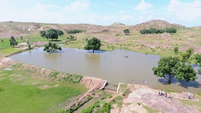
Bundelkhand, spread over Uttar Pradesh and Madhya Pradesh, is one of India's most water-scarce areas. But one village here is a lush-green oasis.

Jakhni village in Banda district of Uttar Pradesh revived traditional water conservation techniques about a decade ago when it was hit by a drought. As a result, the village now has 32 wells, 25 handpumps and four ponds, all of which are brimming with water. While the groundwater level was below 24 m earlier today it is at 2.5-3 m. Many of Jakhni's inhabitants who had left in search of water and better livelihoods, have now returned due to the remarkable turnaround. All this has been achieved by undertaking certain measures.

The inhabitants built bunds (called med bandhi) around every farmland to contain rainwater in the field itself, which in turn helps retain soil moisture for a longer time. The villagers also planted trees alongside these meds. This concept, known as med-par-ped, contributed to the rise in the water level.

Zero water wastage

They adopted the 'zero water wastage principle every single drop of water is utilised. Small drains were constructed, each drain being connected to a house. All the wastewater from the houses gets collected at a pond and is used in the farms.

The residents replenished their ponds by desilting them and removing encroachments. They dug furrows around them and planted shrubs there. Similarly, they trenched their wells and stopped dumping garbage there.

As paddy and lentils require a lot of water, the villagers decided to grow more vegetables like brinjal, spinach, coriander and mustard-crops which can grow on soil moisture. Jakhni is today one of the best sources of fresh vegetables in Bundelkhand.

Called ‘Jalgram’*, Jakhni has become a role model to surrounding villages. There are plans to establish an environment university in Jakhni as well as a research centre for indigenous conservation methods.

Picture Credit : Google 

What makes King Fahd International Airport special?

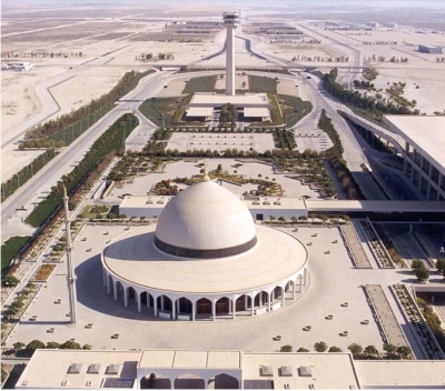
Named after the former King of Saudi Arabia Fahd ibn Abdulaziz, the King Fahd International Airport of Saudi Arabia is the largest airport in the world in terms of area. The area of the entire airport property is approximately 776 square kilometres, with an airport building of around m². Situated 31 km away from the city, the airport has three terminal buildings.

It was the U.S. airbase during the Gulf War, but now it oversees commercial operations since 28 November 1999 and has been able to provide connections to 43 destinations. Before the King Fahd International Airport came into existence, the primary airport serving the region was the Dhahran International Airport. It was extremely busy then, but now it has been assigned for military use and is now known as the King Abdulaziz Air Base. The Dammam Airports Company, also known as DACO, has been operating and managing the King Fahd International Airport since July 1, 2017.

It is the third largest airport in the kingdom in terms of passenger volume, that is, more than 10 million passengers use King Airport every year.

Picture Credit : Google 

Why is the Ganges delta unique?

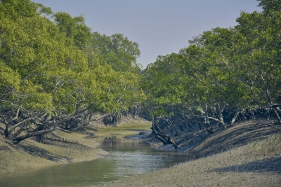
Known as the Sundarbans Delta or the Bengal Delta, the delta of the river Ganges is the world's largest river delta. By definition, deltas are wetlands that are formed by the rivers as they empty their water and sediments into oceans, lakes, or other water bodies. The Sundarbans Delta encompasses more than 105,000 square kilometres and covers West Bengal and Bangladesh. This delta is formed when the combined waters of several river systems that include the Brahmaputra and the Ganges rivers, empty into the Bay of Bengal. Because of its rich soil, it is also one of the most fertile regions in the world, and is called the Green Delta. It begins at the Meghna River and stretches till the Hooghly River.

The biodiversity of the Ganges delta is also very vast. It is covered with deciduous forests and mangroves and is home to the famous Bengal Tiger. Sundarbans, which forms a major part of this delta, is the world's largest mangrove forest and has a wide variety of wildlife such as the Indian python, elephants, and crocodiles. One can also find exotic birds like kingfishers, eagles, and woodpeckers here. It is also one of the world's most populated regions, with approximately 130 million inhabitants.

Picture Credit : Google

What are the specialities of the Caspian Sea?

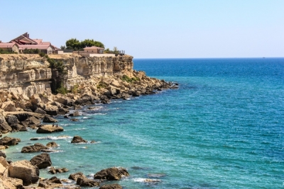
The Caspian Sea is the largest inland body of water and is considered as the world's largest lake. Historically, it has been considered a sea due its size and the saline it embodies many features of a lake. It covers 372,000 square kilometres (without including the lagoon of Garabogazkol to the east). It has a volume of 78,200 cubic kilometres. It is located at the junction of Europe and Asia and is bordered by the Caucasus Mountains to the west and the steppes of Central Asia to the east. Russia lies to its north-west, Azerbaijan to the west, Iran to the south, Turkmenistan to the southeast and Kazakhstan to the northeast.

The Caspian Sea is endorheic, which means it has no natural outlets. According to Natural History Magazine, close to 130 rivers flow into the Caspian Sea, but none of them are in the east. It’s most important tributary is the Volga River in the north, which provides about 80 per cent of the water that flows into the lake. The Caspian Sea is home to a wide range of species.

Picture Credit : Google

Which is the largest desert?

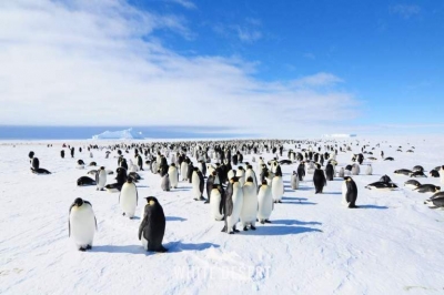
Contrary to popular belief, the largest desert in the world is the Antarctic Desert. Located over the South Pole and covering all of the land of Antarctica, this massive ice sheet receives very little rainfall and is considered a desert. The definition of desert is not vast stretches of sand dunes and high temperatures, but a piece of land that receives very less annual precipitation in the form of rain, snow, mist or fog. In the last 30 years of time, the average annual rainfall at the South Pole is just over 10 mm. Although there is more precipitation towards the coast, the continent as a whole has very little precipitation and that is enough to classify the region as a polar desert. Antarctica is also the coldest, driest, and windiest continent, with the highest average elevation among all the continents in the world.

The Russian expedition headed by Fabian Gottlieb von Bellingshausen and Mikhail Lazarev led to the discovery of the Antarctic ice shelves. After this, French, American, and British expeditions led to more exploration in the region. A Norwegian team was first confirmed to have landed in Antarctica in the year 1895. Later, some British explorers became the first to reach the magnetic South Pole in 1909, and the geographic South Pole was first reached in 1911 by some Norwegian explorers.

About 30 countries govern Antarctica and are parties of the 1959 Antarctic Treaty System. According to the treaty, military activity, mining, nuclear explosions, and nuclear waste disposal are all prohibited in the region. India's first expedition to Antarctica landed there on January 9, 1982. India has set up three research stations in Antarctica, the first being 'Dakshin Gangotri' established in 1984. In 1989, it was re-established and is being used as a supply base and transit camp. The second station 'Maitri' was established in 1988 and the third base 'Bharati' was established in 2015. In line with the Antarctic Treaty System, Bharati can be completely disassembled and removed without leaving even a brick behind.

This polar desert is home to several volcanoes as well. Of those, two of them are active. Mount Erebus, which is the second-highest volcano in Antarctica, is the southernmost active volcano of our planet. The second active volcano is located on Deception Island, which is a volcanic caldera in the South Shetland Islands.

Picture Credit : Google

What makes Greenland different?

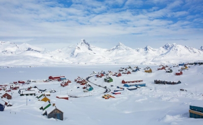
Popular for its vast tundra and immense glaciers, Greenland is the world's largest island, in fact the largest island country. In terms of land area, it is more than three times the size of the U.S. state of Texas. It is an autonomous Danish dependent territory and has its own parliament. Two-thirds of Greenland lies within the Arctic Circle, with its northern regions lying just 800 km away from the North Pole. The island enjoys continuous daylight for two months every year. More than 80 per cent of the land is covered by ice. A major impact of global warming is seen in Greenland as the ice cover is melting away faster than ever. This crisis has however increased access to Green- land's mineral resources.

We know that Greenland is a part of the Kingdom of Denmark, but its home-rule government is responsible for most of its domestic affairs. The people of Greenland are primarily Inuit.

When it comes to Greenland, one of the most interesting question is its name- why is it called Greenland when it is mostly covered in ice? The answer lies in history. An exiled Viking named Eric the Red came up with this name as a means to encourage others to follow him and establish new settlements in the region. It must be noted that South Greenland (where Erik the Red settled) is actually green during the summer. Another interesting fact about Greenland is that it has a very limited road transport system due to the rugged terrain, its deep fjords that outline the coastline, the ice sheets, and the very small population. In fact, all roads end at the outskirts of towns.

Picture Credit : Google

What are the specialities of the Pacific Ocean?

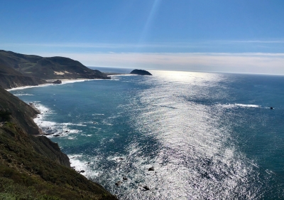
Occupying about one-third of the surface of the planet, the Pacific Ocean is the largest ocean on earth. It lies between the continents of Asia and Australia on the west and is bordered by North America and South America on the east. It covers an area of 161.76 million square kilometres without counting in the South China Sea. It has double the area and more than double the water volume of the next largest water-body, the Atlantic Ocean. It covers more area than the total land surface of the globe.

The Pacific Ocean meets the Arctic Ocean in the Bering Sea in the Northern Hemisphere and in the Southern Hemisphere, it mixes with the Atlantic Ocean in the Drake Passage between Tierra del Fuego in South America and Graham Land in Antarctica.

One cannot clearly say where the Pacific and Indian oceans become separate, but a line of islands extending eastward from Sumatra, through Java to Timor, extending across the Timor Sea to Cape Londonderry in Australia is usually considered as the points of separation of the two. The deepest point in the Pacific Ocean is in the Mariana Trench. It is located in the western Pacific located around 200 kilometres east of the Mariana Islands to the east of the Philippines.

The Pacific Ocean Basin also contains 75 per cent of the world's volcanoes and forms the Ring of Fire, which is a ring of Pacific Ocean volcanoes around the ocean basin. There is also an interesting story behind the name of this ocean.

It was Ferdinand Magellan, who gave the name Pacific inspired from the Latin word 'pacificus' meaning 'tranquil.' It is said that he felt the ocean to be unusually calm as he entered its waters and this led to the name.

Picture Credit : Google

Which is the largest country by area?

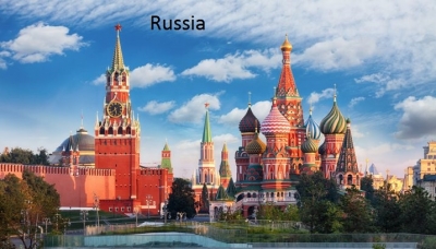
Spanni panning across 17,098,246 square kilometres, Russia is the largest country in the world by area. Russia alone occupies one-tenth of all the land on Earth! It is the only country with 11 time zones due to its vast land area. Russia is also part of two continents- Europe and Asia and has territories on three oceans (the Atlantic, Pacific and Arctic Oceans). The landscapes that one can see across this country vary from sandy and frozen deserts to tall mountains and giant marshes, but the major part of Russia's landscape is covered by continuous stretches of treeless plains called steppes. Taigas is another type of land area found in Siberia, which are pine forests that occupy about three-quarters of Russia.

Russia had its earliest human settlements when Scandinavians moved south to regions near the upper Volga River in AD 500. These settlers mixed with Slavs from the west, leading to the construction of a fortress, which is now the Ukrainian city of Kiev.

Russian history has many eras. Of them, the evolution of Kiev into an empire that ruled most of European Russia was very important. Kiev was in power for 200 years until it broke up into Ukraine, Belarus and Muscovy. Russia was also ruled by the Tsars for a period in history until the Bolshevik Revolution overthrew them. Bolshevik leader, Vladimir Lenin, gave birth to the Union of Soviet Socialist Republics (U.S.S.R.) from Russia and 11 other countries.

The Soviet Union played a critical role in the victory of the Allied Powers in World War II. It was a superpower and was the major opponent to the United States during the Cold War. This era saw great technological advancements such as the launch of the world's first human-made satellite and the first human into space. However, the U.S.S.R was dissolved on 26 December 1991.

Recently, Russia is in news for its ongoing war with Ukraine.

Picture Credit : Google