Which is the largest desert in South America?


 The Atacama Desert is on the other side of Eastern Patagonia. Therefore, you will find that it is surrounded by the Andes in its eastern part and by the Pacific Ocean in the west. The Atacama Desert is known as the driest non-polar place in the world. It could be several years without rain in one of the largest deserts in South America.


The desert occupies an area of about 105,000 square km. Large sections of the desert feature salt lakes, sand, felsic lava, and stony terrain. The Atacama Desert is known to be the world’s driest non-polar location. In the central sector of the desert, rainfall often does not occur for periods of up to four or five years. The species diversity of the Atacama Desert is highly restricted. Some parts of the desert are too dry to sustain any life form at all. Scorpions, desert butterflies, and wasps, the Atacama toad, lava lizards, iguanas, etc., are some of the Atacama Desert fauna. Birds visiting or residing in the desert include sparrows, hummingbirds, Andean flamingos, Humboldt penguins, etc. Seals and sea lions can be sighted along the coast.


Much of the Atacama Desert's core is caked in thick salt deposits called playas, which can stretch for miles and are nearly half a meter thick (1.6 feet) in some places. The desert is speckled with stones that have been carried across the playas by powerful wind gusts. Alluvial fans, which are large, fan-shaped sediment deposits, connect the desert plateau with the mountains that surround it and suggest that water once flowed from the Andes into the desert.


Picture Credit : Google


Which is the largest desert in North America?


The Chihuahuan Desert is the largest hot desert in North America, located in the Southwestern United States and Northern Mexico. Its total area is 140,000 sq mi (360,000 km2).


Though the Chihuahuan Desert is the southernmost, it lies at a fairly high elevation and is not protected by any barrier from arctic air masses, so hard winter freezes are common. Its vegetation consists of many species of low shrubs, leaf succulents, and small cacti. Trees are rare. Rainfall is predominantly in the summer, but in the northern end there is occasionally enough winter rain to support massive blooms of spring annuals. The Chihuahuan Desert is unexpectedly rich in species despite the winter cold.


The eastern boundary of the Chihuahuan Desert is one of the oldest and richest centers of plant evolution on the North American continent. A wide variety of vegetation communities are present in the in the ecoregion, ranging from desert shrublands at lower elevations and conifer woodlands at the highest elevations. The Chihuahuan Desert boasts as many as 3,500 plant species, including nearly a quarter of the world’s cactus species. Approximately 1,000 of the plant species grow only in this ecoregion. Some distinctive habitat types in the Chihuahuan Desert include yucca woodlands, playas, gypsum dunes, and a diverse array of freshwater habitats. Vast desert grasslands and a wide variety of yuccas and agaves, including many endemic species, also make this desert extremely unique.


The Chihuahuan Desert is home to more than 170 species of amphibians and reptiles. At least 18 of these species are endemic to the Ecoregion. There are a surprisingly large number of endemic fish that occur in the Chihuahuan Desert as well—nearly half of the 110 fish species in the region are either endemic or of limited distribution. Most are relic species found in isolated springs in the closed basins.


Picture Credit : Google


Which is the largest desert in Africa?


The Sahara is one of the harshest environments on Earth, covering 3.6 million square miles (9.4 million square kilometers), nearly a third of the African continent, about the size of the United States (including Alaska and Hawaii). The name of the desert comes from the Arabic word ?a?r??, which means "desert."


The Sahara desert has a variety of land features, but is most famous for the sand dune fields that are often depicted in movies. The dunes can reach almost 600 feet (183 meters) high but they cover only about 15 percent of the entire desert. Other topographical features include mountains, plateaus, sand- and gravel-covered plains, salt flats, basins and depressions. Mount Koussi, an extinct volcano in Chad, is the highest point in the Sahara at 11,204 feet (3,415 m), and the Qattara Depression in Egypt is the Sahara’s deepest point, at 436 feet (133 m) below sea level.


Camels are one of the most iconic animals of the Sahara. The large mammals are native to North America and eventually made their way across the Bering Isthmus between 3 and 5 million years ago, according to a study in the Research Journal of Agriculture and Environmental Management in 2015. Camels were domesticated about 3,000 years ago on the Southeast Arabian Peninsula, to be used for transportation in the desert, according to the University of Veterinary Medicine, Vienna.


Plant species in the Sahara have adapted to the arid conditions, with roots that reach deep underground to find buried water sources and leaves that are shaped into spines that minimize moisture loss. The most arid parts of the desert are completely void of plant life, but oasis areas, such as the Nile Valley, support a large variety of plants, including olive trees, date palms and various shrubs and grasses.


Picture Credit : Google


Which is the largest desert in Asia?


Gobi Desert, the largest desert in Asia, promises stunning sand dunes, dinosaur fossils, and warm hospitality from nomad families and friendly Bactrian camels. 


Spanning across 1,295,000 square kilometres, the desert lies in the dry region of the Tibetian Plateau, extending from northern China to Mongolia and passing through several trading cities along the historical Silk Road including Turpan, Hami and Dunhuang. 


Extending from northern China into Mongolia, the Gobi Desert receives an average of 7 inches of rainfall each year because the Himalaya Mountains block rain clouds from reaching the region. The Silk Road actually passes through the Gobi Desert, and through historic trading cities such as Turfan, Hami and Dunhuang. Today, the Gobi continues to grow every year, as winds carry desert sand into nearby areas and erodes the surrounding top soil. This process of desertification renders fertile land unusable and occurs in the Gobi at an alarming rate for the nearby human population. Gobi is not one thing. But it comprises of 33 Gobi with different features and climate. Gobi has canyon, flowery steppe, beautiful crags, wide hollows with few oases, saline and green saxaul thickets. The Gobi Desert is not only famous for dinosaur species discovery, but also well known for its rich natural resources. The Gobi Desert is rich in copper, gold and coal deposits. One of them is called Oyu Tolgoi which is world’s third largest copper and gold mine.


Picture Credit : Google


Which is the longest river in Australia?


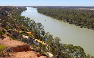
The calculations confirmed that Australia's longest single river is the River Murray at 2508 kilometres. However, if the longest tributaries of the Darling River, the Culgoa, Balonne and Condamine, are taken into account its total length increases to 2740 kilometres, making it Australia's longest waterway.


The National Topographic Database is a nationally consistent dataset containing a range of topographic features, such as relief and drainage, which has been captured and maintained at a scale of 1:250 000 for the whole of Australia. Use of the database to digitally calculate the longest rivers has resulted in more precise estimates than those available previously.


The Murray River was first discovered by European explorers Hamilton H. Hume and William H. Hovell in 1824. It wasn't until five years later, however, that Charles Sturt navigated down the Murrumbidgee to encounter the Murray and named it after Sir George Murray, (Soldier and Tory Party Politician 1772-1846) when his exploration party encountered the Darling connection. Sturt had previously explored the Darling River to the north and was able to determine that they were indeed the same river system.


The Murray River is the world's 16th-longest river at 2,520 kilometres from its source in the Kosciusko National Park. It is fed by several rivers on it's journey from the Australian Alps. The main feeding rivers are the Darling and Murrumbidgee Rivers. The Darling River (2,740 kilometres) begins in the far inland of Australia (Queensland) and joins the Murray at Wentworth (NSW) then flows to the Southern Ocean through South Australia.


Picture Credit : Google


Which is the longest river in Europe?


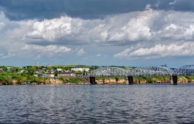
The Volga is the longest river in Europe; its source is in the Valdai Hills, in a town known as Volgo-Verjovie, between the cities of Moscow and Saint Petersburg, at about 228 metres above sea level. With approximately 200 tributaries, the main ones are the Kama, Samara, Oka, Vetluga and Sura rivers.


The Volga has many tributaries, most importantly the Kama, the Oka, the Vetluga, and the Sura rivers. The Volga and its tributaries form the Volga river system, which drains an area of about 1.35 million square kilometres in the most heavily populated part of Russia. The Volga Delta has a length of about 160 kilometres and includes as many as 500 channels and smaller rivers. The largest estuary in Europe, it is the only place in Russia where pelicans, flamingoes, and lotuses may be found. The Volga freezes for most of its length during three months of each year.


The Volga drains most of Western Russia. Its many large reservoirs provide irrigation and hydroelectric power. The Moscow Canal, the Volga-Don Canal, and the Mariinsk Canal systems form navigable waterways connecting Moscow to the White Sea, the Baltic Sea, the Caspian Sea, the Sea of Azov and the Black Sea. High levels of chemical pollution currently give cause for environmental concern.


The fertile river valley provides large quantities of wheat, and also has many mineral riches. A substantial petroleum industry centres on the Volga valley. Other minerals include natural gas, salt, and potash. The Volga Delta and the nearby Caspian Sea offer superb fishing grounds. Astrakhan, at the delta, is the centre of the caviar industry.


Picture Credit : Google


Which is the longest river in Antarctica?


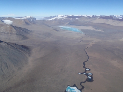
The Onyx River is the longest river in Antarctica, flowing for 19 miles from the coastal Wright Lower Glacier and ending in Lake Vanda. 


The Onyx River, in Wright Valley, is a seasonal stream of meltwater which flows for some 40 km from coastal piedmont glaciers inland into Lake Vanda. The stream bed is mainly braided in fine alluvial gravels, with some stretches of coarser moraine materials. A number of tributary feeders flow from the alpine glaciers of the ranges bordering the valley. Seasonal flows have been regularly monitored from two portions of the river. The Lower Wright site, close to the headwaters of the river, is about 2 km downstream from the shallow Lake Brownworth at the terminus of the Lower Wright Glacier. It is upstream from the confluence with the tributary streams and hence records only the flow contribution from the Lower Wright Glacier. The Vanda Weir is about 500 m upstream from the mouth of the river at Lake Vanda and also contains water from the Clark, Meserve and Bartley glacier streams.


There are no fish in the Onyx River, but it supports microscopic life, and the algal blooms can be quite extensive. The environment consists mainly of cyanobacteria and other algae. A few small animals (nematodes, tardigrades, and rotifers) live in the river. Skuas are also occasionally present in the area.


Picture Credit : Google


Which is the longest river in North America?


The Missouri is the longest river in the US – North America. The Missouri flows entirely though the United States, where it crosses seven states: Montana, North Dakota, South Dakota, Nebraska, Iowa, Kansas and Missouri.


The headwaters of the Missouri are located where the Jefferson, Madison and Gallatin rivers meet, in the Rocky Mountains, in Montana, 1,200 metres above sea level. It flows into the Mississippi river as its main tributary, 16 kilometres from the city of St. Louis.


The Missouri is 3,943 kilometres long. If we consider the Mississippi-Missouri river system, the total length would increase to 7,725 kilometres, forming the world’s fourth longest river, after the Amazon, Nile and Yangtze rivers.


The drainage basin spans 1,371,100 square kilometres, making it the sixth largest one in the world, comprising 16,840 square kilometres in southern Canada.


For thousands of years, the Missouri has been home to Native Americans. The first Europeans to discover the river were explorers Jacques Marquette and Louis Jolliet in 1673. After that, explorers Lewis and Clark (1804-1805) were the first to navigate from its headwaters to its mouth.


During the 19th century, steam boat traffic increased until 1858, when it started to decline. In 1944, the US Congress approved a programme for irrigation development, flood control, and hydropower generation.


Picture Credit : Google


Which is the longest river in Africa?


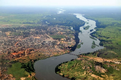
The Nile is the longest river in Africa and the second longest river in the world, with 6,695 kilometres. Its basin spans 3,349,000 square kilometres, approximately 10% of the surface area of Africa.


The Nile river flows through a significant portion of the African continent and has generated numerous ecological relationships among the different populations, with broad ethnic diversity.  In addition, the Nile river is used as a waterway for transport, and in some areas such as South Sudan, travelling is only possible through the Nile between the months of May and November, because of flooding.


It is also responsible for carrying water from the Nile’s furthest source. The section known as Kagera starts in Burundi and it flows out of Lake Rweru through the Burundi-Rwanda and the Tanzania-Rwanda borders to convergence with river Ruvubu. From the confluence, it flows over the Rusumo falls, through the Akagera National Park before turning east and flowing into Lake Victoria. Akagera River is fed by Ruvubu from Burundi and Nyabarongo from Rwanda.


Picture Credit : Google


Which is the longest river in South America?


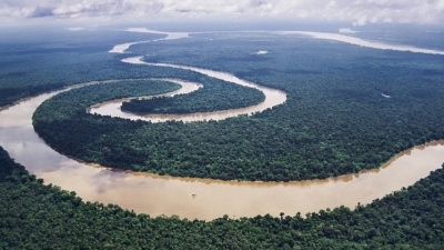
South America boasts no shortage of great rivers. The Madeira River stretches some 3,250 kilometres and the Parana dwarfs it at 4,880 kilometres. Most impressive of all is the longest river in South America is the Amazon River.


The most distant source of the Amazon is the Mantaro River in Peru. The Mantaro joins with other tributaries to form river Ucayali which meets with river Maranon to create the primary stem of the Amazon. The River Ene forms at the confluence of the River Apurimac and the River Mantaro, and it is part of the Amazon river’s headwaters which originates from Mismi. After about 450 miles, the Apurimac meets with river Mantaro and becomes Ene which joins River Perene and becomes river Tambo which drains to Ucayali. Ucayali-Tambo-Ene and Apurimac join the Amazon to form the longest river in the world. The Amazon has an average discharge of 209 million liters per second. The river's discharge represents about 20% of the world flow into the ocean. The Amazon River passes through multiple countries including Venezuela, Guyana, Ecuador, Colombia, Bolivia, Peru and Brazil.


Naturally, the longest river in South America is a source of food and water for the great Amazon rainforest. It’s thought that around a third of all known species live in the rainforest, including jaguars, ocelots and sloths. It’s not all about the rainforest, though. The river itself has plenty of weird and wonderful creatures of its own. Spend a little time on the Amazon river and you might be fortunate enough to encounter the Amazon river dolphin, the Amazonian manatee and the giant otter. If you’re unfortunate, you may stumble upon an anaconda, among the largest snakes in the world and known to hunt in the river’s shallow waters.


Which is the longest river in Asia?


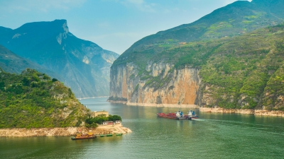
The Yangtze River in China is the longest river in Asia, the third longest river in the world and the longest river to flow entirely in one country. The river begins its journey in the glacial meltwaters of the Tanggula Mountains in Tibet and flows approximately 3,915 miles (6,300 kilometers) until it empties in the East China Sea near the city of Shanghai. The river flows through or borders 10 provinces. 


The river flows through a variety of terrains, including high plateaus and lowland plains, but most of its journey — approximately three-fourths of it — is spent passing through mountainous regions, including some extremely scenic areas with deep valleys, canyons and gorges. The river is fed by approximately 700 tributaries, including eight principal rivers: Yalung, Min, Jialing, Han, Wu, Yuan, Xiang and Gan rivers.


The Yangtze River basin is considered the great granary of China. The economy of the basin focuses largely on agriculture, according to Encyclopaedia Britannica. The grains produced here -- 70 percent of which is rice -- is enough to feed half of the country's population, according to Travel China Guide. Other crops grown here include barley, cotton, wheat, corn and beans.


Picture Credit : Google


Which is the tallest mountain in Europe?


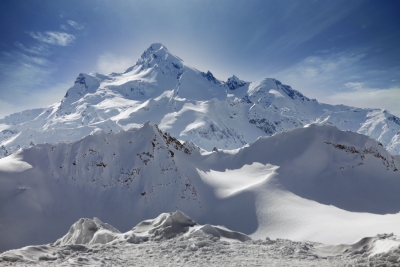
Mount Elbrus is a dormant volcano and the highest mountain in Europe. Its summit is 18,510 feet (5,642 meters) above sea level. It is located in Russia.


With an elevation of 18,510 feet (5,642 meters), it is part of the Caucasus Range that straddles Asia and Europe, although most geographers place it in Europe. This makes it the tallest mountain in Europe and one of the Seven Summits, the highest mountains in each of the continents and elite climbers aspire to summit all of them.


Mount Elbrus’ prominence —a measure of how distinct a mountainis from nearby peaks — is 15,554 feet (4,741 m), making it the 10th most prominent mountain in the world. The east summit is slightly lower at 18,442 feet (5,621 m).


Elbrus has a unique cable car system, which was built on the south side of the mountain from 1959 to 1976. The cable car reaches 12,500 feet (3,658 m).  From there, most climbers take the Standard Route up the south side to the summit.


While the lack of crevasses can lull climbers into a false sense of safety, the Standard Route is challenging due to the snow, high winds and a high elevation. About 15 to 30 climbers die each year, which is a fairly high ratio of climbers to climber deaths when compared to other mountains.


Picture Credit : Google


Which is the tallest mountain in Australia?


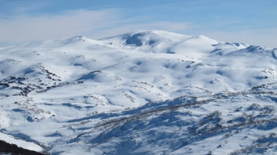
Mount Kosciuszko is the tallest mountain peak in mainland Australia at 2,228 meters (7,310 feet) tall. It is located in the state of New South Wales, in the southeastern part of the country. It is not technically Australia’s largest peak, because a volcano (Mawson Peak) on the Australian-owned Heard Island off the coast of Antarctica is taller. While Mawson Peak is politically part of Australia, geographically it is considered to be “sub-Antarctica.”


The mountain is sometimes included as part of the Seven Summits mountaineering challenge, in which mountain climbers summit the tallest mountain on every continent. There is some controversy over whether Mount Kosciuszko or Indonesia’s Puncak Jaya should be the seventh mountain. This debate comes from the geographical definition of the continent of Australia/Oceania. Mount Kosciuszko is the highest mountain on Australia, however, when taking into account all of Oceania, Puncak Jaya in Indonesia is technically the higher mountain. Many climbers climb both mountains to cover all bases.


Picture Credit : Google


Which is the tallest mountain in Antarctica?


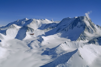
Vinson Massif is a large mountain massif in Antarctica that is 21 km (13 mi) long and 13 km (8 mi) wide and lies within the Sentinel Range of the Ellsworth Mountains. It overlooks the Ronne Ice Shelf near the base of the Antarctic Peninsula. 


Climbed for the first time in 1966, Vinson still sees very few visitors and remains a pristine and majestic peak. To reach this remote area of the world, we fly from Punta Arenas, Chile and land on the blue ice runway of Union Glacier. A short flight then brings us to Vinson Base Camp at the foot of the Branscomb Glacier in the Ellsworth Mountains. From here we ascend the Branscomb Glacier and climb the headwall on Vinson, setting up two camps along the way. Summit Day is one of the most spectacular of any big climb in the world: as we ascend from our High Camp (12,400') the views of the immense ice sheets which surround the Massif gradually come into view, the final steep push up the summit ridge is exhilarating but not technically difficult, and standing atop this remote summit a climber looks for miles in all directions onto a landscape virtually untouched by humans.


Most climbers ascend up the Branscomb Glacier, known as the Normal Route, and make it in about 10 days. About 1,000 climbers have summited Mt. Vinson, much fewer than the other Seven Summits. While other summits are more challenging from a technical climbing perspective, the cold, windy conditions and the short window of opportunity to climb keep many climbers from making it to the top. There is also the cost involved, which can be $30,000 or more because of the summit's remoteness.


Picture Credit : Google


Which is the tallest mountain in South America?


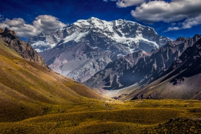
Part of the Andes mountain range, Aconcagua is the second highest of the Seven Summits (the highest peaks on each continent), behind only Mount Everest in Asia. At 22,837 feet (6,961 meters), not only is it the highest mountain in South America, it is the tallest peak in all of the Americas, as well as the Southern and Western Hemispheres.


Aconcagua is located in Argentina, in the province of Mendoza, and lies 70 miles (112 kilometers) northwest of the provincial capital, Mendoza, and 9.3 miles (15 km) from the border with Chile.


The vegetation and wildlife on Aconcagua is concentrated below 13,123 feet (4,000 m), according to the Encyclopedia of World Geography. There are a number of low bushes, such as yellow firewood, yareta and goat horn, and there are open pastures made up of grasses such as huecú and ichu.


Many varieties of birds inhabit the area, including the condor, the purple eagle and a species of snipe called agachona. Spotted sandpipers and torrrentes, a type of duck, thrive in some of the areas with water. Mountain rats and the red fox are among the most common land animals.


Picture Credit : Google