NASA Says Tonga Eruption Was More Powerful Than an Atomic Bomb

The recent volcanic eruption in the region was hundreds of times more powerful than the Hiroshima atomic bomb, says NASA

  • Tonga's eruption unleashed explosive forces equivalent to up to 30 million tonnes of TNT - hundreds of times more than Hiroshima's atomic bomb, NASA says.
  • As a comparison, the U.S. atomic bomb dropped on Hiroshima in August 1945 was estimated to be about 15 kilotons (15,000 tonnes) of TNT.
  • Mount St. Helens exploded in 1980 with 24 megatons and Krakatoa burst in 1883 with 200 megatons of energy.
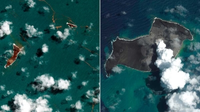
  • Before the eruption, the Hunga Tonga-Hunga Ha'apai volcanic island was two separate islands joined by new land formed in 2015.
  • Nasa says the eruption was so powerful all the new land is gone, along with "large chunks" of the two older islands.
  • Tonga says more than four fifths of the population has been affected by the tsunami and falling ash. Three people were confirmed killed in the tsunami last month.

Picture Credit : Google

What is ozone all about? And why is it considered a pollutant?

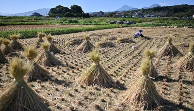
A new study published in journal Nature Food has found that persistently high levels of ozone pollution in Asia are costing China, Japan and South Korea an estimated $63 billion annually in lost rice, wheat and maize crops. The research used pollution monitoring data from the region and field experiments to show ozone affects Asia's crop yields more than previously thought.

The researchers found that on an average 33% of China's wheat crop is lost annually because of ozone pollution. While South Korea lost 28% of wheat. Japan lost 16%. For rice, the mean figure in China was 23%. In South Korea the figure was nearly 11%, while in Japan it was 5%. And maize crops in both China and South Korea were also affected. The crop is not grown in Japan in significant quantities. The study's authors said the findings should push policymakers to reduce emissions that produce ozone.

You may have learnt from your teachers that the ozone layer protects us from the harsh sunlight.

What is ozone?

Ozone is a highly reactive gas composed of three oxygen atoms-03. It occurs naturally in the stratosphere layer of the Earth's atmosphere. But ozone also comes from man-made sources and is found in the lowest layer of the atmosphere (troposphere). While the former affects life on Earth in positive ways, the latter does so in negative ways. Our concern in this article is the second form of ozone.

What is the ozone layer?

The atmosphere consists of a mixture of 78% nitrogen, 21% oxygen and 1% of other gases. Each of the five layers of our atmosphere has its own role in protecting Earth and supporting life on the planet. The second layer - the stratosphere - is the most stable region, where jets fly. It is also the region where ozone is abundant. Stratospheric ozone is formed naturally through the interaction of solar ultraviolet (UV) radiation with molecular oxygen (02). The layer, found about 10 to 40 km above the ground, is the ozone layer. It is part of the stratosphere and it protects life on Earth from the harmful effects of UV rays by absorbing them. Ultraviolet rays can damage DNA, and cause sunburn, skin cancer and cataract in humans.

What is ozone pollution?

At the ground level, ozone is a highly unstable and poisonous gas which is created by chemical reactions between oxides of nitrogen (NOx) and volatile organic compounds (VOC). This happens when pollutants emitted by cars, power plants, industrial boilers, refineries, chemical plants, and other sources chemically react in the presence of sunlight. When the percentage of ozone at ground level reaches alarmingly high levels, ozone pollution occurs. Ozone pollution is common in urban areas because of vehicular pollutions and industries, ozone can be transported long distances by wind so even rural areas, where farming lands are found, can also experience high ozone levels. A higher percentage of ozone gives rise to health issues such as chest pain, congestion and coughing. It also affects crops and other vegetation.

How does ozone affect crop yield?

Ozone damages crops by entering leaves during normal gas exchange. As a strong oxidant, ozone causes symptoms in crops such as yellowing, cell injury, spots, and reddening. Many factors such as soil moisture, presence of other air pollutants, insects or diseases, and other environmental stresses, can increase the impact.

Ozone is the key pollutant causing the yield loss of crops such as rice and maize. Wheat is the most sensitive when it comes to ozone-caused damage. Ozone exposure could have an even bigger impact on yields of soybean, peanut and cotton.

Why is this concern in Asia?

East Asia is one of the biggest bread baskets and ricebowls in the world. It supplies 90% of the world's rice and 44% of its wheat. The researchers said surface ozone is "posing a threat to food security."

Asia is also a hotspot for ozone. While ozone levels have declined in America and Europe over the last two decades, with the introduction of stricter air quality measures, the pollutant is increasing in Asia.

Further, industry, energy and urban expansion are competing for limited land resources.

What is the solution?

The best way to bring down ozone levels is to curb the use of fossil fuels - the same action needed to bring down greenhouse gas emissions causing climate change.

Picture Credit : Google
What natural disasters happened in 2021?

Earthquake in Sulawesi: On Jan. 15, an M 6.2 earthquake struck the city of Majene on the west coast of Indonesia's Sulawesi island, killing more than 90 people and displacing 94,000.

Flood in Australia: Days of heavy rain pounded the Australian province of New South Wales at the end of March 2021, leading to a "once-in-a-hundred-year-flood".

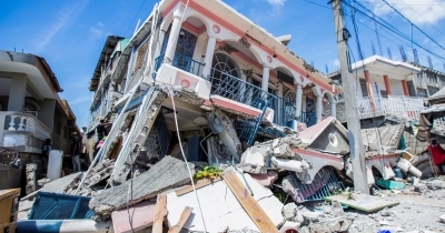
Earthquake in Haiti: On Aug. 14, an M 7.2 earthquake, the biggest since 2010, struck Haiti. It killed more than 2000 people. At least 1,37.500 buildings were damaged or destroyed.

Volcanic eruption in Indonesia: Indonesia's Java Island experienced several days of heavy rain that left a heavy pool of water on the lava dome at the top of Mount Semeru. On Dec 4, the lava dome collapsed, unleashing the molten lava beneath in an explosive eruption that sent thousands of people fleeing the area.

Typhoon in the Philippines: Super Typhoon Rai made landfall on Siargao Island in southeastern Philippines on Dec. 16. It killed more than 400 people and caused half a billion dollars in damages.

U.S. Typhoon: About 68 out-of-season tornadoes ripped across several states in the United States on Dec. 10, and Dec. 11, leaving death and destruction in their wake. They killed more than 90 people across ten States. Officials estimated billions of dollars of damages.

Picture Credit : Google

Wildfires ravaging forestlands in many parts of world

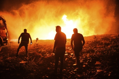
Over the last few years, extreme heatwaves and drought have been leading to longer and severe wildfire seasons across the globe. In 2021, wildfires were reported in North America, many parts of Europe and Australia.

Australia's fire season continued from 2020 into early 2021. The 2021 Wooroloo bushfire at Werribee Road, Wooroloo, in February, was the biggest of them in 2021. It burnt out an area of over 10,500 hectares.

The wildfire season in California, in the U.S., experienced an unusually early start amid an ongoing drought. It began in January and went on till October. The 2021 season outpaced the 2020 season, which itself was the largest season in the state's recorded history, as multiple fires including the Dixie Fire. McFarland Fire. Caldor Fire, and others raged on, forcing evacuation of thousands of people and destruction of thousands of acres of forest. In July, Canada too battled dozens of blazes in British Columbia and Ontario provinces.

Thousands of miles away in Siberia, the fire season started in late April and accelerated dramatically in mid-June. The Siberia wildfire broke a record for annual fire-related emissions of carbon dioxide. The usually hot Mediterranean region experienced higher than usual temperatures last summer, triggering wildfires in Turkey, Cyprus and Greece. The heat combined with dry conditions turned the Mediterranean vegetation into a tinderbox. The wildfires in Turkey and Greece were described as the worst in at least a decade. Italy and Lebanon also witnessed widespread wildfires in August.

Picture Credit : Google

Ken-Betwa river linking project gets green panel nod

Nearly four decades after it was conceptualised. India's first river interlinking project, connecting Ken River in Madhya Pradesh with Betwa in Uttar Pradesh, finally got the green signal from the Union cabinet on December 8. The project is expected to address the woes of five water-starved districts in Uttar Pradesh and six in Madhya Pradesh. It will involve constructing a dam and a channel to transfer water from the Ken to the Betwa rivers in the Bundelkhand region of Uttar Pradesh and Madhya Pradesh. However, the project has stoked concerns about its likely environmental impacts - including submergence of a tiger reserve.

The environmental appraisal committee (EAC) had “duly considered” and “agreed” for the phase I of the project in its meeting held on December 30, 2016.

The project envisages construction of a dam across river Ken in Chhatarpur district in Madhya Pradesh to irrigate 6.35 lakh hectares of land, serve drinking water purposes in Bundelkhand region and generation of 78 MW hydropower.

Of this, 3.69 lakh hectares will be covered in Madhya Pradesh’s Chattarpur, Tikamgarh and Panna districts. The remaining 2.65 lakh hectares of area falls in poll-bound Uttar Pradesh’s Mahoba, Banda and Jhansi districts.

According to the Water Resources Ministry, a total of 10 villages consisting of 1,585 families are likely to be affected by this project.

The project comprises two powerhouses of 2x30 MW and 3x6 MW each, two tunnels of 1.9 km-long upper level, 1.1 km-long lower level tunnel, and a 221 km-long Ken-Betwa link canal, proposed on the left bank of the river.

The project was first mooted in the early 1980s but was actively taken up by the NDA government under Prime Minister Atal Bihari Vajpayee. It was then challenged in the Supreme Court, which finally gave the nod in 2013.

Credit : The Hindu

Picture Credit : Google

India establishes the largest network of Ramsar Sites in South Asia

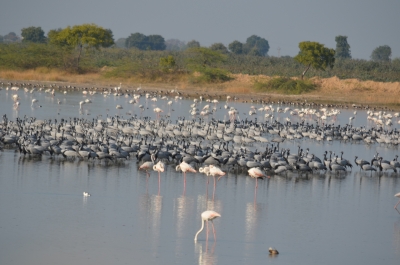
The Ministry of Environment, Forest and Climate Change designated four wetlands to the list of Ramsar Sites - two each from Haryana and Gujarat. They are the Thol Lake Wildlife Sanctuary and the Wadhwana Wetlands from Gujarat and Bhindawas Wildlife Sanctuary and the Sultanpur National Park from Haryana. With these additions, India is now home to the largest network of Ramsar sites (46 in all) in South Asia. A Ramsar Site is a wetland designated to be of international importance under the Ramsar Convention, established by UNESCO.

India ratified the Ramsar Convention in 1982 at the behest of the then Prime Minister, Indira Gandhi, who is also credited to have heralded several key environment legislations in the country. Keoladeo National Park and Chilika were the first two sites to be placed on the Ramsar List by the Government of India initially. Till 1990, only four more sites were added to the list and another 19 over the following two decades. Since 2010, Ramsar Site designation has received a significant policy push from the MoEFCC, and 21 wetlands added to the list in the last decade alone. The network of Indian Ramsar Sites covering over 8% of the known wetlands’ extent of the country and is the largest in South Asia.

The Ramsar sites in India are highly diverse. The sites range from Himalayan high-altitude wetlands (Tso-Moriri, Tso kar complex and Chandertal), lakes and marshes (Wular, Hokera, Renuka,  Keoladeo, Kabartal, Nawabganj, Loktak, Deepor, Rudrasagar, Sandi, Saman, Keshopur-Miani, Sultanpur, Nalsarovar, and Sasthamkotta), river stretches (Upper Ganga River stretch, Beas Conservation Reserve and Kanjili), crater lake (Lonar), salinas (Sambhar), mangrove swamps (Sunderbans, Bhitarkanika, and Point Calimere) and lagoons and estuaries (Chilika, Ashtamudi and Vembanad-Kol). Water storage areas (Pong, Harike, Bhoj, Surinsar-Mansar, Bhindawas, Sur Sarovar, Asan, Wadhvana, and Thol) and assemblages of sewage-fed fish farms (East Kolkata Wetlands) have also been included in the list by the Government of India.  While the smallest Ramsar Site is just 49 ha in area (Chandertal), the largest, the Sunderbans spans 0.42 million ha.

Credit : Mongabay 

Picture Credit : Google

What is plastic waste management Amendment 2021?

On August 13, the Environment Ministry of India notified the Plastic Waste Management Amendment Rules, 2021, which prohibits specific single-use plastic items that have "low utility and high littering potential by 2022. Under this rule, the manufacture, sale, and use of a range of plastic products will be prohibited from July 1, 2022.

The new rule has also increased the permitted thickness of polythene bags. India further strengthened its fight against plastic pollution by launching a Plastic Pact in September. The Plastic Pact, the first of its kind in Asia, is a platform to promote a circular economy for plastic. It is a collaborative initiative that aims to bring together businesses, governments and NGOs to reduce, reuse, and recycle plastics in their value chain. With the pact, India aims to make 100% of the plastic packaging to be reusable or recyclable before 2030.

A National Level Taskforce has also been constituted by the Ministry for taking coordinated efforts to eliminate identified single-use plastic items and effective implementation of Plastic Waste Management Rules, 2016.

The State /UT Governments and concerned Central Ministries/Departments have also been requested to develop a comprehensive action plan for the elimination of single-use plastics and effective implementation of Plastic Waste Management Rules, 2016 and its implementation in a time-bound manner.

Directions under Section 5 of Environment (Protection) Act, 1986, have been issued to all States/Union Territories inter alia for setting up for institutional mechanism for strengthening enforcement of Plastic Waste Management (PWM) Rules, 2016.

The Government has also been taking measures for awareness generation towards the elimination of single-use plastics and effective implementation of Plastic Waste Management Rules, 2016. A two-month-long Awareness Campaign of Single-Use Plastic 2021 has been organized. The Ministry has also organized a pan India essay writing competition on the theme for spreading awareness among schoolchildren.

To encourage innovation in the development of alternatives to identified single-use plastic items and digital solutions to plastic waste management, the India Plastic Challenge – Hackathon 2021, has been organized for students of Higher Educational Institutions and startups recognized under Startup India Initiative.

Credit : Net Indian 

Picture Credit : Google

Why did UNESCO want to put the Great Barrier Reef on the in danger list?

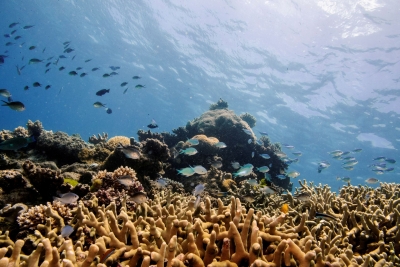
The United Nations heritage body UNESCO and the Australian government got into a tiff over placing the Great Barrier Reef on the list of world heritage sites that are "in danger." Pointing to the threats the world's biggest coral reef system faces from climate change, the UNESCO committee recommended that the listing is necessary to address the issue. But the Australian governments diplomatic effort won enough support to override the UN body's recommendations. The final motion, passed by the UNESCO in July agreed not to place the Great Barrier Reef on the in danger list. The committee, however, asked Australia to deliver an updated report on the state of the reef in February 2022.

The Great Barrier Reef is the largest living marine organism in the world. It was inscribed as a World Heritage site 40 years ago and remains one of the world’s most iconic natural treasures. ‘The Reef’, as it is called in Australia, meets all four natural heritage criteria. These include its extraordinary natural beauty and globally significant biodiversity. The Reef contains vast mangrove forests, seagrass meadows, coral reefs, whales, dolphins, turtles, sharks and dugongs to name just a few species groups.

Australians love the Reef and many people around the world dream of visiting Australia to see it for themselves. Prior to COVID, the Reef generated over AU$6 billion a year to the Australian economy and supported 64,000 jobs. Seventy Indigenous Traditional Owner groups have looked after the Reef for thousands of years. One quarter of the world’s marine species depend on coral reefs for at least part of their life cycle. The Great Barrier Reef has enormous social, economic, cultural, and ecological value.

In 2019, an Australian government report concluded that the outlook for the Great Barrier Reef had deteriorated from poor to very poor. The report, which is based on the best scientific data, found that climate change is the Reef’s biggest threat. 

The Reef has already experienced five coral bleaching events, the most severe and widespread being in the last five years. In 2016 and 2017, about 50 percent of the corals died. While there has been some coral regeneration, the mix of species is shifting in favor of fast growing “weedy” species that are the most vulnerable to future coral bleaching. 

The Reef is also threatened by local pressures, in particular agricultural runoff from intensive sugarcane farming and extensive grazing of livestock in the adjacent catchment. Unsustainable commercial fishing and coastal development add to the pressures. 

The 2021 recommendations regarding the Great Barrier Reef were the first time UNESCO has recommended a World Heritage site be inscribed on the List of World Heritage in Danger predominantly due to climate change. UNESCO referred to 1.5 °C as a critical threshold, the first time UNESCO has highlighted the long-term goal of the Paris Agreement in its recommendations for a specific World Heritage coral reef. It is also the first time UNESCO has called directly on a country to undertake corrective climate change actions.

Credit : Earth Justice 

Picture Credit : Google

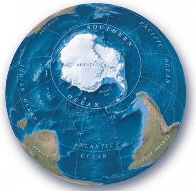
National Geographic Officially Recognizes the Southern Ocean as World’s Fifth Ocean

The icy waters surrounding Antarctica have long been recognised as a distinct ocean by scientists, the media and people across many countries. While many called this region the Southern Ocean, some scientists called it the Antarctic Ocean, or the Austral Ocean. But it had not been given a name by the National Geographic Society, a non-profit scientific and educational organisation whose mapping standards are referenced by atlases and cartographers.

Since the National Geographic began making maps in 1915, it had recognised only four oceans. It was only on June 8, 2021, the Society recognised the Southern Ocean as the world's fifth ocean! By officially naming the ocean, the National Geographic Society hopes to draw attention to the threats from pollution and climate change to the Southern Ocean ecosystem, therefore prompting conservation efforts here.

The US Board of Geographic Names, a federal body created in 1890 to establish and maintain “uniform geographic name usage” through the federal government, already recognizes the Southern ocean as occupying the same territory, but this is the first time the National Geographic has done so.

Attempts to ratify the boundaries and name of the Southern Ocean internationally have been thwarted.

The concept was proposed to the International Hydrographic Organization, which works to ensure the world’s seas, oceans and navigable waters are surveyed and charted, in 2000, but some of the IHO’s 94 members dissented. Despite that, Tait said it was important that the National Geographic christen the water area.

Credit : The Guardian 

Picture Credit : Google

Does the Amazon emit more CO2 than it absorbs?

The Amazon in South America is the largest, most diverse tropical rainforest on Earth. It has been described as the "Lungs of our Planet" because it continuously recycles carbon dioxide into oxygen. More than 20% of the world oxygen is produced in the Amazon Rainforest. But a new study published in March found that the forest is now emitting more CO2 than it is able to absorb. The researchers said it was most likely the result of each year’s deforestation and fires making adjacent forests more susceptible the next year. The trees produce much of the region's rain, so fewer trees means more severe droughts and heatwaves and more tree deaths and fires.

For generations, Amazonia, which spans more than two million square miles, was a reliable carbon sink, meaning that it naturally absorbed high levels of carbon dioxide from the air, and it played an important role in keeping the global environment stable.

However, in recent decades, humans have increasingly contributed to the degradation of the Amazon, upsetting a crucial natural balance. Of the 17% of forest reduction that occurred over the last 50 years, about 14% of that loss to the agricultural industry, which has burned the land and used it for crops and livestock, the report states.

Burning the rainforest to make room for crops or livestock can pose dangers for the climate, even decades after those fires occur. Research shows that areas that were burned as long ago as 30 years back — and the accompanying decomposing trees — were still considerable sources of carbon dioxide. Past fires and other factors like logging can also degrade nearby areas that were previously untouched and make those areas more susceptible to burning, according to the study.

Credit : npr

Picture Credit : Google

Ozone layer recovery back on track after China slows CFC-11 production

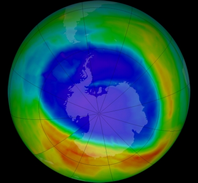
A pair of studies published in the journal Nature in February reported that atmospheric concentrations of ozone-damaging CFC chemicals have dropped precipitously since 2018 and that the recovery of the ozone layer was now "back on track". The ozone layer is a thin part of the Earth's atmosphere that protects us by absorbing the Sun's harmful ultraviolet radiation. There has been a lot of buzz around the ozone layer since its depletion was detected in 1985. The discovery brought the nations together in a treaty called the 1987 Montreal Protocol. They pledged to phase out ozone-harming chemicals, particularly chlorofluorocarbon or CFC, from 2010. The current decline, perhaps, corresponds with a global ban on CFC production.

But in 2018, a study revealed that "the concentration of CFCs in the atmosphere wasn't falling as quickly as we would expect".

"That's where it all started - we wanted to know what was happening," said Dr Western. "The work I was involved in showed that this [extra CFC-11] was primarily coming from East China."

Dr Western and his colleagues used data from air monitoring stations in South Korea and Japan.

Further detective work in China by the Environmental Investigation Agency (EIA) - and by environmental journalists - found that the chemical was being used in the majority of polyurethane insulation foam that was being produced by firms in the region.

The scientists stressed that the scale of this illegal production may never be revealed in full. But this combination - of chemistry, investigative journalism and enforcement of the Montreal Protocol, the researchers say, has avoided significant delays to the healing of the ozone layer.

"First we noticed that the pollution spikes in the region were falling, so likely the nearby polluters were stopping, or at least reducing, their emissions.

"And then we saw that, in 2019, emissions had really fallen back to the levels we hadn't seen since before 2013, which is when we first saw this uptick."

Researchers say the recovery of the ozone layer is now "back on track".

"So later this century we should see recovery of the ozone layer back to levels that we saw in 1980," Dr Western added.

Credit : BBC 

Picture Credit : Google

Delhi government’s ‘Switch’ campaign focusing on electric three-wheelers

The Delhi government launched the 'Switch Delhi' campaign to focus on adoption of electric three-wheelers, including e-autos, e-rickshaws, and e-carts. Many state governments in India followed suit announcing plans to give e-mobility a push. While Karnataka made legal provisions for operating electric bike taxis, Maharashtra, Gujarat and Rajasthan announced financial incentives and schemes for purchasing e-vehicles and setting up charging stations. The governments seem to have two dominant objectives to control pollution and take the lead in an emerging industry. With fuel prices skyrocketing every day, people are also keen to look at e-vehicles as an affordable alternative to conventional vehicles.

“The second week of the campaign focused on outreach related to three wheelers and many users came forward sharing their positive experience. The Delhi government will soon initiate the process for registration of e-autorickshaws. By switching to e-autorickshaws, people will be able to save around ?29,000 per year annually on fuel as compared to their CNG equivalents,” said Delhi’s transport minister Kailash Gahlot.

The Switch Delhi campaign was launched by chief minister Arvind Kejriwal earlier this month. On the launch of the campaign, Kejriwal also said that his government will, in the next six months, change its policy to lease only electric cars as part of an effort to accelerate the adoption of electric cars in the Capital. The campaign is in lines with the government’s long-term plans to reduce air pollution in Delhi.

Credit : Hindustan Times 

Picture Credit : Google