Where is the longest coastline in the world?

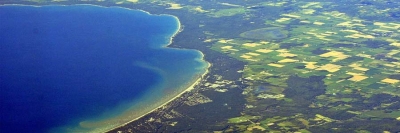
Canada in North America has the longest coastline in the world, which is 202,080 km long, bordered by the Atlantic, Arctic, and the Pacific.

Of the entire coastline of Canada, the government has declared 5 sections to be Large Ocean Management Areas (LOMA’s). These coastline sections are protected by the government as key ecosystems for conservation, management, and planning. The 5 LOMA’s of Canada include: the Pacific North Coast, the Placentia Bay, the Eastern Scotian Shelf, the Beaufort Sea, and the Gulf of St. Lawrence.

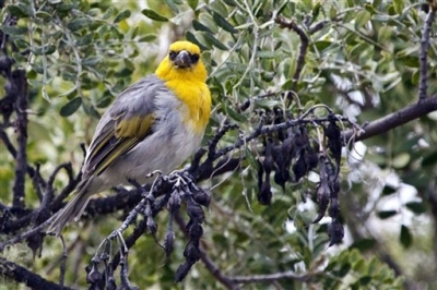
The Pacific North Coast is of particular ecological importance and comprises nearly one-quarter of the Canadian Pacific waters. This coastal zone is home to dolphins, porpoises, sea lions, seals, and 27 whale species. In addition to these marine animals, the Pacific North Coast is also an important habitat for a number of seabirds. In fact, 80% of the global population of Cassin’s auklets inhabit this area. One of the oldest species found here is the glass sponge reefs, which date back over 9,000 years. These reefs are some of the tallest ever recorded, reaching heights equal to 5-floor buildings.

The Placentia Bay region, located off the coast of Newfoundland and Labrador, is another of the Canadian LOMA areas along the coastline. This area has been experiencing an increase in economic development, which has caused some degradation to the shore. In fact, it serves as the largest port for oil exports in the country. Additionally, this bay is home to a number of plant species, 14 marine mammal species, at least 49 bird species, and 23 fish species.

The Eastern Scotian Shelf is located off the coastline of the province of Nova Scotia. This area primarily relies on the fishing industry and petroleum exploration, which led the government to declare it an official LOMA region. Researchers have also identified a significant amount of contaminants throughout the waters. A number of marine animals inhabit the Eastern Scotian Shelf, making it an important place to concentrate conservation efforts.

Credit : World Atlas 

Picture Credit : Google

Meet Santosh Yadav, the World’s First Woman to Have Scaled Mt Everest Twice

Santosh Yadav was the first woman to climb Mount Everest twice. The first time she scaled the peak was in 1992, and she was also the youngest woman in the world to climb the Everest then. She became interested in mountaineering after a chance encounter with a group of climbers in the Aravalli Hills, near Jaipur where she was studying. She enrolled for a course in rock climbing, and then there was no looking back. Climbing became a passion, and the mountains beckoned her.

She enrolled at the Nehru Institute of Mountaineering, in Uttarkashi without informing her parents, knowing that they would never give her permission if she asked. She had done her early schooling in the village of Joniyawas in Haryana, where she was born, and afterwards had had a hard time persuading her parents to send her to Jaipur for further studies. She came from an affluent family that was firmly rooted in tradition-girls had to be married off once they turned 14, and that was it. As it turned out her father was furious when he learnt that she was studying mountaineering. He was getting ready to go to Uttarkashi to bring her back when fate intervened he slipped on the stairs and broke an ankle.

Santosh was an avid student, and learnt quickly in 1986 she topped her class. A few years later, an iron-willed determination to succeed and a great capacity for physical endurance enabled her to set foot on the top of the world's highest peak.

"It was such an incredible feeling" she said, later. I felt a wave of pride rushing through my veins." She hoisted the Tricolour, and sank to her knees to pay homage to Sagarmata, the goddess of the mountain.

The following year she scaled Mount Everest again.

Picture Credit : Google

What is a barrier island?

Barrier islands form as waves repeatedly deposit sediment parallel to the shoreline. As wind and waves shift according to weather patterns and local geographic features, these islands constantly move, erode, and grow. They can even disappear entirely.

They are generally separated from the mainland by tidal creeks, bays, and lagoons. Beaches and sand dune systems form on the side of the island facing the ocean; the side facing the shore often contains marshes, tidal flats, and maritime forests. These areas are important habitat for seabirds, fish and shellfish, and nesting sea turtles.

Many barrier islands are found off the U.S. Gulf and East coasts, such as the Outer Banks off North Carolina. Barrier island chains tend to form near river deltas and in areas with low tectonic activity and relatively flat coastal terrain. The rocky cliffs and shifting tectonic plates off the West Coast, along with other features of the terrain and tides, prevent barrier islands from forming there.

These islands are critical to protecting coastal communities and ecosystems from extreme weather. Beach dunes and grasses on barrier islands absorb wave energy before the wave hits the mainland. This generally means smaller storm surge and less flooding on the coast.

Unfortunately, barrier islands are disappearing at an alarming rate. Erosion can be caused by human activities such as ship traffic, hard levees, and infrastructure projects, even those far upriver. Damming and dredging projects can significantly affect the amount of sand and sediment available to fortify barrier islands. The effects of climate change, including rapid sea level rise and extreme weather events, can cause or worsen barrier island erosion.

Credit : NOAA 

Picture Credit : Google

Where is oceanic island?

Oceanic islands, also known as volcanic islands, are formed by eruptions of volcanoes on the ocean floor. No matter what their height, oceanic islands are also known as “high islands.” Continental and coral islands, which may be hundreds of meters taller than high islands, are called “low islands.”

As volcanoes erupt, they build up layers of lava that may eventually break the water’s surface. When the tops of the volcanoes appear above the water, an island is formed. While the volcano is still beneath the ocean surface, it is called a seamount.

Oceanic islands can form from different types of volcanoes. One type forms in subduction zones, where one tectonic plate is shifting under another. The island nation of Japan sits at the site of four tectonic plates. Two of these plates, the Eurasian plate to the west and the North American plate to the north, are associated with continental shelves. The other two, the Philippine plate and the Pacific plate, are oceanic. The heavy oceanic plates (the Pacific and the Philippine) are subducting beneath the lighter Eurasian and North American plates. Japan’s islands are some of the most actively volcanic in the world.

Another type of volcano that can create an oceanic island forms when tectonic plates rift, or split apart from one another. In 1963, the island of Surtsey was born when a volcanic eruption spewed hot lava in the Atlantic Ocean near Iceland. The volcano was the result of the Eurasian tectonic plate splitting away from the North American plate. This tiny island is one of the world’s newest natural islands.

Another type of oceanic island forms as a continent shifts over a “hot spot.” A hot spot is a break in the Earth’s crust where material from the mantle bubbles or rushes up. The crust shifts, but the hot spot beneath stays relatively stable. Over millions of years, a single hot spot formed the islands of the U.S. state of Hawaii. Hawaii’s “Big Island” is still being formed by Mauna Loa and Kilauea, two volcanoes currently sitting over the hot spot. The newest Hawaiian island, Loihi, also sits over the hot spot, but is still a seamount about 914 meters (3,000 feet) beneath the Pacific.

Credit : National Geographic Society 

Picture Credit : Google

Is tidal island a continental island?

Tidal islands are a type of Continental Island where land connecting the island to the mainland has not completely eroded, but is underwater at high tide. The famous island of Mont Saint-Michel, France is an example of a tidal island.

Typical examples include Jindo and Mondo in South Korea, St. Michael’s Mount in the United Kingdom, Cramond Island in Scotland and many others.

Tidal islands are usually connected to the mainland via an artificial causeway or naturally. The artificial causeways are particularly of an advantage as they enhance easy access to tidal islands while protecting tourists and visitors from dangers associated with high tidal waves.

Located in Mount’s Bay, Cornwall, England, the small tidal island of St Michael’s Mount serves as a civil parish. A human-made causeway, made up of granite setts, connect the island to Marizon town in Cornwall. People can cross between the two lands only in the mid or low tide. In modern popular culture, some films feature the island including Dracula in 1979, a James Bond film from 1983 called Never Say Never Again, and Johnny English in 2003. Some studies show that the Cornwall coast including the tidal island might be at risk from natural erosion and the rise of sea levels.

In the southwestern part of South Korea, there are two islands of Jindo and Mondo with a natural causeway connection caused by the extremely low tide. Twice a year, the land pass appears for about an hour, with a length of about two miles and a width of about 131 feet. Tourists from around the world visit this section to celebrate a festival dedicated to the natural wonder. The Jindo Sea-parting festival attracts many people each year with visitors from each island traditionally walking to the middle for the celebration.

Cramond Island in Scotland is a tidal island covering an area of 7.70 hectares. A paved path, across the Drum Sands, connects it to the mainland in low tide. There are anti-boat pylons, constructed during the Second World War, besides the human-made causeway visible even in high tide. Visitors need to be wary of rising waters and should, therefore, have enough time while crossing to avoid being stranded on the island. The United Kingdom has 43 tidal islands that can be accessed by walking from the mainland, including the Cramond Island.

Credit : World Atlas 

Picture Credit : Google

Is Greenland a continental island?

Greenland is the world’s largest island. While Australia is an island, it is considered a continent. Greenland has an area of 2,166,086 square km, but a meager population of 56,452. The populations is over 85% Inuit. The remaining inhabitants are mainly Danish. The average annual temperature of Greenland varies between -9 to 7 °C.

Greenland is an autonomous country within the Kingdom of Denmark. Greenland is a group of islands and Greenland is the name of the largest, most populated one. Greenland has been inhabited on and off since 2500 BC. Denmark established rule in the 18th century. In 1979 Denmark granted home rule, in a relationship known as the Commonwealth of the Realm and in 2008 Greenland voted to transfer more powers to the local government. The Danish royal government is only in charge of foreign affairs, security, financial policy, and providing a subsidy to each citizen.

Greenland is bordered by the Atlantic Ocean to the southeast, the Greenland Sea to the east, the Artic Ocean to the north, and Baffin Bay to the west. The nearest countries to Greenland are Iceland to the east and Canada to the west. The country also contains the world’s largest national park. Scientists have thought for decades that the ice sheet covering the country may actually conceal three separate island land masses that have been bridged by glaciers over the last geologic cooling period.

The Greenland ice sheet covers 1,755,637 square km. It has a volume of 2,850,000 cubic km. Gunnbjorn Fjeld is the highest point on Greenland at 3,700 m. The majority of Greenland is less than 1,500 m in elevation. The weight of the ice sheet has formed a basin that is more than 300 m below sea level.

Between 1989 and 1993, climate researchers drilled into the summit of Greenland’s ice sheet, obtaining a pair of 3 km ice cores. Analysis of the layering and chemical composition of the cores has provided a revolutionary new record of climate change going back about 100,000 years. It illustrated that the world’s weather and temperature have often shifted rapidly from one stable state to another. The glaciers of Greenland are also contributing to a rise in the global sea level at a faster rate than was previously believed.

Credit : Universe Today

Picture Credit : Google

Who led the deep sea exploration in 1872?

The 1870s voyage of HMS Challenger lasted 1,000 days and covered more than 68,000 nautical miles. Many consider it to be the first true oceanographic expedition because it yielded a wealth of information about the marine environment. Those aboard identified many organisms then new to science, and they gathered data at 362 oceanographic stations on temperature, currents, water chemistry, and ocean floor deposits. The scientific results of the voyage were published in a 50-volume, 29,500-page report that took 23 years to compile. Specialists in numerous scientific disciplines studied the collections and data, and helped produce the reports. Also, the reports written by members of the Challenger expedition provided rich descriptions of the flora, fauna and cultures of the lands visited.

The HMS Challenger originally was designed as a British warship—a steam corvette in the Royal Navy—outfitted with 17 guns and an engine capable of over 1,200 horsepower. The 200-foot ship was three-masted, square-rigged, and built of wood.

In 1870, Dr. C. Wyville Thomson suggested that the Royal Society of London ask the British government for the use of one of its ships for an extended research cruise. The government agreed, and the HMS Challenger was modified to conduct oceanic research. Ammunition and 15 of the guns were removed from the ship and replaced with laboratories, workrooms, and storage space. The HMS Challenger used sails rather than the steam engine most of the time to allow for frequent stops when collecting data. The steam engine was used only during dredging operations to collect samples from the depths of the ocean floor.

The science and ship crew consisted of six civilian/scientific staff, led by Dr. C. Wyville Thomson. It also included 21 naval officers, including Captain George Nares (replaced by Captain Frank Thomson in 1875), and approximately 216 crew. When the voyage ended in 1876, only 144 crew remained on the ship. Seven people had died, five left when Captain Nares did, 26 were left in hospitals or were unable to continue the journey, and several had deserted at the various ports of call.

Credit : Ocean Explorer 

Picture Credit : Google

When was the first deep sea exploration?

Though the ocean covers more than 70% of the Earth’s surface, only 10% of it has been explored. The rest still remains a mystery. The first systematic deep sea exploration began in 1872 on board HMS Challenger. The expedition revealed that the deep sea supports a diverse biota.

The great age of exploration and discovery that began with the Portuguese and Spanish in the fifteenth century had largely run its course by the latter part of the nineteenth century. All the major landmasses of the world had been discovered by that time, the coastlines charted, and explorers were making major inroads towards exploring the continental interiors for geographic, scientific, and commercial purposes. Throughout this time the oceans served as highways between nations and continents, highways upon which ships sailed carrying raw materials, finished goods, people, and money from port to port. Fishermen, whalers, sealers, and others depended on the sea for their livelihood, and the products of their work fed and employed countless people in nearly every country. Yet, in spite of this dependence on the oceans, no systematic scientific study had been made of them until the Challenger set sail in 1872.

Although explorations on land were progressing well, land encompasses only about 30% of the Earth's surface. No matter how thoroughly the continents were mapped and explored, there was a limit to our understanding of the Earth unless serious, scientific exploration of the oceans took place. This is the role that Challenger,under the scientific direction of Charles Wyville Thomson (1830-1832) and the military leadership of Captain George Nares (1831-1915) was to fill.

The Challenger voyage was a logical progression from other scientific voyages sponsored by Britain. Captain James Cook (1728-1779) made three voyages of discovery with the Endeavour between 1768 and his death in 1779, Charles Darwin (1809-1882) accompanied the Beagle in 1831 on a voyage of nearly five years, and other lesser known scientists and explorers made similar voyages. But England's empire on land was held together by her dependence on the sea. So, in 1870, Thomson, a professor of natural history at Edinburgh University, persuaded the Royal Society to recommend a voyage of oceanographic exploration and study, a recommendation that was granted.

At the time Challenger set sail, geologists were relatively certain that there were vast expanses of featureless plains at the bottom of the oceans, probably covered with all the sediments washed from the continents. They were also sure that life could not exist at the ocean bottoms and that any sediments found would likely be unremarkable, fine-grained sediments that varied little from place to place. All of these suppositions were shown to be wrong. Finally, the land-based scientists had some facts with which to work.

Credit : Encyclopedia.com 

Picture Credit : Google

Is the palila extinct?

Palila birds are native to Hawaii. Also called Hawaiian finches, they have a bright yellow head and breast. They exclusively feed on the toxic seeds of the mamane plant, but how they remain unaffected by the poison is a puzzle.

Introduced species—plants and animals imported from other parts of the world—are the six-inch bird's main problem. Escaped domestic sheep and mouflon sheep, brought as sport for hunters in the 1960s, have proliferated and destroy mamane saplings and trees. These non-native animals are a major factor in the Palila's decline.

Non-native cats and mongooses, which eat eggs and nestlings, are another problem for the Palila. Palila are highly susceptible to non-native mosquito-borne diseases, and climate change is expected to increase transmission within their remaining habitat.

The Palila was one of the first species federally listed as Endangered in 1967. There are still only about 1,000 Palila in existence, so the species was included on the 2014 Watch List.

Credit : American Bird Conservancy 

Picture Credit : Google