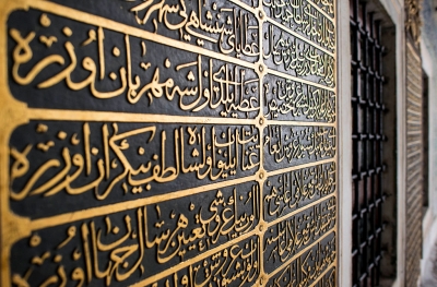
What world heritage sites have been destroyed by war?

Over 160 Ukrainian cultural sites have been damaged or destroyed since the Russian invasion of the country began this February, according to UNESCO. Ukraine is home to seven UNESCO World Heritage sites. As many of these stand threatened today, here's a glimpse of such sites that have been damaged or destroyed due to war in other parts of the world.

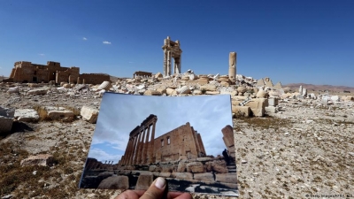
Palmyra and Aleppo, Syria

During the 2015 civil war in Syria, the Islamic State of Iraq and Syria (ISIS) destroyed several parts of Palmyra, including many important archaeological sites such as the Temple of Baalshamin, Monumental Arch, and Tower of Elahbel. After their expulsion from the heritage site, Syrian forces began work on restoring the destroyed parts. The war also damaged many cultural and other heritage sites in Aleppo, one of the oldest Syrian cities. This includes the Citadel, a UNESCO World Heritage Site. The castle was one of the world's largest and oldest dating back to the 3rd millennium BC. Another site destroyed was The Great Mosque of Aleppo that contained the remains of Zechariah, the father of John the Baptist. Minaret of the central Umayyad Mosque, about 60% of the covered marketplace (souk), and ancient houses from the 1st Century AD were also destroyed during the war.

Jonah's Tomb, Iraq

Jonah's Tomb, also known as The Mosque of the Prophet Younis, considered to be the final resting place of the biblical Prophet and one of the important religious sites for both Christians and Muslims, was blown up by the ISIS in 2014. The group claimed it was done to protest against the mosque, which was not a prayer area anymore.

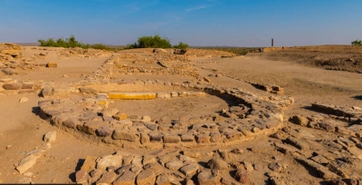
Timbuktu's religious sites, Africa

In 2012, a Malian militant destroyed several religious and historical buildings in Timbuktu, including tombs and mausoleums of Sufi saints, medieval shrines, and the 15th-Century Sidi Yahya mosque. According to UNESCO, 14 of Timbuktu's destroyed mausoleums were rebuilt by 2015. However, Timbuktu has been listed as an endangered World Heritage Site due to the ongoing armed conflict in the region.

Buddhas of Bamiyan, Afghanistan

Built under the Gandhara School of Art, the Buddhas of Bamiyan were the tallest standing statues in the world. They were blown into pieces in 2001 by the Taliban. One of the statues was 180 feet tall. The twin Buddha figurines were located on the ancient Silk Road. Though several attempts were made to restore the statues, reinstallation of the monuments could not be done due to disputes over the materials to be used.

Former Prefectural Industrial Promotion Hall, Japan

In 1945, the U.S. Air Force's atomic bomb that targeted Hiroshima destroyed parts of the former Prefectural Industrial Promotion Hall. Constructed in 1915, it was designed by Czech architect Jan Letzel. The remains of the Hall-A-Bomb Dome - are now part of the Hiroshima Peace Memorial Park. It was included in the UNESCO World Heritage Sites list in 1996.

Malta's Royal Opera House, Valletta

Designed by English architect Edward Middleton Barry and inaugurated in 1866, the Royal Opera House was destroyed by the bombs of Germany's Air Force during World War II in 1942. After several attempts to reconstruct the theatre, an open-air theatre called Pjazza Teatru Rjal was built amid the Royal Opera House ruins in 2013.

St. Michael's Old Cathedral, the U.K.

Another UNESCO World Heritage Site destroyed during World War II was St. Michael's Old Cathedral. The Gothic church was built between the late 14th and early 15th Centuries in Coventry. The 'new cathedral' representing Coventry's medieval and modern history was rebuilt in 1962 alongside the ruins of the old cathedral.

Beijing's Old Summer Palace, China

Constructed during the 18th and early 19th Centuries, the residential complex of the Qing Dynasty was destroyed by British and French troops during the Second Opium War in 1860. It was reconstructed by Emperor Guangxu for use by Empress Dowager Cixi, and renamed the Summer Palace. Though damaged again during the Boxer Rebellion in 1900, it was restored and has been a public park since 1924.

Picture Credit : Google 

What is the historical significance of Hadrian's Wall?

This year marks the 1900 anniversary of the start of the construction of Hadrian's Wall, which took six years to complete and was built to guard the northern frontier of the Roman Empire in 122 AD. The wall ran for 118-km from the Solway Firth to Wallsend on the River Tyne and is now designated a UNESCO World Heritage Site. The wall featured over 80 milecastles or forts, two observation towers and 17 larger forts. After the Romans left Britain in the early 5th century, some 300 years after the wall was constructed, large sections of the wall fell into decay and were recycled into local buildings and houses. As England lines up events to celebrate the anniversary, archaeologists realise the wall is facing a new threat-climate change!

The historic barrier

Nineteen hundred years after it was built to keep out "barbarian hordes", archaeologists at Hadrian's Wall in northern England are facing a new enemy - climate change, which threatens its vast treasure trove of Roman artefacts.

Thousands of soldiers and many of their families lived around the 118-km stone wall, which crosses England from west coast to east coast, marking the limit of the Roman Empire and forming Britain's largest Roman archaeological feature.

The wall was begun in 122 AD during the reign of emperor Hadrian and marked the boundary between Roman Britannia and unconquered Caledonia, helping to keep barbarian raiders out of the empire.

Treasure trove

The Roman soldiers who lived there left behind not just wooden structures but the fascinating detritus of everyday life that allows archaeologists today to reconstruct how they lived in the windswept north of the empire.

They include the fort of Vindolanda, some 33 miles west of the modem day city of Newcastle upon Tyne, a Roman settlement at the original eastern end of the wall, then named Pons Aelius.

New threat

"A lot of the landscapes at Hadrian's Wall are preserved under peat bog and marsh very wet, very moist ground, which has protected the archaeology for almost two millennia," according to Andrew Birley, director of excavations and chief executive of the Vindolanda Trust.

"But as global warming takes place, climate change takes place," he added.

The ground heats up more rapidly than the air temperature, caking the previously moist soil and letting oxygen in through the resulting cracks.

"When that oxygen gets in there, things that are really delicate, that are made of leather, textile, items of wood, crack, decay and are lost forever," said Birley.

"All of this, all this masonry. all of the ground behind me was under the ground. It was under a farmer's field 50 years ago," said Birley. "Less than one percent of Hadrian's Wall has been explored archaeologically and a lot of that landscape is protected in this wet peat land environment and that's a landscape that's really under threat."

Glimpses of the past

Behind him, dozens of Roman shoes from all genders, ages and social strata are displayed, just a small sample of the around 5.500 leather items so far found at the site alone.

Thanks to the black, peaty soil, many of the artefacts have kept a fascinating level of detail

"They are fantastic because they've completely changed our perception of the Roman Empire the Roman army, they've changed it from being a male preserve to lots of women and children running around," he said.

"And without these artefacts surviving, we wouldn't have had that information and that's the sort of stuff that's under threat because of climate change." AFP

1900 years on...

  • The building of the wall began in 122 AD during the reign of emperor Hadrian.
  • Over the years, the dramatic landscape around the wall has revealed stone and wooden structures, leather shoes and clothing, tools, weapons and even handwritten wooden tablets, feeding knowledge of what Roman life in Britain was like.
  • Only around a quarter of the site at Vindolanda has been excavated, and the fort is just one of 14 along Hadrian's Wall, a designated UNESCO World Heritage site since 1987 and one of Britain's best-known ancient tourist attractions.
  • Events are taking place this year to mark the 1.900 years since construction of the wall began.

Picture Credit : Google

UNESCO declare Arabic calligraphy a cultural heritage

UNESCO late last year added Arabic calligraphy, a key tradition in the Arab and Islamic worlds, to its Intangible Cultural Heritage list. It is nothing but the practice of handwriting and calligraphy based on the Arabic alphabet.

In total, 16 Muslim-majority countries, led by Saudi Arabia, presented the nomination to the UN Educational, Scientific and Cultural Organisation, which announced the listing on Twitter.

In Arabic, this practice of calligraphy is called khatt. It is derived from the word line, 'design' or 'construction'. While most use Arabic calligraphy and Islamic calligraphy interchangeably, the two are not the same.

This listing by UNESCO is welcomed by conservationists as many have complained about the lack of people taking to Arabic calligraphy due to technological advancements. Researchers believe that the tag would contribute to developing this cultural heritage

What is intangible heritage?

It includes traditions or living expressions inherited from ancestors and passed on through generations. These may be in the form of performing arts, oral traditions, social practices, rituals, knowledge, festive events and crafts among others. Intangible cultural heritage plays an important role in maintaining cultural diversity in the times of globalisation.

As of 2021, 629 elements from 139 countries have been added to the list of Intangible Cultural Heritage. These include, the Kumbh Mela, Yoga, Chhau dance, Kutiyattam, and Ramlila among others from India.

Picture Credit : Google

Is Durga Puja a UNESCO World heritage Site?

The UNESCO has accorded heritage status to Kolkata's Durga puja festival, bringing glory to the country. "Durga puja in Kolkata has just been inscribed on the intangible heritage list. Congratulations India," UNESCO said in a tweet attaching a photo of the goddess with hashtag living heritage.

While Prime Minister Narendra Modi hailed UNESCO's decision as a "matter of great pride and joy for every Indian", the Chief Minister of West Bengal Mamata Banerjee, called it a "proud moment for Bengal."

What makes Kolkata's Durga puja special? Well, according to the UNESCO, Durga Puja is seen as the best instance of the public interface of religion and art and as a thriving ground for collaborative artists and designers. The festival is characterised by large-scale installations and pavilions in urban areas. During the event, the divides of class, religion and ethnicities collapse as crowds of spectators walk around to admire the installations.

Quick facts

  • Durga puja is celebrated in the month of Ashwin in the Hindu calendar (September October). The 10-day festival marks the worship of Goddess Durga. “It is the major annual festival in West Bengal, It is also celebrated in other parts of India and amongst the Bengali diaspora.” Months before the festival, artisanal workshops in Kolkata sculpt idols of Durga and her children using unfired clay from the river bed of Ganga.
  • The festival marks its beginning on the day of Mahalaya when the ritual of 'pran pratistha' is done by painting the eyes on the goddess idol.
  • Sasthi, Saptami, Ashtami...every day the festival has its own significance and set of rituals. The celebrations culminate on the tenth day known as Vijaya Dashami when the idols are immersed in the river from where the clay was sourced.
  • The significance of Durga puja goes beyond religion and is revered as the celebration of compassion, brotherhood, humanity, art and culture.
  • The city of Kolkata turns into a dazzling place with the decoration of colourful lights. The sound of 'dhaak' reverberates across the city. From new clothes to delicious food, the mood is one of cheer during these days.

Picture Credit : Google

Why is Mount Nimba Strict Nature Reserve a World Heritage Site?

Covering an area of more than 180 sq.km., the Mount Nimba Strict Nature Reserve is located in the western part of Africa, straddling the borders of Guinea and Cote d'Ivoire. Towering over the region is Mount Nimba. One of the highest elevation forest ecosystems in this part of the continent, the area is a stunning mosaic of valleys, plateaus, and cliffs. The slopes of the mountain are marked by dense forests and savannahs, offering fantastic habitats for a wide variety of flora and fauna, many of them endemic to the region. The Reserve is said to support more than 2,000 species of plants, 300 species of vertebrates, and 2.500 species of invertebrates. Among its most noted endemic species are micropotamogale (otter shrew- an insectivore), the viviparous toad (unusually for a reptile, it gives birth to young ones rather than lay eggs), and "chimpanzees capable of using tools". These creatures, however, are critically endangered or are on the brink of extinction. In fact, this Reserve was declared a UNESCO World Heritage Site in 1981 for its "Outstanding Universal Value". But, 11 years from then, it fell under the "List of World Heritage in Danger, and remains there. While activities such as poaching and clearing the land for agriculture have had a negative bearing on the Reserve, long-term mining just outside of it too has been a cause of grave concern.

Wildlife

Among the birds that can be spotted here are ducks, garganeys, guineafowls, quails, francolins, grebes, pigeons, doves, nightjars, swifts, coucals, cuckoos, rails, flufftails. Turacos, storks, herons, bitterns, egrets, ibises, stilts, lapwings, plovers, jacanas, sandpipers, kites, buzzards, vultures, hawks, eagles, owls, owlets, trogons, hombills, hoopoes, honeyguides, woodpeckers, barbets, tinkerbirds, bee-eaters, rollers, kingfishers, falcons, kestrels, pittas, broadbills, orioles, cuckooshrikes, flycatchers, drongos, sunbirds, weavers, finches, waxbills, sparrows, pipits, buntings, larks, warblers, swallows, martins, babblers, starlings, and robins.

Threats

The conservation outlook for this site has been assessed as "critical" in the latest assessment cycle (2020) by the International Union for Conservation of Nature. According to the report, several aspects such as poaching, bush fires, and increasing human activity on the periphery of the Reserve are all together putting pressure on it, and causing "progressive ecological isolation of the region. Adding to the concern is the fact that "the buffer zone is not very functional in Guinea and does not exist in Ivory Coast". Further, many iron mining projects happen to occur close to Reserve's boundaries in Guinea. This points to open pit mining, and it could have a negative impact on wildlife, especially key species, and habitats, particularly if their effects are continuous. Though the Reserve straddles the borders of two countries, there is no transboundary master plan in place. In fact there is no common management system for the whole region either. This could be one of the main reasons for poaching. It could also be aggravated by the lack of good monitoring. Unlike in many regions across the world local communities here are not engaged that well in conservation initiatives or for that matter, even the development of alternative income generating activities is insufficient to reduce the pressure on natural resources”.

Picture Credit : Google

What is Dholavira famous for?

Dholavira is a well-preserved Harappan-era city situated in the Rann of Kutch, Gujarat. It is the fifth largest metropolis of Indus Valley Civilisation excavated so far, after Mohenjo Daro, Harappa, and Ganeriwala in Pakistan, and Rakhigarhi in Hanjana, India. Dholavira is also the most dominant archaeological site of the Indus Civilisation in India.

The ancient city, dating from the 3rd to mid-2nd millennium BCE (3000-2500 BCE), was excavated by the Archaeological Survey of India in 1967. The site, which served as a commercial hub for over 1,500 years before its decline in 1500 BC has a citadel, a middle town, and a lower town with walls made of stone. According to UNESCO, the ancient urban settlement stands out for its water management system, multi-layered defensive mechanisms, extensive use of stone in construction, and special burial structures. A range of artefacts of copper, shell, stone, jewellery, and terracotta had been found at the site. Sites such as these provide valuable insights into the ways of life of earlier societies, their knowledge, and customs.

With Dholavira joining the coveted list,Gujarat now has four world heritage sites - the others being Rani Ki Vav of Patan, Champaner fort, and Ahmedabad City.

The Indus Civilisation

The Indus Valley Civilisation or Harappan Civilisation was one of the earliest human civilisations which flourished around 2.500 BC in the western part of South Asia (present day Pakistan and western  India) Basically an urban civilisation, it was characterised by neatly planned, well-built cities which served as centres of trade. So far over 1.400 sites of the indus Civilisation have been discovered, of which over 900 are in India and over 400 in Pakistan.

What is a World Heritage Site?

 A World Heritage Site is a place designated by UNESCO (the United Nations Educational, Scientific and Cultural Organization) for its special cultural, historic or physical significance. The list of World Heritage Sites is maintained by the World Heritage Programme administered by the UNESCO World Heritage Committee. UNESCO, headquartered in Paris, France, seeks to encourage the identification, protection and preservation of heritage around the world.

What does the status mean?

UNESCO awards world heritage status to sites considered to be of special value to humanity. The sought-after distinction brings intangible benefits boosts tourism, and can help secure funding for the preservation of sites.

Picture Credit : Google

In Bolivia, more than 25% of major fires burned in protected areas

Situated in the northeastern part of Bolivia, the Noel Kempff Mercado National Park in South America borders Brazil. Spanning more than 15,000 sq.km., it is considered one of the largest and the most intact Parks in the Amazon basin. Within its boundaries, it holds a variety of habitats from evergreen Amazon rainforests, grasslands, and swamps to savannahs and semi-deciduous dry forests. Small wonder this region, with large swathes of untouched land, offers incredible biodiversity - think 4,000 species of plants, more than 600 species of birds, 250 fish species, and more than 300 mammal, reptile, and amphibian species together! This includes several globally threatened and endangered species too.

In 1996, the Noel Kempff Climate Action Project, a joint government and private initiative, was set up in the Park. The project ended logging rights and strives for continuous action towards forest protection, reducing emission and degradation, conservation, and sustainable development, among others. In 2005, it became the world's first "forest emissions reduction project to be verified by a third party based on international standards established by the Kyoto Protocol". In 2000, it was declared a UNESCO World Heritage Site.

Wildlife

Fed as it is by the mighty Amazon, the Park's waterways are home to several water-dwelling creatures such as giant otters, dolphins, and caimans. Among the several mammals and marsupials in the region are opossums, tapirs, deer, marmosets, pumas, jaguars, wolves, oxes, raccoons, armadillos, giant anteaters, and monkeys. The birds in the region include tinamous, herons, cormorants, egrets, storks, ibises, ducks, vultures, kites, hawks, eagles, falcons, kestrels, crakes, lapwings, terns, sandpipers, pigeons, doves, macaws, cuckoos, owls, nightjars, swifts, quails, trogons, kingfishers, toucans, piculets, woodpeckers, woodcreepers, flycatchers, atbills, manakins, swallows, martins, thrushes, seed-eaters, honeycreepers, and more than 20 types of parrots / parakeets.

It's good, but...

According to the International Union for Conservation of Nature's latest report (2020), the conservation outlook for this site has been assessed as "good with some concerns. The assessment says that this comforting fact is due to how isolated the Park is. This isolation offers the place a lot of protection from livestock the transmission of diseases from livestock to wildlife, and commercial fishing And so "ecological processes, biodiversity and threatened species are in a good state of conservation Despite this aspects such as illegal logging, fishing, and hunting are of concern. Also, due to its very isolation, there is no clear data on management effectiveness in the region. It is also believed that the park rangers do not have enough means to carry out their work and carry out effective control and surveillance of the advance and incursion of settlers

Forest fires

The foremost threat to the region are forest fires. As recently as 2020, Bolivia witnessed more than 120 forest fires and a quarter of it is said to have burned in protected areas. One of the places affected was the Noel Kempff Mercado National Park, at least 21,000 acres burned then. The Park encompasses three biomes Amazon rainforest, Chiquitano dry forest and Cerrado savanna. It is reported that fires were detected in the transition zone between the rainforest and savanna, moving mostly into the park's drier savanna biome" As climate change becomes more and more severe, forest fires in the region are expected to reach even greater proportions, and perhaps touch such severity this place will be unable to recover from.

Picture Credit : Google

Why Los Katios National Park is unique?

Spread across more than 720 sq km on the northwestern part of Colombia, the Los Katios National Park is contiguous to the Darien National Park in the neighbouring country of Panama. Though located in South America, the region is considered a major convergence zone of North, Central, and South America. It is because of this very reason that the Park offers a startling variety of flora and fauna. Spanning hills, tropical and humid forests, alluvial plains, swamps, and marshes, it has an unusual ecological setting that nurtures more than 600 species of vegetation, including palms and several others endemic to the region. It shows exceptional biodiversity in terms of fauna too, with many threatened species calling the place - their home.

Declared a UNESCO World Heritage Site in 1994, the Park was placed on the Danger List in 2009 due to the severe damage it suffered because of illegal poaching, fishing, and logging. However, continued patrolling and engagement with local communities in preserving the habitat paid off, and the Park was removed from the list in 2015.

Wildlife

The Park is part of one of the most species-rich lowland forest areas in the world. Small wonder it nurtures a wide range of fauna. The area is said to have more than 550 species of vertebrates, excluding fish and including more than 400 species of birds. It is believed to be the only region on the continent where many Central American species are found. This includes the threatened American crocodile, giant anteater, and Central American tapir also known as Baird's tapir. Among other species that can be spotted here are the jaguar, west Indian manatee, bush dog, deer, rodents such as coypu and wild mouse, fox, bear, monkey, and marmoset. Among the birds that can be seen here are tinamous, New World passerine birds, shrikes, quails, humming birds, warblers, doves, macaws, pittas, and puffbirds, in addition to the harpy eagle, northern screamer, and the great currasow.

Threats

The region requires close monitoring even today since concerns in the form of illegal and development activities remain. In fact, according to the International Union for Conservation of Nature's latest assessment (2020), the conservation outlook for this site is of "significant concern". Placing the park on danger list all those years ago did help improve the situation in the region, and some of the efforts continue to be in place. But of utmost concern is the illegal and excess use of legal natural resources. The continuous unsustainable depletion of resources could affect both flora and fauna of the place in the long run. This includes fishing and shellfish harvesting on a scale that may not be sustainable in the future. Security of the property was a concern earlier, and steps were initiated to improve that. However, despite that, illegal activities around the property and the presence of armed groups within it have been reported. Though they do not appear to pose any threat right now, it could later on, if left unchecked. Proposed developmental projects such as roads and power transmission corridors do not suggest "acute threat" yet, but "adequate environmental and social assessment are required to ensure that the natural environment of the property are not damaged in any way if and when these projects are executed.

Picture Credit : Google

What is the conservation status of Srebarna Nature Reserve?

Located almost on the edge of Bulgaria in Europe, the Srebarna Nature Reserve is a freshwater lake and wetland, just a couple of km south of the famous Danube River. Spread across more than 600 hectares, the wetland falls on the route of birds migrating from Europe to Africa. It is said to be the breeding ground for nearly 100 species of birds, including some rare and endangered ones. In addition, it is a temporary habitat for over 75 species that migrate. The floating reed islands (called "kochki" locally) and flooded willow woodlands in the Reserve are important areas for birds to breed. This UNESCO World Heritage Site was placed on the danger list in 1992, due to loss of water and pollution in the lake, resulting in the disappearance of many bird species. However, upstream activities such as housing and farming were halted, bringing about positive changes in the region. Eventually, in 2003, the Reserve was removed from the danger list. The region is also protected as a Wetland of International Importance under the Ramsar Convention and designated as an Important Bird Area by BirdLife International.

Wildlife

The Srebarna Nature Reserve is said to host the only colony of Dalmatian pelicans in the country. It is also believed to be home to the largest breeding populations of four more globally threatened bird species, namely pygmy cormorant, ferruginous duck, white-tailed eagle, and corncrake. Among others birds that can be spotted in the region are night heron, purple heron, glossy ibis, white spoonbill, little bittern, squacco heron, little egret, great white egret, and ruddy shelduck. Three species of terns can also be found here. The globally threatened red-breasted goose winters in the reserve. The wintering populations of whitefronted goose, greylag goose, and fieldfare are considered notable. The lake and the areas around it also support more than 20 species of reptile and amphibian species, and 40 mammal species.

Good conservation status, but...

While globally a lot of natural wildlife habitats face several threats-both natural and human-made, Srebarna is one of those rare spaces that enjoys a good conservation status, "with some concerns", according to the International Union for Conservation of Nature (IUCN). According to IUCN's 2020 Conservation Outlook, there "is an overall trend of improvement of the conservation status of most of the bird populations". Given that the region is very important for birds, it is heartening that the population of some species has increased since it was removed from the danger list.

However, the place is not without concerns. For instance, the conservation status of species such as squacco heron and black tern has deteriorated. Also, "additional information is needed to make reliable assessments of the conservation state" of a few other species. Other concerns, including hydrological management, may not be a severe threat right now, but it is felt that with issues such as climate change looming large, these could affect Srebarna in the future.

Climate change is likely to decrease the water level of the Danube, resulting in the disruption of seasonal flooding in Srebarna. This has the potential to change the quality and quantity of nutrients, sediments, etc. in the region, and lead to a drastic ecological change, affecting both the flora and fauna there.

Picture Credit : Google

Why is the Sumatran rainforest in danger?

Declared a UNESCO World Heritage Site in 2004, the tropical rainforest regions in Indonesia's Sumatra Island comprise three national parks, namely Gunung Leuser National Park, Kerinci Seblat National Park, and Bukit Barisan Selatan National Park. Spread across more than 25,000 sq.km. a portion of the area falls within Sumatra's Leuser ecosystem that's often described as "the last place on Earth where tigers, rhinos, orangutans and elephants still live together".

The Parks, which are located on the spine of Bukit Barisan Mountains of Sumatra, show amazing uniqueness in biodiveristy, and are home to 10,000 species of plants. The regions also show a stunning variety in ecosystem from lowland rainforest to montane forest and subalpine low forest to scrub and shrub vegetation. The Gunung Leuser National Park is the place to see both the world's largest flower (Rafflesia arnoldi) and the tallest flower (Amorphophallus titanum).

Wildlife

The area is said to nurture more than 500 species of birds. Ducks, geese, partridges, scrubfowls, pheasants, grebes, pigeons, doves, quails, cuckoos, coucals, malkohas, koels, frogmouths, nightjars, swifts, swiftlets, needletails, rails, waterhens, crakes, thickknees, stilts, plovers, lapwings, snipes, jacanas, sandpipers, pratincoles, gulls, terns, petrels, shearwaters, storks, frigatebirds, tropicbirds, boobies, darters, cormorants, pelicans, herons, bitterns, egrets, ibises, kites, buzzards, eagles, owls, harriers, trogons, hornbills, kingfishers, bee-eaters, rollers, woodpeckers, barbets, kestrels, falcons, parakeets, broadbills, pittas, ioras, minivets, shrikes, orioles, drongos, fantails, flycatchers, magpies, swallows, bulbuls, warblers, tailorbirds, white eyes, babblers, thrushes, mynas, starlings, leafbirds, flowerpeckers, sunbirds, spiderhunters, wagtails, weavers, munias, and finches are among the birds that can be spotted in the region. The place also supports more than 200 mammal species, including several that are endemic and endangered. The mammals include the endemic Sumatran orangutan, the Sumatran tiger, dlouded leopard, rhinoceros, elephant, and the Malayan sun bear.

Threats

  • Given the expansive wealth of natural resources in the region, Sumatra has attracted heavy international financing zeroing in on extractive industries, "from precious hardwoods and minerals to palm oil, rubber, and coal". As a result, the precious wildlife in the area is losing their habitats and faces a very bleak future.
  • Road development in the rainforests is of great concern because they not just destroy the natural landscape and displace wildlife, but also provide access to people for illegal logging, encroachment, and poaching.
  • Agriculture is another cause of worry. As rainforests are wiped off to give way for agriculture, it becomes difficult to reclaim the lost forest area. In fact, a study less than a decade ago had said that the rainforests of Sumatra are likely to disappear in 20 years. So, right now, we have perhaps about 10 years to save the rainforests. This would also mean the eventual, permanent disappearance of some of the rarest wildlife species on the planet.
  • In 2011, the UNSECO placed the region under its List of World Heritage in Danger. Mining, encroachment, development activities, and, to a certain extent, invasive species are among the several threats to the rainforests in Sumatra listed by it.

Picture Credit : Google

Why Gondwana rainforests of Australia is famous?

Covering an area of 3,700 sq.km., the Gondwana Rainforests of Australia span the States of Queensland and New South Wales. Australia split from Antarctica during the breakup of Gondwana (an ancient supercontinent) several million years ago. And today, the rainforests continue to live on as windows offering insights into what happened all those years ago. These rainforests are signicant not only in terms of evolutionary history and geology, but also for their startling biological diversity. A variety of flora and fauna lineages, with origins that can be traced all the way back to Gondwana, exists today within these areas. Which is to say that many plants and animals have remained relatively unchanged from their ancestors whose fossils have been recorded. In fact, some of them are said to be found only in these rainforests. Apart from these, the region is a primary habitat for several threatened species of plants and animals. Many species continue to be discovered or rediscovered within these forests. For instance, the Hastings river mouse and parma wallaby, previously thought to be extinct, were rediscovered. The sheer diversity in the number of rare and threatened rainforest species in the region are of great global importance for both science and conservation. Though much from the original rainforests has been replaced by other vegetation types, due to several reasons such as climate change, the region continues to reveal secrets and mysteries of a time when humankind did not exist.

Wildlife

Among the mammals that can be found in the region are deer, rats, mice, bats, and flying foxes, echidnas, bandicoots, and platypuses, and marsupials such as wallabies, wallaroos, kangaroos, possums, quolls, and gliders. Pipits, wagtails, sparrows, finches, mynas, starlings, thrushes, swallows, martins, warblers, robins, wagtails, flycatchers, cuckooshrikes, babblers, honeyeaters, wrens, treecreepers, bee-eaters, kookaburras, kingfishers, owls, cuckoos, parrots, lorikeets, cockatoos, buttonquails, lapwings, kestrels, falcons, eagles, kites, buzzards, spoonbills, ibises, herons, egrets, cormorants, frogmouths, nightjars, grebes, ducks, and plenty of other birds can be spotted in these rainforests. Snakes, pythons, skinks, lizards, monitors, geckos, turtles, and frogs are some of the reptiles of the area. These are in addition to several species of fish and insects that call the place their home.

Threats

As mentioned earlier, climate change is a huge threat to these rainforests. But that isn't the region's only problem. Here are a few other concerns:

Wildfires: A UNESCO World Heritage site, these rainforests face the fury of wildfires too. With the intensity and frequency of the wildfires increasing in the region, there are concerns that if timely action is not taken, these ancient wonders could be lost forever. These fears are not unfounded because during the 2019-2020 wildfire season, it is believed that at least 50% of these rainforests were affected. There have been calls to the government for implementing and adhering to policies that protect these areas.

Tourism: While tourism is integral to the development and upkeep of any crucial region, it can have an adverse impact on the very region it seeks to protect. And this is the exact problem that the Gondwana rainforests faces. Every year, it welcomes a few million visitors, who not only enjoy the natural beauty of the place, but, in the process, unwittingly, damage the vegetation. This also leads to soil erosion in the area. In addition, the rubbish that these visitors leave behind could harm the plants and the animals inhabiting the region.

Invasive species: Among others, weeds such as lantana, take over the region, stifling the growth of native plants. In the long run, they could cause large-scale devastation to the native vegetation that has existed for millions of years. This is true of some of the animals too. Invasive speices or pests such as pigs, foxes, cats, goats, deer, and wild dogs could either damage and consume native vegetation or feed on native animals, severely impacting the native wildlife population.

Picture Credit : Google

What is special about Serengeti National Park?

Located on the border between the African countries of Kenya and Tanzania, the Serengeti National Park in Tanzania's Serengeti plain spans an area of nearly 15,000 sq.km. The grassland and woodland savannah of the region, interspersed with rivers, is home to several species of animals such as cheetah, wildebeest, and zebra, and the threatened black rhinoceros. Set up in 1951, the Park attracts tourists from across the globe throughout the year for not just its diverse wildlife but also for hosting one of the most significant land animal migrations. It is one of the largest and the most diverse places in the world to witness the coming together of a large number of predator and prey. The Serengeti National Park was declared a UNESCO World Heritage Site of "outstanding universal value in 1981.

Wildlife

In addition to carnivores such as lions, leopards, cheetahs, and crocodiles, and herbivores such as wildebeest, gazelles and zebras, one can spot wild dogs, topis, warthogs, antelopes, elephants, giraffes, African buffaloes, rhinoceroses, hippopotamuses, and baboons within the periphery of the Park. The Park also nurtures a few hundred species of both resident and visiting birds. They include ostriches, grebes, pelicans, cormorants, darters, bitterns, herons, egrets, storks, ibises, spoonbills, flamingoes, teals, ducks, geese, shovelers, pochards, vultures, harriers, eagles, hawks, kites, kestrels, falcons, quails, francolins, crakes, coots, moorhens, bustards, jacanas, snipes, sandpipers, plovers, terns, gulls, sandgrouses, doves, turacos, nightjars, swifts, kingfishers, bee-eaters, rollers, hoopoes, hornbills, barbets, woodpeckers, larks, swallows, martins, orioles, babblers, shrikes, robins, wheatears, warblers, flycatchers, pipits, weavers, starlings, and sunbirds.

Did you know?

  • Every year, more than 10 lakh wildebeest, along with thousands of other herbivores and ungulates such as zebra and gazelle, go on a 1,000-km circuitous journey between the Park in Tanzania and Kenya's Masai Mara Game Reserve. The migration sees the animals moving to greener pastures in Kenya during the dry season in Serengeti. Throughout the migration, several adults and newborns perish to predators such as crocodiles, lions, and cheetah, but much more survive to keep the world's most astounding spectacle alive.
  • The Park faces threats due to natural causes such as wildfires, and human-related issues such as excessive tourism, water management, poaching, etc. For instance, a recent study that had studied the region over a long period of time found that due to increasing human activity on the boundary, animals congregate increasingly in the core of the protected area. And this is not good news because such a concentration could lead to depletion of natural resources such as plant and water, and even lead to extreme drought.
  • While the large numbers of animals migrating to the region is fantastic news, monitoring something of this magnitude requires a lot of time and labour. Recently, a “research team testing the capacity of both citizen scientists and machine learning algorithms to help survey the annual wildebeest migration in Serengeti National Park in Tanzania found that both methods could produce accurate animal counts, a boon for park managers”.
  • African wild dogs disappeared from the Park around 1991-1992, and several reasons-from rabies and canine distemper diseases to encroachment of farming activity into their habitats have been attributed to the disappearance. Around 2012, a few packs were re-introduced to the region, and some of them even gave birth to young ones.

Picture Credit : Google

What is the reason for the large reptile downfall in Komodo National park?

Situated in the central part of the Indonesian archipelago, the Komodo National Park spans an area of 2,00,000 hectares. A UNESCO World Heritage Site of Outstanding Universal Value, it is home to about 5000 Komodo dragons. As the only place in the world today with these lizards, the area has been of particular interest to both the scientific community and curious tourists. Once found in Australia too, these lizards are said to have thrived in their current home for millions of years now.

Wildlife

Though most noted for Komodo dragons, the park nurtures other wildlife too. Among the more than 70 species of birds spotted in the area are cockatoos, jungle fowl, kestrels, herons, thick-knees, doves, sunbirds, finches, drongos, Orioles, scrub fowl, and friarbirds. The waters around the boundary of the Park nurture several species of whales such as sperm whales, dolphins, sea turtles, and the endangered dugong also known as sea cow.

The “Jurassic Park” problem

Last October while several parts of the world were still grappling with COVID-19 and the destruction it left in its wake, a photo from the park went viral. What did it show? A Komodo dragon facing a truck. What was a truck doing in such an eco-sensitive region? This needs a bit of a history. In 2019, a controversial decision to close the Park was dropped after collective outrage. Soon after that came another piece of news. That the government would end mass tourism by imposing a heavily priced membership scheme to enter the park. “But around the same time they also unveiled plans for a mass tourist development on neighbouring Rinca Island, which is home to the second-largest population of Komodo dragons.” And this project has been dubbed “Jurassic park“, which is where Komodo dragon had an unexpected encounter with that truck. Concerned conservationists have raised questions over the need for such a project, worried that this move will ruin the natural habitat of the world’s largest lizard. A damaged natural environment will eventually affect its habitants too, meaning the Komodo dragons could be in peril if the project is completed. Though it has been said that the project has been stopped, media reports suggest that the project may not have been dropped but only paused for now.

Did you know?

  • The world’s largest and heaviest lizards, these reptiles can grow up to 10 feet, weigh more than £300 and live up to 30 years in the wild.
  • Going by their diet, they are hearty eaters –it is said that in one go, these giants can consume nearly 80% of their body weight. The carnivore’s diet includes everything from deer and pigs to water buffaloes and sometimes even smaller comes from its own species!
  • Poaching and human encroachment are only two of the reasons that could lead to a decline in the population of these lizards.
  • As with the most habitats the world over, climate change is unlikely to spare this region either. While resultant intense wildfires can directly alter the habitat of the Komodo dragon, storms threaten to cause extensive damage to corals and the reefs in the waters surrounding the archipelago.

Picture Credit : Google

What are the interesting facts about the Qutub Minar and other monuments in the Qutb Complex?

The Qutb complex in Delhi contains buildings and monuments from the Delhi Sultanate era. Amongst these is the Qutub Minar, built as a victory tower by Qutb-ud-din Aibak, who was once the Sultan of Delhi. The tower commemorates the victory of the Delhi Sultanate over the Hindu kings. Several monuments were added to the complex later by his successors and future rulers. Today, the complex is a popular tourist spot in the capital and a UNESCO World Heritage Site.

1. Tallest brick minaret

Standing at 72.5 metres, the Qutub Minar is the tallest brick minaret in the world. It has a base diameter of 14.3 metres which reduces to 2.7 metres at the peak. The Minaret of Jam in Afghanistan is the next tallest brick monument at 62 metres. Interestingly, the Qutub Minar is said to have been inspired by the Minaret of Jam.

2. No more climbing to the top

There are 379 steps that lead to the top of the Qutub Minar. It was once allowed for the public to climb the stairs and catch a glimpse of the city from the top. However, on December 4. 1981, a power failure caused a blackout at the staircase, leading to a stampede. Nearly 300 to 400 people were inside when the blackout happened and in the rush to the exit. 47 people, mostly school children, were killed. Ever since, no one has been allowed to climb the monument.

3. The oldest mosque

The Quwwat-ul-Islam Mosque, which is part of the Qutb complex was commissioned by Qutb-ud-din-Aibak. It was the first mosque to be built in Delhi after the Islamic conquest of India. The mosque is one of the oldest mosques in the country and the oldest surviving example of Ghurid architecture in the Indian subcontinent.

4. Khilji's incomplete dream

Emperor Alauddin Khilji of the Khilji dynasty enlarged the Quwwat ul-Islam Mosque during his reign. Post this, he wished to build a minaret of his own called the Alai Minar. This was to be double the size of the Qutub Minar. The construction of this minar was however abandoned after his death in 1316, and the 24.5 metre high first storey core of the minar still stands among the ruins of the Qutb complex.

5. The iron pillar

The Iron Pillar of Delhi is part of the Quth complex. It was constructed by emperor Chandragupta II and was erected elsewhere before being moved to its present location. The pillar is famous for the rust-resistant composition of metals used in its construction. Till date, the pillar has not corroded.

Picture Credit : Google

What are the interesting facts about the Qutub Minar and other monuments in the Qutb Complex?


The Qutb complex in Delhi contains buildings and monuments from the Delhi Sultanate era. Amongst these is the Qutub Minar, built as a victory tower by Qutb-ud-din Aibak, who was once the Sultan of Delhi. The tower commemorates the victory of the Delhi Sultanate over the Hindu kings. Several monuments were added to the complex later by his successors and future rulers. Today, the complex is a popular tourist spot in the capital and a UNESCO World Heritage Site.


1. Tallest brick minaret


Standing at 72.5 metres, the Qutub Minar is the tallest brick minaret in the world. It has a base diameter of 14.3 metres which reduces to 2.7 metres at the peak. The Minaret of Jam in Afghanistan is the next tallest brick monument at 62 metres. Interestingly, the Qutub Minar is said to have been inspired by the Minaret of Jam.


2. No more climbing to the top


There are 379 steps that lead to the top of the Qutub Minar. It was once allowed for the public to climb the stairs and catch a glimpse of the city from the top. However, on December 4. 1981, a power failure caused a blackout at the staircase, leading to a stampede. Nearly 300 to 400 people were inside when the blackout happened and in the rush to the exit. 47 people, mostly school children, were killed. Ever since, no one has been allowed to climb the monument.


3. The oldest mosque


The Quwwat-ul-Islam Mosque, which is part of the Qutb complex was commissioned by Qutb-ud-din-Aibak. It was the first mosque to be built in Delhi after the Islamic conquest of India. The mosque is one of the oldest mosques in the country and the oldest surviving example of Ghurid architecture in the Indian subcontinent.


4. Khilji's incomplete dream


Emperor Alauddin Khilji of the Khilji dynasty enlarged the Quwwat ul-Islam Mosque during his reign. Post this, he wished to build a minaret of his own called the Alai Minar. This was to be double the size of the Qutub Minar. The construction of this minar was however abandoned after his death in 1316, and the 24.5 metre high first storey core of the minar still stands among the ruins of the Qutb complex.


5. The iron pillar


The Iron Pillar of Delhi is part of the Quth complex. It was constructed by emperor Chandragupta II and was erected elsewhere before being moved to its present location. The pillar is famous for the rust-resistant composition of metals used in its construction. Till date, the pillar has not corroded.


Picture Credit : Google