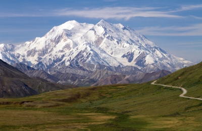
Which is the longest river in South America?


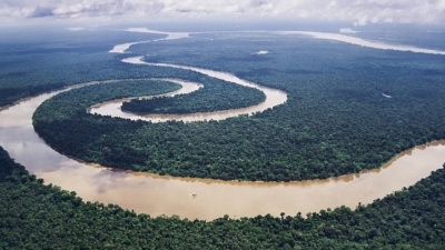
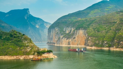
South America boasts no shortage of great rivers. The Madeira River stretches some 3,250 kilometres and the Parana dwarfs it at 4,880 kilometres. Most impressive of all is the longest river in South America is the Amazon River.


The most distant source of the Amazon is the Mantaro River in Peru. The Mantaro joins with other tributaries to form river Ucayali which meets with river Maranon to create the primary stem of the Amazon. The River Ene forms at the confluence of the River Apurimac and the River Mantaro, and it is part of the Amazon river’s headwaters which originates from Mismi. After about 450 miles, the Apurimac meets with river Mantaro and becomes Ene which joins River Perene and becomes river Tambo which drains to Ucayali. Ucayali-Tambo-Ene and Apurimac join the Amazon to form the longest river in the world. The Amazon has an average discharge of 209 million liters per second. The river's discharge represents about 20% of the world flow into the ocean. The Amazon River passes through multiple countries including Venezuela, Guyana, Ecuador, Colombia, Bolivia, Peru and Brazil.


Naturally, the longest river in South America is a source of food and water for the great Amazon rainforest. It’s thought that around a third of all known species live in the rainforest, including jaguars, ocelots and sloths. It’s not all about the rainforest, though. The river itself has plenty of weird and wonderful creatures of its own. Spend a little time on the Amazon river and you might be fortunate enough to encounter the Amazon river dolphin, the Amazonian manatee and the giant otter. If you’re unfortunate, you may stumble upon an anaconda, among the largest snakes in the world and known to hunt in the river’s shallow waters.


Which is the longest river in Asia?


The Yangtze River in China is the longest river in Asia, the third longest river in the world and the longest river to flow entirely in one country. The river begins its journey in the glacial meltwaters of the Tanggula Mountains in Tibet and flows approximately 3,915 miles (6,300 kilometers) until it empties in the East China Sea near the city of Shanghai. The river flows through or borders 10 provinces. 


The river flows through a variety of terrains, including high plateaus and lowland plains, but most of its journey — approximately three-fourths of it — is spent passing through mountainous regions, including some extremely scenic areas with deep valleys, canyons and gorges. The river is fed by approximately 700 tributaries, including eight principal rivers: Yalung, Min, Jialing, Han, Wu, Yuan, Xiang and Gan rivers.


The Yangtze River basin is considered the great granary of China. The economy of the basin focuses largely on agriculture, according to Encyclopaedia Britannica. The grains produced here -- 70 percent of which is rice -- is enough to feed half of the country's population, according to Travel China Guide. Other crops grown here include barley, cotton, wheat, corn and beans.


Picture Credit : Google


Which is the tallest mountain in Australia?


Mount Kosciuszko is the tallest mountain peak in mainland Australia at 2,228 meters (7,310 feet) tall. It is located in the state of New South Wales, in the southeastern part of the country. It is not technically Australia’s largest peak, because a volcano (Mawson Peak) on the Australian-owned Heard Island off the coast of Antarctica is taller. While Mawson Peak is politically part of Australia, geographically it is considered to be “sub-Antarctica.”


The mountain is sometimes included as part of the Seven Summits mountaineering challenge, in which mountain climbers summit the tallest mountain on every continent. There is some controversy over whether Mount Kosciuszko or Indonesia’s Puncak Jaya should be the seventh mountain. This debate comes from the geographical definition of the continent of Australia/Oceania. Mount Kosciuszko is the highest mountain on Australia, however, when taking into account all of Oceania, Puncak Jaya in Indonesia is technically the higher mountain. Many climbers climb both mountains to cover all bases.


Picture Credit : Google


Which is the tallest mountain in Antarctica?


Vinson Massif is a large mountain massif in Antarctica that is 21 km (13 mi) long and 13 km (8 mi) wide and lies within the Sentinel Range of the Ellsworth Mountains. It overlooks the Ronne Ice Shelf near the base of the Antarctic Peninsula. 


Climbed for the first time in 1966, Vinson still sees very few visitors and remains a pristine and majestic peak. To reach this remote area of the world, we fly from Punta Arenas, Chile and land on the blue ice runway of Union Glacier. A short flight then brings us to Vinson Base Camp at the foot of the Branscomb Glacier in the Ellsworth Mountains. From here we ascend the Branscomb Glacier and climb the headwall on Vinson, setting up two camps along the way. Summit Day is one of the most spectacular of any big climb in the world: as we ascend from our High Camp (12,400') the views of the immense ice sheets which surround the Massif gradually come into view, the final steep push up the summit ridge is exhilarating but not technically difficult, and standing atop this remote summit a climber looks for miles in all directions onto a landscape virtually untouched by humans.


Most climbers ascend up the Branscomb Glacier, known as the Normal Route, and make it in about 10 days. About 1,000 climbers have summited Mt. Vinson, much fewer than the other Seven Summits. While other summits are more challenging from a technical climbing perspective, the cold, windy conditions and the short window of opportunity to climb keep many climbers from making it to the top. There is also the cost involved, which can be $30,000 or more because of the summit's remoteness.


Picture Credit : Google


Which is the tallest mountain in South America?


Part of the Andes mountain range, Aconcagua is the second highest of the Seven Summits (the highest peaks on each continent), behind only Mount Everest in Asia. At 22,837 feet (6,961 meters), not only is it the highest mountain in South America, it is the tallest peak in all of the Americas, as well as the Southern and Western Hemispheres.


Aconcagua is located in Argentina, in the province of Mendoza, and lies 70 miles (112 kilometers) northwest of the provincial capital, Mendoza, and 9.3 miles (15 km) from the border with Chile.


The vegetation and wildlife on Aconcagua is concentrated below 13,123 feet (4,000 m), according to the Encyclopedia of World Geography. There are a number of low bushes, such as yellow firewood, yareta and goat horn, and there are open pastures made up of grasses such as huecú and ichu.


Many varieties of birds inhabit the area, including the condor, the purple eagle and a species of snipe called agachona. Spotted sandpipers and torrrentes, a type of duck, thrive in some of the areas with water. Mountain rats and the red fox are among the most common land animals.


Picture Credit : Google


Which is the tallest mountain in North America?


Denali (formerly called Mount McKinley) is the highest mountain in North America. Its summit is 20,310 feet (6,190 meters) above sea level. It is located in the USA, in the state of Alaska. 


Denali is about 210 kilometers (130 miles) north-northwest of Anchorage. Sixty million years ago, tectonic uplift pushed Earth's crust upward, forming Denali and the other Alaska Range mountains. Denali is the centerpiece of the Denali National Park and Preserve, which spans 2.4 million hectares (6 million acres) of land.


Denali is considered an extremely difficult climb due to the severe weather and steep vertical climbs. In 1906, physician and explorer Frederick Cook was famously reported to have reached the summit, a claim that was later found false. Hudson Stuck, Harry Karstens, and their team of climbers were the first on record to actually reach the summit in 1913. Since then, several hundred people attempt to climb Denali each year.


Picture Credit : Google


What is the tallest mountain in Africa called?


Kilimanjaro is the highest mountain in Africa at 19,341 feet (5,895 meters), but it isn't a mountain in a traditional sense. It is a giant stratovolcano that began forming about a million years ago and is composed of many layers of hardened volcanic ash, lava, pumice and tephra — fragmental material that is the fallout from a volcanic eruption.


One of the Seven Summits (the highest peaks on the seven continents), Kilimanjaro is in Tanzania in east Africa. Kilimanjaro lies within the 292-square-mile (756 square kilometers) Kilimanjaro National Park. Kilimanjaro rises from its base approximately 16,732 feet (5,100 meters) from the plains near the Tanzanian municipality of Moshi, making it the tallest free-standing mountain in the world.


About 30,000 people climb Kilimanjaro each year and about three-quarters of those reach the summit. It is a relatively safe climb, and most climbers who fail to summit experience altitude-related issues or harsh weather near the peak. Temperatures at the peak can be 0 degrees F (minus 18 C), and if the winds are blowing, the wind chills reach dangerous levels.


Picture Credit : Google


Which is the largest mountain in Asia?


Mount Everest as seen from Everest Base Camp, Tibet. Mount Everest is the highest mountain in Asia and the highest mountain in the world. Its summit is 29,029 feet (8,848 meters) above sea level. It is located in the Himalaya Mountain Range on the border of Nepal and China.


The first ever recorded people to climb Everest were Edmund Hillary (a mountaineer from New Zealand) and his Tibetan guide Tenzing Norgay. They climbed the mountain in 1953 and hold the record together. The first records of Everest’s height came much earlier, in 1856. British surveyors recorded that Everest was the tallest peak in the world in their Great Trigonometrical Survey of the Indian subcontinent.


Climbing Mount Everest has become a popular expedition for mountain climbers. However, it is a dangerous undertaking. Climbing Everest requires a lot of experience mountaineering elsewhere, as well as a certificate of good health, equipment, and a trained Nepalese guide. The snow and ice on the mountain create deadly hazards like avalanches, and there is only a limited climbing season due to bad weather conditions.


Picture Credit : Google


Which three continents cross the line called the equator?


The Equator passes through three of the seven continents: South America, Africa and Asia. An equator is an imaginary line around the middle of a planet or other celestial body. It is halfway between the North Pole and the South Pole, at 0 degrees latitude. An equator divides the planet into a Northern Hemisphere and a Southern Hemisphere.


When the Sun is directly above the Earth's Equator (on the equinoxes of approximately March 20 and September 23), sunlight shines perpendicular to the Earth's axis of rotation, and all latitudes have a 12-hour day and 12-hour night. On and near the Equator sunlight comes from almost directly above every day year-round, and thus the Equator has a rather stable daytime temperature the whole year.


Locations on the equator experience the shortest sunrises and sunsets because the Sun's daily path is nearly perpendicular to the horizon for most of the year. The length of daylight (sunrise to sunset) is almost constant throughout the year; it is about 14 minutes longer than nighttime due to atmospheric refraction and the fact that sunrise begins (or sunset ends) as the upper limb, not the center, of the Sun's disk contacts the horizon.


Picture Credit : Google


Which continents touch the Atlantic Ocean?


Atlantic Ocean, body of salt water covering approximately one-fifth of Earth’s surface and separating the continents of Europe and Africa to the east from those of North and South America to the west.


The western shores of the Atlantic Ocean are the coasts of North, Central, and South America. The North American countries include Canada and the United States. All of the Central and South American countries on the Caribbean Sea including Cuba, Jamaica, Panama, Columbia, Venezuela, and many others have an Atlantic coast, as well as the South American countries of Argentina and Brazil. The warm, moist air of the southern Atlantic ocean often brings rain, hurricanes and other turbulent weather to Central America and the southern United States before heading north and bringing turbulent weather to the east coast of the United States, including the notorious Nor’easter, and heavy fog off the coast of eastern Canada.


The Atlantic Ocean is home to a wide range of wildlife including crabs, lobsters, shrimp, large whales and sharks, large mammals such as seals and dolphins, and hundreds of species of fish. The Atlantic coasts are home to dozens of species of birds including seagulls and albatross, and penguins can be found in the colder waters of the southern Atlantic. Many birds follow the migration route called the Atlantic Flyway that includes several shorter routes following the coast of North America that come together in the regions around the Gulf of Mexico near Florida, and then continue over Mexico and into the Caribbean sea.


Picture Credit : Google


Which continent is smallest?


Australia is the smallest continent. It is famous for its huge open areas of land, its bright sunshine, and its unusual animals. Australia is a dry land with few people. In fact, it has fewer people than any continent except Antarctica. Australia lies entirely south of the equator. For that reason, it is often called “The Land Down Under”.


Asutralia is completely surrounded by water. It is often grouped with the island of New Zealand and other Pacific islands, which together are called Oceania. Australia is a country, and it is the only country in the world that is also a continent. The island of Tasmania is also part of Australia.


In Australia, most people live in cities near the coasts, such as Sydney and Melbourne. But some people live in the outback, a vast area of dry, flatland far from the cities. Here, in the centre of the continent, is a very famous rock called Uluru (or Ayers Rock) that is several miles in diameter.


People go to Australia to hear music at the beautiful Sydney Opera House. Divers visit the Great Barrier Reef, a chain of coral reefs. Other people go to Australia to see kangaroos and koalas.


Picture Credit : Google


Which continent is almost the smallest of the seven continent?


Europe is almost the smallest of the seven continents. Only Australia is smaller. Europe is a region of mountain ranges, rugged coastlines, deep valleys, and plains. Thousands of islands, including Iceland, Corsica, Great Britain, and Ireland, are part of Europe.


All of Europe lies north of Equator. The parts that are furthest north are close to the North Pole. Europe is joined to Asia on the east. It is separated from Africa by the Mediterranean Sea. A mountain range called the Alps cuts across the southern part of the continent.


There are 49 countries in Europe. The largest country, Russia, is also the largest country in the world. Part of Russia is in Europe, and part of it is in Asia. Vatican City is the smallest country in the world. It is so small it fits entirely within the city of Rome, Italy.


People from all over the world love to visit Europe for its museums and historic buildings. People also visit Stonehenge, and ancient monument in England.


Picture Credit : Google


Which is the fifth largest continent?


Antarctica is the fifth largest continent. Although Antarctica is larger than Australia, nobody lives there all the time. That is because Antarctica is the coldest and iciest place in the world. The South Pole is located in Antarctica.


The stormy waters of the Atlantic, Indian, and Pacific oceans surround Antarctica. Ships must steer around towering icebergs and break through huge ice fields to reach the continent. On Antarctica, most of the land is buried in ice. This ice can measure thousands of metres thick about five times as tall as the world’s tallest building. But under the ice, Antarctica has mountains, lowlands, and valleys, just as the other continents do. One area near the South Pole is called a “polar desert” because so little snow falls there.


Scientists and travellers visit Antarctica for short periods. Scientists from many nations come to study the continent’s animals and plants, ice, and rocks. Only a few small plants and insects can survive on Antarctica;s dry land. But many animals, including fish, penguins, whales and flying birds, live in the cold waters around Antarctica.


Picture Credit : Google


Which is the fourth largest continent?


South America is the fourth largest continent. It has tropical rain forests, deserts, snowy peaks, volcanoes, and rolling grasslands. South America has fewer people than North America.


Most of South America lies south of the equator. At the north, the continent is joined to North America by a narrow strip of land. The southern part of the continent is close to Antarctica.


South America has 12 countries. The largest country in South America is Brazil. The smallest is Suriname. Most people in South America live in crowded cities.


People travel to South America to see such ancient ruins as Machu Picchu. The Amazon rain forest and Iguacu Falls are also in South America.


Picture Credit : Google


Which is the third largest continent?


North America is the third largest continent. It has fewer people than Europe, Asia, or Africa. The northern part of the continent is near the North Pole. The southern part is connected to South America by a narrow strip of land. The north has icy plains. The south has sunny beaches. 


North America includes magnificent mountain peaks, sandy deserts, flat grasslands, and thick forests.


North America has 23 countries. Canada is the biggest, but the U.S.A. has the most people. Major North American cities include Calgary, Montreal, and Toronto, in Canada; Chicago, Los Angeles, and New York, in the U.S.A.; Havana, in Cuba; and Mexico City, in Mexico.


Picture Credit : Google