What are Coral reefs?


These are made from the skeletons left by tiny sea animals, called coral polyps, when they die. The skeletons build up into huge reefs, where plants and other sea creatures live. The coral species that build reefs are known as hermatypic, or "hard," corals because they extract calcium carbonate from seawater to create a hard, durable exoskeleton that protects their soft, sac-like bodies. Other species of corals that are not involved in reef building are known as “soft” corals.


Each individual coral is referred to as a polyp. Coral polyps live on the calcium carbonate exoskeletons of their ancestors, adding their own exoskeleton to the existing coral structure. As the centuries pass, the coral reef gradually grows one tiny exoskeleton at a time, until they become massive features of the marine environment.


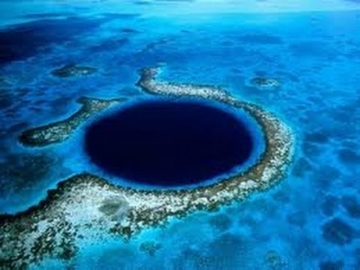
Corals are found all over the world's oceans, from the Aleutian Islands off the coast of Alaska to the warm tropical waters of the Caribbean Sea. The biggest coral reefs are found in the clear, shallow waters of the tropics and subtropics. The largest of these coral reef systems, the Great Barrier Reef in Australia, is more than 1,500 miles long (2,400 kilometers).


Picture Credit : Google


What is the Oceanic trench?


When tectonic plates in the ocean floor move and collide, one may be pushed under the other, creating a narrow trench. These trenches are the deepest places in the Earth’s oceans.


Trenches are formed by subduction, a geophysical process in which two or more of Earth's tectonic plates converge and the older, denser plate is pushed beneath the lighter plate and deep into the mantle, causing the seafloor and outermost crust (the lithosphere) to bend and form a steep, V-shaped depression. This process makes trenches dynamic geological features—they account for a significant part of Earth’s seismic activity—and are frequently the site of large earthquakes, including some of the largest earthquakes on record. Subduction also generates an upwelling of molten crust that forms mountain ridges and volcanic islands parallel to the trench. Examples of these volcanic "arcs" can be seen in the Japanese Archipelago, the Aleutian Islands, and many other locations around this area called the Pacific "Ring of Fire."


Many of the organisms living in trenches have evolved surprising ways to survive in these unique environments. Recent discoveries in the hadal zone have revealed organisms with proteins and biomolecules suited to resisting the crushing hydrostatic pressure and others able to harness energy from the chemicals that leak out of hydrocarbon seeps and mud volcanoes on the seafloor. Other hadal species thrive on the organic material that that drifts down from the sea surface and is funneled to the axis of the V-shaped trenches.


Picture Credit : Google


What is the Open Ocean?


This is the top layer of the ocean, nearest the surface. The open ocean is vast. Although food can sometimes be hard to find, many animals, such as dolphins, seals, and turtles, live there.


Many open ocean organisms live out their existence without ever coming into contact with the shore, the seafloor, or the water’s surface. They spend their entire lives surrounded by water on all sides and do not know that anything else even exists. In the case of the deep open ocean, organisms never even see sunlight. As land mammals that breathe air, walk on land, and rely on our sense of sight for almost all functions, it is difficult for people (even experts) to comprehend that most of the organisms on the planet are never exposed to air, land, or sunlight.


Picture Credit : Google


What are volcanic islands?


These islands are formed from layers of magma, or liquid rock, which erupts from a volcano under the water, then cools and hardens. The magma layers eventually build up to create an island.


Volcanic islands are formed by volcanic activity on the seabed, often near the boundaries of the tectonic plates that form Earth’s crust. Where two plates pull apart, lava erupts to form an undersea ridge. Layers of lava build up until a ridge breaks the sea’s surface to form an island. Sometimes a whole chain of volcanic islands, called an island arc, is formed in this way. Some island arcs contain thousands of islands.


Sometimes, volcanoes occur in close proximity to each other on the sea floor, creating a very large island. For example, the big island of Hawaii is actually five, side-by-side volcanoes that have grown together. The island chain of countries that make up Southeast Asia; Indonesia and Papua New Guinea, the Philippine Islands were all created by volcanic activity on the sea floor. New Zealand, the Island country off the Southeast coast of Australia, was also formed by ancient volcanoes.


Picture Credit : Google


What are Oceans?


Around 71 percent of the Earth’s surface is covered by oceans. Many different and interesting features are found in and around them, and a huge variety of animals and plants have adapted to life in this watery world. Humans depend on these teeming waters for comfort and survival, but global warming and overfishing threaten to leave the ocean agitated and empty.


The oceans hold about 320 million cubic miles (1.35 billion cubic kilometers) of water, which is roughly 97 percent of Earth's water supply. The water is about 3.5 percent salts and contains traces of all chemical elements found on Earth. The oceans absorb the sun's heat, transferring it to the atmosphere and distributing it around the world via the ever-moving ocean currents. This drives global weather patterns and acts as a heater in the winter and an air conditioner in the summer.


Picture Credit : Google


How we use water?


We use large quantities of water. We drink it, wash with it, use it in industry, and also prepare food with it. Below are the percentage of the water that each person uses every day for these activities.


Drinking:


Only a 0.2% of the water a person uses every day is for drinking. Your drinking water comes from natural sources that are either groundwater or surface water.


Groundwater comes from rain and snow that seeps into the ground. The water gets stored in open spaces and pores or in layers of sand and gravel known as aquifers. We use water wells or springs to harvest this groundwater.


Surface Water also comes from rain and snow. It is the water that fills the rivers, lakes, and streams.


Personal:


Nearly 4.2% of the water a person uses for washing, cleaning your teeth, and flushing the toilet use up this share. Water generally gets to our homes in one of two ways. Either it is delivered by a city/county water department (or maybe from a private company), or people supply their own water, normally from a well. Water delivered to homes is called "public-supplied deliveries" and water that people supply themselves is called "self supplied", and is almost always from groundwater.


Manufactured goods:


Nearly 30.6% of water a person use for manufactured goods. The industries that produce metals, wood and paper products, chemicals, gasoline and oils, and those invaluable grabber utensils you use to get your ring out of the garbage disposal are major users of water. Probably every manufactured product uses water during some part of the production process. Industrial water use includes water used for such purposes as fabricating, processing, washing, diluting, cooling, or transporting a product; incorporating water into a product; or for sanitation needs within the manufacturing facility. Some industries that use large amounts of water produce such commodities as food, paper, chemicals, refined petroleum, or primary metals.


Food production:


This takes up most of the water we use. Water is an essential part of our diet. Without it, our bodies would not work! For vegetative growth and development plants require water in adequate quantity and at the right time. Crops have very specific water requirements, and these vary depending on local climate conditions. The production of meat requires between six and twenty time more water than for cereals. 


Picture Credit : Google


What is the water cycle?


Earth’s water is always moving from one place to another. This process, called the water cycle, is a continuous journey, in which water moves between the land, the atmosphere, and the ocean.


The water cycle shows the continuous movement of water within the Earth and atmosphere. It is a complex system that includes many different processes. Liquid water evaporates into water vapor, condenses to form clouds, and precipitates back to earth in the form of rain and snow. Water in different phases moves through the atmosphere (transportation). Liquid water flows across land (runoff), into the ground (infiltration and percolation), and through the ground (groundwater). Groundwater moves into plants (plant uptake) and evaporates from plants into the atmosphere (transpiration). Solid ice and snow can turn directly into gas (sublimation). The opposite can also take place when water vapor becomes solid (deposition). 


Picture Credit : Google


How much is water on Earth?


Most of the water on Earth is in the ocean – in fact, nearly 97%. The remaining 3% is freshwater and is stored in ice sheets, ice caps and glaciers, groundwater, and surface water such as lakes and rivers. The majority of this freshwater is frozen and stored in the Antarctic and Greenland ice sheets. Glaciers around the world are changing rapidly. In general, freezing and melting are a natural part of the water cycle, but for glaciers, more ice is melting each summer than falls as snow during the winter, and they are shrinking in size as a result. Glaciers also provide water resources, like drinking water, for downstream communities, but as the size of these glaciers changes, so too does this important resource.


Picture Credit : Google


What is Water on Earth?


Water is essential to life on Earth. Without it, plants and animals would not be able to survive. Around 71 per cent of Earth is covered in water in water. This includes both salt water and fresh water. Not all of Earth’s water is easily available for us to use.


The water is concentrated at the Earth’s surface, so its relative mass compared to the whole Earth is small. It amounts to about 0.02 % of Earth’s mass!


The largest drop here represents the volume of all water, the mid sized drop freshwater, and the smallest drop (near Atlanta) all of Earth’s lake water.


Picture Credit : Google


What are Desert landforms?


Over thousands of years, many different natural features, or landforms, have developed in deserts. A desert landform is a place that gets little to no rain. The climate can be either hot or cold and sometimes both. Each desert landform has one thing in common; it has less than 10 inches of rain per year. Usually deserts have a lot of wind because they are flat and have no vegetation to block out the wind.These include hills; mountains; narrow, steep-sided valleys called canyons; large, flat areas called plains; sand dunes; strange rock formations; and oases.


1. Sand dunes: These hills are formed by the wind blowing across the desert sand, so that it piles up. The most common in deserts include barchans and seif dunes. Barchan dunes are formed due to the wind action resulting in crescent-shaped dunes. These small crescent-shaped sand bodies form in locations where the wind blows consistently from one direction. Seif dunes, on the other hand, are long and narrow with a sharp crest common in the Sahara. They can also form a long chain of dunes.


2. Oases: Rare underground water can create pools of water. Plants then spring up around them. Oases typically occurs in the middle of a desert. They are fertile areas of the desert consisting of one or multiple springs surrounded by vegetation. Oasis is formed due to a mix of extreme temperatures resulting in islands of life. This comes about because the oases is situated in parts of the desert where the elevation is so low that the water table is just near the surface enabling vegetation to flourish.


3. Mesas and buttes: A mesa is a hill with steep sides and a flat top. A smaller mesa is sometimes called a butte. These landforms can also be called table mountains or table hills, because the word mesa actually means table in Spanish.


Scientists believe that mesas and buttes were formed when streams or rivers weathered and eroded away the smaller, softer rocks, leaving only the strong rock of the mesa or butte behind.


Picture Credit : Google


What are Polar deserts?


These are extremely dry and cold. Temperatures rarely rise above 10° C (50° F), even in summer. Some are covered in ice and snow all year, while others are covered in gravel and large rocks. Most of Antarctica is polar desert.


Ross Island is located in Ross Sea, Antarctica and in McMurdo Sound. Due to the persistent presence of ice sheet, the isle is sometimes taken to be part of mainland Antarctica. The island is 43 miles (69 km) long and 45 miles wide. On it are Mount Erebus (an active volcano 12,450 feet [3,800 metres] high) and Mount Terror (10,750 feet) among a series of mountain ranges intersected by deep valleys. Mount Erebus was the site in 1979 of a crash that claimed 257 lives on a sightseeing and photographic flight over Antarctica. The ranges are free of snow except for hanging glaciers on the highest slopes. McMurdo, a U.S. base, is located on the island just north of Cape Armitage, its southernmost extremity. About one mile south is Scott Base, a New Zealand station. A steep pyramid of rock called Observation Hill rises between the two stations. In 1907 Ernest Shackleton, a British explorer, established a camp at Camp Royds, and Robert Falcon Scott, in 1910, set up a camp at Cape Evans on his return expedition. These are now maintained as historic monuments.


Picture Credit : Google


What are Coastal deserts?


Here, cold winds blowing off the ocean cause thick fog to form and drift inland. Water droplets in the fog soon dry up under the hot Sun, rather than falling as rain, leaving the land below very dry.


The Atacama Desert is one of the driest places on Earth. The Atacama is in the country of Chile in South America. In an average year, much of this desert gets less than 1 millimeter (0.04 inch) of rain! That makes it 50 times drier than Death Valley in California.


It is hard to survive in the Atacama Desert. Few people, animals, plants, or even microbes live there. But the desert isn't completely without life. Some people and other living creatures do get by in the Atacama.


The north end of the Atacama Desert is near the border of Chile and Peru. It runs about 1,000 km (600 miles) south from there. It has an area of 140,000 km (54,000 square miles). That is about the size of the state of New York in the U.S.A.


The Atacama is the driest hot desert in the world. There are some weather stations in the Atacama where there has never been any rain! Not all deserts are hot. The Dry Valleys in Antarctica are cold deserts. They are the driest deserts on Earth.


Picture Credit : Google


What are Cold deserts?


The largest cold deserts are in Central Asia, usually in high, flat areas. They are very dry, like all deserts, but are also very cold for most of the time. During the long winters, temperatures often drop as low as -40° C (-40° F).


Gobi, also called Gobi Desert, great desert and semidesert region of Central Asia. The Gobi (from Mongolian Gobi, meaning “waterless place”) stretches across huge portions of both Mongolia and China.The Gobi is overall a cold desert, with frost and occasionally snow occurring on its dunes. Besides being quite far north, it is also located on a plateau roughly 910–1,520 metres (2,990–4,990 ft) above sea level, which contributes to its low temperatures. An average of approximately 194 millimetres (7.6 in) of rain falls annually in the Gobi. Additional moisture reaches parts of the Gobi in winter as snow is blown by the wind from the Siberian Steppes. These winds may cause the Gobi to reach ?40° C (?40° F) in winter to 45° C (113° F) in summer.


However, the climate of the Gobi is one of great extremes, combined with rapid changes of temperature of as much as 35° C (63° F). These can occur not only seasonally but within 24 hours.


Picture Credit : Google


What are hot deserts?


Temperatures often reach 50° C (122° F) or higher during the day in hot deserts. But at night, it can be very cold. Most hot deserts are near the equator, where there is strong sunlight all year round.


The Sahara is the largest hot desert in the world, and the third largest desert behind Antarctica and the Arctic, which are both cold deserts. The Sahara is one of the harshest environments on Earth, covering 3.6 million square miles (9.4 million square kilometers), nearly a third of the African continent, about the size of the United States (including Alaska and Hawaii).


The Sahara desert has a variety of land features, but is most famous for the sand dune fields that are often depicted in movies. The dunes can reach almost 600 feet (183 meters) high but they cover only about 15 percent of the entire desert. Other topographical features include mountains, plateaus, sand- and gravel-covered plains, salt flats, basins and depressions. Mount Koussi, an extinct volcano in Chad, is the highest point in the Sahara at 11,204 feet (3,415 m), and the Qattara Depression in Egypt is the Sahara's deepest point, at 436 feet (133 m) below sea level.


Picture Credit : Google


What are Deserts?


About third of Earth’s surface is covered by deserts. They are areas that get little or no rain, so they are extremely dry. Only a few species of animals and plants can survive in them. We usually think of deserts as very hot places, but some are very cold.


Deserts are formed by weathering processes as large variations in temperature between day and night put strains on the rocks which consequently break in pieces. Although rain seldom occurs in deserts, there are occasional downpours that can result in flash floods. Rain falling on hot rocks can cause them to shatter and the resulting fragments and rubble strewn over the desert floor are further eroded by the wind. This picks up particles of sand and dust and wafts them aloft in sand or dust storms. Wind-blown sand grains striking any solid object in their path can abrade the surface. Rocks are smoothed down, and the wind sorts sand into uniform deposits. The grains end up as level sheets of sand or are piled high in billowing sand dunes. Other deserts are flat, stony plains where all the fine material has been blown away and the surface consists of a mosaic of smooth stones. These areas are known as desert pavements and little further erosion takes place. Other desert features include rock outcrops, exposed bedrock and clays once deposited by flowing water. Temporary lakes may form and salt pans may be left when waters evaporate. There may be underground sources of water in the form of springs and seepages from aquifers. Where these are found, oases can occur.


Picture Credit : Google