HOW MANY HOURS ARE THERE IN A DAY?

Our system of telling time is based on the premise that every day is exactly 24 hours long — quite precisely, with no exceptions. This concept is fully ingrained into our culture, a core principle of our modern technological society. At the same time, we are taught in school that a day corresponds to one complete rotation of the Earth on its axis. Unfortunately, these two concepts don’t quite match up — and the mismatch is more than just a few milliseconds. In fact, the mismatch amounts to several minutes every day. Furthermore, because our traditional concept of a “day” is actually defined by the cycle of sunlight and darkness — and not by one rotation of the Earth — the length of a real day is not consistent, but varies somewhat during the year. We only pretend that all days are the same length — by averaging the length of all the days in the year, and then defining this average as a “standard day” of exactly 24 hours.

This is not a bad thing. In fact, it has been quite helpful to define our system of time in this manner. But once you understand why this system does not quite match up with the real world, then you can begin to make sense of several interesting phenomena. For example, you would think that the earliest sunset and the latest sunrise would both occur on the shortest day of the year, which is the first day of winter. But this is not the case at all.

If our definition of a day was truly based on one complete rotation of the Earth on its axis — a 360 degree spin — then a day would be 23 hours, 56 minutes, and 4 seconds. This is nearly 4 minutes shorter than our 24-hour standard day. However, our concept of a “day” has long been based on the natural cycle of sunlight — a period of daylight followed by a period without daylight. The mismatch of nearly 4 minutes is because the Earth must rotate more than 360 degrees between one dawn and the next. As you know, the Earth experiences two simultaneous motions — it not only spins on its axis, but it also travels in orbit around the sun. In a period of one day, the Earth travels about 1/365 of the way around the sun (because it takes about 365 days to go all the way around, which is how we define a year). This daily progress in the Earth’s orbit is almost exactly a degree (defined as 1/360 of a circle). Therefore the Earth has to spin an extra degree in order to line up with the sun again each day. The result is that one complete cycle of sunlight and darkness — one day — represents a rotation of about 361 degrees, not 360 degrees. Although a year consists of 365 and a quarter days, the Earth actually spins 366 and a quarter times during a year. From the standpoint of sunrises and sunsets, one complete spin is negated each year by the journey around the sun.
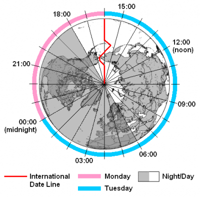
Credit: medium.com

Picture credit: Google

WHY DOES THE SUN RISE IN THE EAST?

Because Earth is spinning eastwards, the Sun comes up from the ground in the east, and sinks in the west.


Most people know that the Sun "rises in the east and sets in the west". However, most people don't realize that is a generalization. Actually, the Sun only rises due east and sets due west on 2 days of the year -- the spring and fall equinoxes! On other days, the Sun rises either north or south of "due east" and sets north or south of "due west."

Each day the rising and setting points change slightly. At the summer solstice, the Sun rises as far to the northeast as it ever does, and sets as far to the northwest. Every day after that, the Sun rises a tiny bit further south.

At the fall equinox, the Sun rises due east and sets due west. It continues on it's journey southward until, at the winter solstice, the Sun rises are far to the south as it ever does, and sets as far to the southwest.

Many, if not most, prehistoric cultures tracked these rising and settings points with great detail. If they had jagged mountains along the horizon, the exact points could be readily remembered. Without a suitably interesting horizon, standing stones could be arranged to line up with the various rising and setting points. Or, tree poles could replace the standing stones. Or, rock cairns could be used.

Credit: Stanford Solar Centre

Picture credit: Google

WHERE IS THE ANTARCTIC CIRCLE?

The Antarctic Circle is a parallel of latitude on the Earth at approximately 66.5 degrees south of the equator. On the day of the southern summer solstice (around December 22 each year), an observer on the Antarctic Circle will see the Sun above the horizon for a full 24 hours.

Observers further south than the Antarctic Circle will see the Sun remain above the horizon for many days, and at the South Pole, there is a six-month ‘day’ that starts on the autumnal equinox changing to a six-month ‘night’ on the vernal equinox.

The 66.5 degree angle comes from the tilt of the Earth’s rotation axis (23.5°), such that 90° – 23.5° = 66.

Credit: Cosmos

Picture credit: Google

WHERE IS THE ARCTIC CIRCLE?

The Arctic Circle is a line of latitude that circles the Earth at approximately 66° 33' 47.2" north of the Equator. How was that strange number determined? The position of the Arctic Circle is at the latitude above which the sun does not set on the summer solstice and does not rise on the winter solstice.

This is what causes the Arctic to have a very long continuous night each year and a very long continuous day. The length of these long continuous days and nights are six months each at the North Pole. Their length decreases with distance from the North Pole.

The latitude of the Arctic Circle is slowly drifting northward at a speed of about 15 meters per year. On July 2, 2018 it was at approximately 66° 33' 47.2" north of the Equator. This drift has nothing to do with climate change. Instead, the drift occurs because the Earth wobbles on its axis of rotation in a 40,000 year cycle in response to the gravitational attraction of the moon.

To most of the general public, using the Arctic Circle as the defining southern boundary for "the Arctic" is easy and makes total sense. However, some researchers believe that there are better ways to draw a map of the Arctic.

Credit: geology.com

Picture credit: Google

WHAT IS THE EQUATOR?

The equator is the circle that goes round the centre of Earth. It is perpendicular to the axis and divides the planet into two equal hemispheres (or half-spheres), the Northern and the Southern.

The Earth's Equator is the imaginary line that runs around the centre of the globe at 0 degrees latitude, at equal distance between the North and South Poles. Like the other lines of latitude, it's based on the Earth's axis of rotation and its orbit around the sun. It is the longest of Earth's five circles of latitude, the others being the polar circles, and tropical circles. This is because of how the Earth bulges around its centre.

The Equator is just under 25,000 miles long, wrapping around the entire Earth. The Equator divides the Earth into northern and southern hemispheres, with both experiencing different amounts of daylight at different times. This, weather, climate and the seasons we experience are a result of the Earth's tilt on its axis and its orbit around the sun. The northern and southern hemispheres are either turned toward or away from the sun depending on the Earth's position whilst it's orbiting the sun.

When the Sun is directly above the Earth's Equator, sunlight shines perpendicular to the Earth's axis, and all latitudes have a 12-hour day and 12-hour night. The Sun passes directly over the equator twice a year, on the March and September equinoxes.

Credit: twinkl

Picture credit:  Google

WHY ARE LATITUDE AND LONGITUDE IMPORTANT?

Two points on Earth can lie at the same latitude but still be far away from each other. Similarly, two distant points may lie on the same longitude. But only one point lies on a particular combination of latitude and longitude. So latitudes and longitudes are necessary for locating an exact point on Earth.

The importance of longitude and latitude are:

  • Latitudes help in identifying and locating major heat zones of the earth.
  • Latitude measures the distance between the north to south from the equator.
  • Latitude helps in understanding the pattern of wind circulation on the global surface.
  • Longitude measures the distance between the west to earth from the prime meridian.
  • Both longitude and latitude help us measure both the location and time using a single standard.
  • The lines of longitude and latitude help us in measuring the distance from the Earth’s Equator
  • Latitudes help us to find out the distance of any place from the Equator, which is base on its degree of latitude.
  • Longitude and latitude help us to find the location of any place on earth. These coordinates are what the Global Position System or GPS

Credit: Byju’s

Picture credit: Google

WHAT MAKES THE SEASONS?

Earth is always tilted the same direction as it orbits the Sun. So when Earth is on one side of the Sun, the northern hemisphere is tilted closer towards the Sun, making it warmer. At the same time, the southern hemisphere is tilted away from the Sun, and is, therefore, colder. When Earth reaches the other side of the Sun, it is the opposite, so it’s winter in the northern hemisphere and summer in the southern.

Seasons happen at different times in different parts of the world. The tilt of the Earth doesn’t change as it rotates around the Sun. But the part of the planet that gets the most direct sunlight does change.

The Northern Hemisphere is tilted away from the Sun from September to March. That means the northern half of the planet doesn’t get as much light and heat from the Sun. This causes autumn and winter. During the same months, the Southern Hemisphere is tilted towards the Sun. That means the southern half of the planet gets spring and summer.

From March to September, the Northern Hemisphere is tilted towards the Sun. So that’s when the northern half of the Earth experiences spring and summer. During the same months, the Southern Hemisphere experiences autumn and winter.
Other planets also have seasons. But the length and intensity of each season varies from planet to planet. 

  • On Earth, seasons last between 90 and 93 days. 
  • On Venus, seasons last between 55 and 58 days. 
  • On Mars, seasons change about once every six months. Summer lasts 199 days and winter lasts 146 days. 
  • On Saturn, seasons last about seven years. 
  • And if you lived on Neptune, you would have to wait more than 40 years for the seasons to change!

Credit: Let’s talk Science

Picture credit: Google

WHAT IS THE PRIME MERIDIAN?

This is an imaginary line of 0° longitude that is perpendicular to the equator, and parallel to the axis. It passes through Greenwich in the UK, and divides Earth into eastern and western hemispheres. As it crosses the poles to the opposite side of the globe, the line becomes 180° longitude and is also known as the International Date Line.

The prime meridian is arbitrary, meaning it could be chosen to be anywhere. Any line of longitude (a meridian) can serve as the 0 longitude line. However, there is an international agreement that the meridian that runs through Greenwich, England, is considered the official prime meridian.

Governments did not always agree that the Greenwich meridian was the prime meridian, making navigation over long distances very difficult. Different countries published maps and charts with longitude based on the meridian passing through their capital city. France would publish maps with 0 longitude running through Paris. Cartographers in China would publish maps with 0 longitude running through Beijing. Even different parts of the same country published materials based on local meridians.

Finally, at an international convention called by U.S. President Chester Arthur in 1884, representatives from 25 countries agreed to pick a single, standard meridian. They chose the meridian passing through the Royal Observatory in Greenwich, England. The Greenwich Meridian became the international standard for the prime meridian.

Credit: National geographic

Picture credit: Google

WHAT ARE LATITUDE AND LONGITUDE?

Every place on Earth’s surface can be pinpointed by two figures: its latitude and its longitude. Lines of latitude (called ‘parallels’) form rings around Earth, parallel to the equator. A place’s latitude is given in degrees (°) north or south of the equator, which is considered latitude 0°. On the other hand, lines of longitude (called ‘meridians’) run round Earth from north to south, dividing the world up like the segments of an orange.

A place’s longitude is given as degrees west or east of the prime meridian, which is longitude 0°. 

Latitude and longitude are angles that uniquely define points on a sphere. Together, the angles comprise a coordinate scheme that can locate or identify geographic positions on the surfaces of planets such as the earth.

Latitude is defined with respect to an equatorial reference plane. This plane passes through the center C of the sphere, and also contains the great circle representing the equator. The latitude of a point P on the surface is defined as the angle that a straight line, passing through both P and C, subtends with respect to the equatorial plane. If P is above the reference plane, the latitude is positive (or northerly); if P is below the reference plane, the latitude is negative (or southerly). Latitude angles can range up to +90 degrees (or 90 degrees north), and down to -90 degrees (or 90 degrees south). Latitudes of +90 and -90 degrees correspond to the north and south geographic poles on the earth, respectively.

Longitude is defined in terms of meridians, which are half-circles running from pole to pole. A reference meridian, called the prime meridian , is selected, and this forms the reference by which longitudes are defined. On the earth, the prime meridian passes through Greenwich, England; for this reason it is also called the Greenwich meridian. The longitude of a point P on the surface is defined as the angle that the plane containing the meridian passing through P subtends with respect to the plane containing the prime meridian. If P is to the east of the prime meridian, the longitude is positive; if P is to the west of the prime meridian, the longitude is negative. Longitude angles can range up to +180 degrees (180 degrees east), and down to -180 degrees (180 degrees west). The +180 and -180 degree longitude meridians coincide directly opposite the prime meridian.

Credit: WhatIs.com

Picture credit: Google

WHAT ARE TIME ZONES?

As Earth spins, different parts of its surface turn towards the Sun at different times - the Sun is always rising in one place and setting in another. So, the time of day varies around the world. When it’s dawn where you live, it’s sunset on the other side of the world. To make it easier to set clocks, the world is split into 24 time zones, one for each hour of the day. As you go east around the world, you put clocks forward by one hour for each zone - until you reach an imaginary line called the International Date Line. If you go further on across the Date Line, you carry on adding hours, but put the calendar back by a day.

A time zone is a region on Earth that uses a uniform time. They are often based on the boundaries of countries or lines of longitude. Greenwich Mean Time (GMT) is the mean solar time at the Royal Observatory located in Greenwich, London, considered to be located at a longitude of zero degrees. Although GMT and Coordinated Universal Time (UTC) essentially reflect the same time, GMT is a time zone, while UTC is a time standard that is used as a basis for civil time and time zones worldwide. Although GMT used to be a time standard, it is now mainly used as the time zone for certain countries in Africa and Western Europe. UTC, which is based on highly precise atomic clocks and the Earth's rotation, is the new standard of today.

UTC is not dependent on daylight saving time (DST), though some countries switch between time zones during their DST period, such as the United Kingdom using British Summer Time in the summer months.

Most time zones that are on land are offset from UTC. UTC breaks time into days, hours, minutes, and seconds, where days are usually defined in terms of the Gregorian calendar. Generally, time zones are defined as + or - an integer number of hours in relation to UTC; for example, UTC-05:00, UTC+08:00, and so on. UTC offset can range from UTC-12:00 to UTC+14:00. Most commonly, UTC is offset by an hour, but in some cases, the offset can be a half-hour or quarter-hour, such as in the case of UTC+06:30 and UTC+12:45

Credit: calculator.net

Picture credit: Google

HOW THICK IS EARTH'S CRUST?

Earth's Crust

The crust is what we live on and is by far the thinnest of the layers of earth. The thickness varies depending on where you are on earth, with oceanic crust being 5-10 km and continental mountain ranges being up to 30-45 km thick. Thin oceanic crust is denser than the thicker continental crust and therefore 'floats' lower in the mantle as compared to continental crust. You will find some of the thinnest oceanic crust along mid ocean ridges where new crust is actively being formed. In comparison, when two continents collide as in the case of the India Plate and Eurasia Plate, you get some of the thickest sections of crust as it is crumpled together.

The temperatures within Earth's crust will vary from air temperatures at the surface to approximately 870 degrees Celsius in deeper sections. At this temperature, you begin to melt rock and form the below-lying mantle. Geologists subdivide Earth's crust into different plates that move about in relation to one another.

Given that Earth's surface is mostly constant in area, you cannot make crust without destroying a comparable amount of crust. With convection of the underlying mantle, we see insertion of mantle magma along mid ocean ridges, constantly forming new oceanic crust. However, to make room for this, oceanic crust must subduct (sink below) continental crust.  Geologists have studied extensively the history of this plate movement, but we are sorely lacking in determining why and how these plates move the way they do.

Earth's crust "floats" on top of the soft plastic-like mantle below. In some instances mantle clearly drives changes in the crust, as in the Hawaiian Islands. However, there is ongoing debate whether oceanic crust subduction and mid ocean ridge spreading is driven by a push or pull mechanism.

In very broad terms, oceanic crust is made up of basalt and continental crust is made up of rocks similar to granite. Below the crust is a solid relatively cooler portion of the upper mantle that is combined with the crust to make the  lithosphere layer. The lithosphere is physically distinct from the below-lying layers due to its cool temperatures and typically extends 70-100 km in depth.

Below the lithosphere is the asthenosphere layer, a much hotter and malleable portion of the upper mantle. The asthenosphere begins at the bottom of the lithosphere and extends approximately 700 km into the Earth. The asthenosphere acts as the lubricating layer below the lithosphere that allows the lithosphere to move over the Earth's surface.

Credit: Forbes

Picture credit: Google