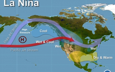
WHAT IS A MONSOON SEASON?

A monsoon is a seasonal wind pattern that lasts for several months and results in heavy rainfall during the summer and dry spells in the winter. It is responsible for the wet and dry seasons throughout much of the tropics. Typically Indian monsoon lasts from June-September, with large areas of western and central India receiving more than 90% of their total annual precipitation during the period. The word comes from the Arabic 'mausin' which means season and was first used in the English language during the British occupation of India.

What causes a monsoon?

A monsoon (from the Arabic mawsim, which means "season") arises due to a difference in temperatures between a land mass and the adjacent ocean, according to the National Weather Service. The sun warms the land and ocean differently, according to Southwest Climate Change, causing the winds to play "tug of war" eventually switching directions bringing the cooler, moister air from over the ocean. The winds reverse again at the end of the monsoon season. 

Wet versus dry

A wet monsoon typically occurs during the summer months (about April through September) bringing heavy rains, according to National Geographic. On average, approximately 75 percent of India's annual rainfall and about 50 percent of the North American monsoon region (according to a 2004 NOAA study) comes during the summer monsoon season. The wet monsoon begins when winds bringing cooler, more humid air from above the oceans to the land, as described above.

A dry monsoon typically occurs between October and April. Instead of coming from the oceans, the winds tend to come from drier, warmer climates such as from Mongolia and northwestern China down into India, according to National Geographic. Dry monsoons tend to be less powerful than their summer counterparts. Edward Guinan, an astronomy and meteorology professor at Villanova University, states that the winter monsoon occurs when "the land cools off faster than the water and a high pressure develops over the land, blocking any ocean air from penetrating." This leads to a dry period. 

The winds and rains

The monsoon season varies in strength each year bringing periods of lighter rains and heavier rains as well as slower wind speeds and higher wind speeds. The Indian Institute of Tropical Meteorology has compiled data showing yearly rainfalls across India for the last 145 years. 

According to the data, the intensity of a monsoon varies over an average of period of 30 – 40 years. In each period, the amount of rain received is higher than average resulting in many floods or lower than average resulting in droughts. The long-term data suggest that the monsoon trends may turn from being in a low rain period that began in approximately 1970 to a higher rain period. Current records for 2016 indicate that total rainfall between June 1 and September 30 is 97.3 percent of the seasonal normal.

The most rain during a monsoon season, according to Guinan, was in Cherrapunji, in the state of Meghalaya in India between 1860 and 1861 when the region received 26,470 millimeters (1,047 inches) of rain. The area with the highest average annual total (which was observed over a ten year period) is Mawsynram, also in Meghalaya, with an average of 11,872 millimeters (467.4 inches) of rain.

The average wind speeds in Meghalaya during peak summer monsoon season average 4 kilometers per second and typically vary between 1 and 7 kilometers per hour, according to Meteoblue. During the winter months, wind speeds typically vary between 2 and 8 kilometers per hour with an average of 4 - 5 kilometers per hour.

Credit : Live science 

Picture Credit : Google 

WHAT IS LA NINA WEATHER?

La Nina is a climatic pattern that refers to the cooling of the ocean surfaces along the tropical west coast of South America. During this weather pattern, warm ocean water and clouds move westwards increasing the chances of places like Indonesia and Australia getting much more rain than usual. These fluctuations tend to leave the regions of southwestern U.S. extremely dry.

The most severe La Nina occurrence in recent history was the 1988-89 event, which led to a seven-year drought in California. La Niña is a complex weather pattern that occurs every few years, as a result of variations in ocean temperatures in the equatorial band of the Pacific Ocean, The phenomenon occurs as strong winds blow warm water at the ocean's surface away from South America, across the Pacific Ocean towards Indonesia. As this warm water moves west, cold water from the deep sea rises to the surface near South America; it is considered to be the cold phase of the broader El Niño–Southern Oscillation (ENSO) weather phenomenon, as well as the opposite of El Niño weather pattern. The movement of so much heat across a quarter of the planet, and particularly in the form of temperature at the ocean surface, can have a significant effect on weather across the entire planet.

Tropical instability waves visible on sea surface temperature maps, showing a tongue of colder water, are often present during neutral or La Niña conditions.

La Niña events have occurred for hundreds of years, and occurred on a regular basis during the early parts of both the 17th and 19th centuries. Since the start of the 20th century, La Niña events have occurred during the following years:

1903–04
1906–07
1909–11
1916–18
1924–25
1928–30
1938–39
1942–43
1949–51
1954–57
1964–65
1970–72
1973–76
1983–85
1988–89
1995–96
1998–2001
2005–06
2007–08
2008–09
2010–12
2016
2017–18
2020–22

Credit :  Wikipedia 

Picture redit : Google 

WHAT IS THE KYOTO PROTOCOL?

The Kyoto Protocol was the first significant international treaty that aimed to combat global warming. It was named after the city (in Japan) in which it was adopted in December 1997.

It urged participating countries to develop national programmes to reduce emission of greenhouse gases (like carbon dioxide and methane). It came into effect only in 2005 after delayed approval. Since 1997, 191 countries have backed the agreement. However, some developed countries including the US, Canada, and Russia have denied meeting the emission targets.

While the Kyoto Protocol expired in 2020, the Paris Agreement is now the active instrument to fight climate change.

The Kyoto Protocol is based on the principles and provisions of the Convention and follows its annex-based structure. It only binds developed countries, and places a heavier burden on them under the principle of “common but differentiated responsibility and respective capabilities”, because it recognizes that they are largely responsible for the current high levels of GHG emissions in the atmosphere.

In its Annex B, the Kyoto Protocol sets binding emission reduction targets for 37 industrialized countries and economies in transition and the European Union. Overall, these targets add up to an average 5 per cent emission reduction compared to 1990 levels over the five year period 2008–2012 (the first commitment period).

In Doha, Qatar, on 8 December 2012, the Doha Amendment to the Kyoto Protocol was adopted for a second commitment period, starting in 2013 and lasting until 2020.

As of 28 October 2020, 147 Parties deposited their instrument of acceptance, therefore the threshold of 144 instruments of acceptance for entry into force of the Doha Amendment was achieved.  The amendment entered into force on 31 December 2020.

The amendment includes:

New commitments for Annex I Parties to the Kyoto Protocol who agreed to take on commitments in a second commitment period from 1 January 2013 to 31 December 2020;
A revised list of GHG to be reported on by Parties in the second commitment period; and
Amendments to several articles of the Kyoto Protocol which specifically referenced issues pertaining to the first commitment period and which needed to be updated for the second commitment period.

Credit : United nations climate change 

Picture Credit : Google 

WHAT IS THE JET STREAM?

Jet streams are bands of strong wind that generally blow from the west to the east across the world. They impact weather, air travel and many other things that take place in our atmosphere. They form when warm air masses meet cold air masses in the atmosphere. The fast-moving air currents in a jet stream can impact the weather system in a region affecting temperature and precipitation. But if a weather system is far away from a jet stream, it might hover over one place, causing heat waves or floods.

What Causes Jet Streams?

Jet streams form when warm air masses meet cold air masses in the atmosphere.

The Sun doesn’t heat the whole Earth evenly. That’s why areas near the equator are hot and areas near the poles are cold.

So when Earth’s warmer air masses meet cooler air masses, the warmer air rises up higher in the atmosphere while cooler air sinks down to replace the warm air. This movement creates an air current, or wind. A jet stream is a type of air current that forms high in the atmosphere.

On average, jet streams move at about 110 miles per hour. But dramatic temperature differences between the warm and cool air masses can cause jet streams to move at much higher speeds — 250 miles per hour or faster. Speeds this high usually happen in polar jet streams in the winter time.

How Do Jet Streams Affect Air Travel?

Jet streams are located about five to nine miles above Earth’s surface in the mid to upper troposphere — the layer of Earth’s atmosphere where we live and breathe.

Airplanes also fly in the mid to upper troposphere. So, if an airplane flies in a powerful jet stream and they are traveling in the same direction, the airplane can get a boost. That’s why an airplane flying a route from west to east can generally make the trip faster than an airplane traveling the same route east to west.

How Do Jet Streams Affect Weather?

The fast-moving air currents in a jet stream can transport weather systems across the United States, affecting temperature and precipitation. However, if a weather system is far away from a jet stream, it might stay in one place, causing heat waves or floods.

Earth’s four primary jet streams only travel from west to east. Jet streams typically move storms and other weather systems from west to east. However, jet streams can move in different ways, creating bulges of winds to the north and south.

How Does the Jet Stream Help Us Predict the Weather?

Weather satellites, such as the Geostationary Operational Environmental Satellites-R Series (GOES-R), use infrared radiation to detect water vapor in the atmosphere. With this technology, meteorologists can detect the location of the jet streams.

Monitoring jet streams can help meteorologists determine where weather systems will move next. But jet streams are also a bit unpredictable. Their paths can change, taking storms in unexpected directions. So satellites like GOES-16 can give up-to-the-minute reports on where those jet streams are in the atmosphere — and where weather systems might be moving next.

Credit : Science jinks 

Picture Credit : Google