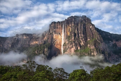
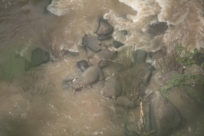
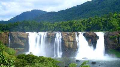
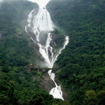
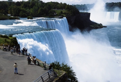
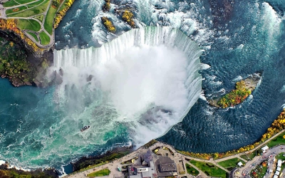
Which is the highest waterfall in the world?

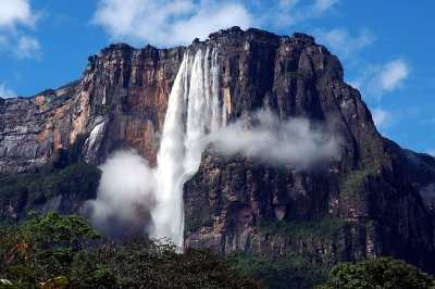
Located in the Guiana Highlands in Bolivar state of southeastern Venezuela, the Angel Falls is the world's highest uninterrupted waterfall. It occurs on the Churun River, which is a tributary of the Caron, located 260 kilometres to the southeast of Ciudad Bolivar. This cataract drops 979 metres and is 150 metres wide at the base.

Angel Falls was not known to the outside world until 16th November, 1933 when Jimmie Angel, an American aviator, flew over them while he was searching for an ore bed, based on the directions given by the Spanish explorer Felix Cardona.

Once he located the falls, he returned on 9th October, 1937 to land his Flamingo monoplane El Rio Caroni on top of Auyantepui, a tabletop mountain. But his plane was damaged when its wheels sank into the marshy ground, leaving Angel and his three companions, including his wife Marie, stranded. They were forced to climb down the tepui, which took them 11 days. The news of this adventure spread across the world and the waterfall was named Angel Falls in his honour.

Since it is located in the Canaima National Park, the dense jungle surrounding it prevents it from being seen from the air. Angel Falls is one of Venezuela's top tourist attractions, and its other name, "Salto del angel" was first published on a Venezuelan government map in December 1939.


Picture Credit : Google

HOW DO WATERFALLS FORM?

A waterfall develops when the bed of the river changes from hard to soft rock. As the force of the water wears away soft rock faster, the level of the softer riverbed drops, and the river plunges over a ledge of hard rock. The depth of the fall increases over time as more and more of the soft rock is washed away.

A waterfall is a river or a body of water that steeply falls over a rocky edge into a plunge pool. These are also called cascades.

Erosion is the process of wearing away the earth. It plays an important part in the formation of waterfalls. Waterfalls also contribute to erosion.

The process of formation of waterfalls happens when a stream flows from soft rock to hard rock. This happens both laterally and vertically. In every case the soft rock erodes and leaves the hard rock as it is. Over this a stream falls.

The fall line is an imaginary line along which parallel rivers plunge while flowing from uplands to low lands. Many waterfalls in this way help the geologists determine a region's fall line and underlying rock structure.

As the stream flows it carries various amounts of sediments- be it microscopic silt, pebbles or boulders. Sediments erode the beds of soft rocks like sandstone or limestone. The stream then cuts the beds so deep that only hard rocks like granite are left.

Credit: jagranjosh.com

Picture Credit : Google

WHICH IS THE HIGHEST WATERFALL?

Angel Falls or Salto Ángel (indigenous name: Kerepakupay Vená) is the world's highest free-falling waterfall at 3,212 feet with an uninterrupted drop of 2,648 feet lying in the Canaima National Park, Venezuela. It is situated on the Churún River, an affluent of the Carrao. Curún in indigenous Pemón language means "thunder."

Angel Falls is located in the Guayana highlands, one of the five topographical regions of Venezuela. It plunges off the edge of a tepui, or table-top mountain, called Auyan Tepui (“Devils Mountain”). It is 500 feet wide at its base and in total is 15 times higher than America's Niagara Falls Angel Falls in Venezuela, which plunge 979 m vertically.

Angel Falls is one of Venezuela's top tourist attractions, despite its remoteness and the absence of roads leading to nearby villages. One of the world's great natural wonders, Angel Falls inspires feelings of awe in the hearts of those who make the journey.

Although sighted in the early twentieth century by the explorer Ernesto Sanchez La Cruz, the waterfall was not known to the Western world until it was visited in 1935 by the American aviator, James Crawford Angel, on a flight while searching for a valuable ore bed. In 1936, he returned and landed his plane at the top of the waterfall. The falls are currently named "Angel Falls" after him; interestingly, the indigenous name for the falls means "Devil's Mouth."

Credit: NEW WORLD ENCYCLOPEDIA.

Picture Credit : Google

HOW LOUD IS THE ROAR OF ZIMBABWE'S VICTORIA FALLS?

Victoria Falls, waterfall, c.1 mi (1.6 km) wide with a maximum drop of 420 ft (128 m), in the Zambezi River, S central Africa, on the Zambia-Zimbabwe border. The falls are formed as the Zambezi plummets into a narrow chasm (c.400 ft/120 m wide) carved by its waters along a fracture zone in the earth's crust. Numerous islets at the crest of the falls divide the water to form a series of falls. The thick mist and loud roar produced there are perceptible from a distance of about 25 mi (40 km). The Boiling Pot, the beginning of a winding gorge (c.50 mi/80 km long) through which the river flows below the falls, is spanned by a 650 ft (198 m) long bridge that is 310 ft (94 m) above the river. The gorge is now partially submerged as a result of the construction of the Kariba Dam. David Livingstone, the British explorer, visited the falls in 1855 and named them for Queen Victoria. The falls are part of two national parks and draw many tourists to the area.

Credit: Infoplease

Picture Credit : Google

Where to find the world’s most famous waterfalls?


The most famous waterfalls in the world are at 500,000 tons of water rush over the Niagara precipice into a gorge below every minute and make this one of the best sources of hydroelectric power in America. The dull roar of the waters can be heard from a great distance. The people who live near the falls are used to the sound and would be quite nervous if it should suddenly stop. This almost happened one night in March 1848 when the waters of the river Niagara were blocked by huge masses of ice and the great falls were reduced to a trickle for a few hours.


There are two falls at Niagara and they are separated by a huge rock, called Goad Island. The larger of the falls is in Canada and the other is in the United States. Engineers have bored a tunnel in the rock through which people can go to see the marvelous spectacle. The falls are very beautiful in winter because of the ice round them. They are visited by over 4 million sightseers a year.


Picture Credit : Google


Is a waterfall a river?


A waterfall is a river or other body of water's steep fall over a rocky ledge into a plunge pool below. Waterfalls are also called cascades.


Often, waterfalls form as streams flow from soft rock to hard rock. This happens both laterally (as a stream flows across the earth) and vertically (as the stream drops in a waterfall). Many waterfalls in an area help geologists and hydrologists determine a region's fall line and underlying rock structure.


Waterfalls are also classified by height. Angel Falls, the world’s tallest waterfall, plummets 979 meters (3,212 feet) into a remote canyon in a rain forest in Venezuela. The water, from the Gauja River, often does not reach the bottom. The fall is so long, and so steep, that air pressure is stronger often than the water pressure of the falls. The water is turned to mist before it reaches the small tributary below.


Picture Credit : Google


In which river does Shivanasamudra Falls originate?


The Shivanasamudra Falls is on the Kaveri River after the river has found its way through the rocks and ravines of the Deccan Plateau and drops off to form waterfalls. The island town of Shivanasamudra divides the river into twin waterfalls. 


Shivanasamudra Falls is a waterfall in Chamarajanagar District of the state of Karnataka, India. It is situated along the river Kaveri, which forms here the boundary to the Mandya, and is the location of one of the first hydro-electric power stations in Asia, which was set up in 1902.The project was designed by Diwan Sheshadri Iyer.


The Gaganachukki waterfalls are best viewed from the Shivanasamudra watch tower. Most of the pictures showing the twin waterfalls are taken from that location. There is another approach to the Gaganachukki falls from the Darga Hazrath Mardane Gaib (Imam Ali). Despite warnings being posted, people climb down the rocks and attempt to view the waterfalls from behind/top, resulting in many fatal accidents. It is 139 km (86 mi) from the city of Bangalore.


Picture Credit : Google


Peraruvi, Aintharuvi, Shenbagadevi Falls and Thenaruvi are part of which famous waterfall in Tamil Nadu?


Courtallam falls is not just one but a set of nine falls settled close to each other in the Tirunelveli district of Tamil Nadu. They are named as Peraruvi (Main Falls), Aintharuvi (Five Falls), Thenaruvi (Honey Falls), Chithirai Aruvi, Puli Aruvi (Tiger Falls), Shenbagadevi Falls, Pazhaya Aruvi (Old Falls), Puthu Aruvi (New Falls) and Pazhathotta Aruvi (Fruit Garden Falls). Besides, what adds more charm to the panoramic surroundings are the Western Ghats and the Chittar river where these famous waterfalls find their home.


Coutrallam Falls is located in Western Ghats to the South of Coutrallam town and to the north of Coutrallam Lower, the first lake in the descent of Chittar. It is located 5 km (3.1 mi) from the nearest town Tenkasi and 59 km (37 mi) from the nearest city Tirunelveli. The place is frequented by animals like Tiger and Panther, which are frequently spotted in the route from Coutrallam Falls to Papansam as both are located close to Kalakkad Mundanthurai Tiger Reserve.


The falls receives its waters during the South-west monsoon from May to September, but the maximum amount of rainfall is received during the North-east monsoon during October to December. The Kutralanathar Temple is located close to the main falls. The falls is usually frequented by devotees of the Papanasanathar Temple, who take a holy dip in the falls before visiting the temple. The falls is also frequented by tourists to Sabarimala during the November - December season in a religious circuit in the region and Agasthiyar Falls.


Picture Credit : Google


Which is the tallest human made waterfall in the world?


The Cascata delle Marmore is an ancient artificial waterfall with a total height of 165 meters makes it the tallest man-made waterfall in the world.


It appears to have been created by the Romans as a means of mitigating perceived health risks from wetlands formed by the source of the waterfall, the river Velino.


The waterfall consists of three discrete sections with the topmost the tallest part at around 83 meters. It is located in the Italian region of Umbria, just under 8km from Terni. 


Most of the time, the water in the canals above the falls is diverted to a hydroelectric power plant, so the flow in the falls themselves is heavily reduced. Piediluco Lake, above the falls, is used as a reservoir for the power plant. The Galleto power plant, built in 1929, is architecturally interesting. Its capacity is about 530 MW. To control the operation of the power plant, and to satisfy tourists, the falls are turned on according to a set schedule, achieving a spectacular effect at full flow.


Picture Credit : Google


In which national park in October, 2019 11 elephants died while trying to save each other after a baby elephant fell from a waterfall?


Six elephants died while trying to save each other after a baby elephant fell from a waterfall in a Thai national park, officials said.


Staff at Khao Yai National Park, about 85 miles northeast of Bangkok, found the roughly 3-year-old baby elephant drowned on Saturday. Five more dead elephants also were discovered at the bottom of Haew Narok Waterfall, according to the Thailand Department of National Parks, Wildlife and Plant Conservation.


Elephants are sympathetic animals that have been known to help each other when they are distressed. They also show something resembling grief when one of their own dies.


Khao Yai is Thailand's third-largest national park. Haew Narok, the park's tallest waterfall, has three tiers that total about 492 feet. Elephants are common nearby.


Picture Credit : Google


Which is the largest waterfall in Kerala?


Athirappilly Falls, is situated in Athirappilly Panchayat in Chalakudy Taluk of Thrissur District in Kerala, India on the Chalakudy River, which originates from the upper reaches of the Western Ghats at the entrance to the Sholayar ranges. It is the largest waterfall in Kerala, which stands tall at 80 feet. 


The 145 kilometres (90 mi) long Chalakudy River, originates in the Anamudi mountains of the Western Ghats[2] and flows through the Vazhachal Forest toward the Arabian Sea. The river initially runs smoothly but becomes more turbulent as it nears Athirapilly. At Athirappilly Falls, the water surges around big rocks and cascades down in three separate plumes. Below the falls, the river remains turbulent for about 1 kilometre (0.62 mi) until it reaches Kannamkuzhi. Then it calms and flows smoothly until reaching the dam at Thumburmuzhi.


Daily jungle safari trips are organized by Thrissur District Tourism Promotion Council with Athirappilly Destination Management Council from Chalakudy to Malakkappara.


Picture Credit : Google


Which waterfall in India literally means Sea of Milk?


One of the most scenic waterfalls in India, Dudhsagar literally means ‘Sea of Milk’. Though perennial, the beauty of the waterfall increases multi-fold during the rainy season. Dudhsagar Waterfall is situated inside the Bhagwan Mahavir wildlife sanctuary in Sanguem district of Goa close to the border with Karnataka. It is about 60 km from state capital Panaji.


The roads leading to the waterfall, maintained by the Goa Forest Department, remain closed during the monsoon and open in October. Trekking to the waterfall is the most popular activity and passes through steep mountain terrain. Jeep safari is also popular with tourists. There are four routes to reach the waterfall. The most adventurous trek starts from Kuveshi village. It is not allowed during monsoon as it requires cross the Mandovi River. The 10 km long route passes through thick jungle.


Legend has it that a beautiful princess lived in the forest on the edge of the King's palace grounds. She enjoyed bathing in a lake nearby and ritually drank sweetened milk from a Golden Jug upon finishing with her bath. One day while enjoying her jug of milk she found herself being watched by a handsome prince standing amongst the trees. Red with embarrassment at her inadequate bathing attire, the Princess poured the jug of milk in front of her to form an improvised curtain to hide her body, while one of the maids rushed to cover her with a dress.


The sweetened milk cascades down the mountain slope to this day as tribute to the virtue and modesty of the Princess.


Picture Credit : Google


Which waterfall features in the film “Harry Potter and the Goblet of Fire”?


Recognize this waterfall? That’s because it appears in the Harry Potter and the Goblet of Fire film while Harry battles the Hungarian Horntail during the first task of the Triwizard Tournament. The Steall Falls, near Fort Williams in the UK, is so popular with walkers that it now needs repairs to its surface due to erosion. On average, 40,000 people a year climb the 393 ft. path up the falls.


Repairs will involve a helicopter because it will be the easiest way to drop necessary materials down on the path. This need and methods used for repair will mean closure for the path and road through Glen Nevis when work needs to be completed on the aerial section.


Goodman also stated, “The trail retains that feel of wildness that people of all ages love.” His statement certainly reflects the popularity of the waterfall and the need to repair the landmark for future climbers.


Picture Credit : Google


Which two countries does the Niagara Falls straddle?


Niagara Falls is a geological wonder and one of the most famous waterfalls in the world. Straddling the border between the United States and Canada, it has been a popular tourist attraction for over 200 years, as well as a major source of hydroelectric power.  


When Niagara Falls formed, it was about 7 miles (11 km) downstream from where it is today. Even now, erosion continues to push the falls farther upstream at a rate of about a foot a year. By some estimates, the river will erode back to Lake Erie in about 50,000 years, cutting through an escarpment and through soft shale and beginning to drain Lake Erie. 


Native Americans settled in the area between A.D. 1300 and 1400, according to Niagara Falls Info. One of the first native tribes called themselves the Onguiaahra, which French explorers turned into "Niagara." Also among the earlier settlers was an Iroquois group, the Atiquandaronk, who were called the "Neutrals" by French explorers because of the tribe's peacekeeping efforts between neighboring warring tribes.


Picture Credit : Google


Horseshoe Falls, American Falls and Bridal Veil Falls collectively make up which popular waterfall?


Niagara Falls in Canada is a collective name given to three waterfalls, namely Horseshoe Falls, American Falls, and Bridal Veil Falls, on the River Niagara along the border of US state of New York and the Canadian province of Ontario. 


Niagara Falls is a collective name given to three separate waterfalls situated on the River Niagara on the border between US state of New York and Canada’s Province of Ontario. The main waterfall, the Horseshoe Falls, lies on the US-Canada border while the American Falls and Bridal Veil are the territories of the USA.


The largest waterfalls of the Niagara Falls is the Horseshoe Falls, which has an average flow rate of 225000 Cubic Feet per second, making it the largest waterfall in North America by flow rate. Over 90% of River Niagara flows into this fall while only 10% goes to the other two combined.


The best time of the day to visit the Niagara Falls, especially during the peak, is just after the opening timing when people are still yet to come or just before the closing time when most people have left.


Picture Credit : Google