WHAT IS THE DEFINITION OF GLOBAL WARMING?

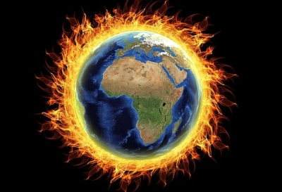
The long-term heating up of the planet due to human activity since the 19th century pre-industrial era is called global warming. One of the main causes driving global warming is the burning of fossil fuels which increases the level of heat-trapping greenhouse gases in the atmosphere. Research has pointed out that human activities have increased the earth's average temperature by about 1 degree Celsius. From the atmosphere to ocean and land, the temperature is rising. The figure is projected to increase with every passing decade. Rising temperatures can impact sea level, thaw glaciers, affect rainfall patterns and lead to extreme events such as hurricanes, flash floods and tomados.

What causes global warming?

 Global warming occurs when carbon dioxide (CO2) and other air pollutants collect in the atmosphere and absorb sunlight and solar radiation that have bounced off the earth’s surface. Normally this radiation would escape into space, but these pollutants, which can last for years to centuries in the atmosphere, trap the heat and cause the planet to get hotter. These heat-trapping pollutants—specifically carbon dioxide, methane, nitrous oxide, water vapor, and synthetic fluorinated gases—are known as greenhouse gases, and their impact is called the greenhouse effect.

Though natural cycles and fluctuations have caused the earth’s climate to change several times over the last 800,000 years, our current era of global warming is directly attributable to human activity—specifically to our burning of fossil fuels such as coal, oil, gasoline, and natural gas, which results in the greenhouse effect. In the United States, the largest source of greenhouse gases is transportation (29 percent), followed closely by electricity production (28 percent) and industrial activity (22 percent).

Curbing dangerous climate change requires very deep cuts in emissions, as well as the use of alternatives to fossil fuels worldwide. The good news is that countries around the globe have formally committed—as part of the 2015 Paris Climate Agreement—to lower their emissions by setting new standards and crafting new policies to meet or even exceed those standards. The not-so-good news is that we’re not working fast enough. To avoid the worst impacts of climate change, scientists tell us that we need to reduce global carbon emissions by as much as 40 percent by 2030. For that to happen, the global community must take immediate, concrete steps: to decarbonize electricity generation by equitably transitioning from fossil fuel–based production to renewable energy sources like wind and solar; to electrify our cars and trucks; and to maximize energy efficiency in our buildings, appliances, and industries.

How is global warming linked to extreme weather?

 Scientists agree that the earth’s rising temperatures are fueling longer and hotter heat waves, more frequent droughts, heavier rainfall, and more powerful hurricanes.

In 2015, for example, scientists concluded that a lengthy drought in California—the state’s worst water shortage in 1,200 years—had been intensified by 15 to 20 percent by global warming. They also said the odds of similar droughts happening in the future had roughly doubled over the past century. And in 2016, the National Academies of Science, Engineering, and Medicine announced that we can now confidently attribute some extreme weather events, like heat waves, droughts, and heavy precipitation, directly to climate change.

The earth’s ocean temperatures are getting warmer, too—which means that tropical storms can pick up more energy. In other words, global warming has the ability to turn a category 3 storm into a more dangerous category 4 storm. In fact, scientists have found that the frequency of North Atlantic hurricanes has increased since the early 1980s, as has the number of storms that reach categories 4 and 5. The 2020 Atlantic hurricane season included a record-breaking 30 tropical storms, 6 major hurricanes, and 13 hurricanes altogether. With increased intensity come increased damage and death. The United States saw an unprecedented 22 weather and climate disasters that caused at least a billion dollars’ worth of damage in 2020, but 2017 was the costliest on record and among the deadliest as well: Taken together, that year's tropical storms (including Hurricanes Harvey, Irma, and Maria) caused nearly $300 billion in damage and led to more than 3,300 fatalities.

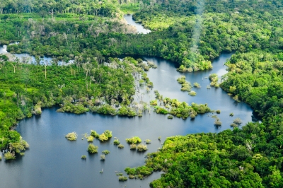
The impacts of global warming are being felt everywhere. Extreme heat waves have caused tens of thousands of deaths around the world in recent years. And in an alarming sign of events to come, Antarctica has lost nearly four trillion metric tons of ice since the 1990s. The rate of loss could speed up if we keep burning fossil fuels at our current pace, some experts say, causing sea levels to rise several meters in the next 50 to 150 years and wreaking havoc on coastal communities worldwide.

Credit : NRDC

Picture Credit : Google

WHAT IS THE PERU PROBLEM OF AMAZON RAINFOREST?

Discussions on the perils faced by this iconic South American rainforest focus invariably on Brazil. However, the lingering political crisis in Peru, where the second-largest part of the Amazon lies, has also been simultaneously affecting the inhabitants of the region.

The political crisis

Peru has descended into one of the worst political crises in its history, and the protection of its Amazon rainforest is failing, according to a report published recently. Peru is home to the second-largest portion of the Amazon rainforest after Brazil. The country had pledged to stop deforestation by 2021.

The South American country has been immersed in political turbulence since 2016. Corruption scandals and disputes between the executive and legislative branches of government have led to intense turnover-four Presidents in five years. Peru's current President, leftist outsider Pedro Castillo has already survived two impeachment attempts since he took office in July 2021.

The Monitoring of the Andean Amazon Project (MAAP), an initiative of the nonprofit Amazon

Conservation Association, reports that deforestation in the Peruvian Amazon has hit six historical highs in the last 10 years. The analysis is based on data from the University of Maryland, the U.S., which has kept records since 2002.

The worst year ever was 2020 when Peru lost around 4,20,000 acres of Amazon rainforest. Last year, that number declined, but still ranked as the sixth highest on record. Peruvian official data, which only goes through 2020, agrees.

Corrupt actors who benefit from environmental crime, together with the political crisis have resulted in a lack of govemment ability to fight environmental crime, the report said "What's more, the Peruvian government continues to prioritize economic development over the protection of the Amazon rainforest." The Igarape Institute commissioned the report from InSight Crime, a non-profit organisation focussed on investigating crime in Latin America

As in Brazil's Amazon, cattle ranching and agriculture are the main drivers of deforestation. Agribusiness companies and poor migrants from other parts of Peru seize land illegally. Other illegal activities that harm the forest are gold mining, logging, and coca plantations.

The report titled The Roots of Environmental Crime in the Peruvian Amazon, identifies three actors behind deforestation: big businesses, such as palm oil companies: entrepreneurial criminal networks, which profit from the trade in timber, land or drugs, and cheap labour poorly paid workers who cut down trees and plant coca crops.

The Brazil problem

The largest portion of the Amazon lies in Brazil - within its borders the country holds roughly 60 % of the total forest area. It is also the country in which the forest has faced its worst decline. Deforestation has been happening here for more than five decades, and reports show that it has reached alarming heights under the current President Jair Bolsonaro's administration, thanks to his encouragement of agriculture and mining and weakening of environmental protections in the region. In fact, in 2021, the deforestation in the Amazon was the highest since 2006. Apart from agriculture and cattle ranching, infrastructure development, forest fires, mining, and illegal logging are causes for widespread deforestation. Here's something to put the level of destruction into perspective - "every minute an area of Amazon rainforest roughly equivalent to 5 football pitches is cut down", according to WWF. The commercial exploitation has left us with a scenario that appears grim - scientists warn that the region "is approaching a critical tipping point at which the damage is irreversible".

Why is the Amazon important?

There's a reason the Amazon is often referred to as "the lungs of the Earth" - it produces at least 5% of the world's total oxygen, and has played a crucial role in climate regulation. Not just that. For years, it has functioned as a 'carbon sink, meaning it absorbs more carbon than it emits. However, that's no longer the case. Scientists have discovered that the region now emits more carbon than it takes in. And the resultant impact on the environment is beginning to show - hotter temperatures, more forest fires, changing weather patterns altering habitats, etc. All of these affect not just the three million wildlife species dependent on the region for survival but also the hundreds of indigenous tribes that call the place home. Several of them have been displaced already, and many have their lands occupied illegally. When the forest disappears, it takes along with it its inhabitants and their culture, leaving in its wake a world that's altered forever.

Picture Credit : Google 

WHERE IS THE LARGEST SEAGRASS MEADOW FOUND?

Scientists have discovered the world's largest plant off the Australia coast- a seagrass meadow that has grown by repeatedly cloning itself. Genetic analysis has revealed that the underwater fields of waving green seagrass are a single organism covering 180 sq.km. through making copies of itself over 4,500 years.

Scientists confirmed that the underwater meadow was a single organism by sampling and comparing the DNA of seagrass shoots across the bed, wrote Jane Edgeloe, a study co-author and marine biologist at the University of Western Australia.

A variety of plants and some animals can reproduce asexually. There are disadvantages to being clones of a single organism. such as increased susceptibility to diseases- but "the process can create hopeful monsters" by enabling rapid growth, the researchers wrote.

The scientists call the meadow of Poseidon's ribbon weed "the most widespread known clone on Earth", covering an area larger than Washington, the US.

Though the seagrass meadow is immense, it's vulnerable. A decade ago, the seagrass covered an additional seven square miles, but cyclones and rising ocean temperatures linked to climate change have recently killed almost a 10th of the ancient seagrass bed.

Did you know?

  • The species is commonly found along parts of Australia's coast, and grows "like a lawn" up to 35 cm a year, Which is how they arrived at this plant's age.
  • This specific plant is believed to have spread from a single seed.
  • The plant is hardy, growing in different types of conditions within its present location - from a variety of temperatures and salinities to extreme high light conditions, all of which would have been very stressful to most other plants.
  • A place in the Guinness World Records

The Poseidon's ribbon weed has entered the Guinness World Records as the "largest single living organism based on area". The weed has claimed its title from a honey mushroom, which is spread over 2,385 acres in the U.S. The mushroom is still "the world's largest fungus".

Picture Credit : Google 

WHAT IS SPECIAL ABOUT THE GEOGRAPHIC SOUTH POLE?

The geographic South Pole in Antarctica is the only place on earth where you can time travel! All lines of longitude converge at this exact point, so you are literally standing in all 24 time zones. You can step from today into yesterday and back into tomorrow! Since Antarctica is largely uninhabited, the continent is not officially divided into time zones. Research stations use the time zone of the country that operates them, while others observe the local time of countries nearby officially divided into time zones. Research stations use the time zone of the country that operates them, while others observe the local time of countries nearby.

What is a time zone?

A time zone can be described as a region of the Earth that observes a standard time for several purposes, including commercial, legal, and social. Time zones often follow the boundaries of a country and its subdivisions since it is convenient for places in close proximity to observe the same time. Time zones on land are usually offset from Coordinated Universal Time (UTC). The Earth’s rotation means that time zones are determined by the lines of longitude that connect the North and South Poles, and divide the globe into different time zones. A country or region may have multiple time zones. For example, the United States is spread across six time zones. However, since all lines of longitude converge at the poles, it means that the poles are technically located within all time zones simultaneously. 

Time at the geographic poles.

In most parts of the globe, lines of longitude determine the local time, such that the specific time is synchronized to the position of the Sun in the sky. However, this does not apply at the North and South Poles, where the rising and setting of the Sun occurs only once a year. At the North Pole, the sun is continuously above the horizon in the summer and below the horizon during winter. The Sun rises during the March equinox and reaches sunset around the September equinox. The South Pole does not receive any sunlight from March until September, while the Sun is continuously above the horizon from September until March, meaning that the pole experiences one of the coldest climates in the world.

How is time determined at the geographical poles?

While there are no permanent human settlements at the poles and no specific time zone has been assigned to either pole, explorers and polar expeditions choose to follow any time zone deemed convenient. Therefore, a group of explorers may choose to observe the same time zone as their country of origin or may opt to use Greenwich Mean Time. For example, a group working at the McMurdo Station in the South Pole followed the local time in New Zealand local time (UTC+12 or 13).

Credit : World atlas 

Picture Credit : Google 

WHY DEAD SEA CALLED DEAD SEA?

At the very lowest point on earth lies a natural wonder replete with a unique ecosystem, breathtaking desert views, and mineral treasures that have been attracting visitors for thousands of years: The Dead Sea. Located in the desert in southern Israel, it is also the world’s deepest hypersaline lake. Although the high salinity of the water makes it almost impossible to dive, in this article we will delve deep into its geological origins, geography and history, become familiar with the biology and chemistry of this unique environment and discover everything there is to do and where to stay in the area surrounding this natural gem. 

The Dead Sea is a salt lake located in the Judean desert of southern Israel, bordered by Jordan to the East. With its origin dating back to some four million years ago, it is one of earth’s saltiest bodies of water and is the lowest point on earth. Its arid desert climate features year-round sunny skies, relatively high temperatures, with little precipitation.

The Dead Sea is located at the lowest point on earth, which is thought to be the result of volcanic processes leading to a continuous dropping of land. It is one of the four saltiest bodies of water in the world. These special conditions are an outcome of its extreme geomorphological structure alongside a harsh desert climate. These create constant dramatic changes that form a landscape that is different from any other in the world. Also, the unique mineral content of the air, land, and water in the area is globally renowned for its therapeutic qualities, as is evident in that it has been a health resort for thousands of years.

There are contending theories about the Dead Sea formation. About 3.7 million years ago, the area now known as the Jordan River Valley was repeatedly flooded by water from the Mediterranean Sea. The waters created a lagoon called the Sedom Lagoon, which connected to the sea through what is currently called the Jezreel Valley. Later on, about 2 million years ago, the land between this lagoon and the Mediterranean Sea rose to such an extent, that the sea could no longer flood the area, leading to the creation of a landlocked lake. Shifts in tectonic plates led to the rising and dropping of the floor of the valley, and the harsh desert climate led to gradual evaporation and shrinking of the lake, until finally, about 70,000 years ago, what remained was the Dead Sea with its low elevation. 

Until the end of the 1960s, the Jordan River was the only major water source flowing into the Dead Sea, although there are small perennial springs under and around the lake, forming pools and quicksand pits along its edges. Today, after the diversion of the waters from the Sea of Galilee, the only incoming source of water is from sulfur springs and waste water, along with rare drizzles and flash floods.

Credit : Deadsea.com

Picture Credit : Google 

What is a spit?

A spit is a narrow, extended piece of land that develops where a coastline sharply turns in towards the landmass. Attached to the coast at one end, the spit seems to grow out of it, as the movement of waves and tides deposits sand and pebbles at the angle of the landmass. The other end extends out into the sea, growing longer over time as more debris accumulates along it.

Spit is a landform in geography that is created from the deposition of the sand by the tide movements. One end of the spit remains attached to the mainland while the other end is open out in the water. It is narrow and elongated. Also known as sandspit, this type of landform is found off the coasts or the lake shores.

Spits are usually formed when re-entrance takes place by the longshore drift process from longshore currents. When waves at an oblique angle meet the beach, drift occurs. There is a deposit of sediment in a narrow strip in zigzag pattern moving down the beach. The same waves also cause longshore currents that complement the formation of the spit.

At the re-entrance, the longshore current spreads out or dissipates and not being able to carry the full load, drops much of the sediment which is called deposition. The longshore or littoral drift continues to transport sediment with the help of this submerged bar of deposit into the open waters alongside the beach in the direction the waves are breaking

This process forms an above-water spit. The formation of spit will continue out into the sea until the water pressure obstructs in the deposition of sand. As it grows, it becomes stable and often fertile; vegetation starts to grow and supports habitation.

Credit: Earth Eclipse

Picture Credit : Google