WHAT IS THE TUNDRA?

The tundra refers to a vast, flat, treeless Arctic region of Europe, Asia, and North America in which the subsoil is permanently frozen. Tundra ecosystems are also found on the mountaintops here, where the climate is cold and windy, and rainfall is scant. These lands are covered with snow for much of the year, which melts during the summer. Yet it hosts a few species of wildlife acclimatised to harsh conditions. As the tundra faces the threat of global warming, so do its inhabitants.

Plants and Animals in Tundras:

Mountain goats, sheep, marmots, and birds live in mountain—or alpine—tundra and feed on the low-lying plants and insects. Hardy flora like cushion plants survive in the mountain zones by growing in rock depressions, where it is warmer and they are sheltered from the wind.

The Arctic tundra, where the average temperature is -34 to -6 degrees Celsius (-30 to 20 degrees Fahrenheit), supports a variety of animal species, including Arctic foxes (Vulpes lagopus), polar bears (Ursus maritimus), gray wolves (Canis lupus), caribou (Rangifer tarandus), snow geese (Anser caerulescens), and musk oxen (Ovibos moschatus). The summer growing season is just 50 to 60 days, when the sun shines up to 24 hours a day.

The relatively few species of plants and animals that live in the harsh conditions of the tundra are essentially clinging to life. They are highly vulnerable to environmental stresses like reduced snow cover and warmer temperatures brought on by global warming.

Climate Change Impact on Tundras

The Arctic tundra is changing dramatically due to global warming, a term that falls within a wider range of trends scientists now prefer to call climate change. The impacts in this region are broad and somewhat unpredictable. Animals that are typically found farther south, like the red fox (Vulpes vulpes), are moving north onto the tundra. This means the red fox is now competing with the Arctic fox for food and territory, and the long-term impact on the sensitive Arctic fox is unknown.

Other tundra denizens, such as the wolf spider (Lycosidae spp.), are growing bigger and thriving. Shrubs are getting taller, contributing to declines in the sensitive groups of lichen that caribou and other species depend on for food. Lakes and ponds are evaporating or draining away.

Ctedit : National geographic society 

Picture Credit : Google 

WHAT IS SOIL DEGRADATION ?

Soil degradation refers to the decline of soil quality due to its improper use, usually for agriculture, industry, and urban activity. Degraded soil can have lower amount of fertility and organic matter, and be high in salinity, acidity, and toxicity. Since soil is inevitable for all life forms on our planet, the continuous decline in soil quality can have disastrous results such as desertification, flooding, landslides, loss of wildlife, etc.

Various Causes of Soil Degradation

1. Physical Factors

There are several physical factors contributing to soil degradation distinguished by the manners in which they change the natural composition and structure of the soil. Rainfall, surface runoff, floods, wind erosion, tillage, and mass movements result in the loss of fertile top spoil thereby declining soil quality.

2. Biological Factors

Biological factors refer to the human and plant activities that tend to reduce the quality of the soil. Some bacteria and fungi overgrowth in an area can highly impact the microbial activity of the soil through biochemical reactions, which reduces crop yield and the suitability of soil productivity capacity.

Human activities such as poor farming practices may also deplete soil nutrients thus diminishing soil fertility. The biological factors affect mainly lessens the microbial activity of the soil.

3. Chemical Factors

The reduction of soil nutrients because of alkalinity or acidity or waterlogging are all categorized under the chemical components of soil degradation. In the broadest sense, it comprises alterations in the soil’s chemical property that determine nutrient availability.

4. Deforestation

Deforestation causes soil degradation on the account of exposing soil minerals by removing trees and crop cover, which support the availability of humus and litter layers on the surface of the soil.

5. Misuse or excess use of fertilizers

The excessive use and the misuse of pesticides and chemical fertilizers kill organisms that assist in binding the soil together. Most agricultural practices involving the use of fertilizers and pesticides often entail misuse or excessive application, thereby contributing to the killing of soil’s beneficial bacteria and other micro-organisms that help in soil formation.

6. Industrial and Mining activities

Soil is chiefly polluted by industrial and mining activities. As an example, mining destroys crop cover and releases a myriad of toxic chemicals such as mercury into the soil thereby poisoning it and rendering it unproductive for any other purpose.

7. Improper cultivation practices

There are certain agricultural practices that are environmentally unsustainable and at the same time, they are the single biggest contributor to the worldwide increase in soil quality decline. The tillage on agricultural lands is one of the main factors since it breaks up the soil into finer particles, which increase erosion rates.

8. Urbanization

Urbanization has major implications on the soil degradation process. Foremost of all, it denudates the soil’s vegetation cover, compacts soil during construction, and alters the drainage pattern.

9. Overgrazing

The rates of soil erosion and the loss of soil nutrients, as well as the topsoil, are highly contributed by overgrazing. Overgrazing destroys surface crop cover and breaks down soil particles, increasing the rates of soil erosion. As a result, soil quality and agricultural productivity are greatly affected.

Fatal Effects of Soil Degradation

1. Land degradation

Soil quality decline is one of the main causes of land degradation and is considered to be responsible for 84% of the ever-diminishing acreage. Year after year, huge acres of land lost due to soil erosion, contamination, and pollution.

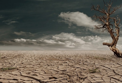
2. Drought and aridity

Drought and aridity are problems highly influenced and amplified by soil degradation. As much as it’s a concern associated with natural environments in arid and semi-arid areas, the UN recognizes the fact that drought and aridity are anthropogenic induced factors especially as an outcome of soil degradation.

3. Loss of arable land

Because soil degradation contributes to land degradation, it also means that it creates a significant loss of arable land. As stated earlier, about 40% of the world’s agricultural land is lost on the account of soil quality depreciation caused by agrochemicals and soil erosion.

4. Increased flooding

The land is commonly altered from its natural landscape when it rids its physical composition from soil degradation. For this reason, the transformed land is unable to soak up water, making flooding more frequent.

5. Pollution and clogging of waterways

Most of the soil eroded from the land together with the chemical fertilizers and pesticides utilized in agricultural fields are discharged into waterways and streams. With time, the sedimentation process can clog waterways, resulting in water scarcity.

SOLUTIONS : There are many solutions to soil degradation, which include: practicing responsible farming techniques, active forestation, as well as preventing soil erosion and pollution. In addition, soil degradation can be avoided through responsible developments in urban and residential environments.

WHAT IS PERMAFROST AND WHY IS IT IMPORTANT?

Permafrost is permanently frozen ground comprising soil, rocks, and sand, and often spans the Arctic regions. Found both on land and below the ocean floor, it covers vast expanses, and is a habitat for several animals and plants. Melting permafrost is a concern because it releases vast amounts of trapped greenhouse gases into the atmosphere.

What is Permafrost Made Of?

Permafrost is made of a combination of soil, rocks and sand that are held together by ice. The soil and ice in permafrost stay frozen all year long.

Near the surface, permafrost soils also contain large quantities of organic carbon—a material leftover from dead plants that couldn’t decompose, or rot away, due to the cold. Lower permafrost layers contain soils made mostly of minerals.

A layer of soil on top of permafrost does not stay frozen all year. This layer, called the active layer, thaws during the warm summer months and freezes again in the fall. In colder regions, the ground rarely thaws—even in the summer. There, the active layer is very thin—only 4 to 6 inches (10 to 15 centimeters). In warmer permafrost regions, the active layer can be several meters thick.

How Does Climate Change Affect Permafrost?

As Earth’s climate warms, the permafrost is thawing. That means the ice inside the permafrost melts, leaving behind water and soil.

Thawing permafrost can have dramatic impacts on our planet and the things living on it. For example:

  1. Many northern villages are built on permafrost. When permafrost is frozen, it’s harder than concrete. However, thawing permafrost can destroy houses, roads and other infrastructure.
  2. When permafrost is frozen, plant material in the soil—called organic carbon—can’t decompose, or rot away. As permafrost thaws, microbes begin decomposing this material. This process releases greenhouse gases like carbon dioxide and methane to the atmosphere.
  3. When permafrost thaws, so do ancient bacteria and viruses in the ice and soil. These newly-unfrozen microbes could make humans and animals very sick. Scientists have discovered microbes more than 400,000 years old in thawed permafrost.
  4. Because of these dangers, scientists are closely monitoring Earth’s permafrost. Scientists use satellite observations from space to look at large regions of permafrost that would be difficult to study from the ground.

Credit : Climate kids

Picture Credit : Google 

WHAT IS LA NINA WEATHER?

La Nina is a climatic pattern that refers to the cooling of the ocean surfaces along the tropical west coast of South America. During this weather pattern, warm ocean water and clouds move westwards increasing the chances of places like Indonesia and Australia getting much more rain than usual. These fluctuations tend to leave the regions of southwestern U.S. extremely dry.

The most severe La Nina occurrence in recent history was the 1988-89 event, which led to a seven-year drought in California. La Niña is a complex weather pattern that occurs every few years, as a result of variations in ocean temperatures in the equatorial band of the Pacific Ocean, The phenomenon occurs as strong winds blow warm water at the ocean's surface away from South America, across the Pacific Ocean towards Indonesia. As this warm water moves west, cold water from the deep sea rises to the surface near South America; it is considered to be the cold phase of the broader El Niño–Southern Oscillation (ENSO) weather phenomenon, as well as the opposite of El Niño weather pattern. The movement of so much heat across a quarter of the planet, and particularly in the form of temperature at the ocean surface, can have a significant effect on weather across the entire planet.

Tropical instability waves visible on sea surface temperature maps, showing a tongue of colder water, are often present during neutral or La Niña conditions.

La Niña events have occurred for hundreds of years, and occurred on a regular basis during the early parts of both the 17th and 19th centuries. Since the start of the 20th century, La Niña events have occurred during the following years:

1903–04
1906–07
1909–11
1916–18
1924–25
1928–30
1938–39
1942–43
1949–51
1954–57
1964–65
1970–72
1973–76
1983–85
1988–89
1995–96
1998–2001
2005–06
2007–08
2008–09
2010–12
2016
2017–18
2020–22

Credit :  Wikipedia 

Picture redit : Google 

WHAT IS THE JET STREAM?

Jet streams are bands of strong wind that generally blow from the west to the east across the world. They impact weather, air travel and many other things that take place in our atmosphere. They form when warm air masses meet cold air masses in the atmosphere. The fast-moving air currents in a jet stream can impact the weather system in a region affecting temperature and precipitation. But if a weather system is far away from a jet stream, it might hover over one place, causing heat waves or floods.

What Causes Jet Streams?

Jet streams form when warm air masses meet cold air masses in the atmosphere.

The Sun doesn’t heat the whole Earth evenly. That’s why areas near the equator are hot and areas near the poles are cold.

So when Earth’s warmer air masses meet cooler air masses, the warmer air rises up higher in the atmosphere while cooler air sinks down to replace the warm air. This movement creates an air current, or wind. A jet stream is a type of air current that forms high in the atmosphere.

On average, jet streams move at about 110 miles per hour. But dramatic temperature differences between the warm and cool air masses can cause jet streams to move at much higher speeds — 250 miles per hour or faster. Speeds this high usually happen in polar jet streams in the winter time.

How Do Jet Streams Affect Air Travel?

Jet streams are located about five to nine miles above Earth’s surface in the mid to upper troposphere — the layer of Earth’s atmosphere where we live and breathe.

Airplanes also fly in the mid to upper troposphere. So, if an airplane flies in a powerful jet stream and they are traveling in the same direction, the airplane can get a boost. That’s why an airplane flying a route from west to east can generally make the trip faster than an airplane traveling the same route east to west.

How Do Jet Streams Affect Weather?

The fast-moving air currents in a jet stream can transport weather systems across the United States, affecting temperature and precipitation. However, if a weather system is far away from a jet stream, it might stay in one place, causing heat waves or floods.

Earth’s four primary jet streams only travel from west to east. Jet streams typically move storms and other weather systems from west to east. However, jet streams can move in different ways, creating bulges of winds to the north and south.

How Does the Jet Stream Help Us Predict the Weather?

Weather satellites, such as the Geostationary Operational Environmental Satellites-R Series (GOES-R), use infrared radiation to detect water vapor in the atmosphere. With this technology, meteorologists can detect the location of the jet streams.

Monitoring jet streams can help meteorologists determine where weather systems will move next. But jet streams are also a bit unpredictable. Their paths can change, taking storms in unexpected directions. So satellites like GOES-16 can give up-to-the-minute reports on where those jet streams are in the atmosphere — and where weather systems might be moving next.

Credit : Science jinks 

Picture Credit : Google 

WHAT IS THE DEFINITION OF GLOBAL WARMING?

The long-term heating up of the planet due to human activity since the 19th century pre-industrial era is called global warming. One of the main causes driving global warming is the burning of fossil fuels which increases the level of heat-trapping greenhouse gases in the atmosphere. Research has pointed out that human activities have increased the earth's average temperature by about 1 degree Celsius. From the atmosphere to ocean and land, the temperature is rising. The figure is projected to increase with every passing decade. Rising temperatures can impact sea level, thaw glaciers, affect rainfall patterns and lead to extreme events such as hurricanes, flash floods and tomados.

What causes global warming?

 Global warming occurs when carbon dioxide (CO2) and other air pollutants collect in the atmosphere and absorb sunlight and solar radiation that have bounced off the earth’s surface. Normally this radiation would escape into space, but these pollutants, which can last for years to centuries in the atmosphere, trap the heat and cause the planet to get hotter. These heat-trapping pollutants—specifically carbon dioxide, methane, nitrous oxide, water vapor, and synthetic fluorinated gases—are known as greenhouse gases, and their impact is called the greenhouse effect.

Though natural cycles and fluctuations have caused the earth’s climate to change several times over the last 800,000 years, our current era of global warming is directly attributable to human activity—specifically to our burning of fossil fuels such as coal, oil, gasoline, and natural gas, which results in the greenhouse effect. In the United States, the largest source of greenhouse gases is transportation (29 percent), followed closely by electricity production (28 percent) and industrial activity (22 percent).

Curbing dangerous climate change requires very deep cuts in emissions, as well as the use of alternatives to fossil fuels worldwide. The good news is that countries around the globe have formally committed—as part of the 2015 Paris Climate Agreement—to lower their emissions by setting new standards and crafting new policies to meet or even exceed those standards. The not-so-good news is that we’re not working fast enough. To avoid the worst impacts of climate change, scientists tell us that we need to reduce global carbon emissions by as much as 40 percent by 2030. For that to happen, the global community must take immediate, concrete steps: to decarbonize electricity generation by equitably transitioning from fossil fuel–based production to renewable energy sources like wind and solar; to electrify our cars and trucks; and to maximize energy efficiency in our buildings, appliances, and industries.

How is global warming linked to extreme weather?

 Scientists agree that the earth’s rising temperatures are fueling longer and hotter heat waves, more frequent droughts, heavier rainfall, and more powerful hurricanes.

In 2015, for example, scientists concluded that a lengthy drought in California—the state’s worst water shortage in 1,200 years—had been intensified by 15 to 20 percent by global warming. They also said the odds of similar droughts happening in the future had roughly doubled over the past century. And in 2016, the National Academies of Science, Engineering, and Medicine announced that we can now confidently attribute some extreme weather events, like heat waves, droughts, and heavy precipitation, directly to climate change.

The earth’s ocean temperatures are getting warmer, too—which means that tropical storms can pick up more energy. In other words, global warming has the ability to turn a category 3 storm into a more dangerous category 4 storm. In fact, scientists have found that the frequency of North Atlantic hurricanes has increased since the early 1980s, as has the number of storms that reach categories 4 and 5. The 2020 Atlantic hurricane season included a record-breaking 30 tropical storms, 6 major hurricanes, and 13 hurricanes altogether. With increased intensity come increased damage and death. The United States saw an unprecedented 22 weather and climate disasters that caused at least a billion dollars’ worth of damage in 2020, but 2017 was the costliest on record and among the deadliest as well: Taken together, that year's tropical storms (including Hurricanes Harvey, Irma, and Maria) caused nearly $300 billion in damage and led to more than 3,300 fatalities.

The impacts of global warming are being felt everywhere. Extreme heat waves have caused tens of thousands of deaths around the world in recent years. And in an alarming sign of events to come, Antarctica has lost nearly four trillion metric tons of ice since the 1990s. The rate of loss could speed up if we keep burning fossil fuels at our current pace, some experts say, causing sea levels to rise several meters in the next 50 to 150 years and wreaking havoc on coastal communities worldwide.

Credit : NRDC

Picture Credit : Google

WHAT IS THE PERU PROBLEM OF AMAZON RAINFOREST?

Discussions on the perils faced by this iconic South American rainforest focus invariably on Brazil. However, the lingering political crisis in Peru, where the second-largest part of the Amazon lies, has also been simultaneously affecting the inhabitants of the region.

The political crisis

Peru has descended into one of the worst political crises in its history, and the protection of its Amazon rainforest is failing, according to a report published recently. Peru is home to the second-largest portion of the Amazon rainforest after Brazil. The country had pledged to stop deforestation by 2021.

The South American country has been immersed in political turbulence since 2016. Corruption scandals and disputes between the executive and legislative branches of government have led to intense turnover-four Presidents in five years. Peru's current President, leftist outsider Pedro Castillo has already survived two impeachment attempts since he took office in July 2021.

The Monitoring of the Andean Amazon Project (MAAP), an initiative of the nonprofit Amazon

Conservation Association, reports that deforestation in the Peruvian Amazon has hit six historical highs in the last 10 years. The analysis is based on data from the University of Maryland, the U.S., which has kept records since 2002.

The worst year ever was 2020 when Peru lost around 4,20,000 acres of Amazon rainforest. Last year, that number declined, but still ranked as the sixth highest on record. Peruvian official data, which only goes through 2020, agrees.

Corrupt actors who benefit from environmental crime, together with the political crisis have resulted in a lack of govemment ability to fight environmental crime, the report said "What's more, the Peruvian government continues to prioritize economic development over the protection of the Amazon rainforest." The Igarape Institute commissioned the report from InSight Crime, a non-profit organisation focussed on investigating crime in Latin America

As in Brazil's Amazon, cattle ranching and agriculture are the main drivers of deforestation. Agribusiness companies and poor migrants from other parts of Peru seize land illegally. Other illegal activities that harm the forest are gold mining, logging, and coca plantations.

The report titled The Roots of Environmental Crime in the Peruvian Amazon, identifies three actors behind deforestation: big businesses, such as palm oil companies: entrepreneurial criminal networks, which profit from the trade in timber, land or drugs, and cheap labour poorly paid workers who cut down trees and plant coca crops.

The Brazil problem

The largest portion of the Amazon lies in Brazil - within its borders the country holds roughly 60 % of the total forest area. It is also the country in which the forest has faced its worst decline. Deforestation has been happening here for more than five decades, and reports show that it has reached alarming heights under the current President Jair Bolsonaro's administration, thanks to his encouragement of agriculture and mining and weakening of environmental protections in the region. In fact, in 2021, the deforestation in the Amazon was the highest since 2006. Apart from agriculture and cattle ranching, infrastructure development, forest fires, mining, and illegal logging are causes for widespread deforestation. Here's something to put the level of destruction into perspective - "every minute an area of Amazon rainforest roughly equivalent to 5 football pitches is cut down", according to WWF. The commercial exploitation has left us with a scenario that appears grim - scientists warn that the region "is approaching a critical tipping point at which the damage is irreversible".

Why is the Amazon important?

There's a reason the Amazon is often referred to as "the lungs of the Earth" - it produces at least 5% of the world's total oxygen, and has played a crucial role in climate regulation. Not just that. For years, it has functioned as a 'carbon sink, meaning it absorbs more carbon than it emits. However, that's no longer the case. Scientists have discovered that the region now emits more carbon than it takes in. And the resultant impact on the environment is beginning to show - hotter temperatures, more forest fires, changing weather patterns altering habitats, etc. All of these affect not just the three million wildlife species dependent on the region for survival but also the hundreds of indigenous tribes that call the place home. Several of them have been displaced already, and many have their lands occupied illegally. When the forest disappears, it takes along with it its inhabitants and their culture, leaving in its wake a world that's altered forever.

Picture Credit : Google 

WHERE IS THE LARGEST SEAGRASS MEADOW FOUND?

Scientists have discovered the world's largest plant off the Australia coast- a seagrass meadow that has grown by repeatedly cloning itself. Genetic analysis has revealed that the underwater fields of waving green seagrass are a single organism covering 180 sq.km. through making copies of itself over 4,500 years.

Scientists confirmed that the underwater meadow was a single organism by sampling and comparing the DNA of seagrass shoots across the bed, wrote Jane Edgeloe, a study co-author and marine biologist at the University of Western Australia.

A variety of plants and some animals can reproduce asexually. There are disadvantages to being clones of a single organism. such as increased susceptibility to diseases- but "the process can create hopeful monsters" by enabling rapid growth, the researchers wrote.

The scientists call the meadow of Poseidon's ribbon weed "the most widespread known clone on Earth", covering an area larger than Washington, the US.

Though the seagrass meadow is immense, it's vulnerable. A decade ago, the seagrass covered an additional seven square miles, but cyclones and rising ocean temperatures linked to climate change have recently killed almost a 10th of the ancient seagrass bed.

Did you know?

  • The species is commonly found along parts of Australia's coast, and grows "like a lawn" up to 35 cm a year, Which is how they arrived at this plant's age.
  • This specific plant is believed to have spread from a single seed.
  • The plant is hardy, growing in different types of conditions within its present location - from a variety of temperatures and salinities to extreme high light conditions, all of which would have been very stressful to most other plants.
  • A place in the Guinness World Records

The Poseidon's ribbon weed has entered the Guinness World Records as the "largest single living organism based on area". The weed has claimed its title from a honey mushroom, which is spread over 2,385 acres in the U.S. The mushroom is still "the world's largest fungus".

Picture Credit : Google 

WHAT IS SPECIAL ABOUT THE GEOGRAPHIC SOUTH POLE?

The geographic South Pole in Antarctica is the only place on earth where you can time travel! All lines of longitude converge at this exact point, so you are literally standing in all 24 time zones. You can step from today into yesterday and back into tomorrow! Since Antarctica is largely uninhabited, the continent is not officially divided into time zones. Research stations use the time zone of the country that operates them, while others observe the local time of countries nearby officially divided into time zones. Research stations use the time zone of the country that operates them, while others observe the local time of countries nearby.

What is a time zone?

A time zone can be described as a region of the Earth that observes a standard time for several purposes, including commercial, legal, and social. Time zones often follow the boundaries of a country and its subdivisions since it is convenient for places in close proximity to observe the same time. Time zones on land are usually offset from Coordinated Universal Time (UTC). The Earth’s rotation means that time zones are determined by the lines of longitude that connect the North and South Poles, and divide the globe into different time zones. A country or region may have multiple time zones. For example, the United States is spread across six time zones. However, since all lines of longitude converge at the poles, it means that the poles are technically located within all time zones simultaneously. 

Time at the geographic poles.

In most parts of the globe, lines of longitude determine the local time, such that the specific time is synchronized to the position of the Sun in the sky. However, this does not apply at the North and South Poles, where the rising and setting of the Sun occurs only once a year. At the North Pole, the sun is continuously above the horizon in the summer and below the horizon during winter. The Sun rises during the March equinox and reaches sunset around the September equinox. The South Pole does not receive any sunlight from March until September, while the Sun is continuously above the horizon from September until March, meaning that the pole experiences one of the coldest climates in the world.

How is time determined at the geographical poles?

While there are no permanent human settlements at the poles and no specific time zone has been assigned to either pole, explorers and polar expeditions choose to follow any time zone deemed convenient. Therefore, a group of explorers may choose to observe the same time zone as their country of origin or may opt to use Greenwich Mean Time. For example, a group working at the McMurdo Station in the South Pole followed the local time in New Zealand local time (UTC+12 or 13).

Credit : World atlas 

Picture Credit : Google 

WHY DEAD SEA CALLED DEAD SEA?

At the very lowest point on earth lies a natural wonder replete with a unique ecosystem, breathtaking desert views, and mineral treasures that have been attracting visitors for thousands of years: The Dead Sea. Located in the desert in southern Israel, it is also the world’s deepest hypersaline lake. Although the high salinity of the water makes it almost impossible to dive, in this article we will delve deep into its geological origins, geography and history, become familiar with the biology and chemistry of this unique environment and discover everything there is to do and where to stay in the area surrounding this natural gem. 

The Dead Sea is a salt lake located in the Judean desert of southern Israel, bordered by Jordan to the East. With its origin dating back to some four million years ago, it is one of earth’s saltiest bodies of water and is the lowest point on earth. Its arid desert climate features year-round sunny skies, relatively high temperatures, with little precipitation.

The Dead Sea is located at the lowest point on earth, which is thought to be the result of volcanic processes leading to a continuous dropping of land. It is one of the four saltiest bodies of water in the world. These special conditions are an outcome of its extreme geomorphological structure alongside a harsh desert climate. These create constant dramatic changes that form a landscape that is different from any other in the world. Also, the unique mineral content of the air, land, and water in the area is globally renowned for its therapeutic qualities, as is evident in that it has been a health resort for thousands of years.

There are contending theories about the Dead Sea formation. About 3.7 million years ago, the area now known as the Jordan River Valley was repeatedly flooded by water from the Mediterranean Sea. The waters created a lagoon called the Sedom Lagoon, which connected to the sea through what is currently called the Jezreel Valley. Later on, about 2 million years ago, the land between this lagoon and the Mediterranean Sea rose to such an extent, that the sea could no longer flood the area, leading to the creation of a landlocked lake. Shifts in tectonic plates led to the rising and dropping of the floor of the valley, and the harsh desert climate led to gradual evaporation and shrinking of the lake, until finally, about 70,000 years ago, what remained was the Dead Sea with its low elevation. 

Until the end of the 1960s, the Jordan River was the only major water source flowing into the Dead Sea, although there are small perennial springs under and around the lake, forming pools and quicksand pits along its edges. Today, after the diversion of the waters from the Sea of Galilee, the only incoming source of water is from sulfur springs and waste water, along with rare drizzles and flash floods.

Credit : Deadsea.com

Picture Credit : Google