WHAT IS SPECIAL ABOUT CANADA'S MIGUASHA NATIONAL PARK?

Canada's Miguasha National Park is a treasure trove of natural history, as it holds within  it priceless fossils that educate us about what was in the world millions of years ago.

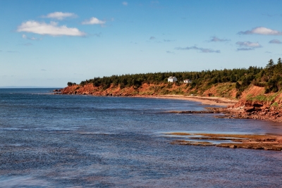
Spanning more than 215 acres, the Miguasha National Park is located on the southern coast of the Gaspe peninsula in Quebec, Canada. Unlike most parks around the world, this Park is not popular for its animals, plants, birds, reptiles, amphibians, insects, or marine creatures living today. However, it is an extremely important region to trace the history of the planet's wildlife as we know it, thanks to the fossils in this area.

On the shore of the peninsula are remarkably well-preserved fossil beds from the Devonian period (see box), from millions of years ago. From vertebrates and invertebrates (such as lobe-finned fishes) to plants, algae, and several microorganisms, the astonishing biodiversity of these fossils offers scientists much more than just a glimpse of Devonian life. Even though there are more than 50 Devonian period fossil sites across the globe, "none matches Miguasha in abundance of specimens, quality of fossil preservation and representation of evolutionary events for vertebrates".

Discovered in 1842, the site has been of great scientific interest and significance the world over, and fossil specimens from the location were sent to museums and universities for studies. In 1999, the Park was declared a UNESCO World Heritage Site, and is considered "the world's most outstanding illustration of the Devonian Period".

Past  forward

The most important contribution of the Miguasha National Park to the study of evolution is through the largest number of and best-preserved fossil specimens of the lobe-finned fish that gave rise to the first four-legged. air-breathing, terrestrial vertebrates the tetrapods

Among the fossils that made Miguasha popular are 21 species of fish fossils. And the most significant among them? The Eusthenopteron foordi- the extinct lobe-finned fish fossil. It is this creature's "limblike fins and two-way gills-and-lungs respiratory system that led to the present understanding of evolution from fish to four-limbed, land-dwelling vertebrates". And not surprisingly, this specimen has been named "the Prince of Miguasha"!

Good news but...

According to the International Union for Conservation of Nature, the conservation outlook for this site has been assessed as "good" in the latest assessment cycle (2020).

In fact rigorous and continuous fieldwork and research initiatives have resulted in the discovery of new fossils and resultant inferences on how Devonian fishes and tetrapods evolved over a period of time. Though fossil sites have the potential to be disturbed or damaged by human activity, this site is "secure and well protected". "Overall site management and protection can be rated as mostly or highly effective."

In addition to the research initiatives. the educational outreach programmes and "interpretive facilities for visitors" too have been impressive enough to create awareness.

Picture Credit : Google 

WHERE IS THE MAYON VOLCANO LOCATED?

Mayon, located in the Philippines, is a highly active stratovolcano with recorded historical eruptions dating back to 1616. The most recent eruptive episode began in early January 2018 that consisted of phreatic explosions, steam-and-ash plumes, lava fountaining, and pyroclastic flows (BGVN 43:04).

The volcano with its surrounding landscape was declared a national park on July 20, 1938, the first in the nation. It was reclassified as a natural park and renamed the Mayon Volcano Natural Park in 2000. It is the centerpiece of the Albay Biosphere Reserve, declared by UNESCO in 2016, and is currently being nominated as a World Heritage Site.

Mayon is the most active volcano in the Philippines, and its activity is regularly monitored by the Philippine Institute of Volcanology and Seismology (PHIVOLCS) from their provincial headquarters on Ligñon Hill, about 12 kilometers (7.5 mi) from the summit.

Mayon is the main landmark and highest point of the province of Albay and the whole Bicol Region in the Philippines, rising 2,463 meters (8,081 ft) from the shores of the Albay Gulf about 10 kilometers (6.2 mi) away. The volcano is geographically shared by the eight cities and municipalities of Legazpi, Daraga, Camalig, Guinobatan, Ligao, Tabaco, Malilipot, and Santo Domingo (clockwise from Legazpi), which divide the cone like slices of a pie when viewing a map of their political boundaries. Mayon is a classic stratovolcano with a small central summit crater. The cone is considered the world's most perfectly formed volcano for its symmetry.

Mayon is the most active volcano in the Philippines, erupting over 47 times in the past 500 years. Historical observations accounted its first eruption in 1616. The first eruption for which an extended account exists was the six-day event of July 20, 1766.

Following the declaration of alert level 3 for the volcano, the United States issued an advisory cautioning its nationals from traveling to Mayon. Canada and the United Kingdom also posted advisories discouraging their nationals from visiting the volcano.

The United States government committed $100,000 in financial aid for the evacuees of Mayon. In cooperation with the Philippine government the assistance was delivered through the Philippine National Red Cross and other NGOs by USAID.

Credit : Wikipedia 

Picture Credit : Google 

WHAT IS EL NIÑO?

EI Niño, or "the little boy" in Spanish, is a climatic pattern that describes the unusual warming of surface waters in the eastern equatorial Pacific Ocean. EI Niño often produces some of the hottest years on record because of the vast amount of heat that rises from Pacific waters into the atmosphere.

El Niño is a climate pattern that describes the unusual warming of surface waters in the eastern tropical Pacific Ocean. El Nino is the “warm phase” of a larger phenomenon called the El Nino-Southern Oscillation (ENSO). La Nina, the “cool phase” of ENSO, is a pattern that describes the unusual cooling of the region’s surface waters. El Niño and La Niña are considered the ocean part of ENSO, while the Southern Oscillation is its atmospheric changes.

El Niño has an impact on ocean temperatures, the speed and strength of ocean currents, the health of coastal fisheries, and local weather from Australia to South America and beyond. El Niño events occur irregularly at two- to seven-year intervals. However, El Niño is not a regular cycle, or predictable in the sense that ocean tides are.

El Niño was recognized by fishers off the coast of Peru as the appearance of unusually warm water. We have no real record of what indigenous Peruvians called the phenomenon, but Spanish immigrants called it El Niño, meaning “the little boy” in Spanish. When capitalized, El Niño means the Christ Child, and was used because the phenomenon often arrived around Christmas. El Niño soon came to describe irregular and intense climate changes rather than just the warming of coastal surface waters.

Credit: National Geographic Society

Picture Credit : Google 

WHEN WAS THE DEADLIEST HURRICANE EVER RECORDED?

More than 20,000 people died in the Caribbean during the Great Hurricane of 1780, when winds may have reached a phenomenal 320 km per hour.

Great hurricane of 1780, hurricane (tropical cyclone) of October 1780, one of the deadliest on record in the Atlantic Ocean. More than 20,000 people were killed as the storm swept through the eastern Caribbean Sea, with the greatest loss of life centred on the Antilles islands of Barbados, Martinique, and Sint Eustatius.

The hurricane took place before modern tracking of tropical storms began, but historical accounts indicate that the storm started in the Atlantic and on October 10 reached Barbados, where it destroyed nearly all the homes on the island and left few trees standing. Witness reports in Barbados and Saint Lucia claimed that even sturdy stone buildings and forts were completely lost to the wind, with heavy cannons being carried hundreds of feet. The storm traveled northwest across the Antilles, causing destruction throughout the region; on some islands entire towns disappeared. The storm ravaged Martinique, taking an estimated 9,000 lives. On the island of Sint Eustatius an estimated 4,000 to 5,000 people were killed. During this time, European naval forces were concentrated in the Caribbean because of the American Revolution, and both British and French forces sustained particularly large losses, with more than 40 French vessels sunk near Martinique and roughly 4,000 soldiers dead. As the storm continued north, it damaged or sank many other ships that were returning to Europe.

Credit: Britannica

Picture Credit : Google 

What are Hurricanes?

A hurricane is a giant, spiralling tropical storm in the Atlantic Ocean that can reach wind speeds of over 257 km per hour and unleash more than nine trillion litres of rain! It begins as thunderstorms that are set off by moist air rising over the warm ocean. If the water is warm enough, the thunderstorms join together, growing bigger as they begin to spiral across the ocean. As the hurricane grows, it spins faster and tighter around its centre, or 'eye', which remains a very calm area of low pressure. A hurricane can be as much as 800 km across and can take l8 hours to pass over. In the northern Indian Ocean hurricanes are known as cyclones and in the western Pacific Ocean, as typhoons.

Hurricanes are large, swirling storms. They produce winds of 119 kilometers per hour (74 mph) or higher. That's faster than a cheetah, the fastest animal on land. Winds from a hurricane can damage buildings and trees.

Hurricanes form over warm ocean waters. Sometimes they strike land. When a hurricane reaches land, it pushes a wall of ocean water ashore. This wall of water is called a storm surge. Heavy rain and storm surge from a hurricane can cause flooding.

Once a hurricane forms, weather forecasters predict its path. They also predict how strong it will get. This information helps people get ready for the storm.

There are five types, or categories, of hurricanes. The scale of categories is called the Saffir-Simpson Hurricane Scale. The categories are based on wind speed.

  • Category 1: Winds 119-153 km/hr (74-95 mph) - faster than a cheetah
  • Category 2: Winds 154-177 km/hr (96-110 mph) - as fast or faster than a baseball pitcher's fastball
  • Category 3: Winds 178-208 km/hr (111-129 mph) - similar, or close, to the serving speed of many professional tennis players
  • Category 4: Winds 209-251 km/hr (130-156 mph) - faster than the world's fastest rollercoaster
  • Category 5: Winds more than 252 km/hr (157 mph) - similar, or close, to the speed of some high-speed trains

Credit: NASA

Picture credit: NASA

What is Climatology?

Climatology is the study of the atmosphere and weather patterns over time. This field of science focuses on recording and analyzing weather patterns throughout the world and understanding the atmospheric conditions that cause them. It is sometimes confused with meteorology, which is the study of weather and weather forecasting. However, climatology is mainly focused on the natural and artificial forces that influence long-term weather patterns. Scientists who specialize in this field are called climatologists.

The first studies of climate can be traced back to ancient Greece, but climate science as it is now known did not emerge until the advent of the industrial age in the nineteenth century. The science of climatology grew as scientists became interested in understanding weather patterns. In recent times, climatologists have increasingly focused their research on the changes in Earth’s climate that have occurred since the industrial age. Earth has been growing warmer and warmer as human industry has expanded and released more carbon into the atmosphere. This effect, called global warming, is a particularly important object of study for climatologists. By studying global warming, climatologists can better understand and predict the long-term impact of human-caused climate change.

Credit: National Geographic Society


Picture Credit : Google

How does the Sun create weather?

The energy (heat) that the Earth receives from the Sun is a major cause of different weather Conditions. The Sun's energy in different parts of the Earth depends on where a place is in the world, the time of year and the time of day.

The energy that the Earth receives from the Sun is the basic cause of our changing weather. Solar heat warms the huge air masses that comprise large and small weather systems. The day-night and summer-winter cycles in the weather have obvious causes and effects.

The effects of currently observed changes in the Sun - small variations in light output, the occurrence of solar particle streams and magnetic fields are very small in the Earth's lower atmosphere or troposphere where our weather actually occurs. However, at higher altitudes, the atmosphere reacts strongly to changes in solar activity. The ozone layer, at an altitude of 25 kilometers (16 miles), and the ionosphere, which extends upwards in a series of layers above 60 kilometers (37 miles), are produced by solar ultraviolet light and X-rays which ionize the thin air at these altitudes. Although the visible light of the Sun is stable, large variations in X-ray and ultraviolet radiation accompany solar activity, and these variations on the Sun cause major changes in the ionosphere. Some meteorologists believe that the ionospheric changes in turn influence the weather in the lower atmosphere, but the physical mechanism by which this may occur has not been definitely identified. There is much research under way or possible relationships between solar activity and the weather.

Credit: A Meeting with Universe

Picture Credit : Google

What is Atmospheric circulation?

It is the uniform pattern in which air moves around our planet's atmosphere. It happens because the Sun heats Earth more at the equator than at the poles, and it is also affected by the spinning of the Earth.

Solar radiation that reaches the Earth passes through the atmosphere and is either absorbed or reflected by the atmosphere and Earth’s surface. Most of this absorption happens on Earth’s surfaces, which increases the temperature of both land and water. A small amount of heat in the first few centimeters of the atmosphere is transferred from the surface by conduction, the process of molecules colliding and transferring energy. Because air molecules are farther apart than they are in liquids or solids, they do not collide as frequently as in liquids and solids, and air is a poor conductor of heat. Most heat is transferred in the atmosphere by radiation and convection.

Sunlight absorbed by Earth’s surfaces is re-radiated as heat, warming the atmosphere from the bottom up. This heat is absorbed and re-radiated by greenhouse gases in the atmosphere, resulting in the greenhouse effect. Warmed air expands and becomes less dense than cool air, so warmed air near the surface of the Earth rises up. Cooler air from above sinks and air moves horizontally to replace the rising warm air, which we experience as wind over the surface of the Earth. This transfer of heat because of density differences in air is called convection.

Patterns of air movement are further complicated because of Earth’s spin. Air moving from the equator towards the poles does not travel in a straight line, but is deflected because of the Coriolis effect, adding to the complexity of atmospheric circulation patterns.

Credit: Understanding Global change

Picture Credit : Google 

What creates different weather conditions?

The weather depends on the way the air moves (wind), the moisture if carries (humidity), and its temperature (warmth). These are controlled by changes in air pressure. As air heats up, it becomes thinner and lighter. It rises upwards, creating an area of low pressure beneath it, which pulls in air from around to fill the empty space. As the air rises, it cools, forming clouds. But the cooler the air gets, the denser and heavier it becomes until eventually it starts to sink. The high pressure created pushes air down towards the ground, causing it to fan out and blow away everything in its way, stopping   the formation of clouds. This is why clear blue skies occur on high air-pressure days.

Weather comes in all different forms, and it changes by the day. It could be sunny one day and raining the next. It could even be sunny, rainy, cloudy, and stormy in one day.

Temperature

It’s getting hot out there. When you talk about the heat of the air outside on a summer day, this is the temperature. Measured with a thermometer in Fahrenheit, Celsius, or Kelvin, the temperature tells you how fast the air molecules and atoms are moving. Fast-moving molecules and atoms mean the temperature is high, while slow-moving molecules in the air create a low temperature.

Humidity

The moisture or dryness of the air is humidity. It’s an important weather aspect. Without it, humans wouldn’t be able to survive. However, the amount of water vapor, or humidity, in the air needs to have balance. Too little or too much water vapor in the air causes health issues and can be dangerous.

Precipitation

Precipitation is just a big word to describe how water falls to the ground. It can be rain, snow, sleet, ice, hail, or drizzle. The form these water or solid particles take depends on other weather factors. For example, if the temperature is cold, below 32 degrees, precipitation comes to the surface in the form of snow. If the weather is nice and warm, water comes down in the form of rain.

Wind

Air moves. All you must do is walk out your door to feel that. The movement of air is created by how the sun heats the Earth, and then convection tells you how air moves in predictable patterns. Therefore, meteorologists have some idea of how a storm will move or the type of weather you’ll have in a week.

Credit: Your Dictionary

Picture Credit : Google 

What is La Niña?

Meaning "the little girl" in Spanish, La Niña is a climatic pattern caused by a build-up of cooler-than-normal waters in the tropical Pacific, the area of the Pacific Ocean between the Tropic of Cancer and the Tropic of Capricorn. The drastic drop in sea-surface temperature affects patterns of rainfall, atmospheric pressure and atmospheric circulation around the world.

La Niña is a climate pattern that describes the cooling of surface ocean waters along the tropical west coast of South America. La Nina is considered to be the counterpart to El Nino, which is characterized by unusually warm ocean temperatures in the equatorial region of the Pacific Ocean.

Together, La Niña and El Niño are the "cold" (La Niña) and "warm" (El Niño) phases of the El Nino-Southern Oscillation (ENSO). ENSO is series of linked weather- and ocean-related phenomena. Besides unusually warm or cool sea-surface temperatures, ENSO is also characterized by changes in atmospheric pressure.

La Niña events sometimes follow El Niño events, which occur at irregular intervals of about two to seven years. The local effects on weather caused by La Niña ("little girl" in Spanish) are generally the opposite of those associated with El Niño ("little boy" in Spanish). For this reason, La Niña is also called anti-El Niño and El Viejo (the old man in Spanish).

Scientists use the Oceanic Nino Index to measure the deviations from normal sea-surface temperatures that El Niño and La Niña produce in the east-central Pacific Ocean. La Niña events are indicated by sea-surface temperature decreases of more than .5 degrees Celsius (.9 degrees Fahrenheit) for at least five successive three-month seasons.

La Niña is caused by a build-up of cooler-than-normal waters in the tropical Pacific, the area of the Pacific Ocean between the Tropic of Cancer and the Tropic of Capricorn. Unusually strong, eastward-moving trade winds and ocean currents bring this cold water to the surface, a process known as upwelling.

Credit: National Geographic Society

Picture credit: NOAA

What is wind?

Wind is moving air, ranging from a light, gentle breeze to a very strong and fast-moving storm capable of great destruction. Air moves because the Sun warms some places more than the others, creating differences in air pressure, which causes the air to be pushed around in the form of air currents.

Differences in atmospheric pressure generate winds. At the Equator, the sun warms the water and land more than it does the rest of the globe. Warm equatorial air rises higher into the atmosphere and migrates toward the poles. This is a low-pressure system. At the same time, cooler, denser air moves over Earth’s surface toward the Equator to replace the heated air. This is a high-pressure system. Winds generally blow from high-pressure areas to low-pressure areas.Wind is the movement of air caused by the uneven heating of the Earth by the sun. It does not have much substance—you cannot see it or hold it—but you can feel its force. It can dry your clothes in summer and chill you to the bone in winter. It is strong enough to carry sailing ships across the ocean and rip huge trees from the ground. It is the great equalizer of the atmosphere, transporting heat, moisture, pollutants, and dust great distances around the globe. Landforms, processes, and impacts of wind are called Aeolian landforms, processes, and impacts.

The boundary between these two areas is called a front. The complex relationships between fronts cause different types of wind and weather patterns.

Credit: National Geographic Society

Picture Credit : Google 

WHICH FOSSIL CONNECTS ALL THE SOUTHERN CONTINENTS?

Fossil remains of the fern Glossopteris are found in Australia, Antarctica, India, Africa and South America.

Wegener found fossil evidence that the continents were once joined. The same type of plant and animal fossils are found on continents that are now widely separated. These organisms would not have been able to travel across the oceans. So how did the fossils get so far apart?

Fossils of the seed fern Glossopteris are found across all of the southern continents. These seeds are too heavy to be carried across the ocean by wind. Mesosaurus fossils are found in South America and South Africa. Mesosaurus could swim, but only in fresh water. Cynognathus and Lystrosaurus were reptiles that lived on land. Both of these animals were unable to swim at all. Their fossils have been found across South America, Africa, India, and Antarctica.

Wegener thought that all of these organisms must have lived side by side. The lands later moved apart so that the fossils are separated.

Credit: ck12

Picture Credit : Google

WHAT IS THE SAN ANDREAS FAULT IN CALIFORNIA, USA?

San Andreas Fault, major fracture of the Earth’s crust in extreme western North America. The fault trends northwestward for more than 800 miles (1,300 km) from the northern end of the Gulf of California through western California, U.S., passing seaward into the Pacific Ocean in the vicinity of San Francisco. Tectonic movement along the fault has been associated with occasional large earthquakes originating near the surface along its path, including a disastrous quake in San Francisco in 1906, a less serious event there in 1989, and a strong and destructive quake centred in the Los Angeles suburb of Northridge in 1994 that occurred along one of the San Andreas’s larger secondary faults.

According to the theory of plate tectonics, the San Andreas Fault represents the transform (strike-slip) boundary between two major plates of the Earth’s crust: the Northern Pacific to the south and west and the North American to the north and east. The Northern Pacific plate is sliding laterally past the North American plate in a northerly direction, and hence the San Andreas is classified as a strike-slip fault. The movement of the plates relative to each other has been about 1 cm (0.4 inch) per year over geologic time, though the annual rate of movement has been 4 to 6 cm (1.6 to 2.4 inches) per year since the early 20th century. Parts of the fault line moved as much as 6.4 metres (21 feet) during the 1906 earthquake.

Credit: Britannica

Picture Credit : Google

FROM WHERE IN THE SUPERCONTINENT DID ANTARCTICA BREAK AWAY?

Gondwana was an ancient supercontinent that broke up about 180 million years ago. The continent eventually split into landmasses we recognize today: Africa, South America, Australia, Antarctica, the Indian subcontinent and the Arabian Peninsula.

According to plate tectonic evidence, Gondwana was assembled by continental collisions in the Late Precambrian (about 1 billion to 542 million years ago). Gondwana then collided with North America, Europe, and Siberia to form the supercontinent of Pangea. The breakup of Gondwana occurred in stages. Some 180 million years ago, in the Jurassic Period, the western half of Gondwana (Africa and South America) separated from the eastern half (Madagascar, India, Australia, and Antarctica). The South Atlantic Ocean opened about 140 million years ago as Africa separated from South America. At about the same time, India, which was still attached to Madagascar, separated from Antarctica and Australia, opening the central Indian Ocean. During the Late Cretaceous Period, India broke away from Madagascar, and Australia slowly rifted away from Antarctica. India eventually collided with Eurasia some 50 million years ago, forming the Himalayan Mountains, while the northward-moving Australian plate had just begun its collision along the southern margin of Southeast Asia.

Credit: Britannica

Picture Credit : Google

WHICH COUNTRY HAS THE LONGEST COASTLINE?

Canada, the second largest country in the world by total area, is comprised of ten provinces and three territories. Canada also has the longest total coastline among all of the countries of the world. The country’s 202,080 km long coastline fronts on the Pacific Ocean to the west, the Atlantic Ocean to the east, and the Arctic Ocean to the north. Most of the Canadian provinces and territories, with the exception of Alberta and Saskatchewan, have their own respective coastlines. The coastline of the country exhibits varied landscapes across different parts of the country, and most shoreline types are present around the Canadian coastlines, with the exception of such tropical and subtropical ecosystems as mangrove swamps and coral reefs.

Credit: World Atlas

Picture Credit : Google